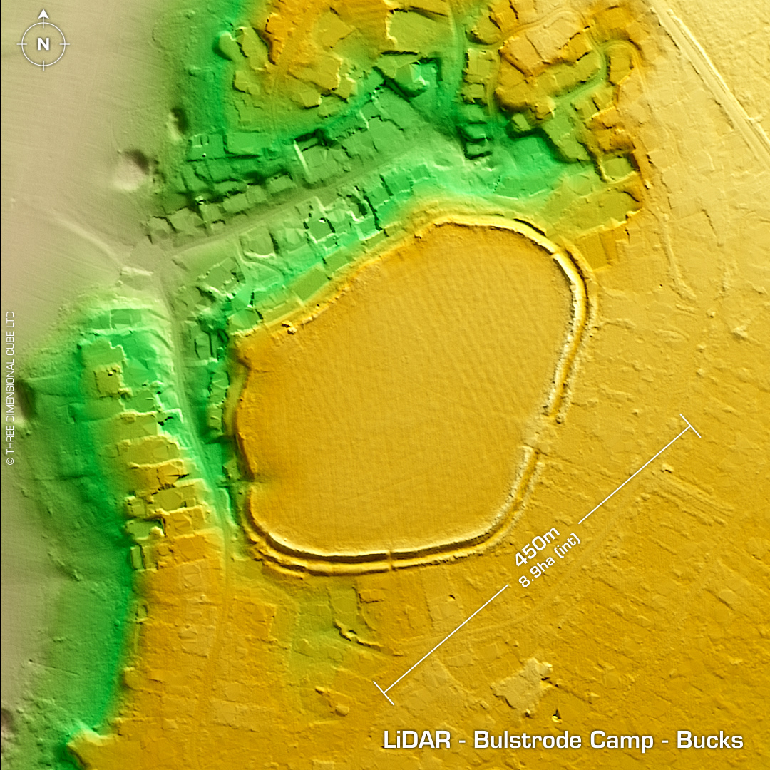
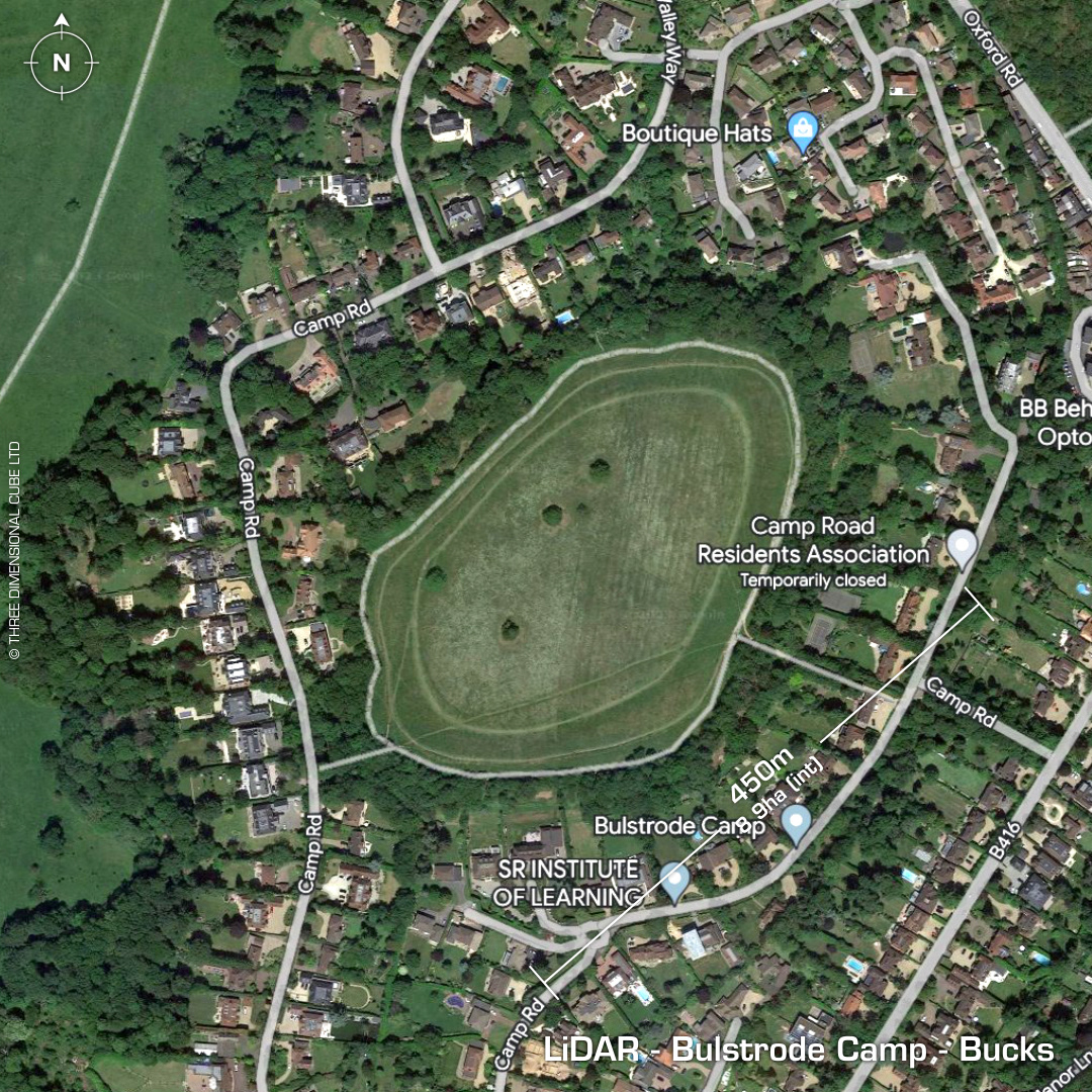
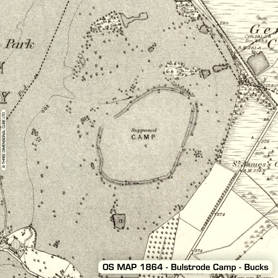
DTM- (Digital Terrain Model, i.e. No buildings or foliage) Overlooking the village of Gerrards Cross from the west and ringed by gazzilionaire mansions lies the bivallate hillfort, Bulstrode Camp. Ramparts follow the natural contours of the level plateau. A 1925 excavation showed the outer bank to be constructed from sandy gravels. Ditch excavation abandoned due to high water level & flooding. Geophys in 2003 recorded possible roundhouse platforms & a neolithic long barrow. Possible Iron Age pottery sherds found. Outer ring part-sold to developers (north to southwest ramparts destroyed by development), hence encroachment by the aforementioned mansions. If you look on Historic England's HER there's nothing there whatsoever, apart from to say is scheduled. I went to visit this site and unless you are a resident you will struggle to find a parking space as it’s all private roads. You will not believe the houses ringing the fort. Some are being 'developed' as we speak (with lots of groundwork). The amount of archaeology that has been lost on this enormous site is staggering. Just goes to show, if you've got the money then you can do whatever you like. Iron Age tribal association (conjecture based on location): Catuvellauni (Scheduled Monument) [Any descriptive text attributed to the Atlas of Hillforts & Historic England websites]