
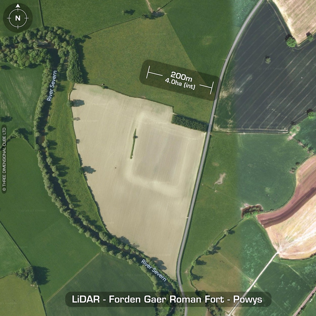
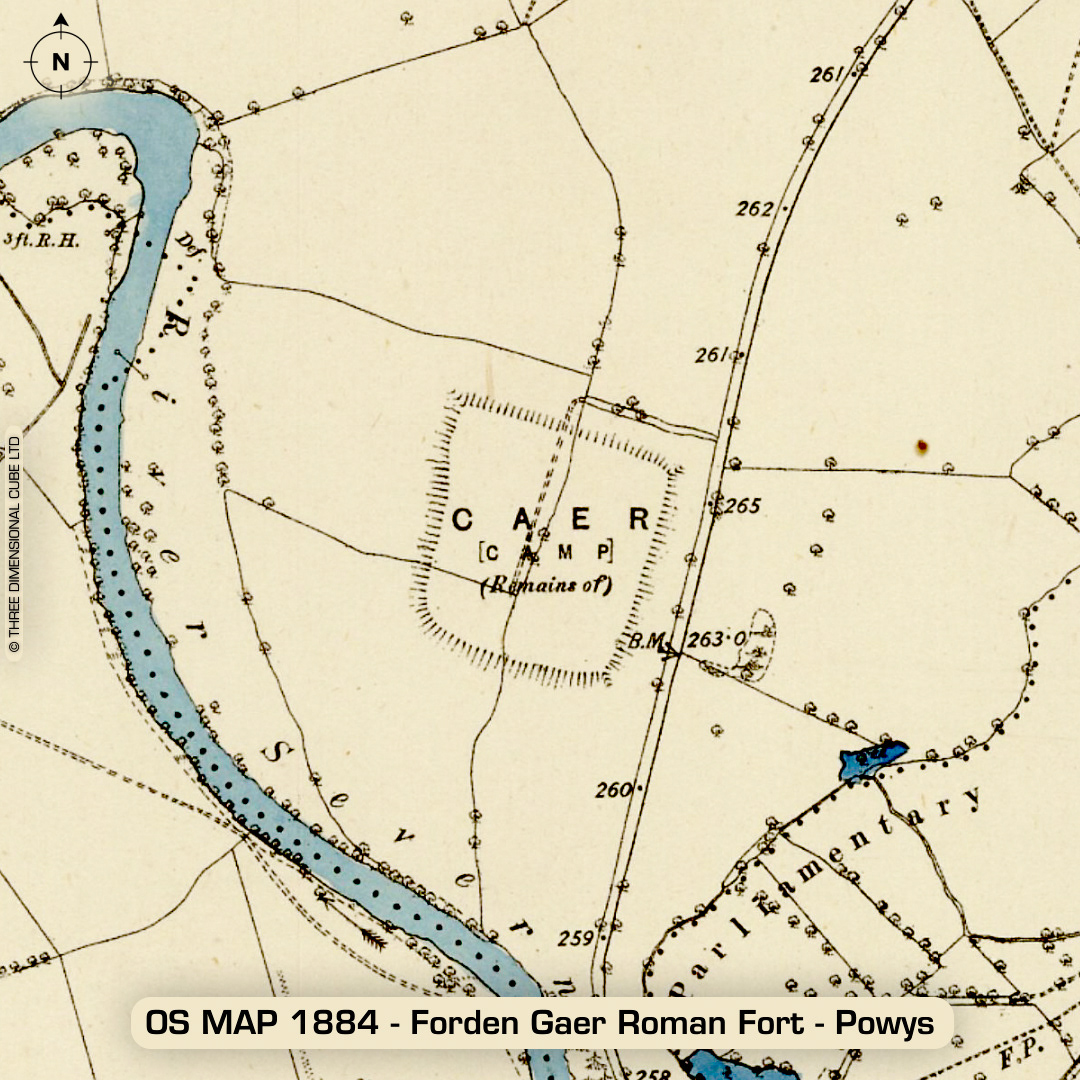
LiDAR – Forden Gaer Roman Fort – Powys DTM- (Digital Terrain Model, i.e. No buildings or foliage) Just to the northeast of the village of Caerhowel and the River Severn lies Forden Gaer Roman Fort I found this while researching the Wroxeter site far to the north. Roman name: Levobrinta. (Possibly from the Ravenna Cosmography, written by an unknown cleric in Ravenna circa 700AD) Fist construction circa 75AD. Remodelled in 3rd & 4th century AD. Site destroyed/abandoned in 296AD. Re-occupied in 343AD. Site burnt down in 353AD. (Burnt material & pottery found by river bank) Re-occupied in 383AD. Sita evacuated circa Roman military abandonment of Britain around 409AD. Excavations in 1987. Valentinianic-Theodosian coins found in fort. Heavily degraded by ploughing. Farmer dug a trench through rampart near north gate in 1975 without permission (the big twat). Site now sits on private land and is farmed regularly. Geophys in 2006. (Scheduled monument, but not according to the farmer apparently) Iron Age tribal association (conjecture based on location): Cornovii Descriptions from www.britainexpress.com and CADW. 1st ED OS Mapping via National Library of Scotland. Contains public sector information licensed under the Open Government Licence v3.0.