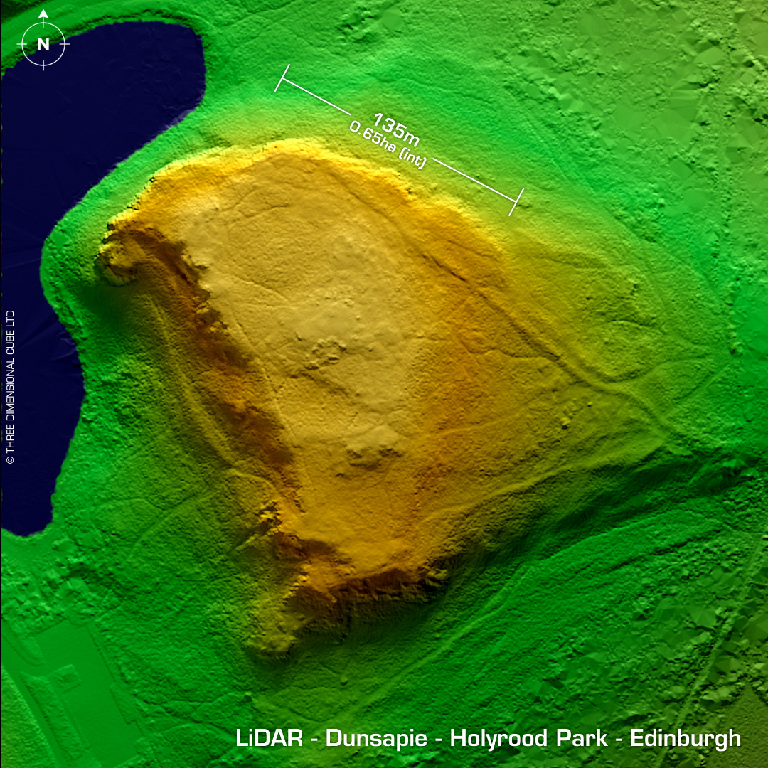
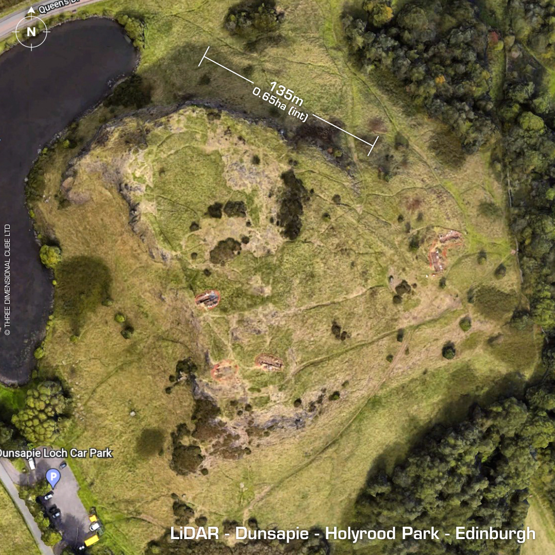
DTM- (Digital Terrain Model, i.e. No buildings or foliage) Lying within Holyrood Park in the east-end of Edinburgh sits the Iron Age hillfort, Dunsapie. I was watching Digging for Britain on catch-up with Alice Roberts who was visiting the excavations at Dunsapie (by Holyrood Archaeology). That influenced me to see if I could download some Scottish LiDAR. Interestingly, Google Maps still shows the excavation trenches that were on the show! Previous finds include a stone mould and a hoard of three early Bronze Age flat axes. Iron Age tribal association (conjecture based on location): Otadini (Scheduled Monument) [Any descriptive text attributed to the Atlas of Hillforts & Historic England websites]

