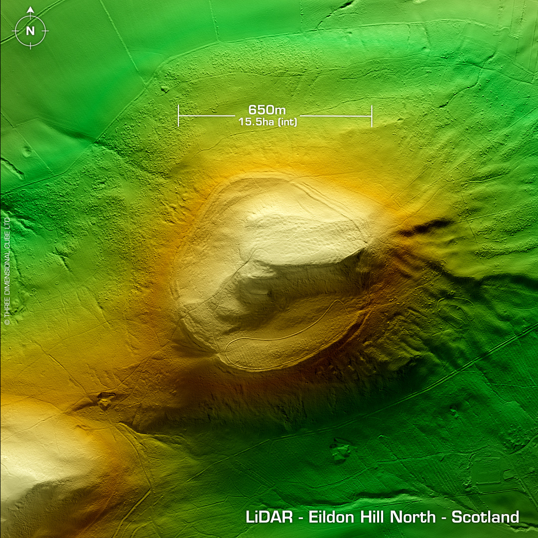
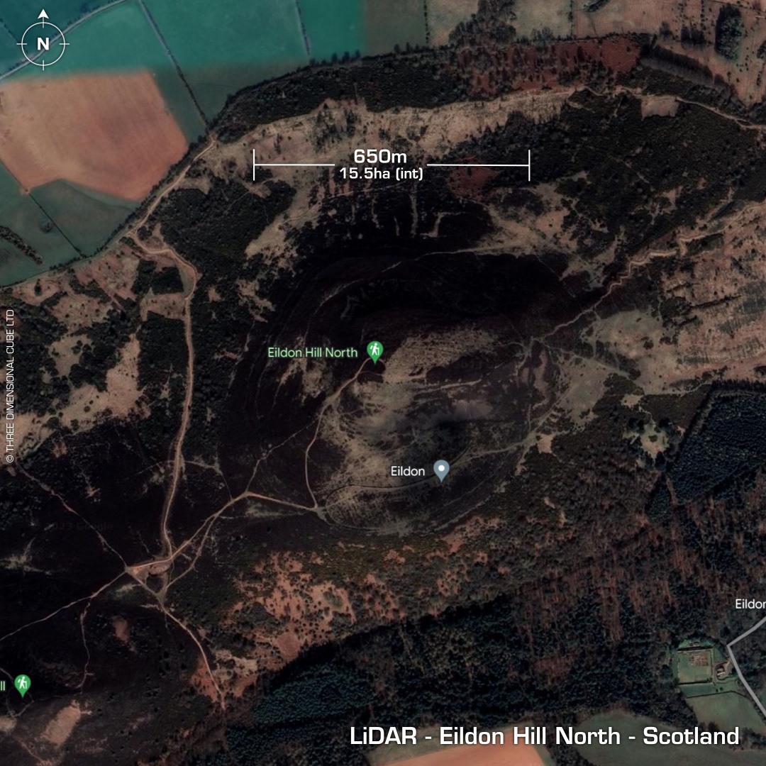
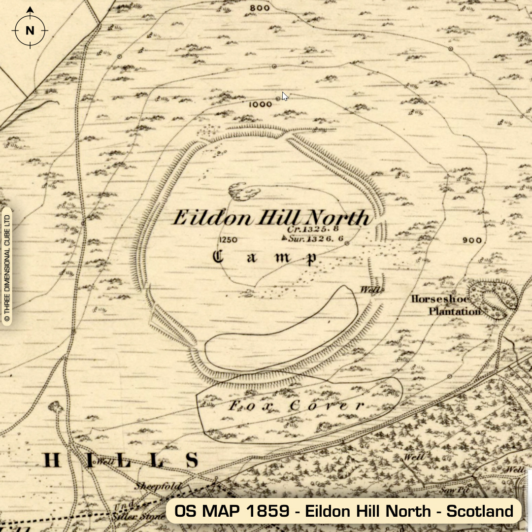
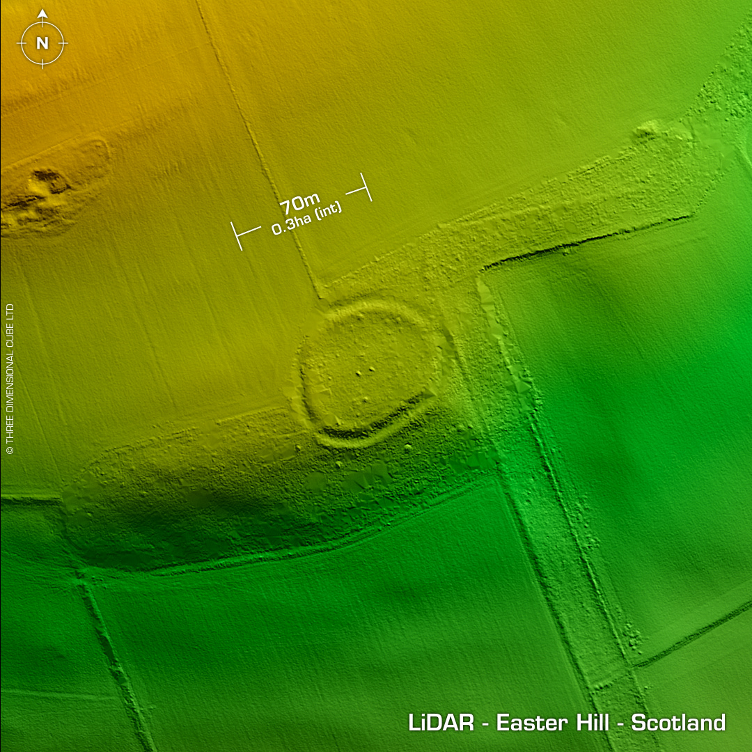
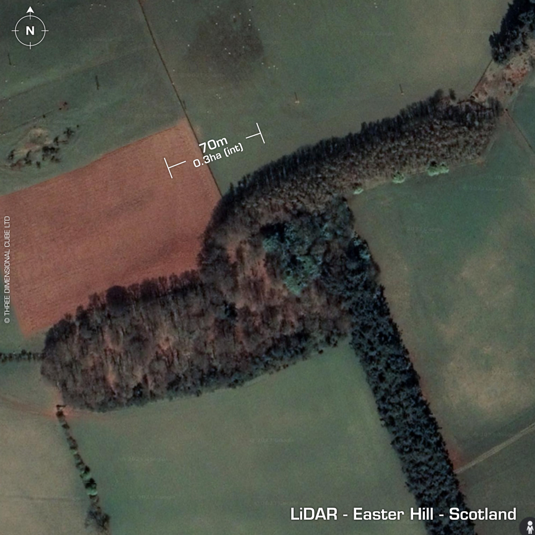
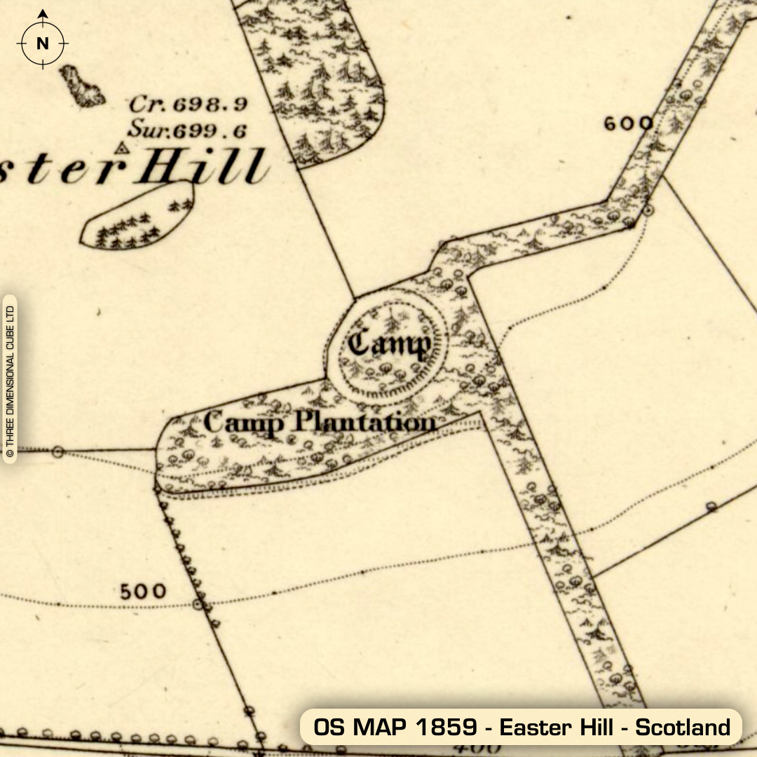
DTM- (Digital Terrain Model, i.e. No buildings or foliage) Part two on my post about @trimontiumtrust site & surrounding area. Overlooking the Roman site of Trimontium from the southwest lies the imposing hillfort, Eildon Hill North. This is one of the largest sites in Scotland. First actual written reference (inferred) by Ptolemy in AD 150. (Although his placement of Trimontium as a Selgovae site is still contested) Next subsequent verified written reference in 1743 (Adam Milne). An excavation in 1986 found among the vast amount of hut platforms (numbered in the hundreds) on the upper plateau, a Late Bronze Age hearth. (1010-740 BC) The hut platforms look like dimples on the LiDAR. Additional C14 testing on other recovered items yield Bronze age to Romano-British dates. (200-385 AD) Converted to a Roman signal station covering Trimontium. Post medieval cultivation. The second hillfort, Easter Hill lies just north of the Roman site across the River Tweed. Excavated in 1909 by James Curle who found a Roman pottery sherd. Now planted with trees. No subsequent excavations or finds recorded. Iron Age tribal association (conjecture based on location): Selgovae (Scheduled Monuments)

