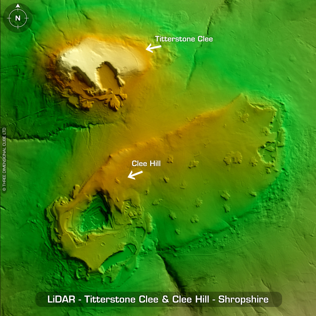

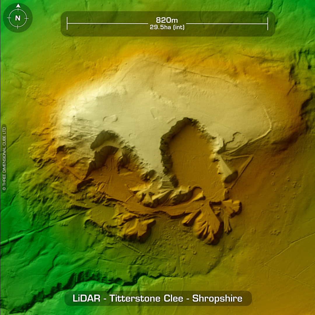
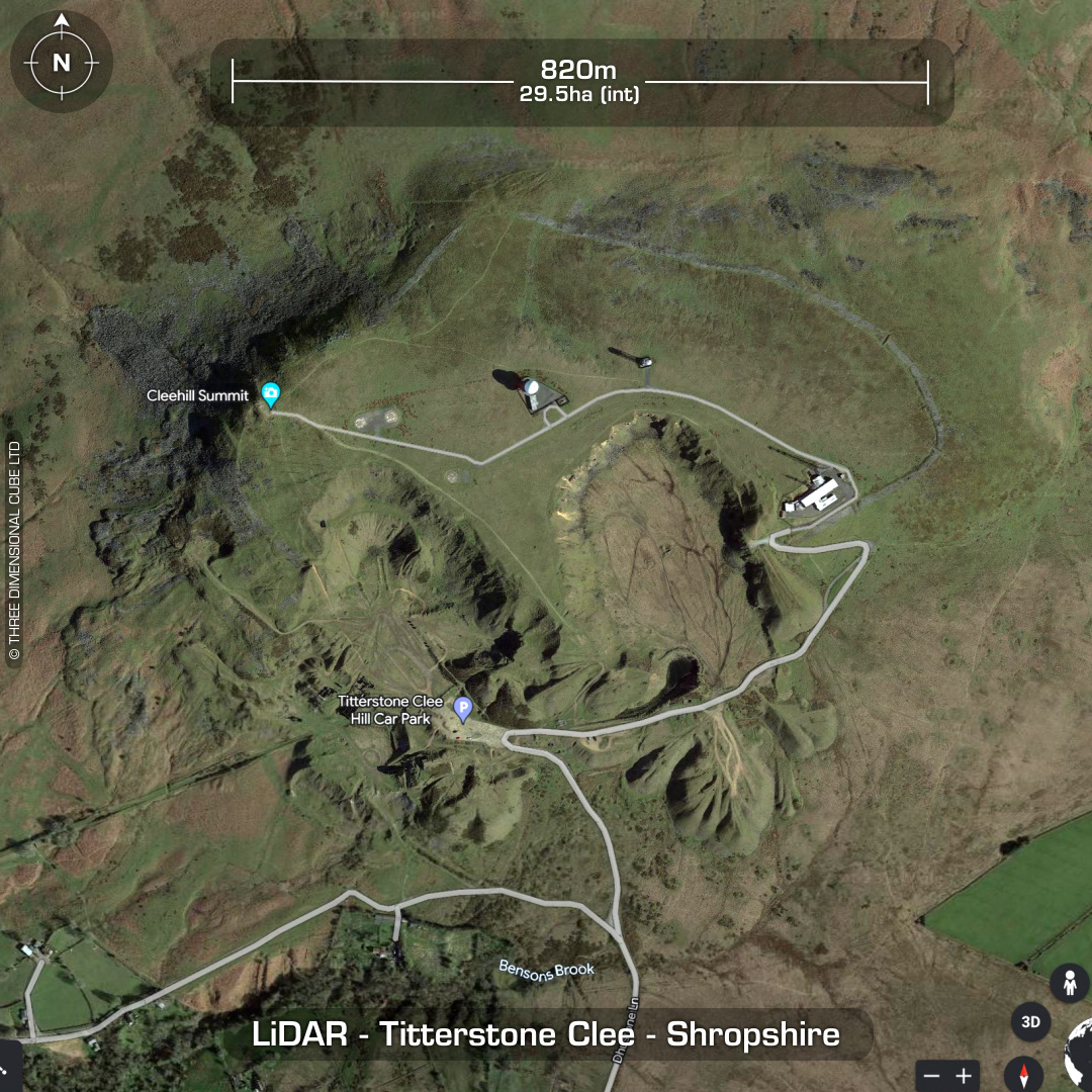

DTM- (Digital Terrain Model, i.e. No buildings or foliage) North of the village of Cleehill and north of the huge quarry atop Clee Hill lies the largest hillfort in Shropshire, Titterstone Clee. We visited at the weekend on the way home from a stay at Ludlow. The road track up is great with various signs warning of dire consequences if you drive off-road. Unfortunately, there is a honking great NATS radar & transmission station blocking access to the hillfort, and we didn't fancy risking getting my Disco impounded for driving round the fence line. Cracking views over the countryside. Lots of RV's camping-out in the car park near the summit. If you don't have an SUV, be super careful as the summit car park has pot-holes that made for interesting driving in my D4. As we were on the way home, we had limited time for a proper look round but will return. Titterstone Clee hillfort has been heavily degraded by quarrying (for dolerite) & lost on the south side. Extant ramparts surround the hill circuit around the north side, bisected by emergency excavation trenches in 1932 by O'Neil (still visible), who suggested a two-phase construction starting in the bonze Age due to lines of post-holes surrounding the circuit. Elaborate guard chambers at gate dismantled post Roman conquest. Two ring cains. First written reference in 1665 Aubrey's Monumenta Britannica. (Scheduled monument) Iron Age tribal association (conjecture based on location): Cornovii Descriptions from hillforts.arch.ox.ac.uk & Historic England.
