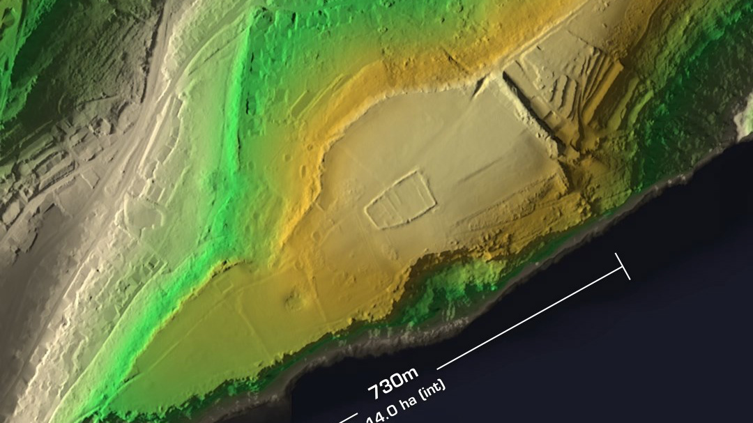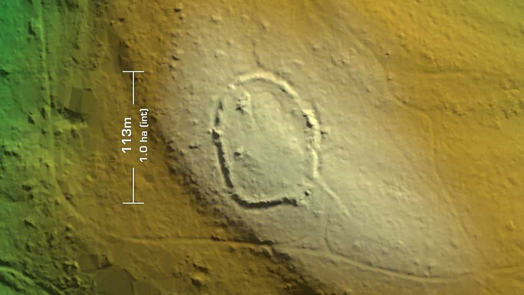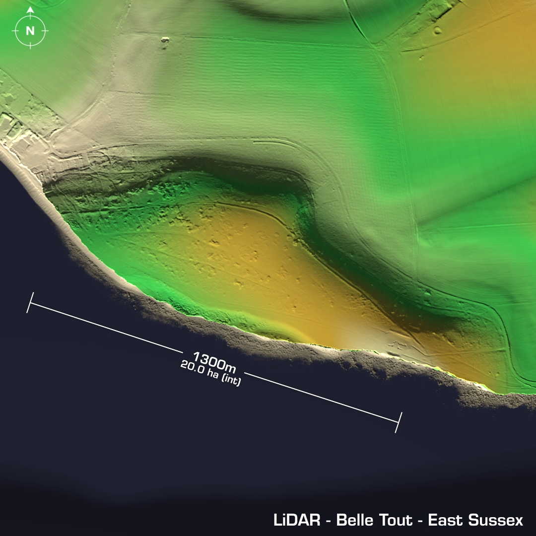
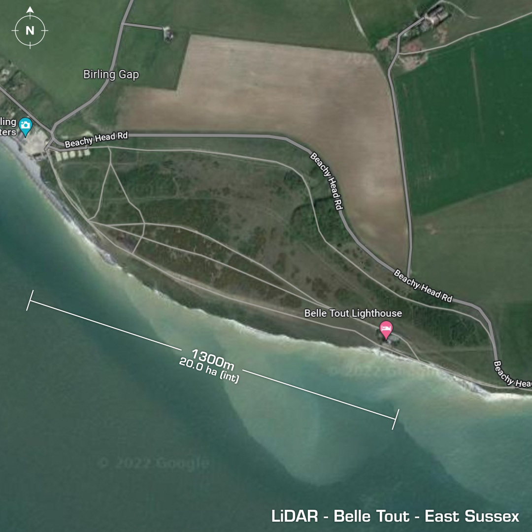
DTM- (Digital Terrain Model, i.e. No buildings or foliage) To the west of Beachy Head at Birling Gap & within the grounds of the Belle Tout Lighthouse lies the heavily eroded coastal promontory fort, Belle Tout. Most of the site has been lost to cliff erosion by the sea. First recorded in 1812. Neolithic or Bronze Age enclosure on cliff edge at SW side. (L - shaped earthwork) Bowl barrow on north side. Possibly three overlapping enclosures now truncated by cliff falls. Finds include Beaker Pottery (circa 4000BC) and flint working. A cliff-fall in 1971 exposed a hand-cut shaft or well of Iron Age/Romano British date but it has now been lost to the sea. 1995 Geophys survey. Results lost. Site could be a Neolithic enclosure as opposed to a Iron Age fortified structure but as so much has been lost to costal erosion only a full excavation would conclude those theories, which is unlikely to happen as there are arguably more important sites. Iron Age tribal association (conjecture based on location): Regni (Scheduled Monument)