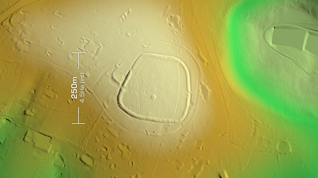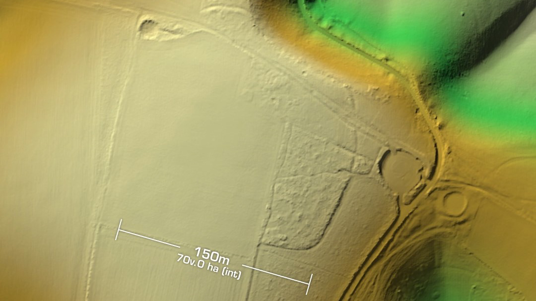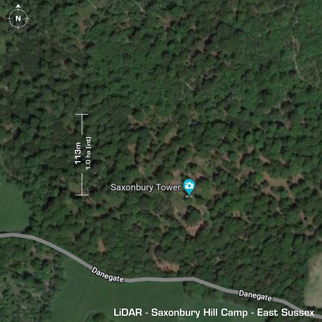

DTM- (Digital Terrain Model, i.e. No buildings or foliage) To the North of the village, Mark Cross and within Nap wood lies the small univallate contour hillfort, Saxonbury Hill Camp. When I downloaded the LiDAR tile for this hillfort, I have to say I was expecting great things due to the name. It’s a bit of a disappointment to be honest but has plenty of history going back to the prehistoric. First excavated in 1929 found its stone-based construction. Earlier buried foundations of a prehistoric enclosure were also revealed. Finds include Flint artefacts, Iron age pottery & copious amounts of iron age slag and a 1st century Roman coin. Building foundations were also excavated. A derelict 19th century folly is still on site and is called the Saxonbury Tower. (Not on this LiDAR but added to the images, © www.castles.nl) Iron Age tribal association (conjecture based on location): Regni (Scheduled Monument)