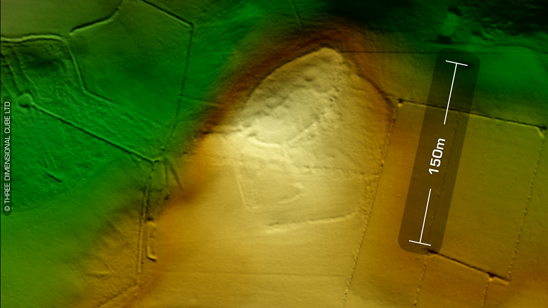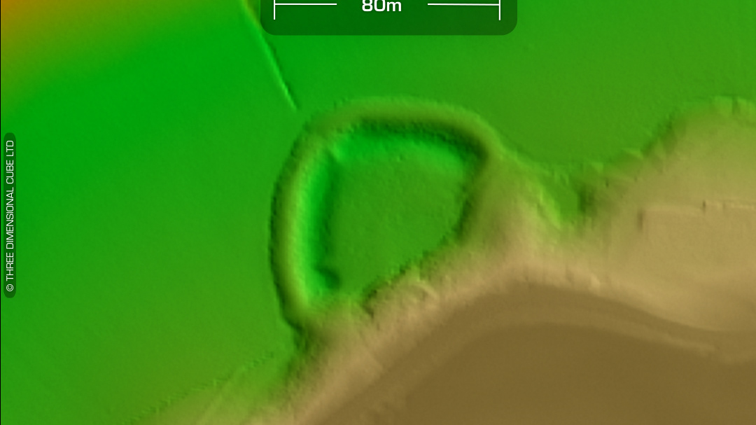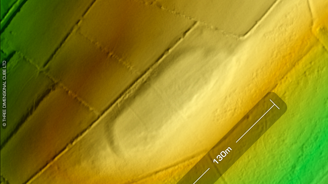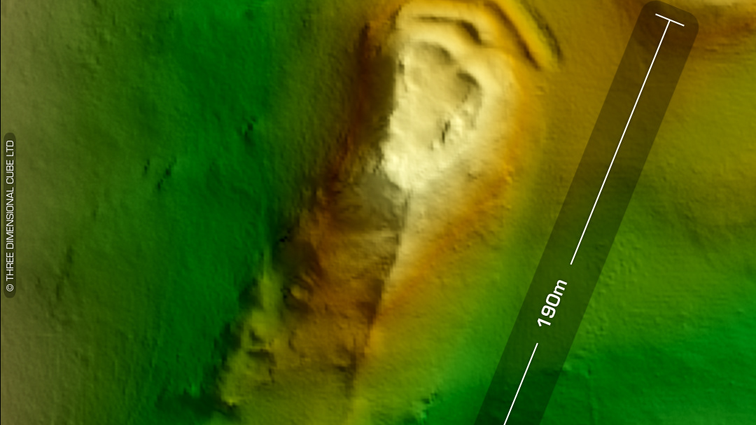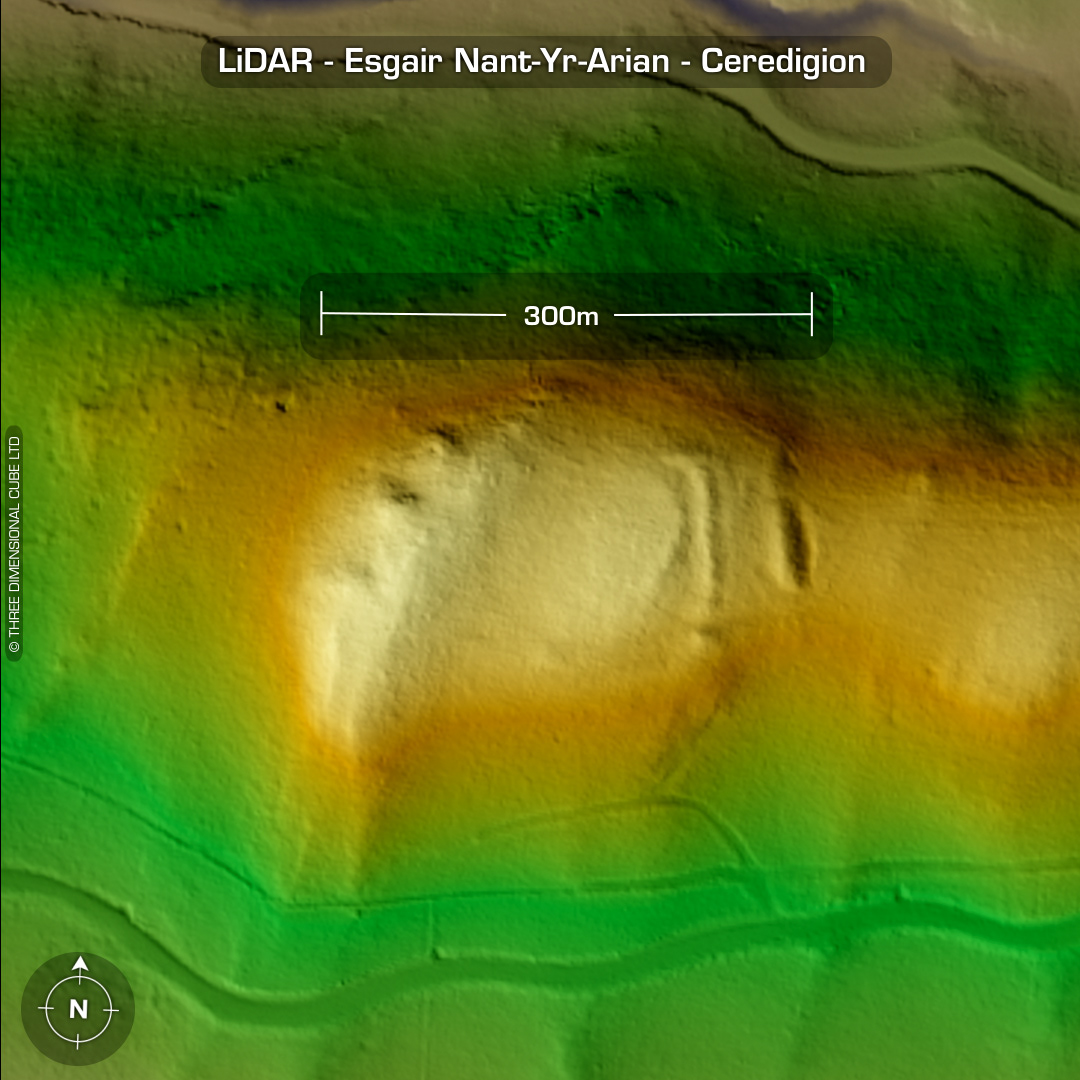
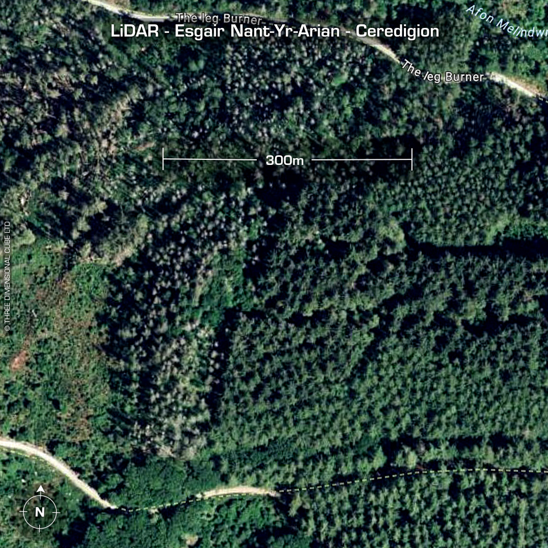
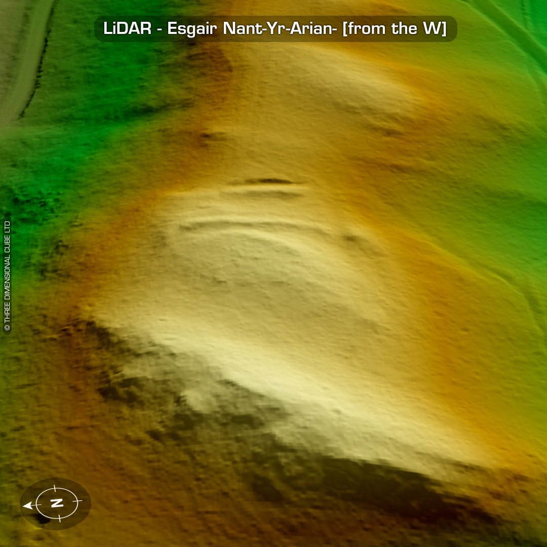
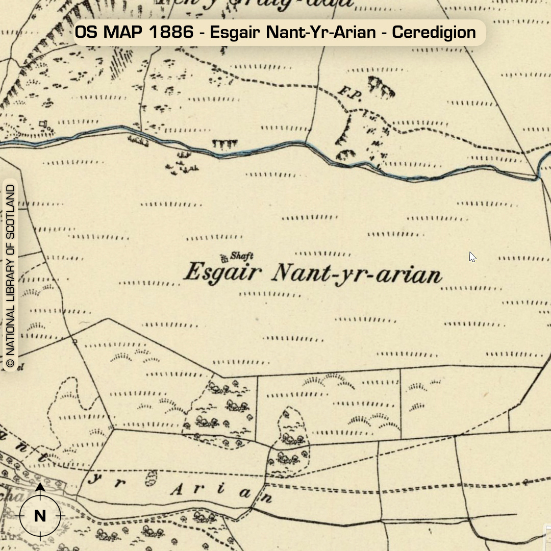
DTM- (Digital Terrain Model, i.e. No buildings or foliage) Overlooking the A44 as it passes the Bwlch Nant yr Arian Forest Visitor Centre sits the promontory fort, Esgair Nant-Yr-Arian. Not listed on early OS maps. Earliest record in 1926. Heavily wooded with bramble interior. If you squint at the oblique LiDAR you can just make out a couple of circular hut platforms. (I didn’t bother with an oblique Bing Map overview as its just trees) No recorded finds or excavations, hence undated*. (Scheduled monument) Iron Age tribal association (conjecture based on location): Demetae *Possible age range 2000-2700BP (Before present) Descriptions from hillforts.arch.ox.ac.uk & Dyfed Archaeological Trust HER. 1st ED OS Mapping via National Library of Scotland. Contains public sector information licensed under the Open Government Licence v3.0.