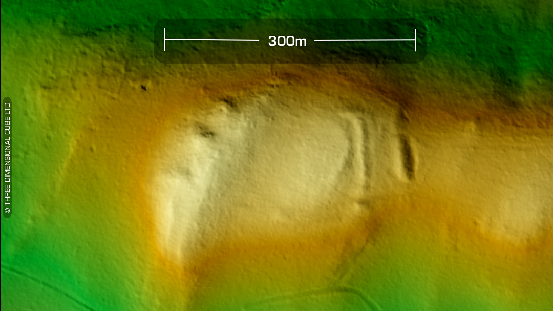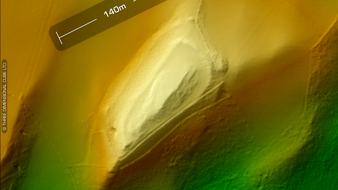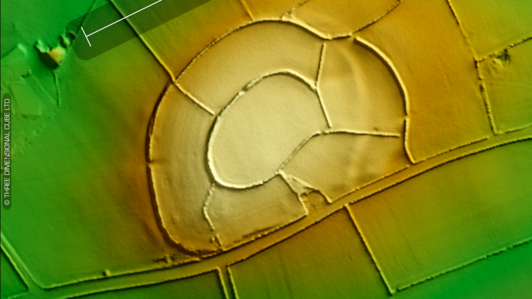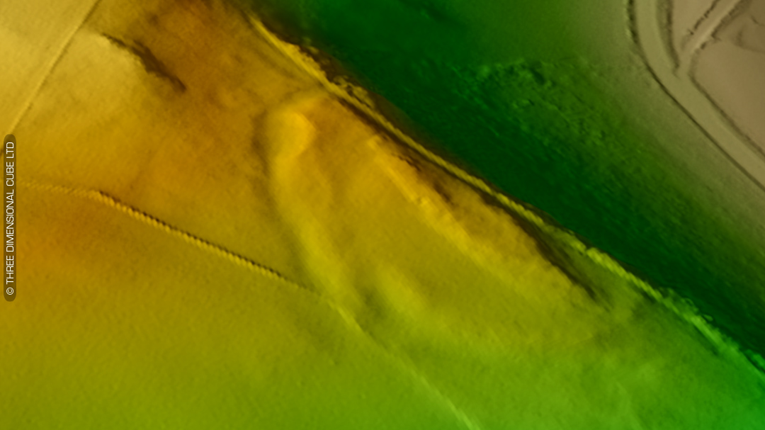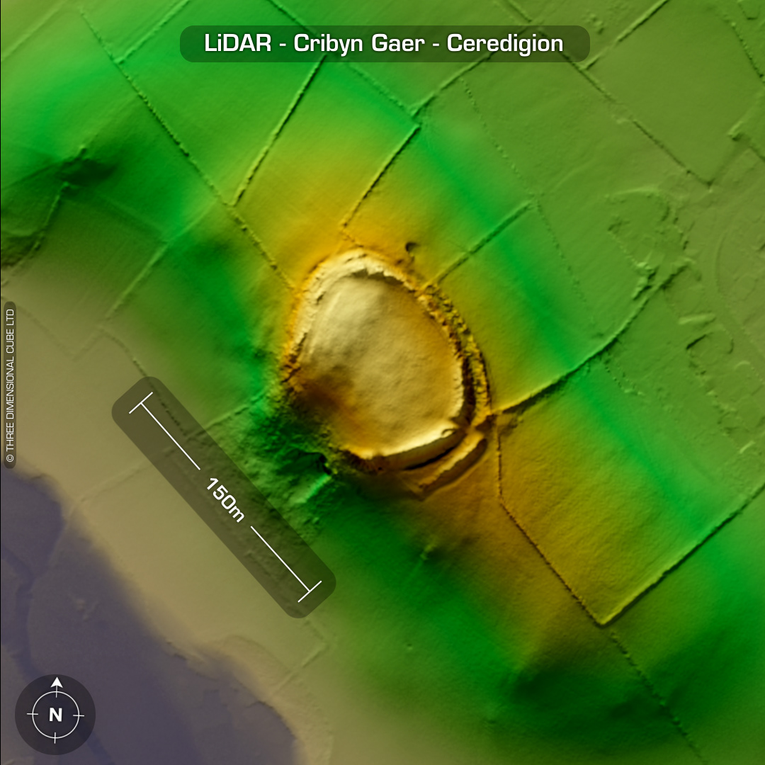
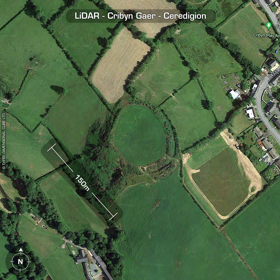
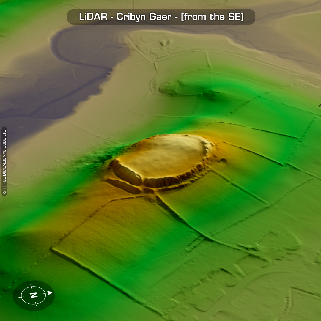
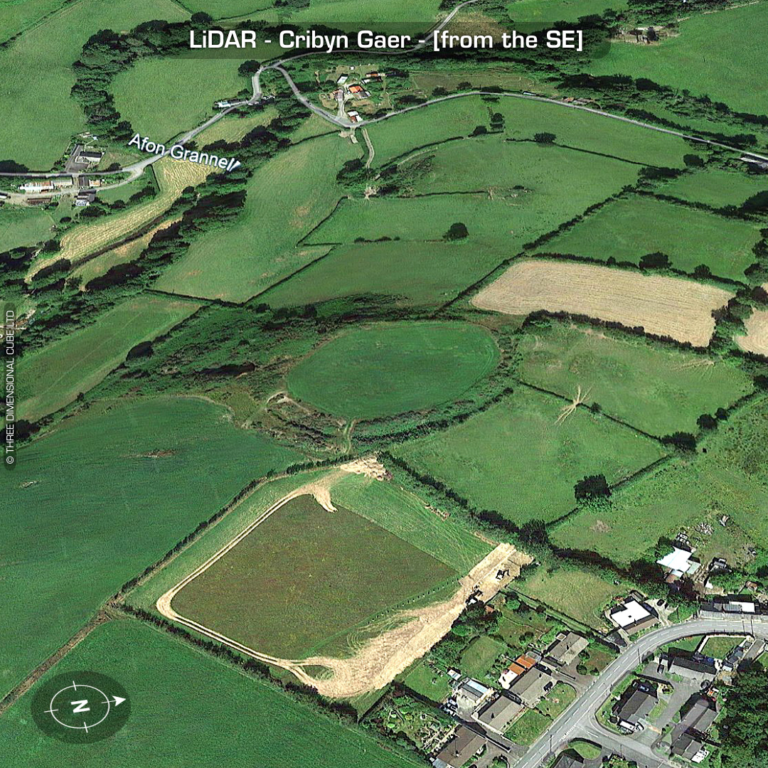
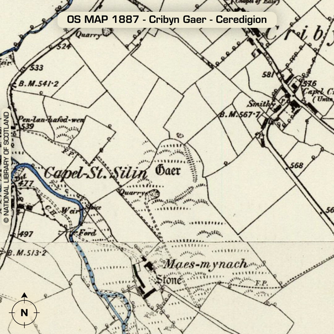
DTM- (Digital Terrain Model, i.e. No buildings or foliage) On a ridge overlooking the village of Cribyn from the south lies the bivallate hillfort, Cribyn Gaer. Possible small annex between ramparts on SE corner. Entrance on SE corner. Two possible hut platforms visible on LiDAR on south side of interior. (The elevation of the LiDAR data was exaggerated to bring these features out) No recorded finds or excavations, hence undated*. (Scheduled monument) Iron Age tribal association (conjecture based on location): Demetae *Possible age range 2000-2700BP (Before present) Descriptions from hillforts.arch.ox.ac.uk & Dyfed Archaeological Trust HER. 1st ED OS Mapping via National Library of Scotland. Contains public sector information licensed under the Open Government Licence v3.0.