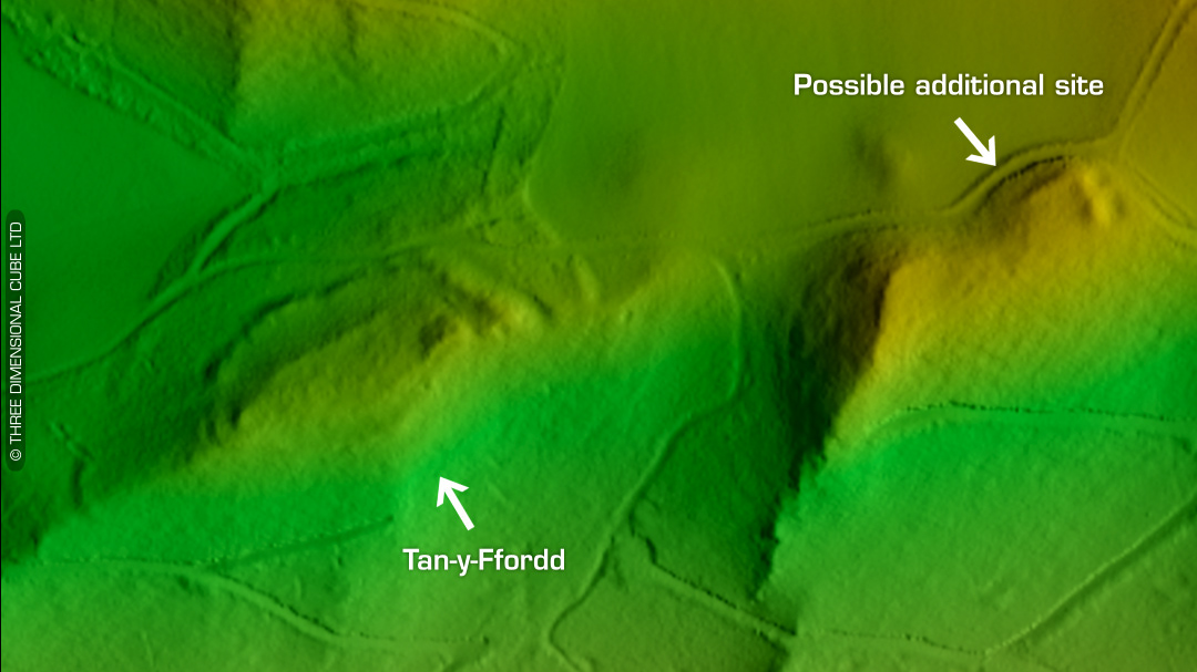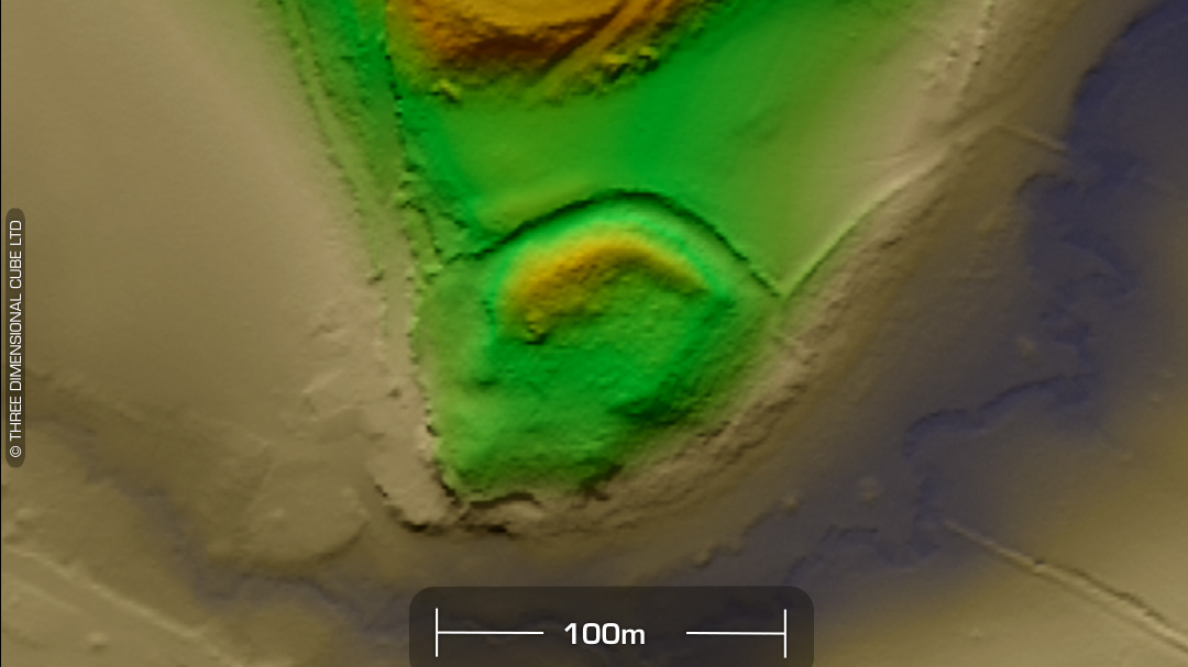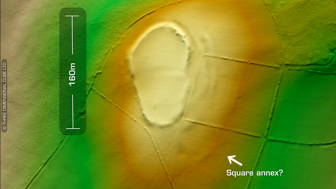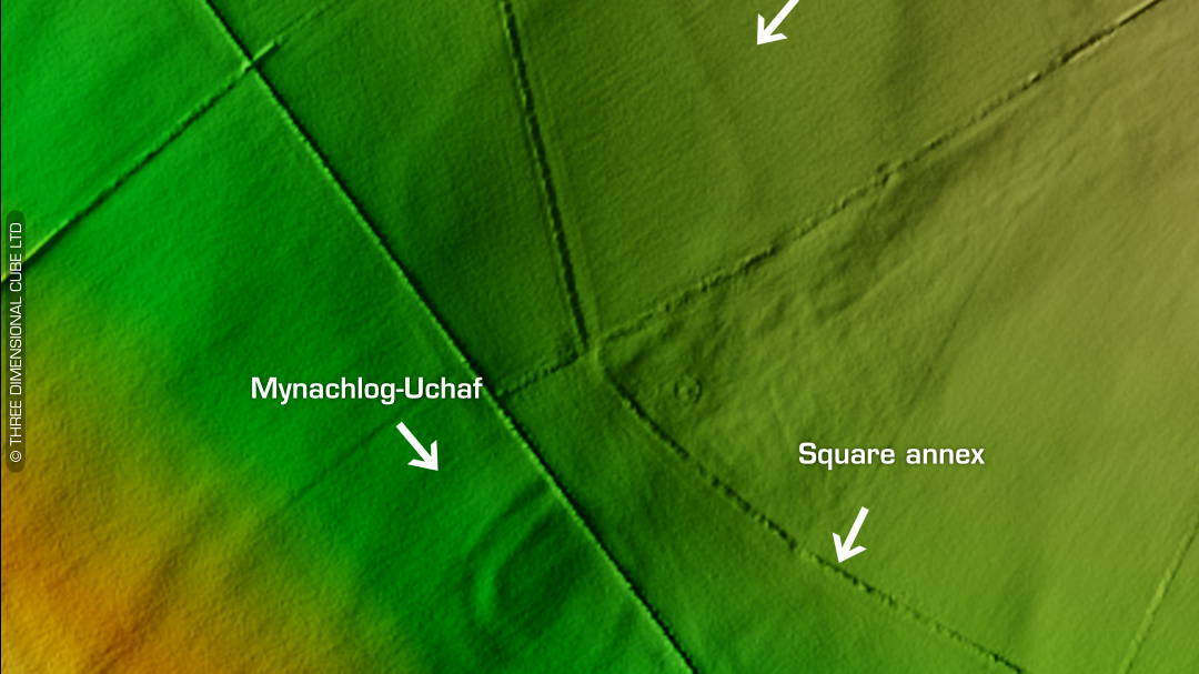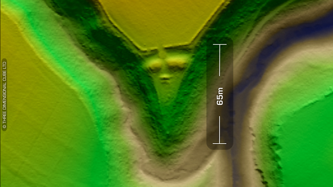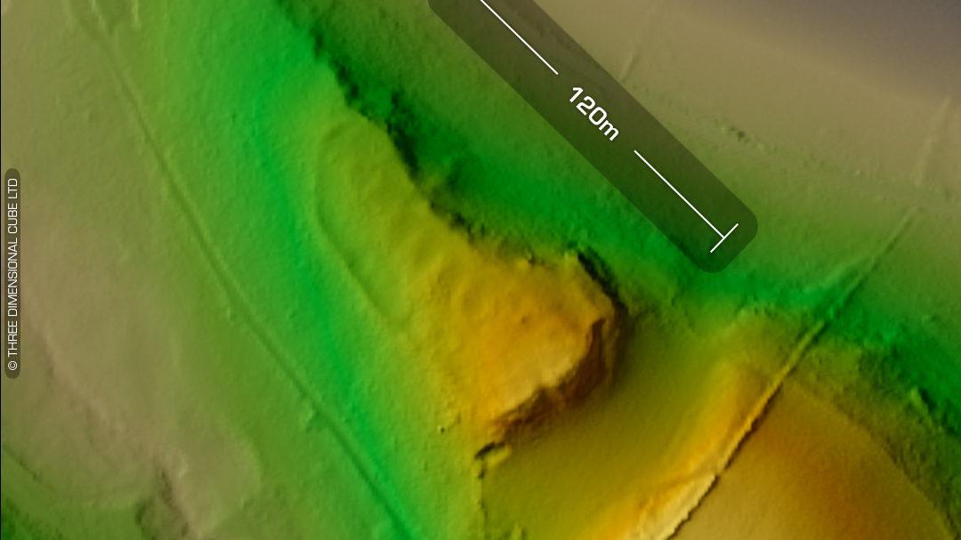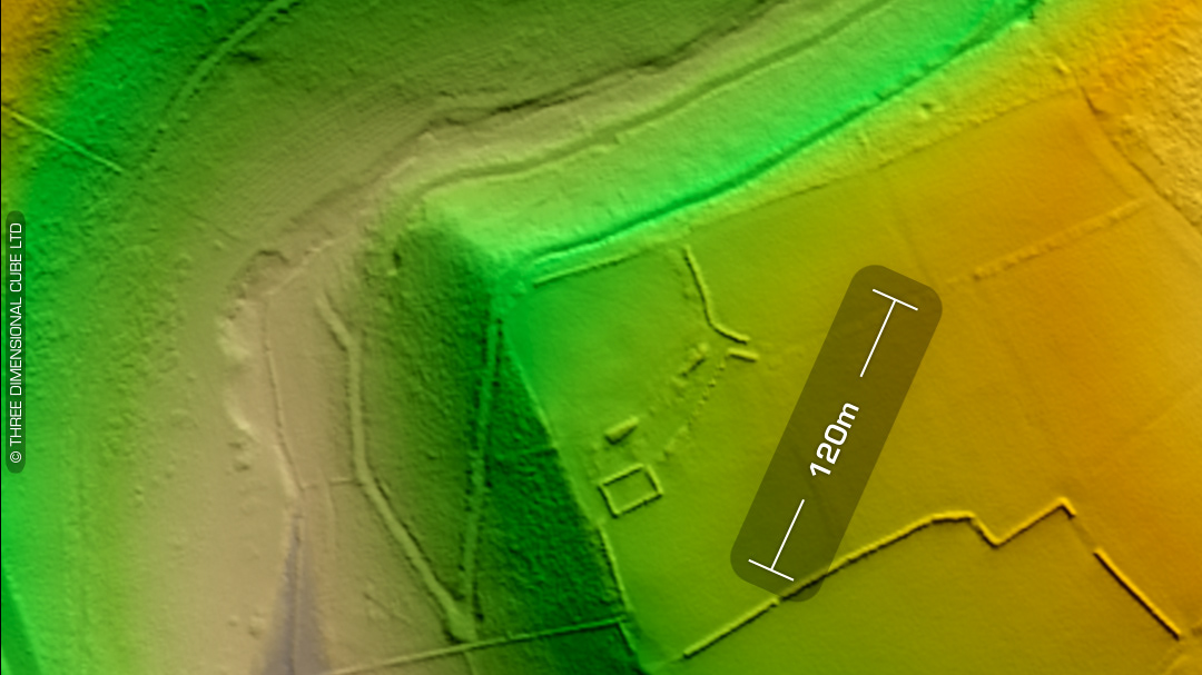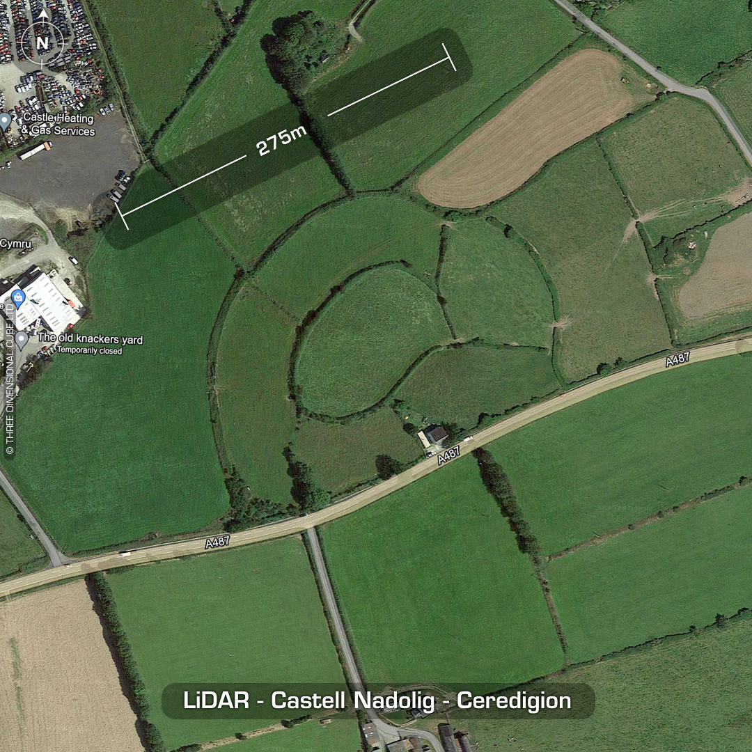
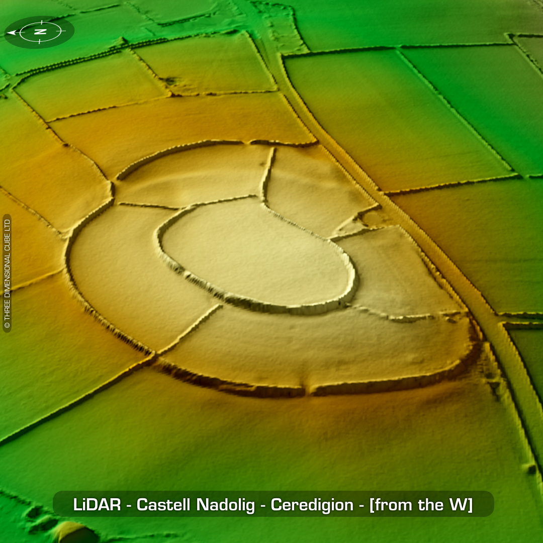
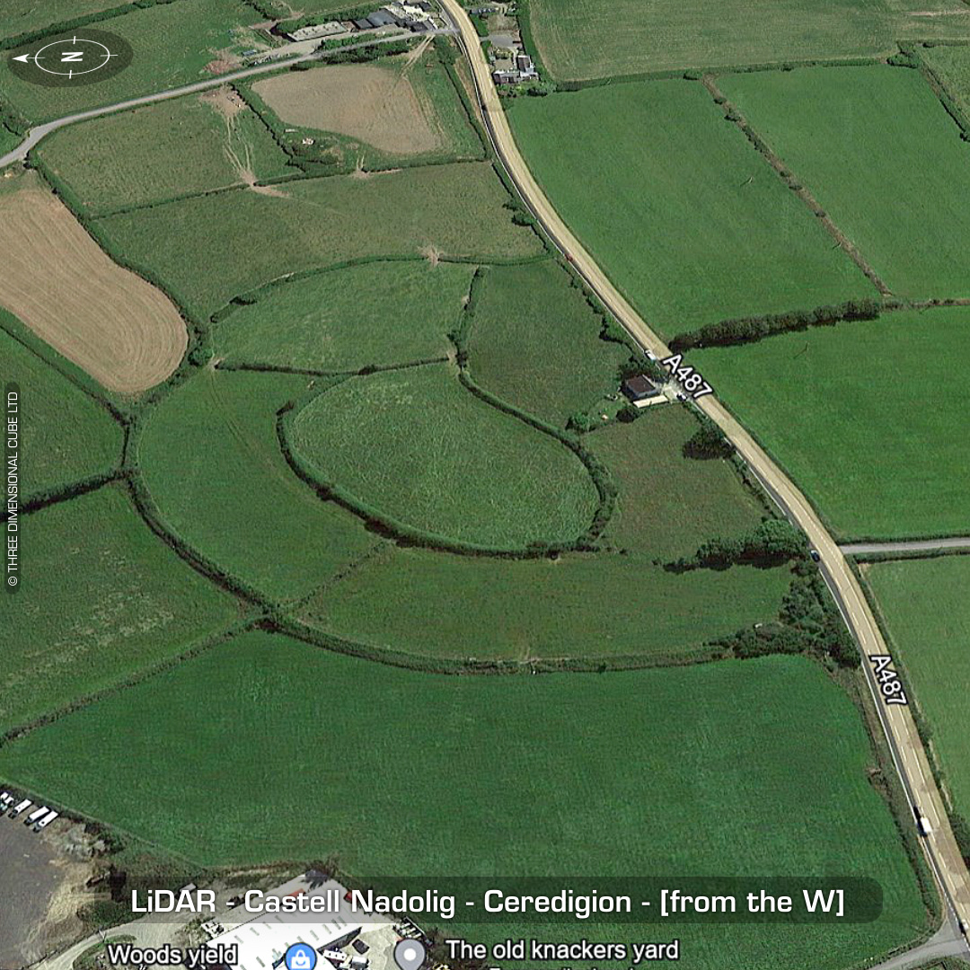
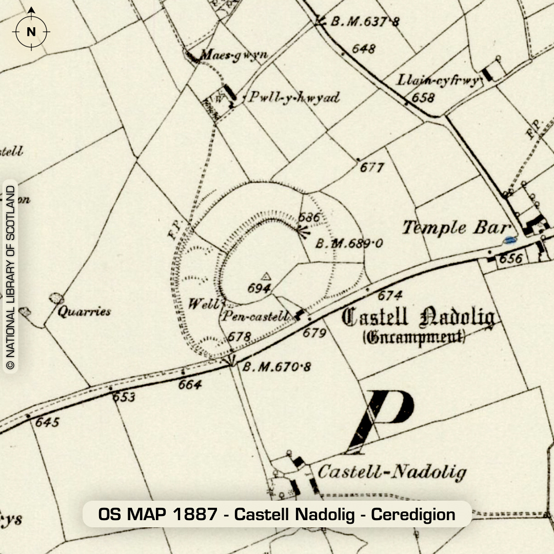
DTM- (Digital Terrain Model, i.e. No buildings or foliage) Just to the south & overlooking the National Trust site of Penbryn but resting atop the A487 sits the complex hillfort, Castell Nadolig. Original rampart circuit either removed (or degraded by ploughing) for the annex extension on east-side. Possible hut platforms visible on LiDAR on west-side within outer enclosure ring. South & SE side bisected by A487 but no trace exists in the fields below the road so the remaining shape may be the original shape. No recorded finds or excavations, hence undated*. (Scheduled monument) Iron Age tribal association (conjecture based on location): Demetae *Possible age range 2000-2700BP (Before present) Descriptions from hillforts.arch.ox.ac.uk & Dyfed Archaeological Trust HER. 1st ED OS Mapping via National Library of Scotland. Contains public sector information licensed under the Open Government Licence v3.0.