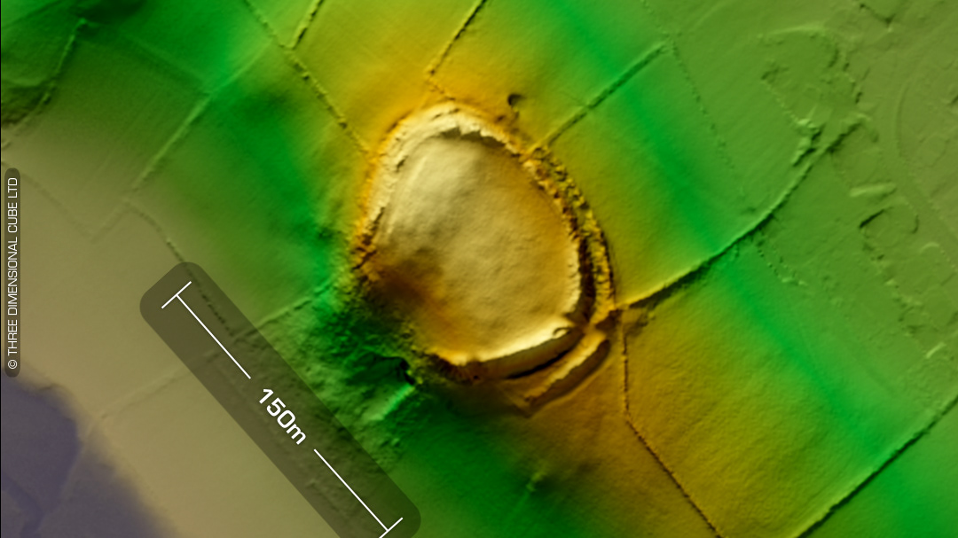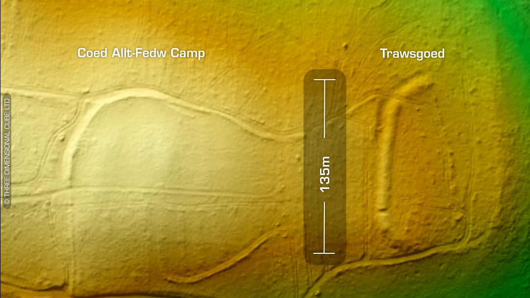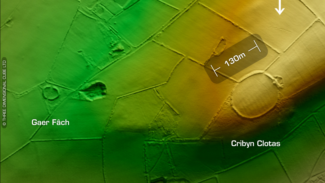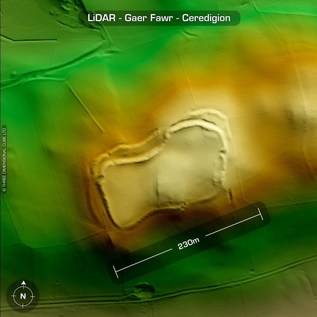
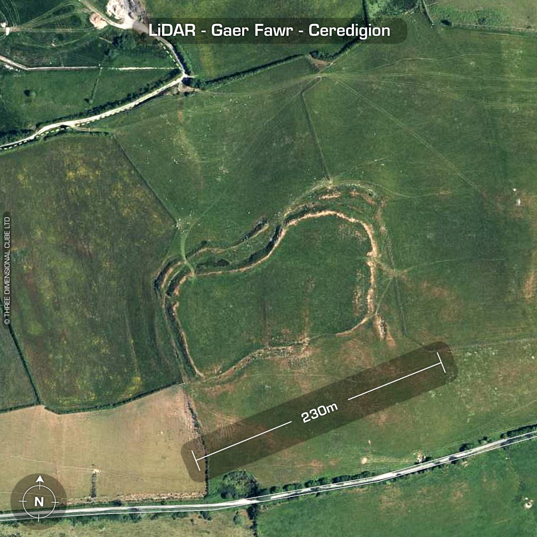
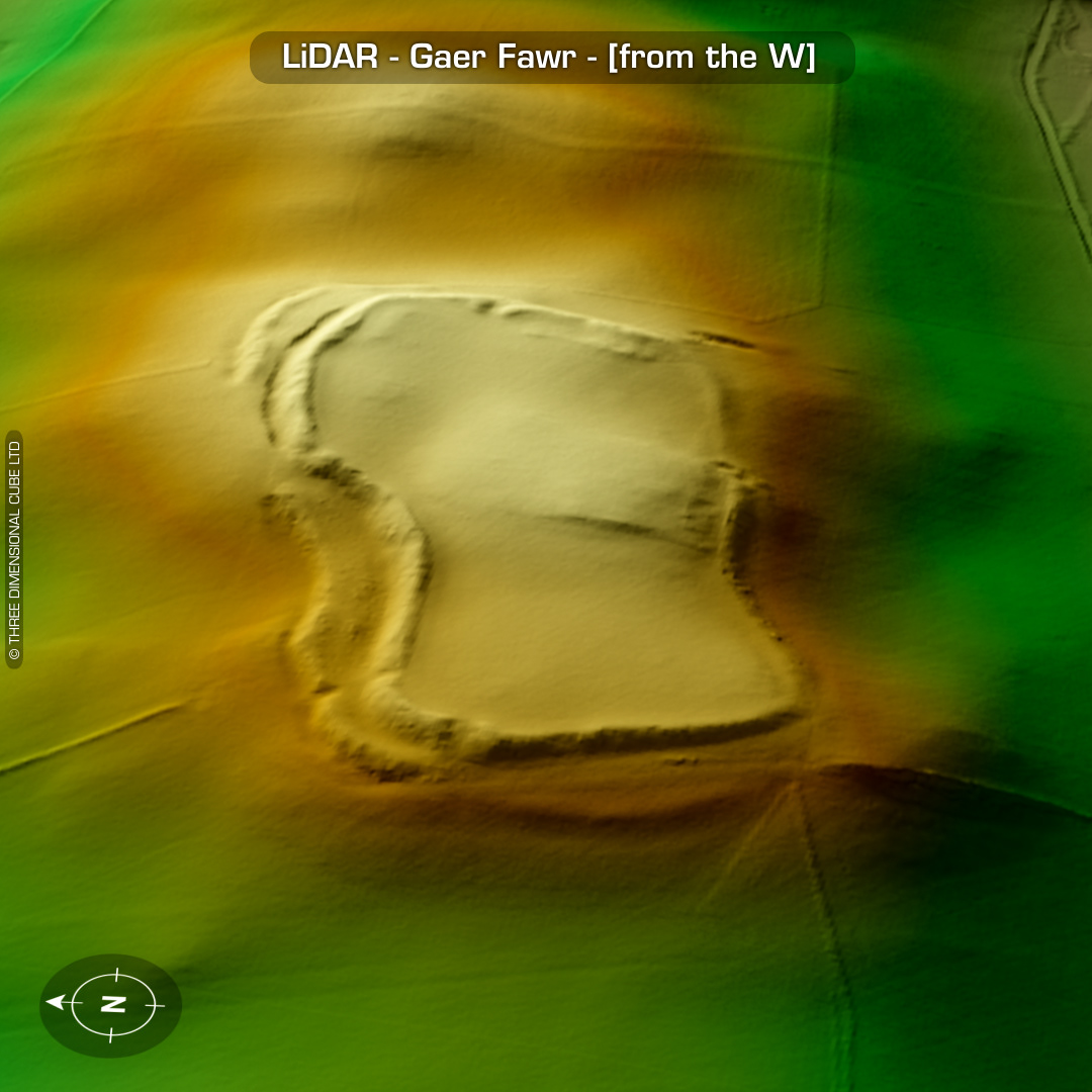

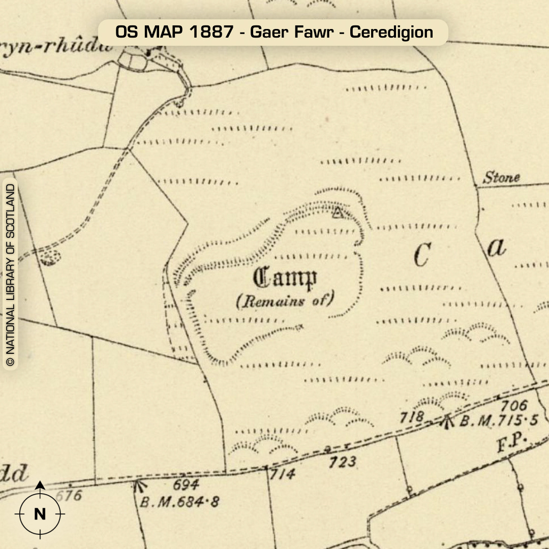
DTM- (Digital Terrain Model, i.e. No buildings or foliage) Overlooking the A485 from the east just north of the village of Lledrod sits the bivallate contour hillfort, Gaer Fawr. Inturned entrance on east-side. Possibly an unfinished site suggested by an incomplete circuit of the outer rampart (Hogg). The whole area is populated with ‘Bronze age’ standing stones classed as ‘Quartz monoliths’. No recorded finds or excavations, hence undated*. (Scheduled monument) Iron Age tribal association (conjecture based on location): Demetae *Possible age range 2000-2700BP (Before present) Descriptions from hillforts.arch.ox.ac.uk & Dyfed Archaeological Trust HER. 1st ED OS Mapping via National Library of Scotland. Contains public sector information licensed under the Open Government Licence v3.0.