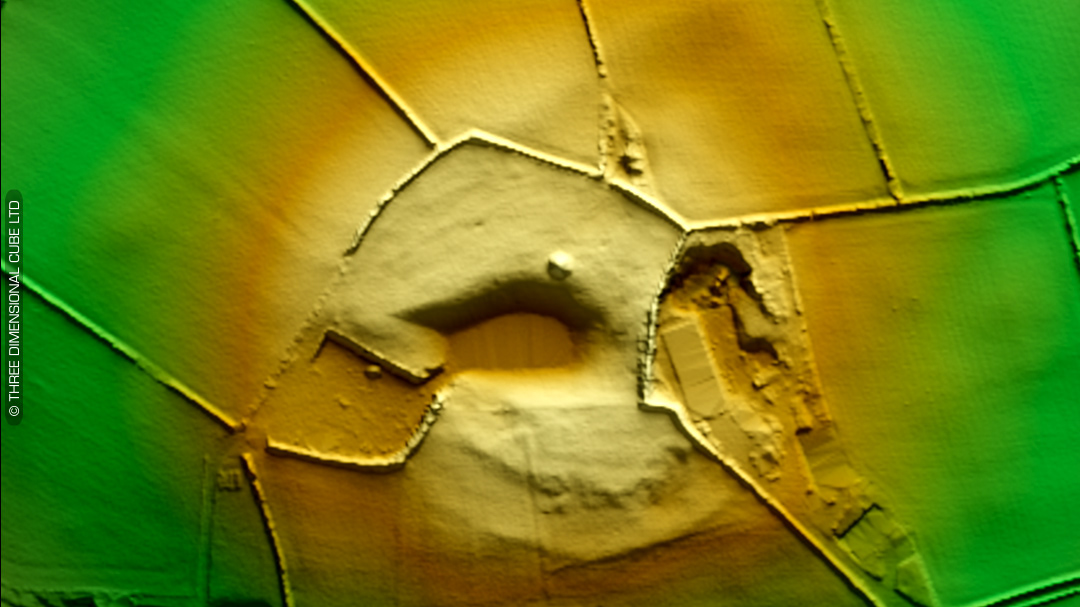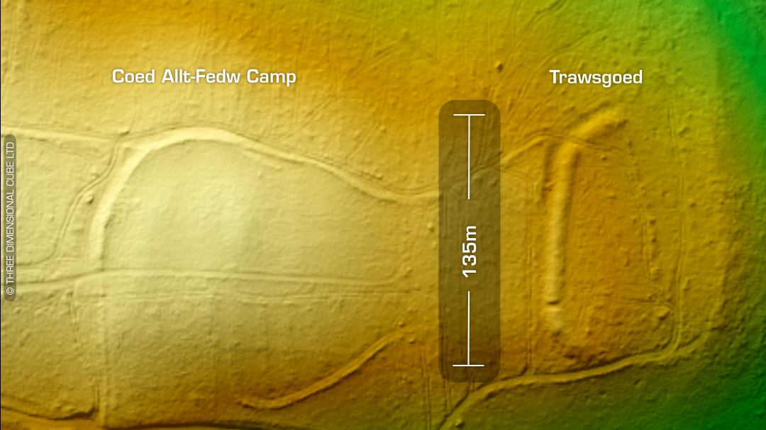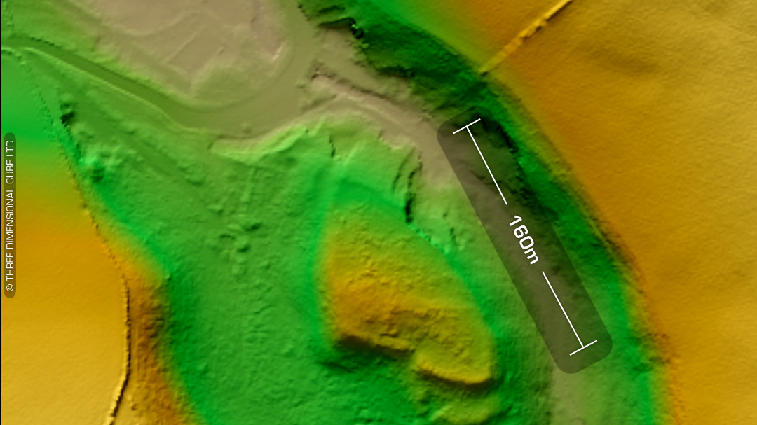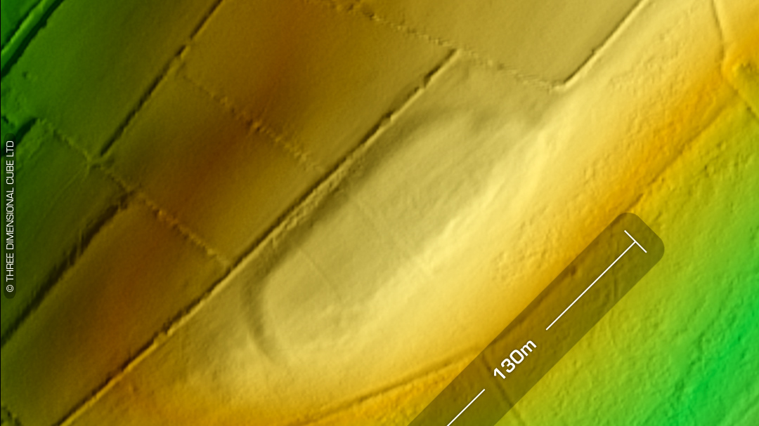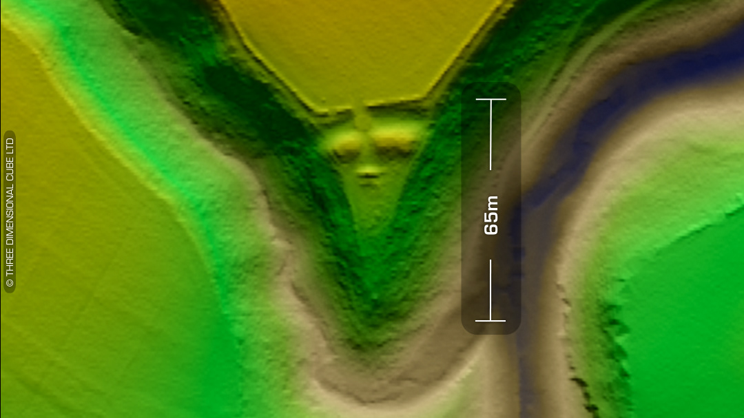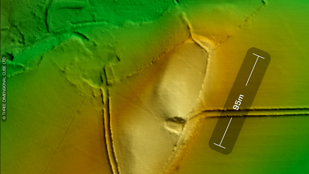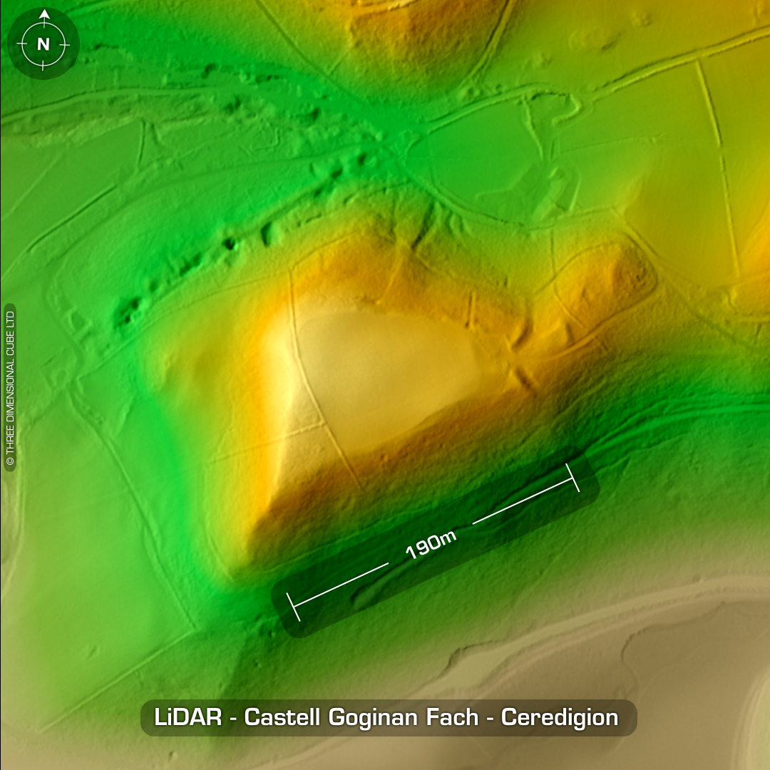


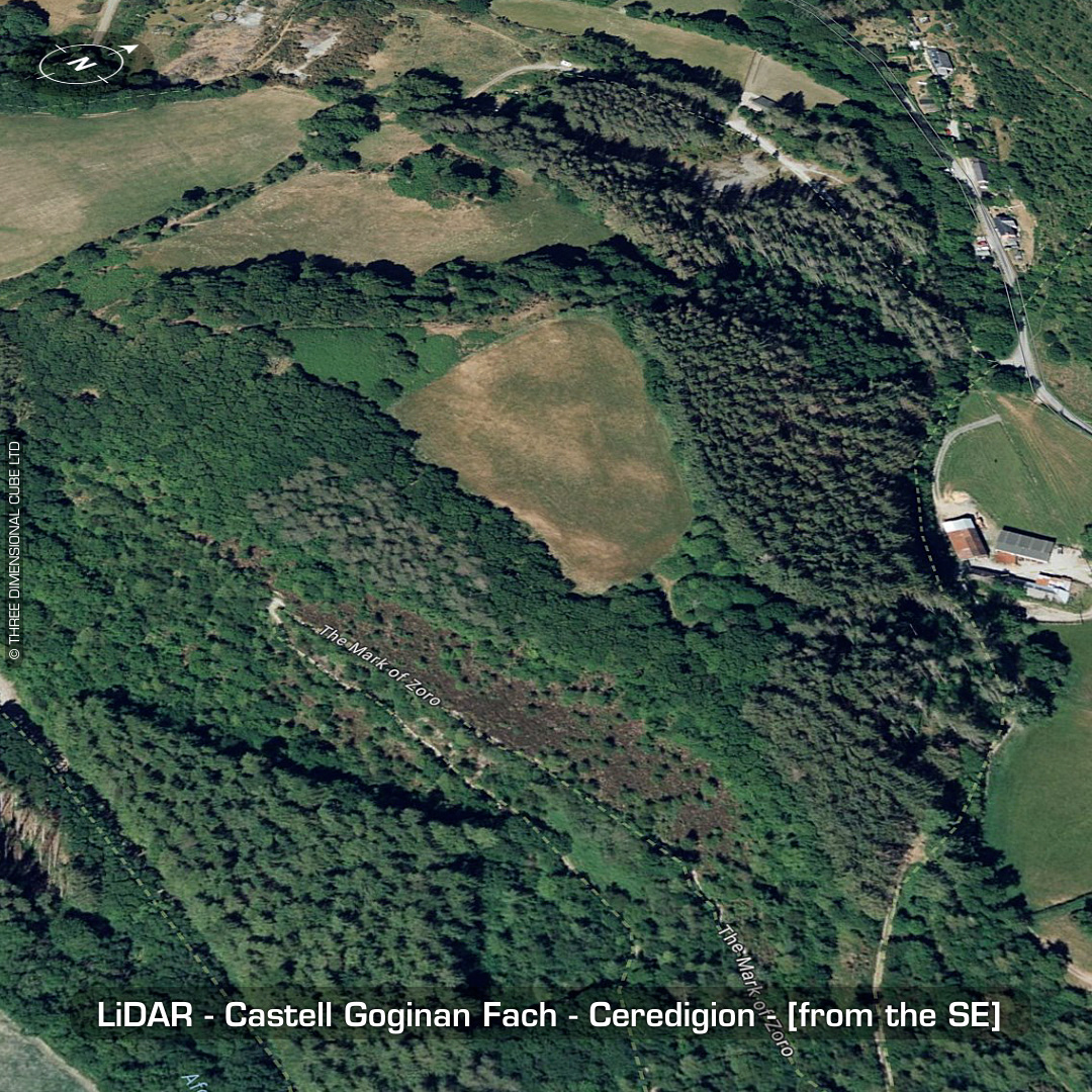

DTM- (Digital Terrain Model, i.e. No buildings or foliage) Seven miles east of Aberystwyth & overlooking the village of Old Goginan from the east and its long abandoned associated lead mine sits the inland promontory fort, Castell Goginan Fach. East facing funnel shaped bastion entrance. The lean mine operated between the late 1500’s to 1886 when it finally closed due to falling lead prices. No recorded finds or excavations, hence undated*. (Scheduled monument) Iron Age tribal association (conjecture based on location): Demetae *Possible age range 2000-2700BP (Before present) Descriptions from hillforts.arch.ox.ac.uk & Dyfed Archaeological Trust HER. 1st ED OS Mapping via National Library of Scotland. Contains public sector information licensed under the Open Government Licence v3.0.