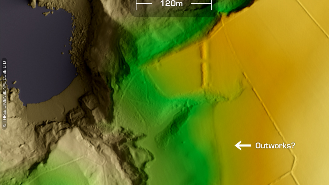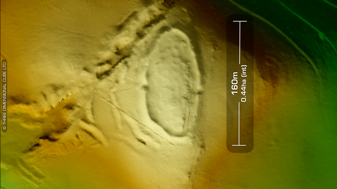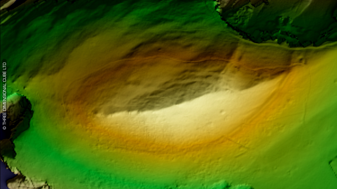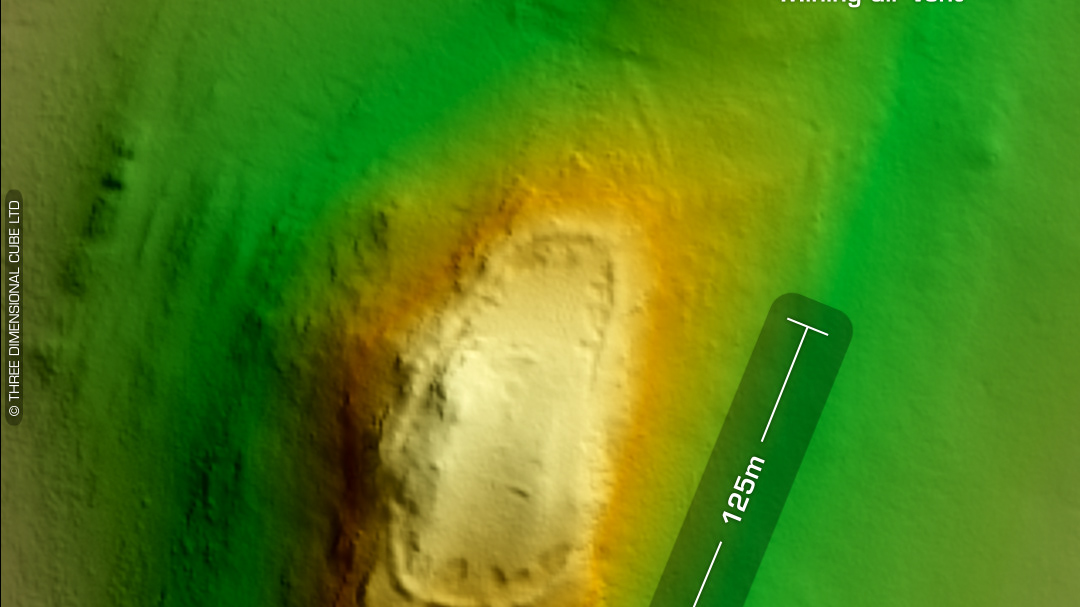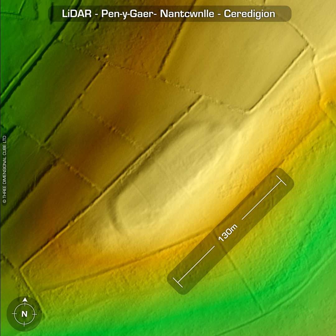
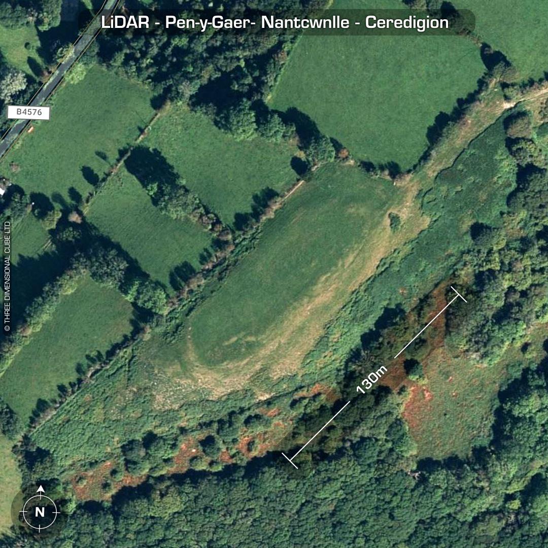
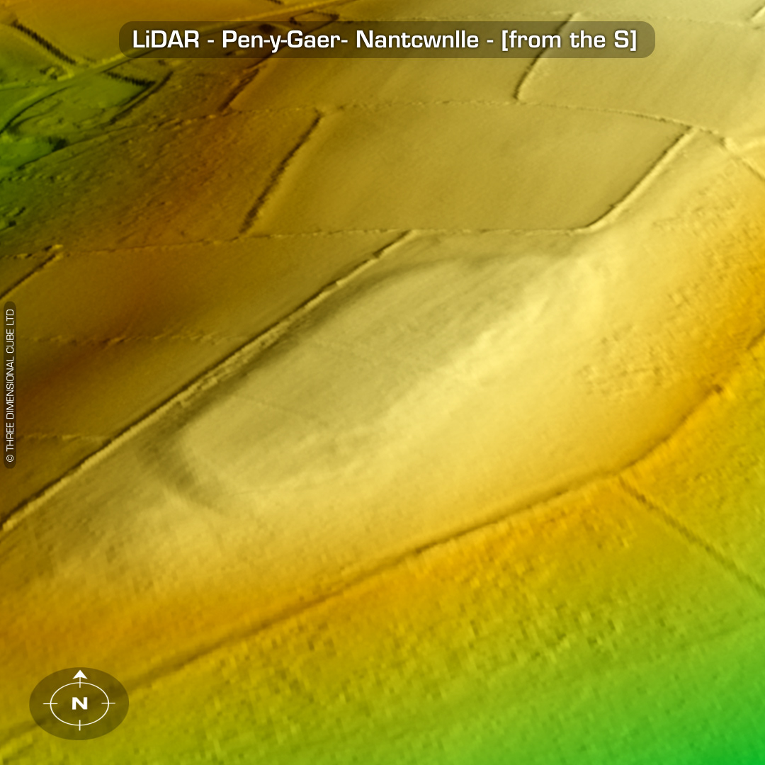
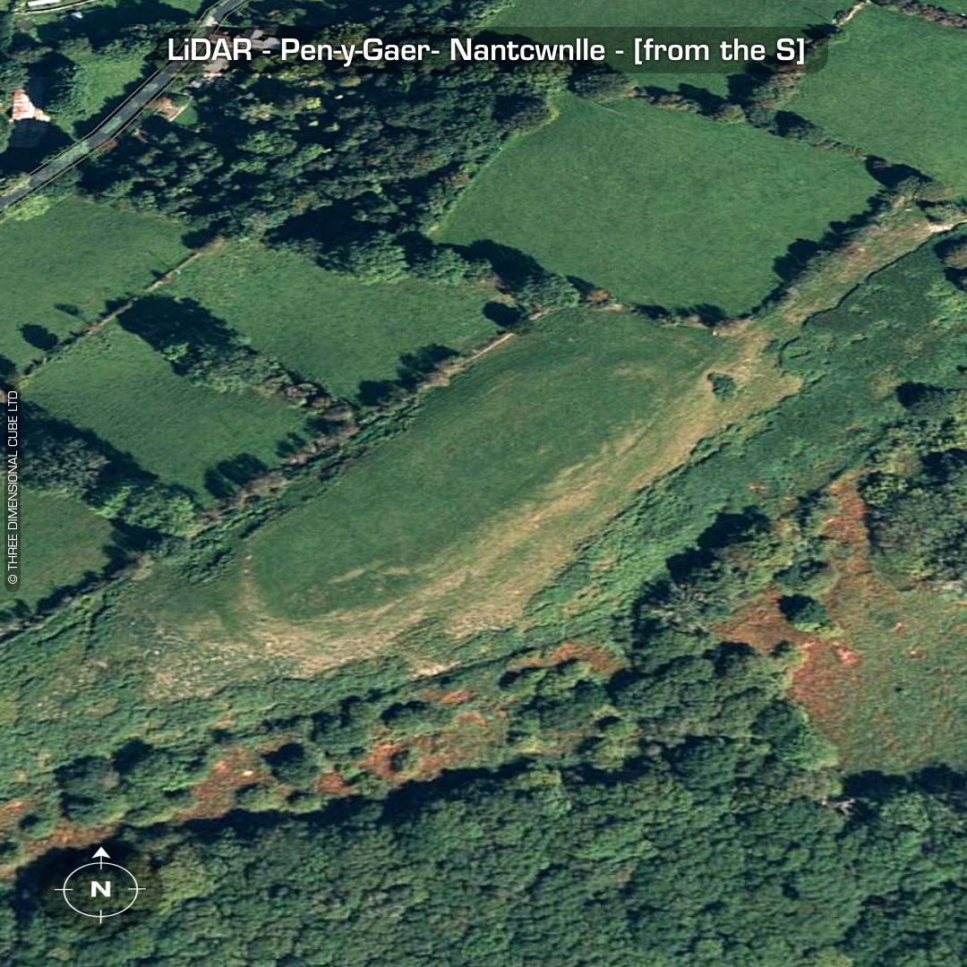
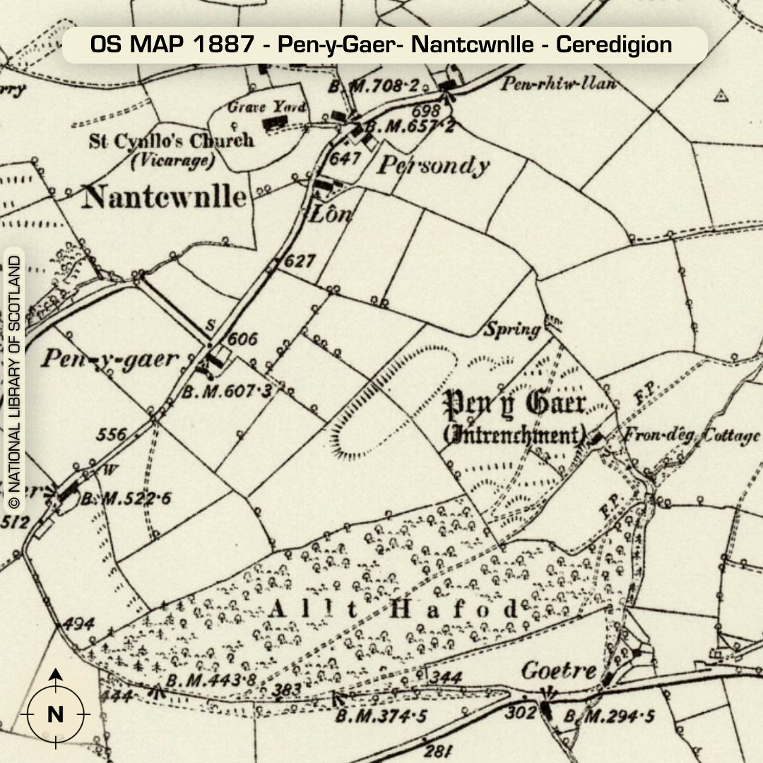
LiDAR – Pen-y-Gaer- Nantcwnlle - Ceredigion DTM- (Digital Terrain Model, i.e. No buildings or foliage) Overlooking the village of Bwlch-Ilan from the south is the almost ploughed-out plateau-situated hillfort, Pen-y-Gaer. Gap in northern bank is the entrance. No recorded excavations or finds, hence undated*. (Scheduled monument) Iron Age tribal association (conjecture based on location): Demetae *Possible age range 2000-2700BP (Before present) Descriptions from hillforts.arch.ox.ac.uk & Dyfed Archaeological Trust HER. 1st ED OS Mapping via National Library of Scotland. Contains public sector information licensed under the Open Government Licence v3.0.