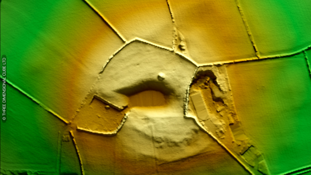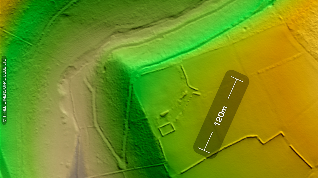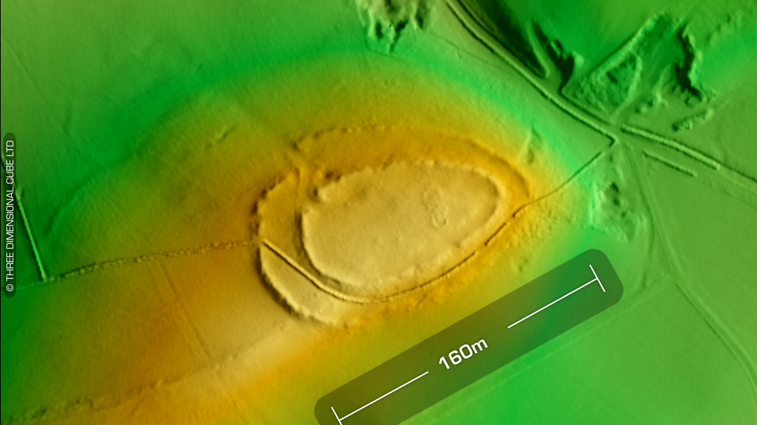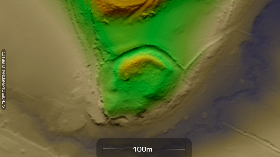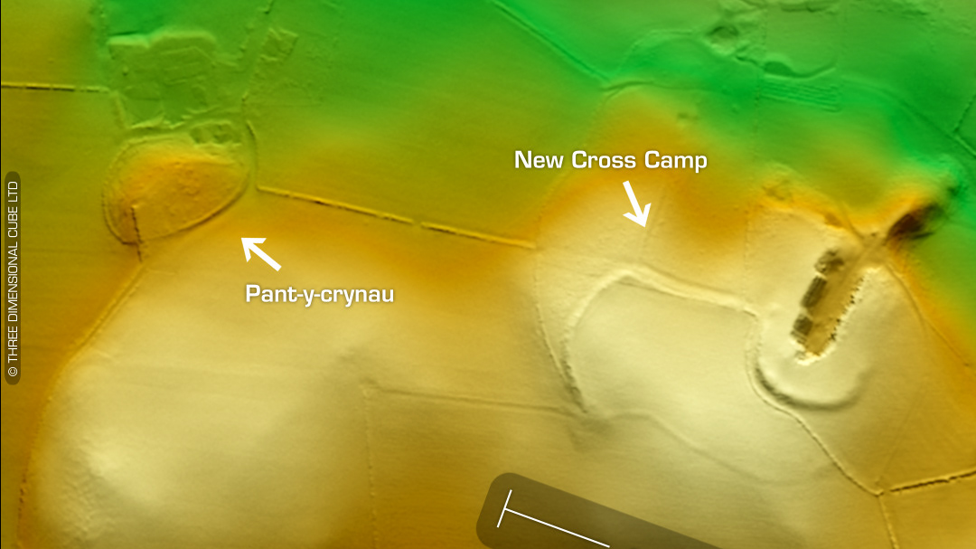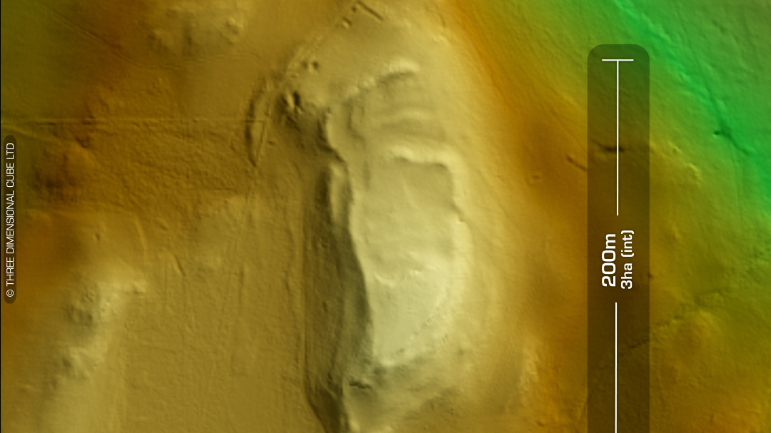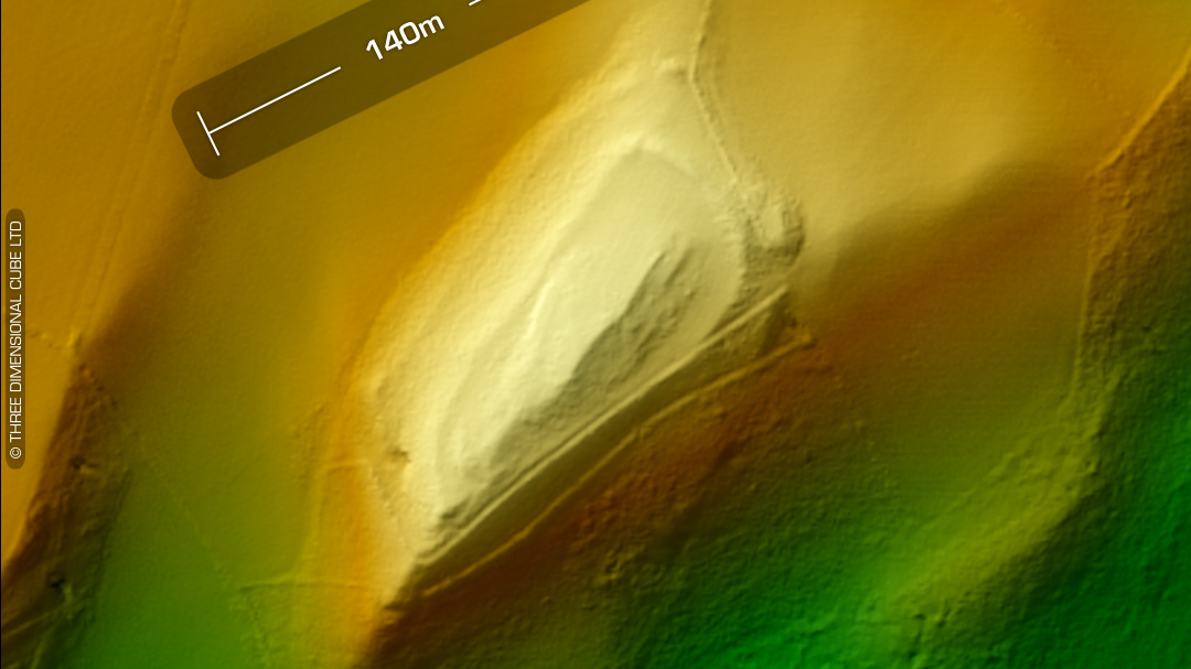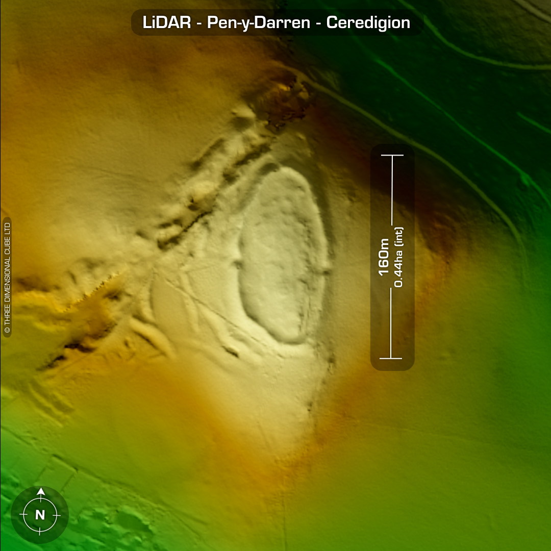


LiDAR – Pen-y-Darren - Ceredigion DTM- (Digital Terrain Model, i.e. No buildings or foliage) 2km northwest of the village of Goginan and overlooking the old mining works of ‘Daren’ lies the damaged by mining works but still extant contour hillfort, Pen-y-Darren (or Banc Y Darren). A survey found at least ten house platforms and terraces populating the interior. Bronze age cain at summit. West & east side entrances. Annex layout disturbed by medieval & post medieval mining. Minor excavation (T. Driver) in 1996 found a well-built revetment wall as well as a Bronze Age pot sherd. Site landscape populated by Bronze Age standing stones and round barrows. I’ve found what could be a 30m wide bowl barrow on the LiDAR. It predates the old field systems as a boundary bisects the site. The LiDAR picks-out a rock-cut trackway entering the site from the NE. (Scheduled monument) Iron Age tribal association (conjecture based on location): Demetae *Possible age range 2000-2700BP (Before present) Descriptions from hillforts.arch.ox.ac.uk & Dyfed Archaeological Trust HER. 1st ED OS Mapping via National Library of Scotland. Contains public sector information licensed under the Open Government Licence v3.0.