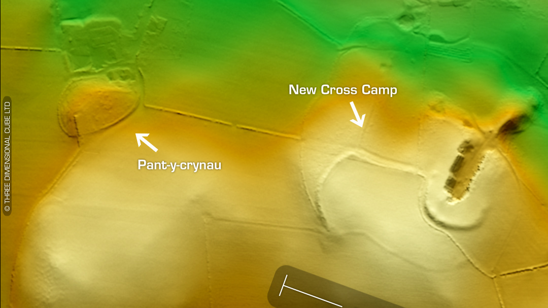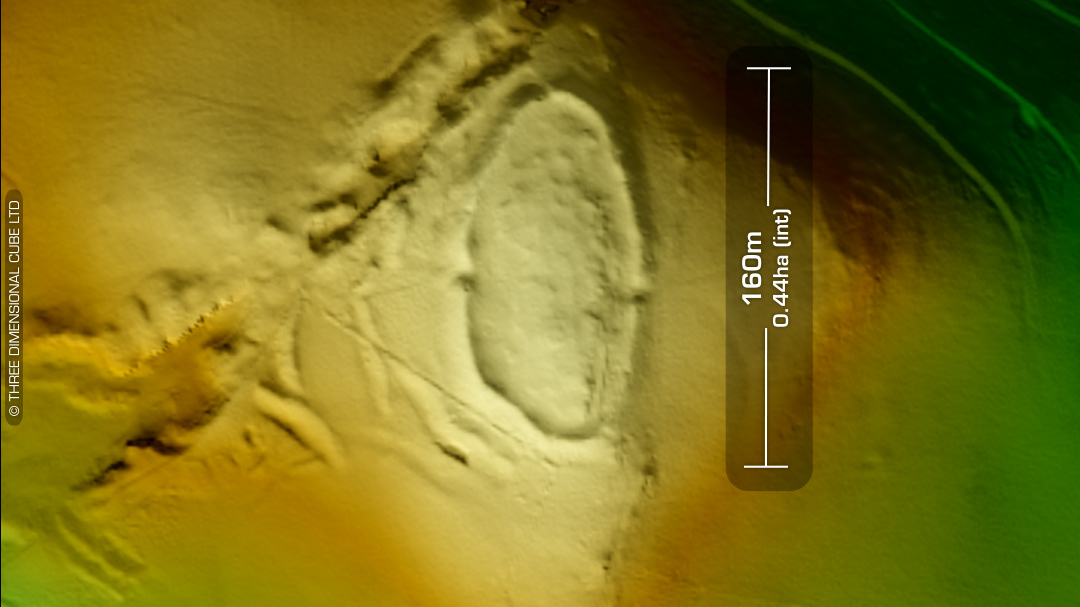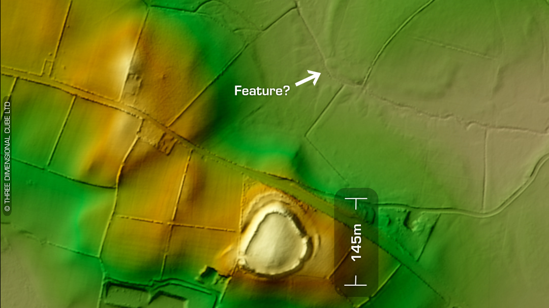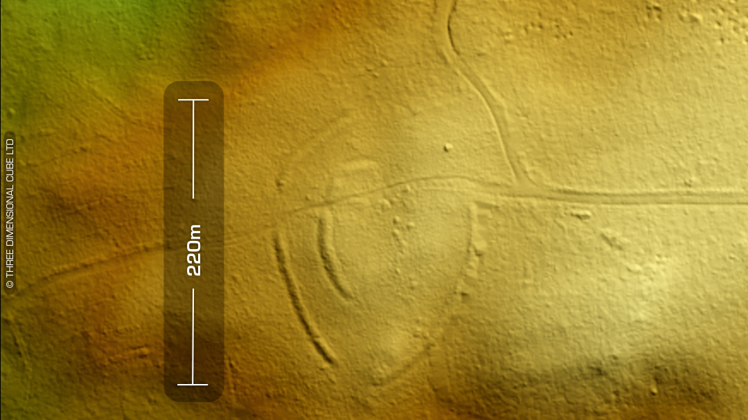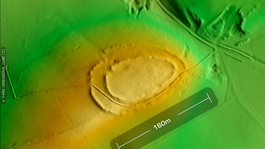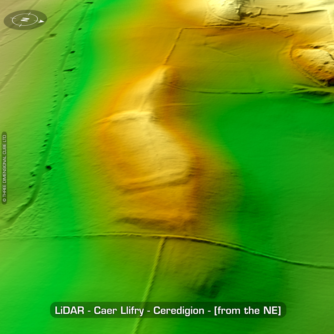


DTM- (Digital Terrain Model, i.e. No buildings or foliage) Overlooking the village of Ystrad Aeron from a ridgeline to the west lies the almost destroyed hillfort, Caer Llifry. Not indicated on early OS maps (as you can see). According to locals the ramparts were levelled completely in the 1990s by the bell-end farmers. West end of fort defended by a bank of shattered shale. Two possible house platforms. First written reference in 1933. No recorded finds or excavations, hence undated*. (Scheduled monument) Iron Age tribal association (conjecture based on location): Demetae *Possible age range 2000-2700BP (Before present) Descriptions from hillforts.arch.ox.ac.uk & Dyfed Archaeological Trust HER. 1st ED OS Mapping via National Library of Scotland. Contains public sector information licensed under the Open Government Licence v3.0.