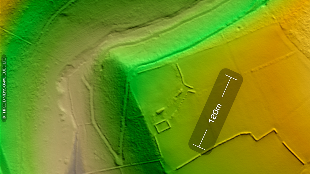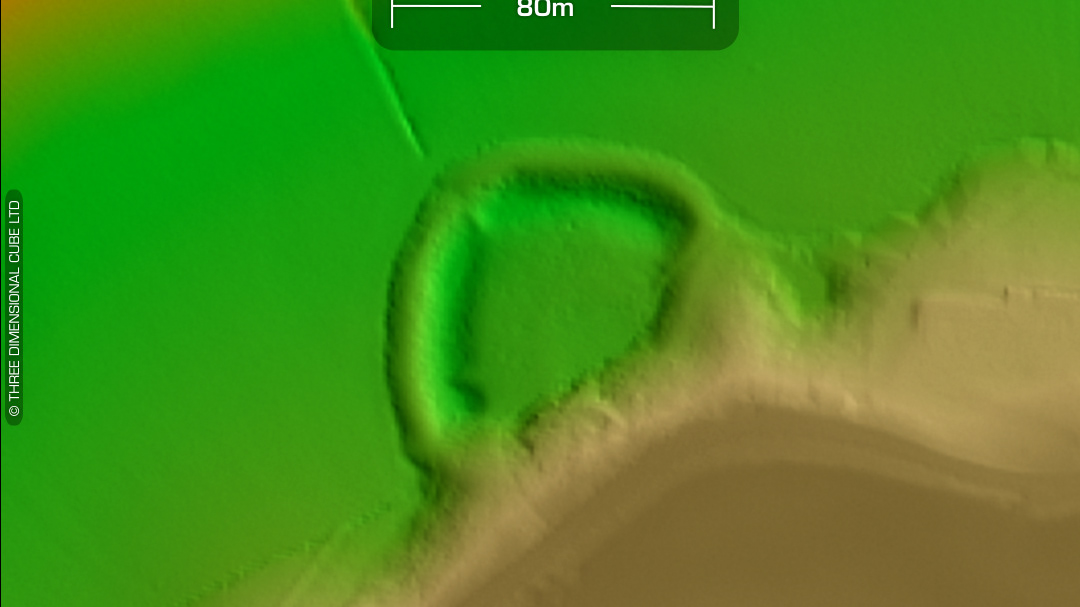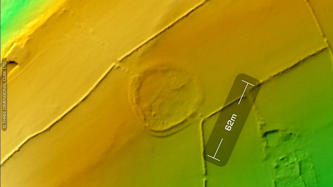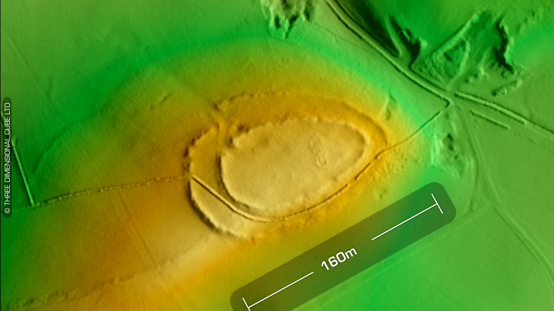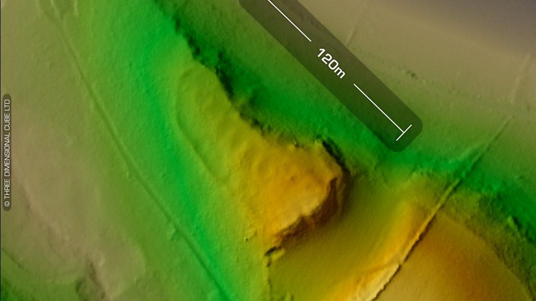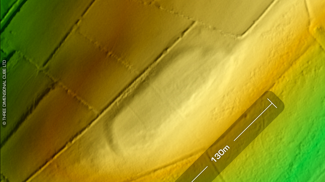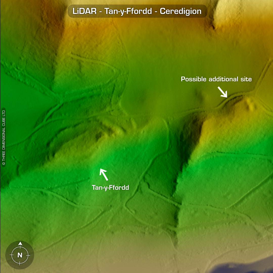
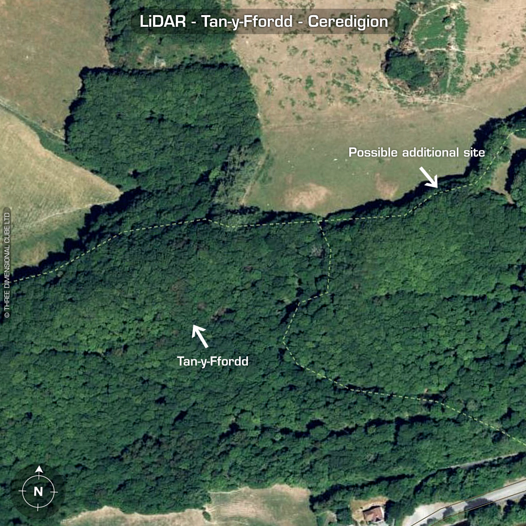
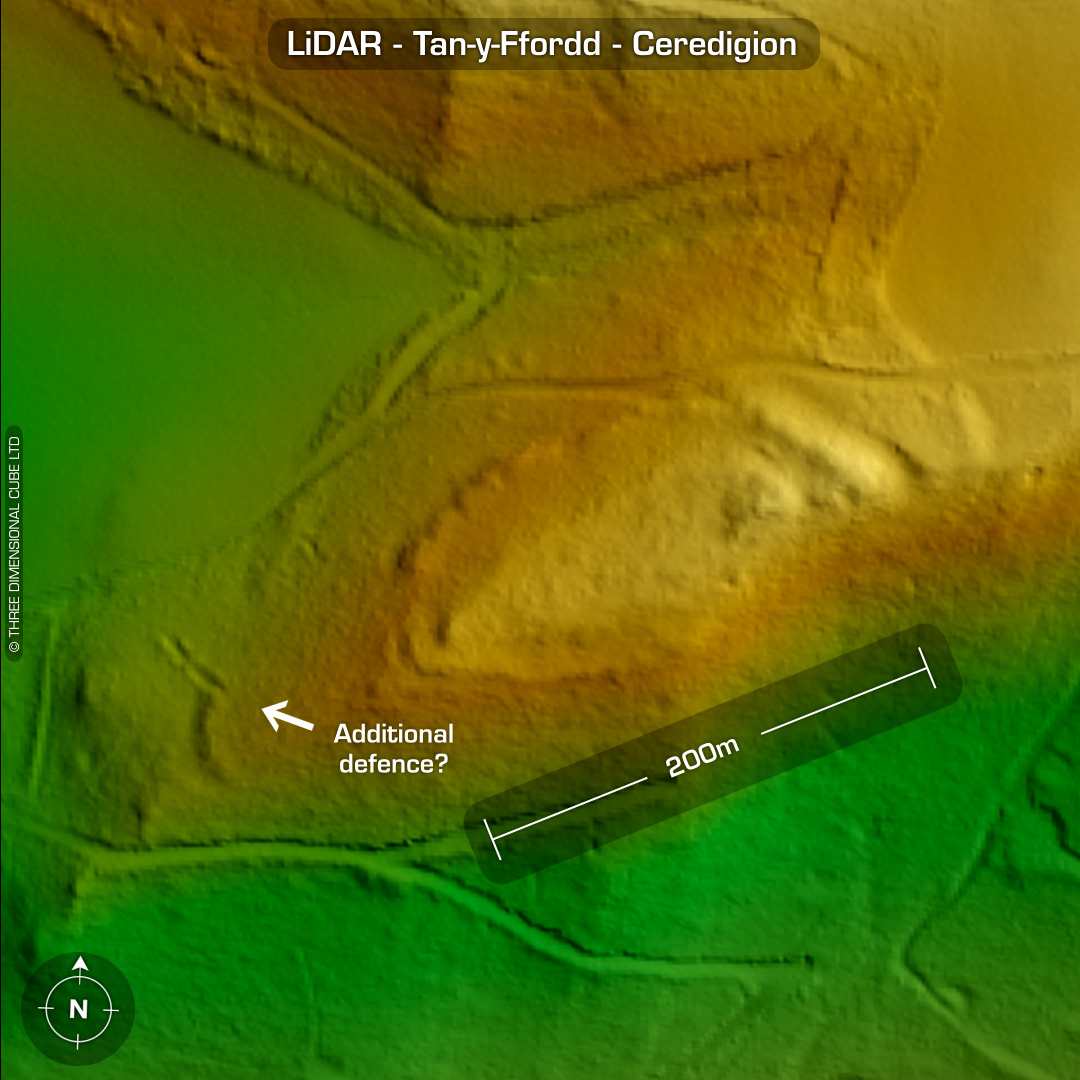

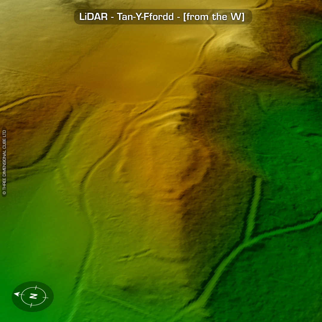
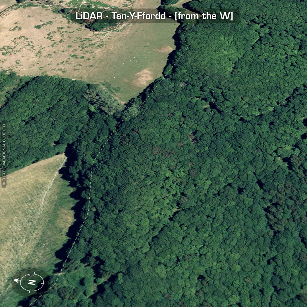
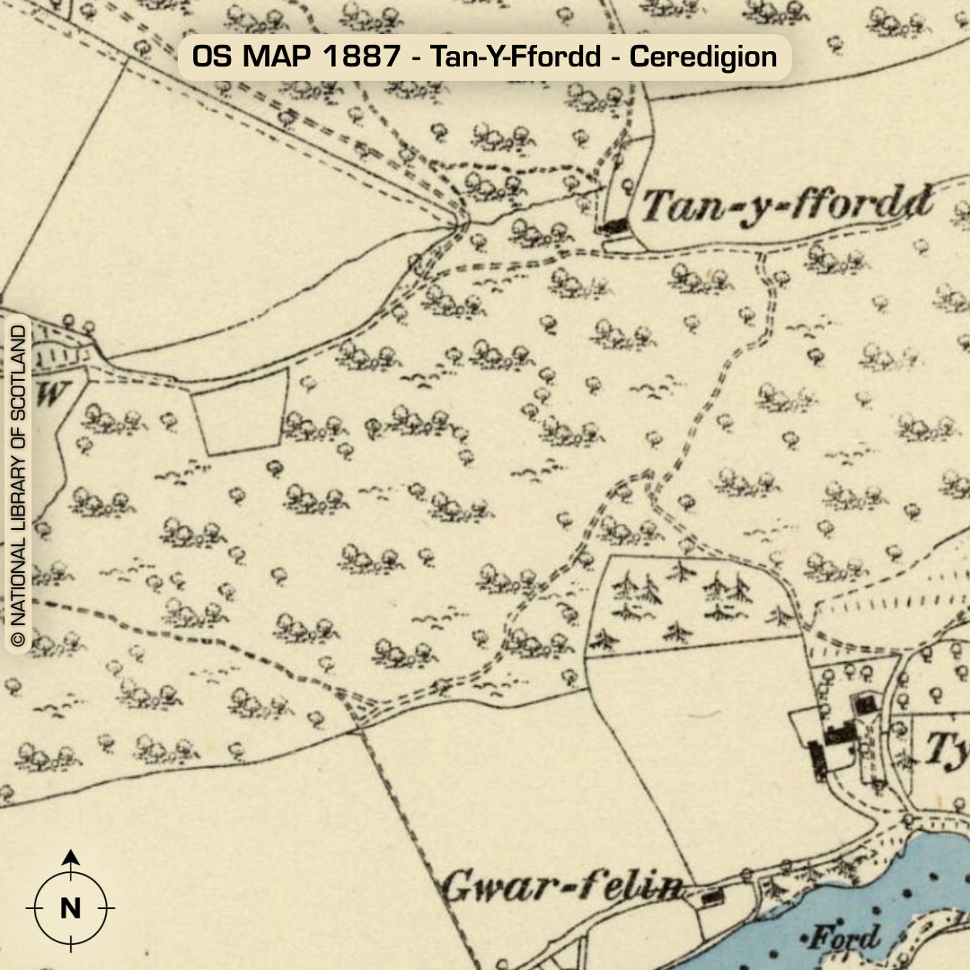
iDAR – Tan-y-Ffordd - Ceredigion DTM- (Digital Terrain Model, i.e. No buildings or foliage) Overlooking the Cwm Rheidol Reservior from the north & just above Aberffrwd railway station sits the complex site of Tan-y-Ffordd (named after the farm just above the site). Completely hidden in woodland & scrub. (not on old OS Maps. 1st written reference in 1950) The wide LiDAR view suggests a second site to its east. Main site has a double gateway to its west. Toby Driver did an on-site visit in 2004 and described the main site as far as he could considering it being totally overgrown with bracken. The LiDAR revealed an additional line of defence beyond the main gate. The second site to its east has what appears to be a large east facing rampart which curves round to the west with a gap on its east-face. The site is of similar size to Tan-Y-Ffordd but not as complex. As its completely hidden in woodland it’s not surprising it has been missed. I’ve seen this ‘knuckle’ rampart style before at coastal promontory forts bisecting the site from the mainland. No recorded excavations or finds, hence undated*. (Scheduled monument) Iron Age tribal association (conjecture based on location): Demetae *Possible age range 2000-2700BP (Before present) Descriptions from hillforts.arch.ox.ac.uk & Dyfed Archaeological Trust HER. 1st ED OS Mapping via National Library of Scotland. Contains public sector information licensed under the Open Government Licence v3.0.