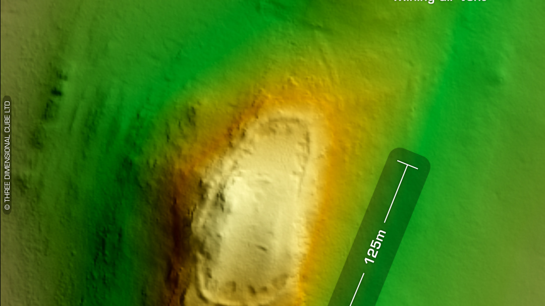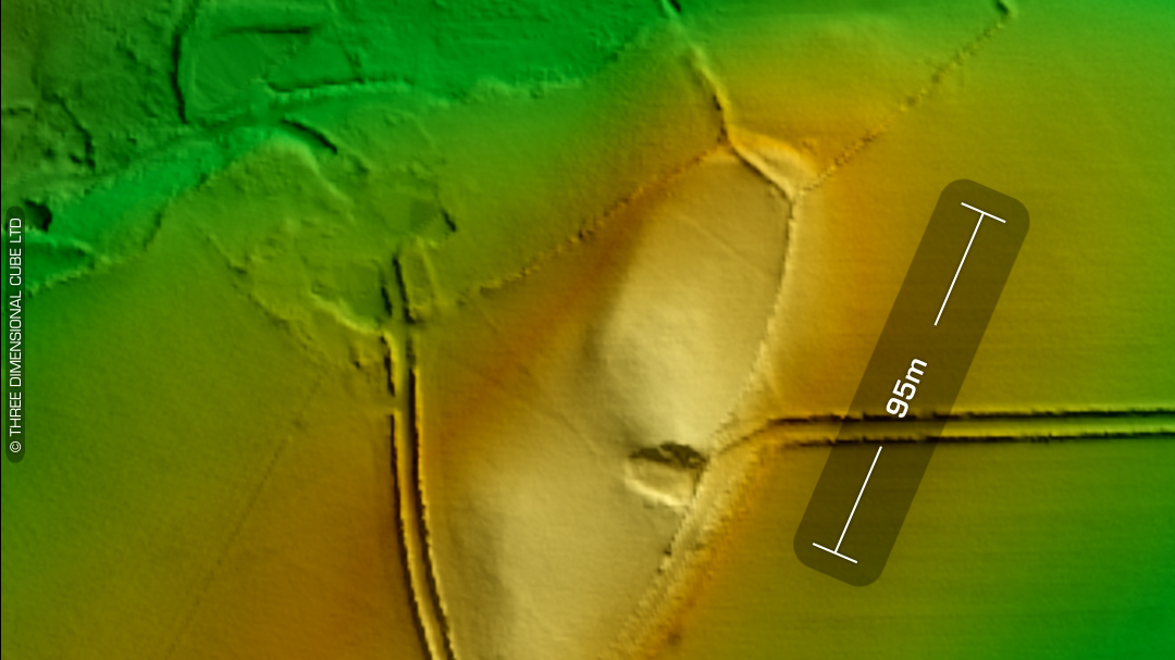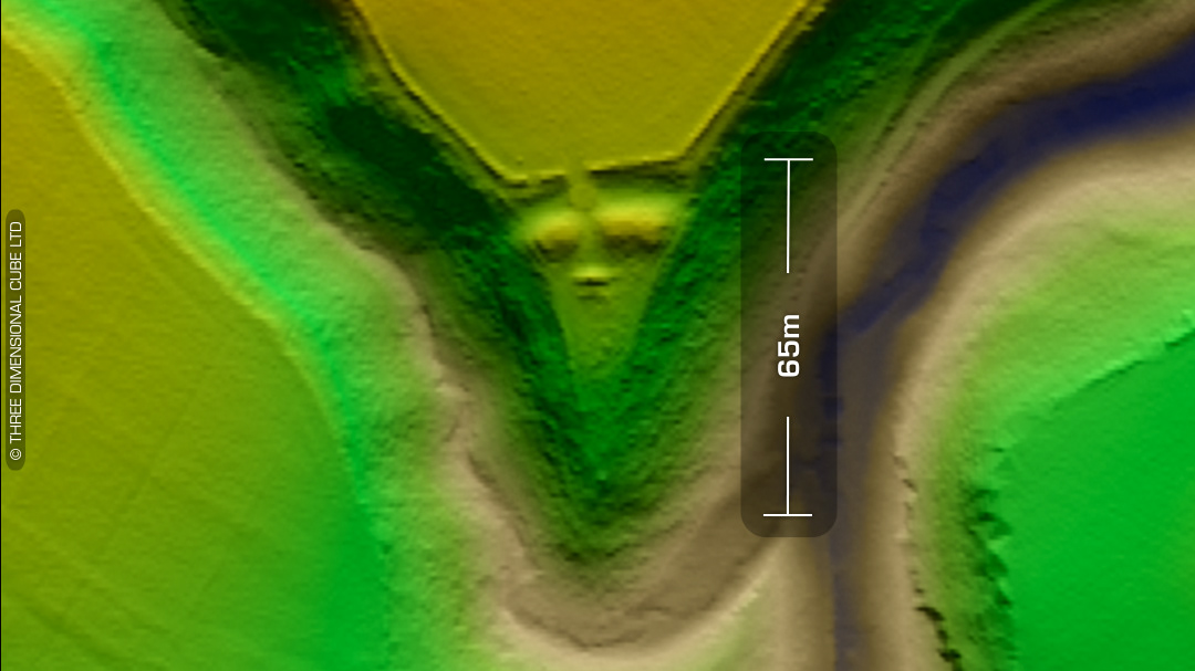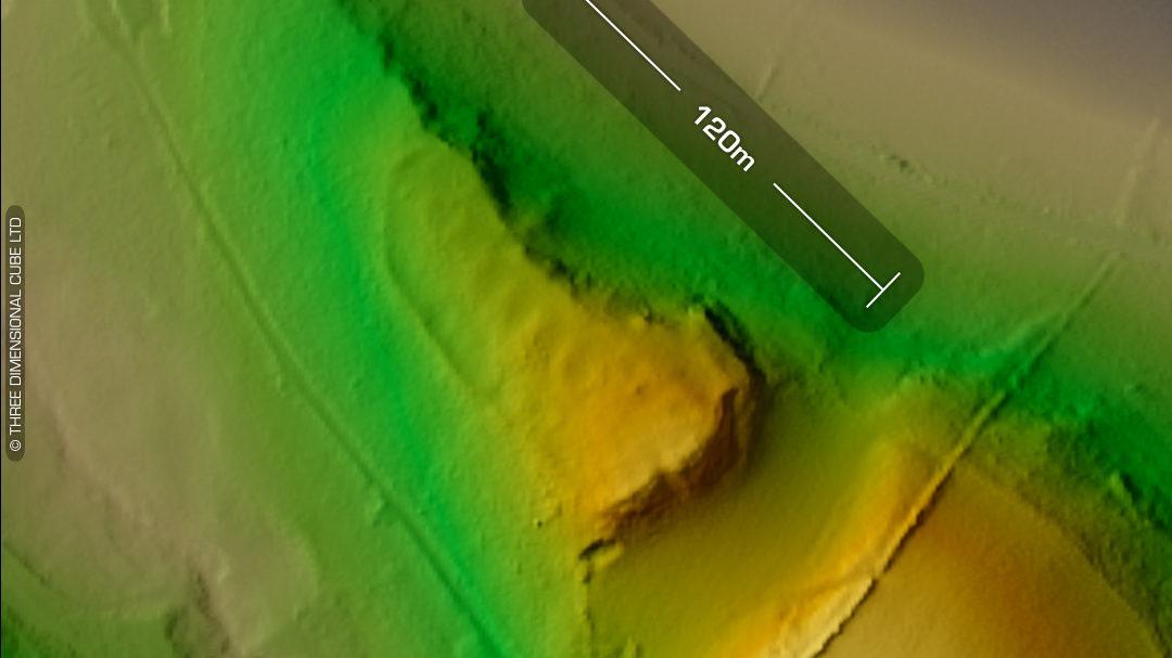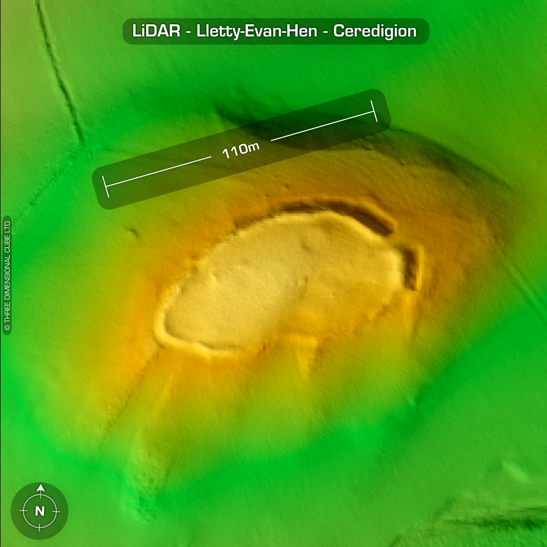
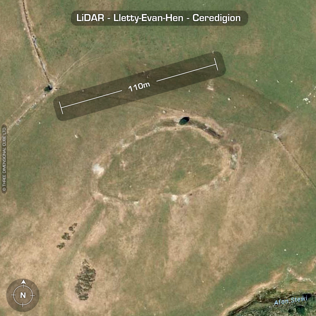
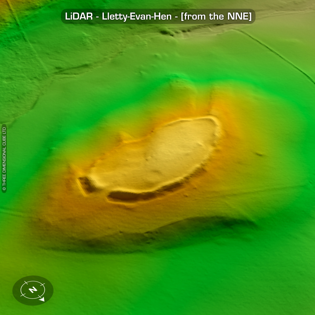

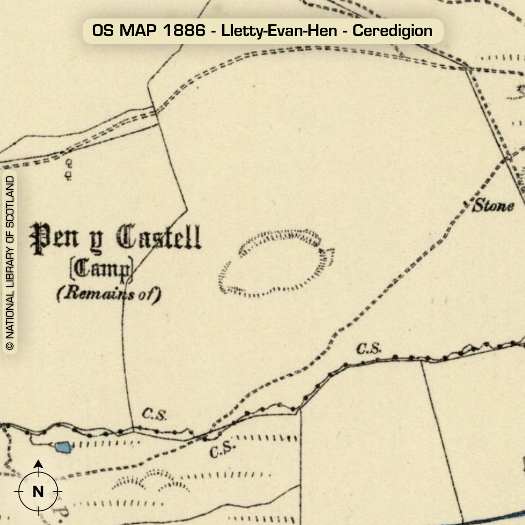
DTM- (Digital Terrain Model, i.e. No buildings or foliage) Overlooking the ‘Satmer yeshiva gedolah camp’ 1.2km northwest of the village of Cwmsymlog sits the univallate contour hillfort, Lletty-Evan-Hen. Traces of walling remain on parts of the bank face. Entrance on NE end. Six house platforms noted on the Ceredigion Archaeological Survey. One of these is clearly visible on LiDAR. Site degraded by 20th century ploughing. Standing stone 200m SSE of site. (Destroyed in the 1930s. Details lost) Knoll still visible on LiDAR. An additional stone 0.8m high located just outside entrance. A crack or split in the stone is said to be explained by a local tradition that it was used by "Romans" to sharpen their swords. No recorded finds or excavations, hence undated*. (Scheduled monument) Iron Age tribal association (conjecture based on location): Demetae *Possible age range 2000-2700BP (Before present) Descriptions from hillforts.arch.ox.ac.uk & Dyfed Archaeological Trust HER. 1st ED OS Mapping via National Library of Scotland. Contains public sector information licensed under the Open Government Licence v3.0.