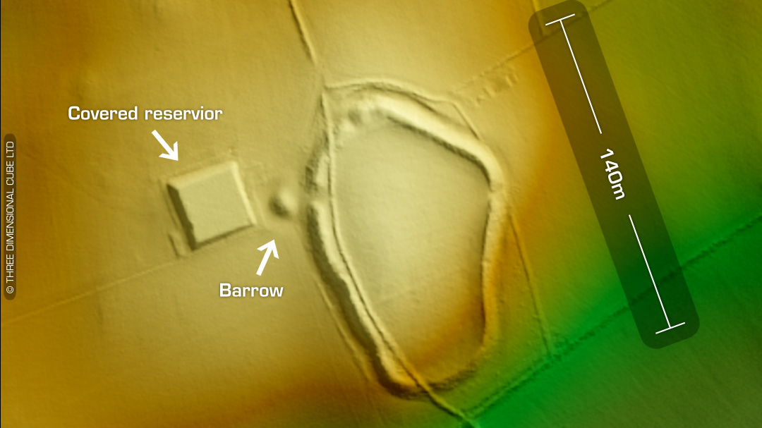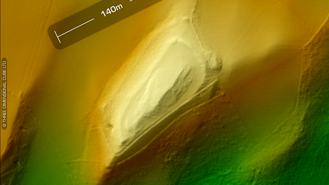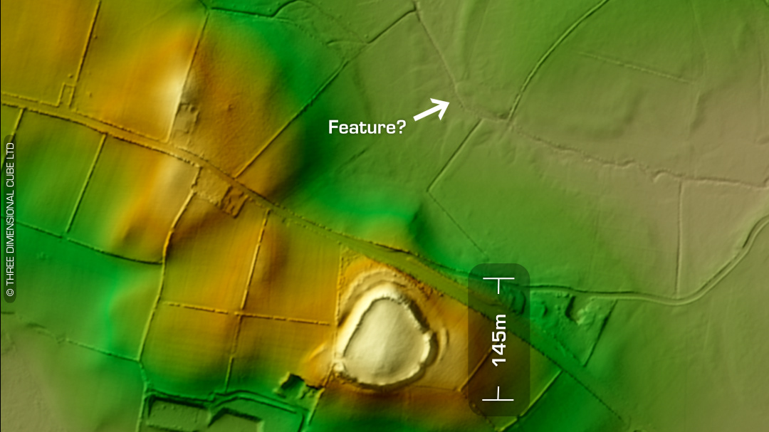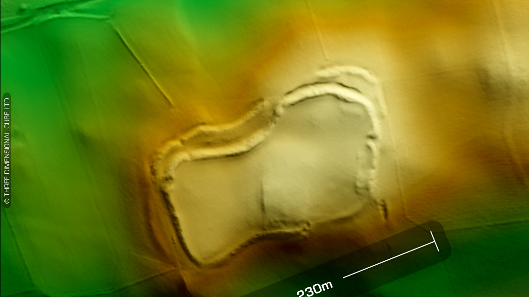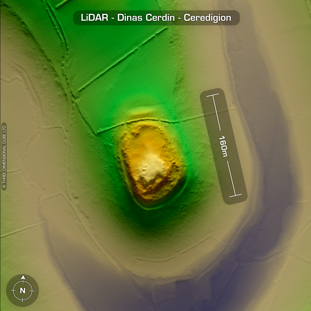
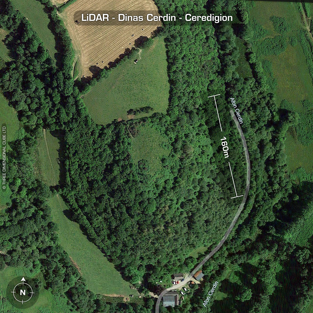
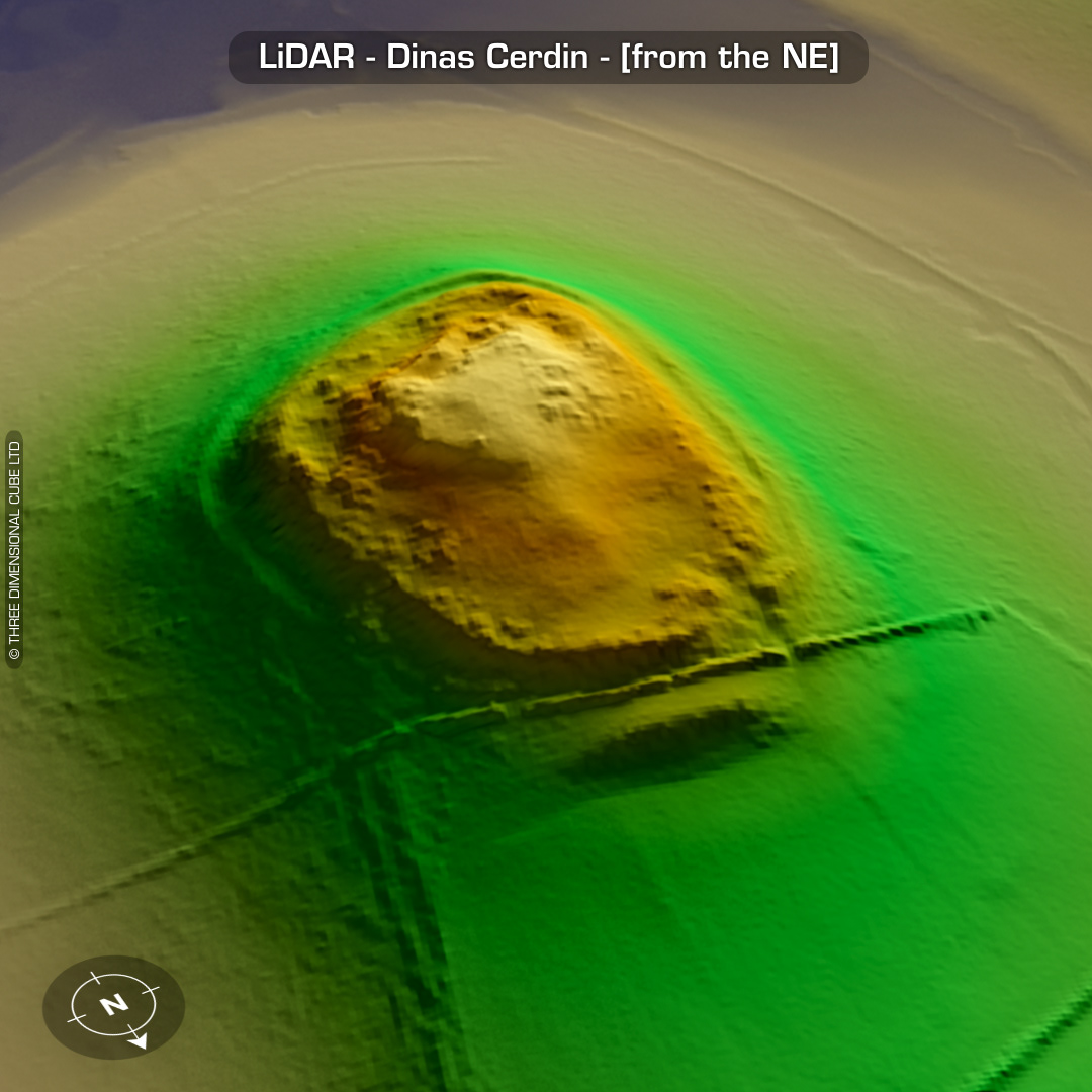
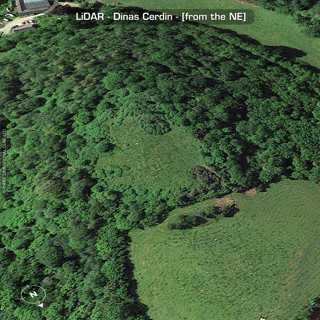
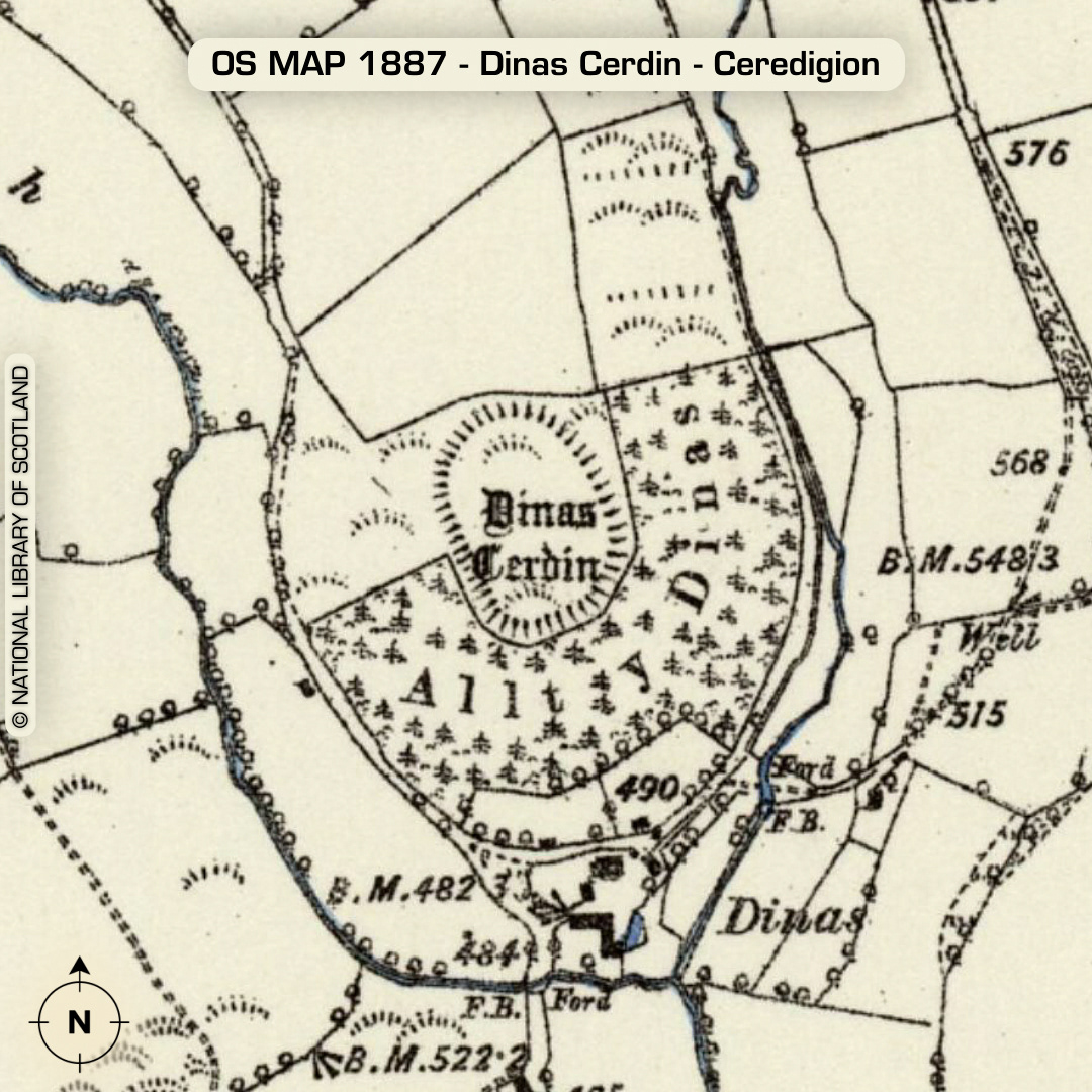
DTM- (Digital Terrain Model, i.e. No buildings or foliage) Ringed by woodland at the end of a promontory 1.3km SE of the village of Ffostrasol sits the well defended promontory hillfort, Dinas Cerdin. A field boundary runs between the rampart and the fort on the north side. Possible hut platforms indicated within interior on a previous site visit. Random chance surface Iron age & Roman finds in the 1950’s (no details). Last site visit in 2007. No recorded finds or excavations, hence undated*. (Scheduled monument) Iron Age tribal association (conjecture based on location): Demetae *Possible age range 2000-2700BP (Before present) Descriptions from hillforts.arch.ox.ac.uk & Dyfed Archaeological Trust HER. 1st ED OS Mapping via National Library of Scotland. Contains public sector information licensed under the Open Government Licence v3.0.