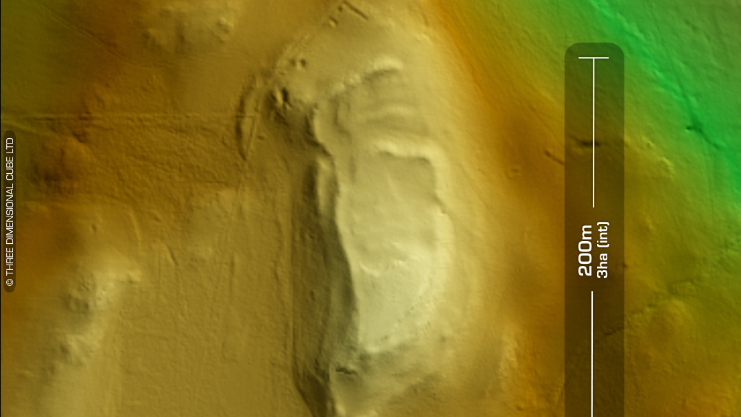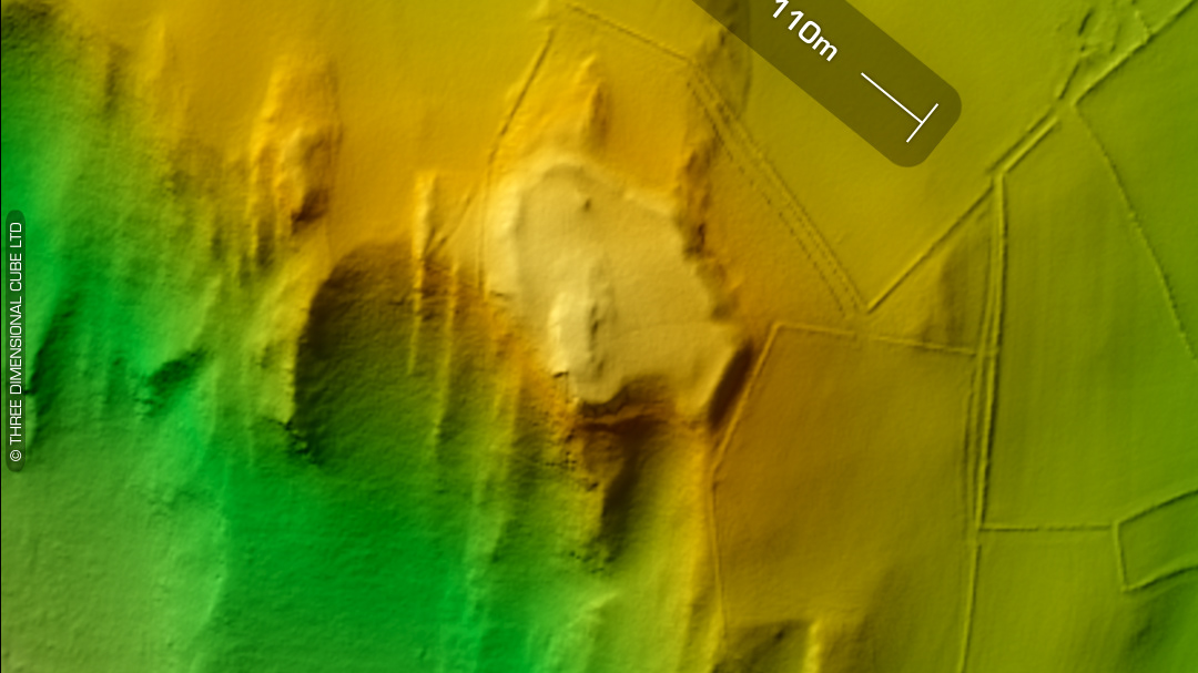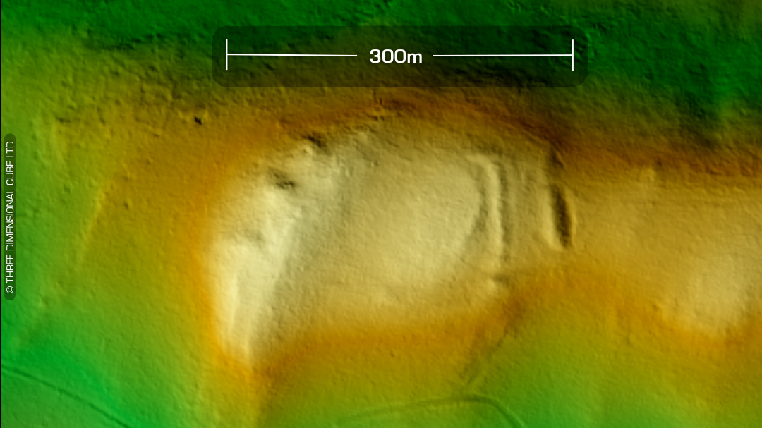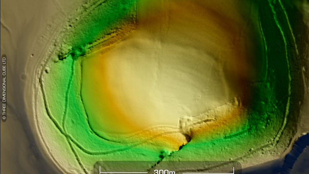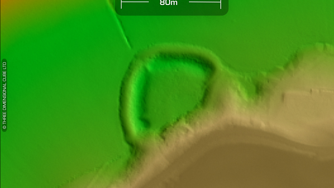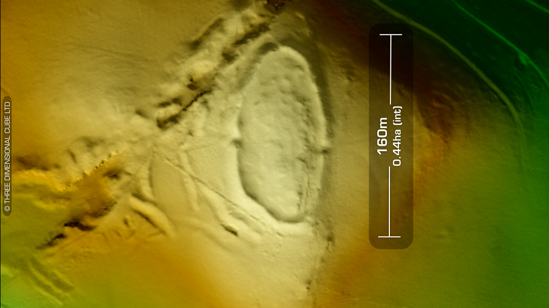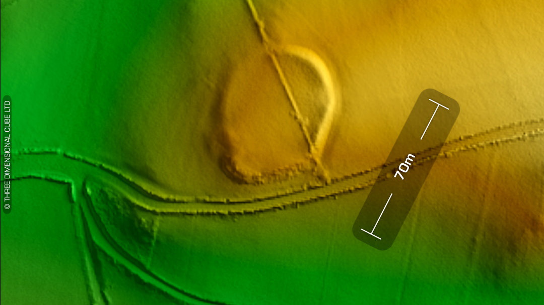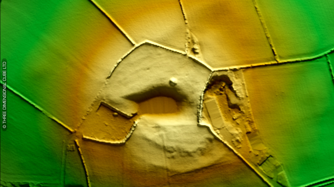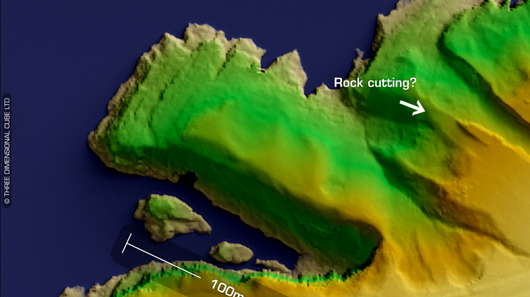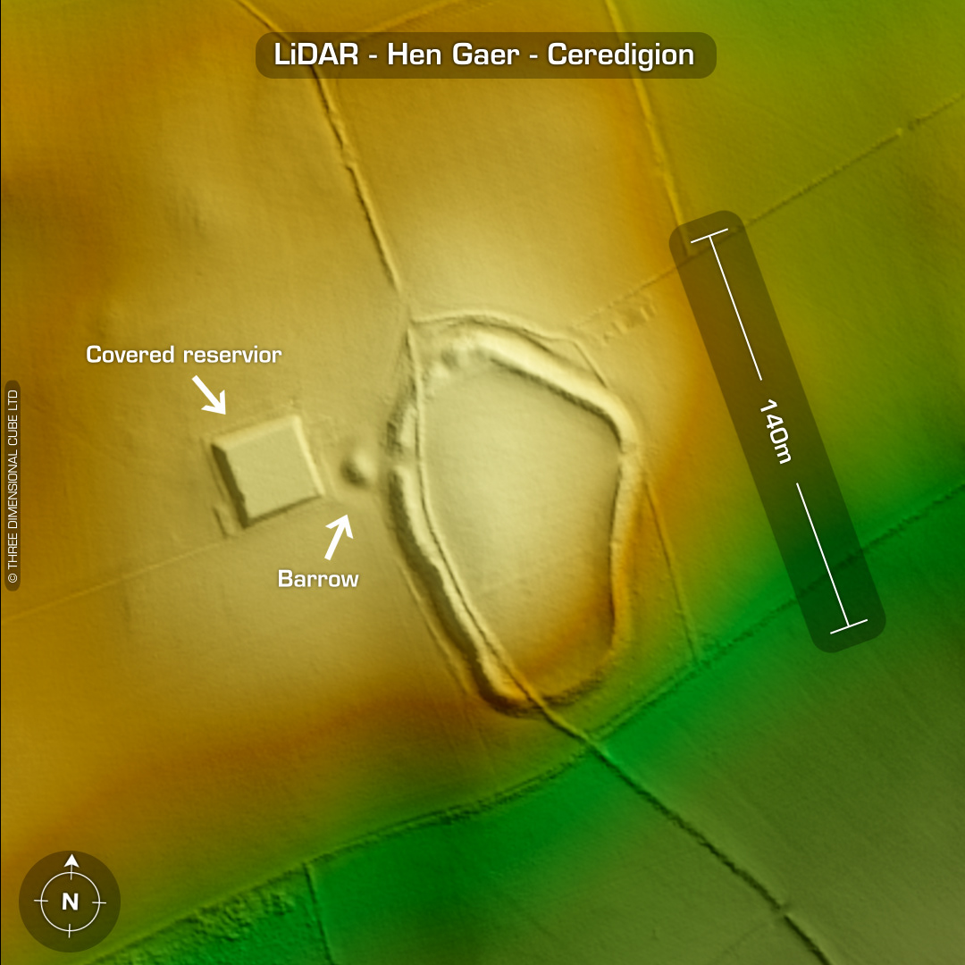
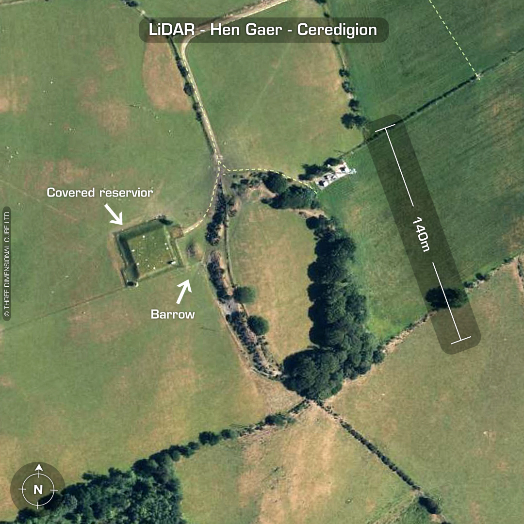
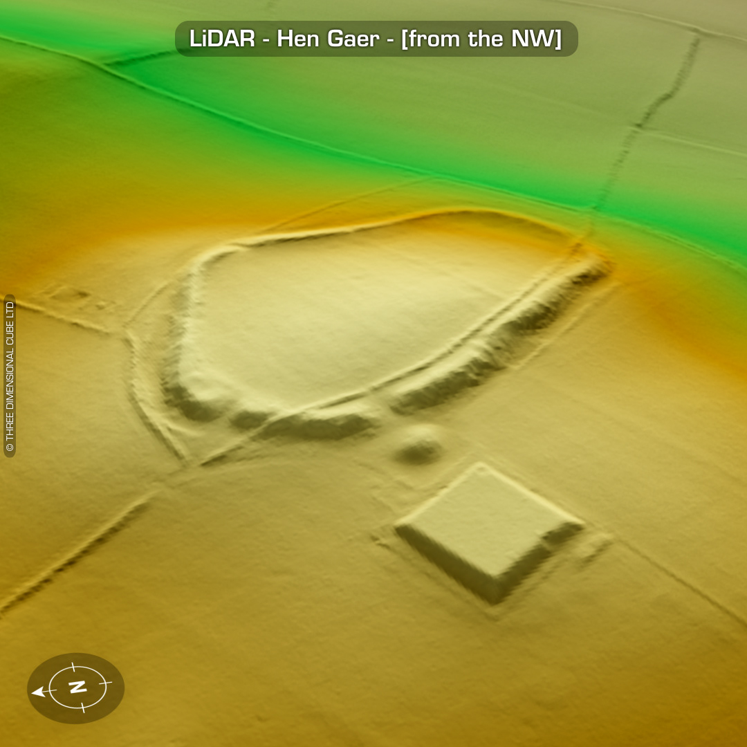
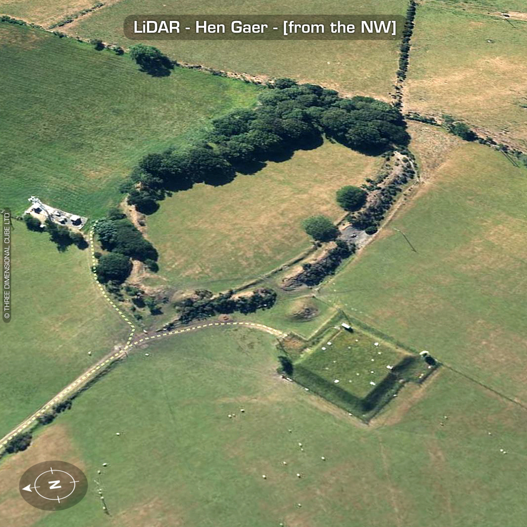
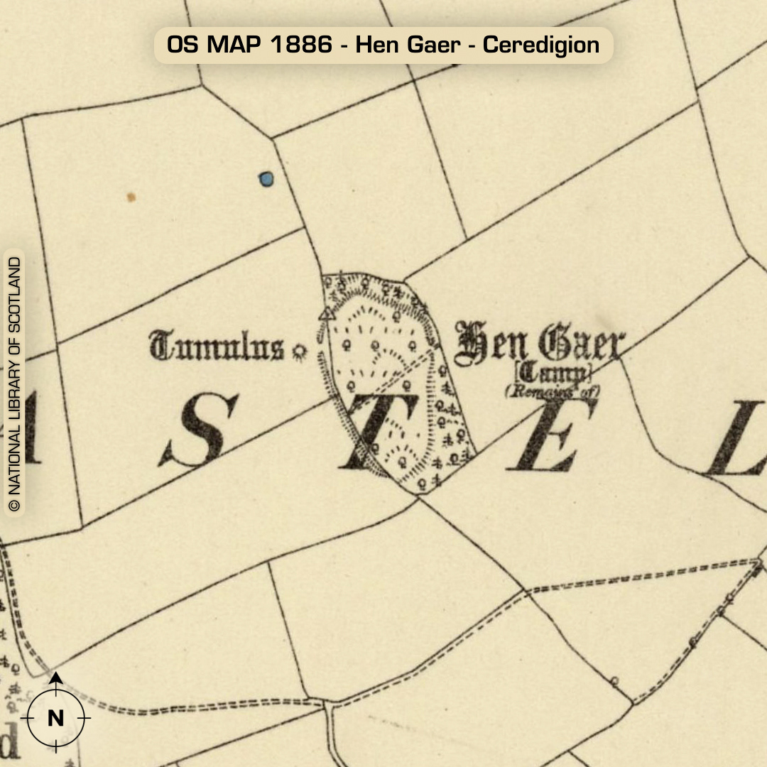
DTM- (Digital Terrain Model, i.e. No buildings or foliage) Ringed by trees and overlooking the village of Bow Street from the east lies the univallate hillfort, Hen Gaer. Entrance on west side. ‘Barrow’ just outside entrance. In 2004 a ditch was found during cable laying for the reservoir surrounding the Barrow so it may well be part of the site’s defences instead. Interior degraded by ploughing and a weird field boundary passes inside the defences. Large square ‘reservoir’ and transmitter tower on each side of fort. Why they were placed in such close proximity to the site is beyond me… Theres no record of any findings when these two sites were constructed in the 1990s, apart from the ring trench around the ‘barrow’. Theres plenty of ariel photos of this site on www.coflein.gov.uk No recorded finds or excavations, hence undated*. (Scheduled monument) Iron Age tribal association (conjecture based on location): Demetae *Possible age range 2000-2700BP (Before present) Descriptions from hillforts.arch.ox.ac.uk & Dyfed Archaeological Trust HER. 1st ED OS Mapping via National Library of Scotland. Contains public sector information licensed under the Open Government Licence v3.0.