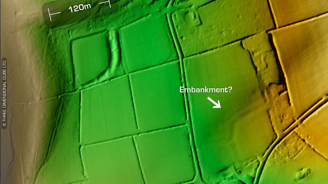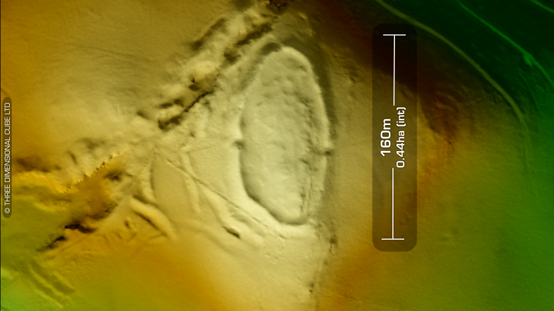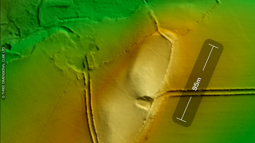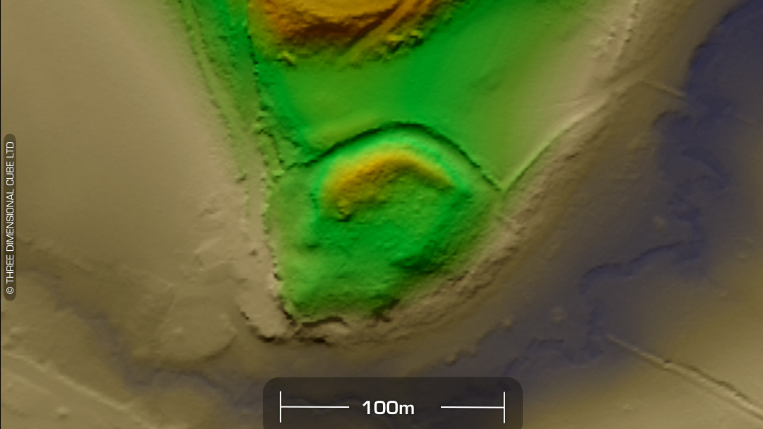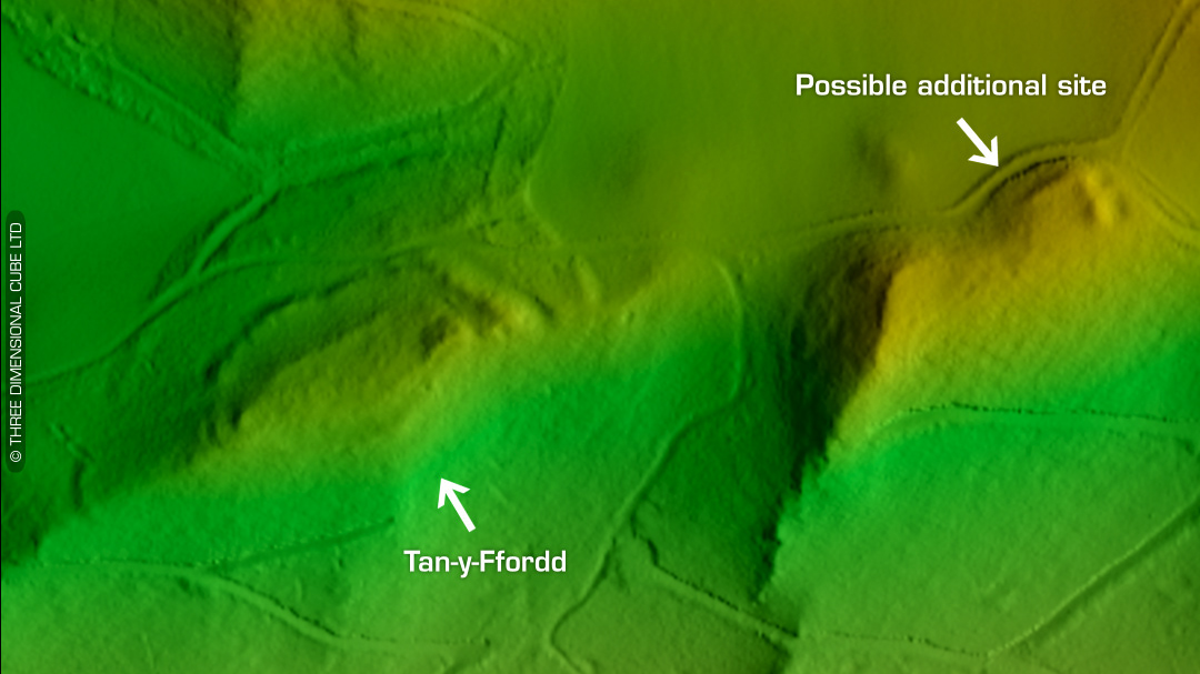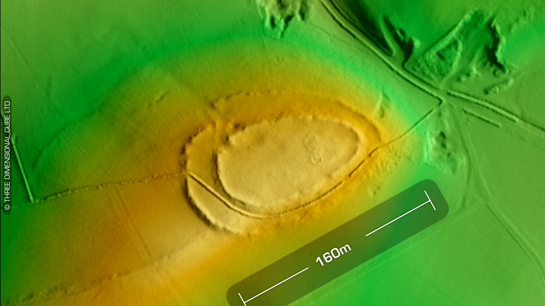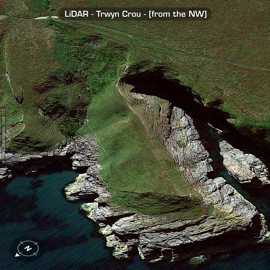

LiDAR – Trwyn Crou - Ceredigion DTM- (Digital Terrain Model, i.e. No buildings or foliage) On a coastal promontory just to the north of the village of Pontgarreg lies the very recently discovered hillfort, Trwyn Crou. Fortified by cross-banks & ditches. Discovered via aerial reconnaissance (RCAHMW) in 2009. Heavily eroded. LiDAR picked-up a rock-cut seaward access path to the NE of the site. Unknown if contemporary or part of the hillfort where much has been lost to the sea. No recorded excavations or finds, hence undated*. (Scheduled monument) Iron Age tribal association (conjecture based on location): Demetae *Possible age range 2000-2700BP (Before present) Descriptions from hillforts.arch.ox.ac.uk & Dyfed Archaeological Trust HER. 1st ED OS Mapping via National Library of Scotland. Contains public sector information licensed under the Open Government Licence v3.0.