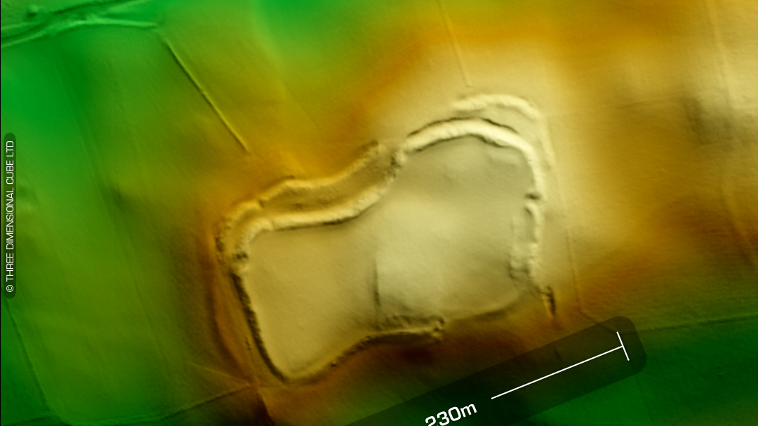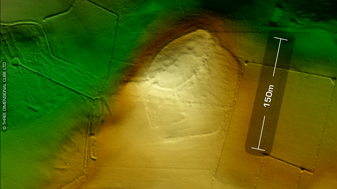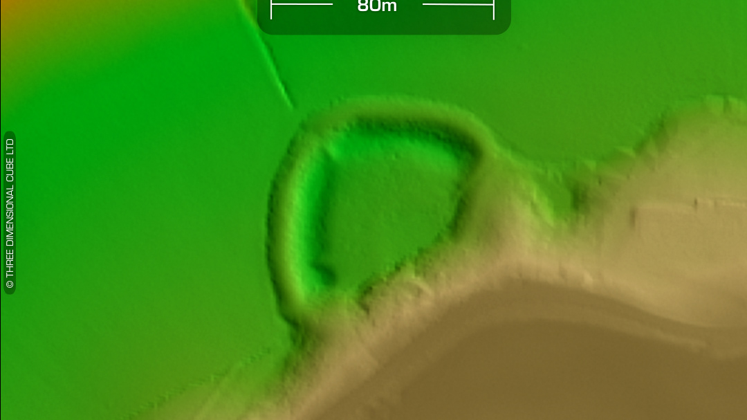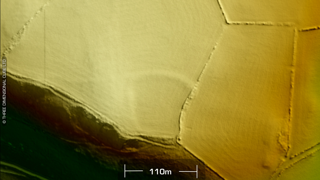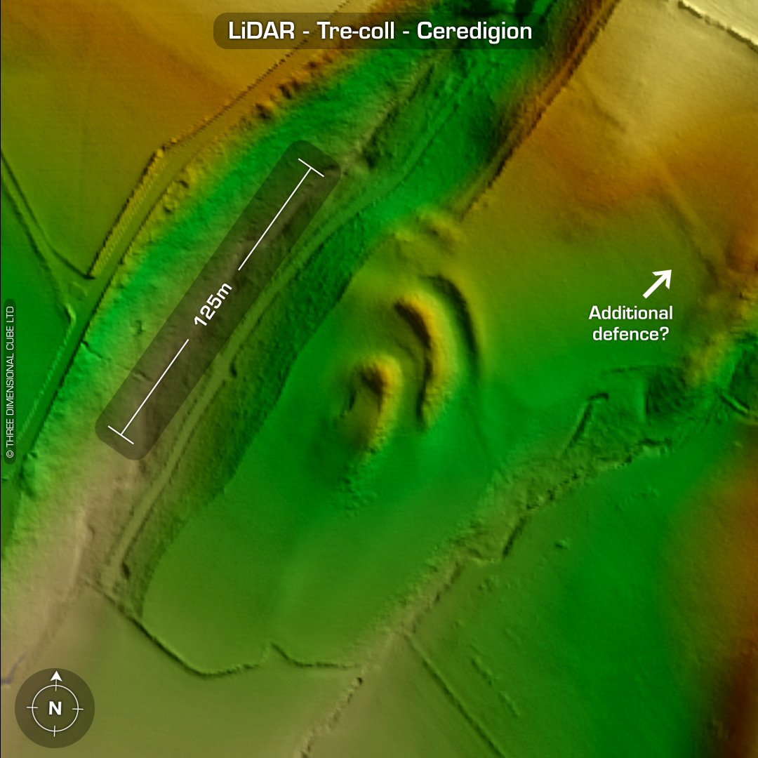

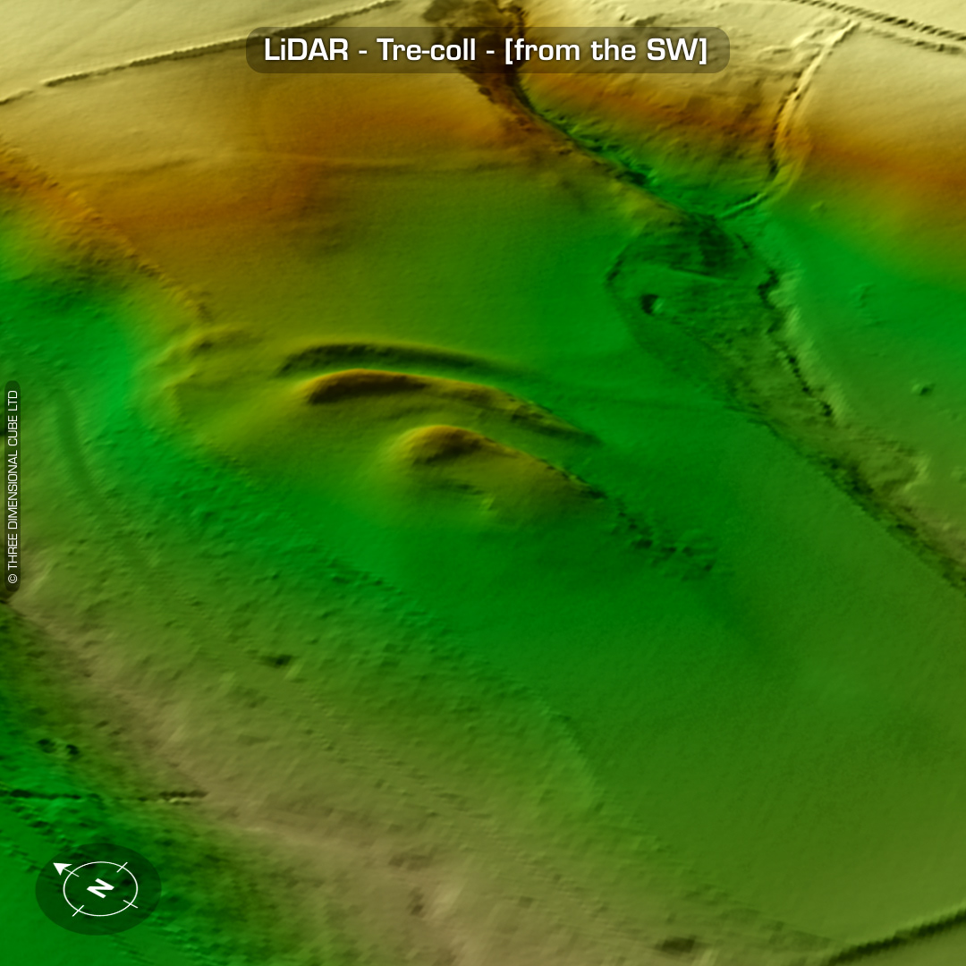
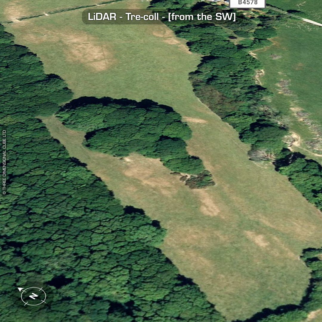
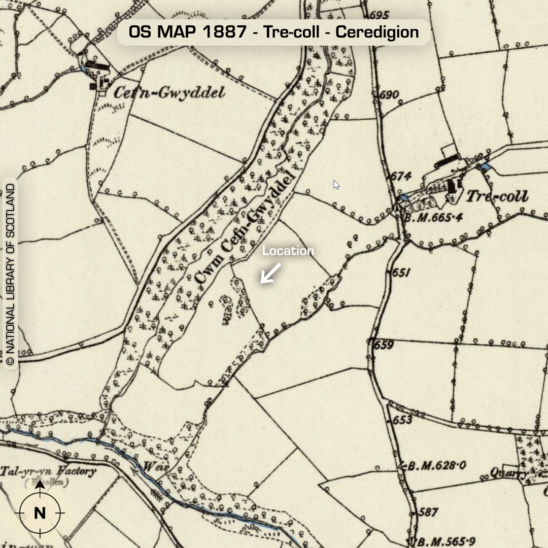
LiDAR – Tre-coll - Ceredigion DTM- (Digital Terrain Model, i.e. No buildings or foliage) Just to the south of the village of Tyncelyn and west of the B4578 with its ramparts overgrown by trees sits the heavily degraded inland promontory fort, Tre-coll (named after the farm to its east). Possible additional outwork bank NE of site but on old OS maps it looks like a field boundary but on the LiDAR its quite wide for a field boundary… Ramparts 6-7m high. Evidence of stone revetments noted by T.Driver in the banks. Discovered in 1971 by A.H.A. Hogg. No recorded excavations or finds, hence undated*. (Scheduled monument) Iron Age tribal association (conjecture based on location): Demetae *Possible age range 2000-2700BP (Before present) Descriptions from hillforts.arch.ox.ac.uk & Dyfed Archaeological Trust HER. 1st ED OS Mapping via National Library of Scotland. Contains public sector information licensed under the Open Government Licence v3.0.