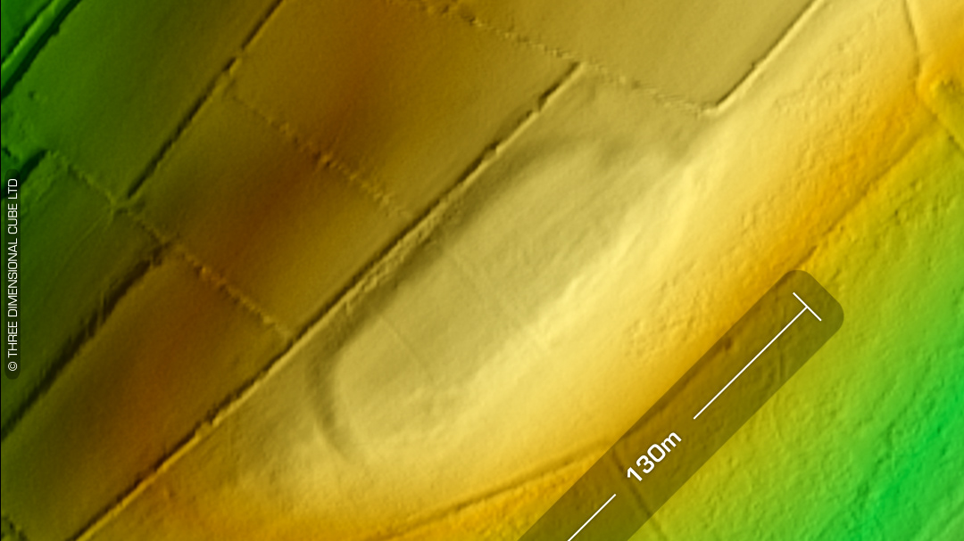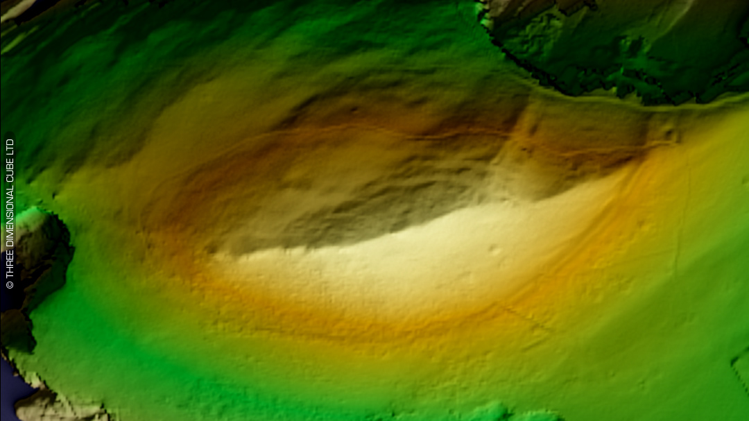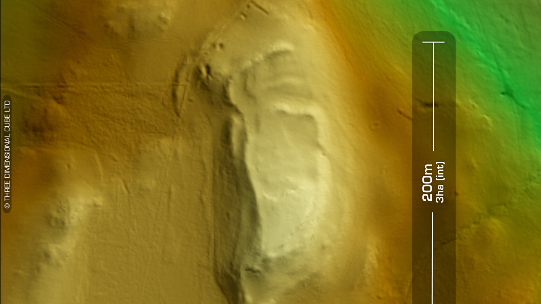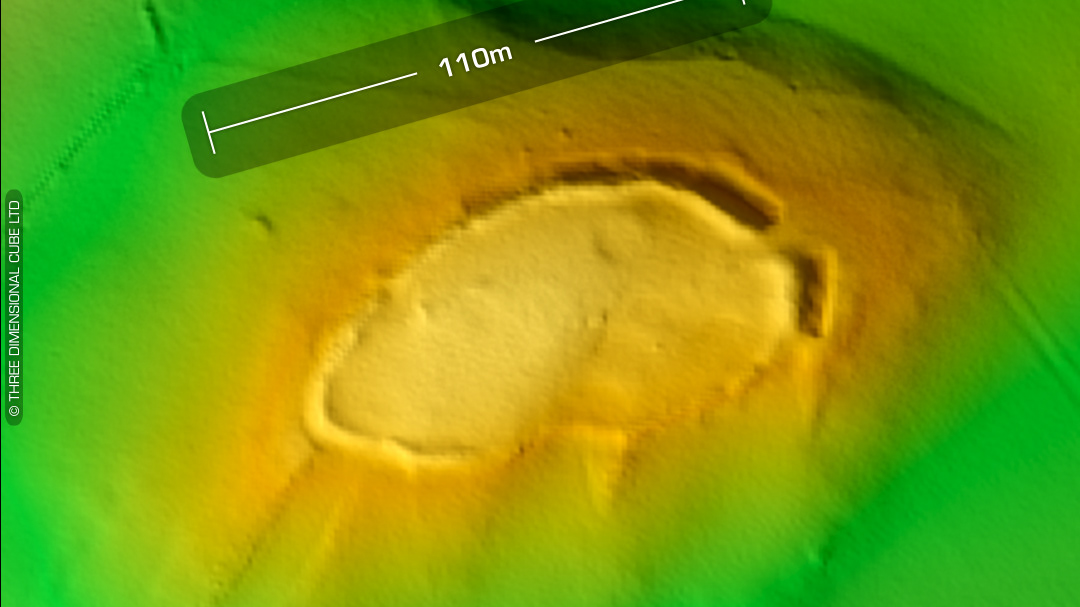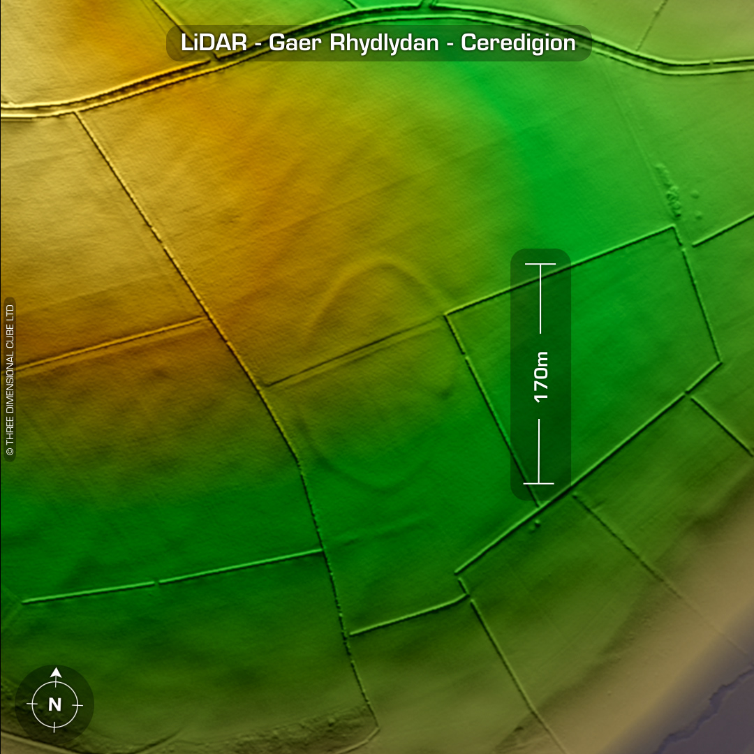
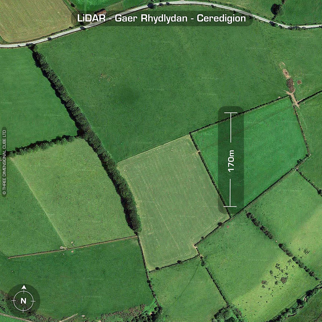

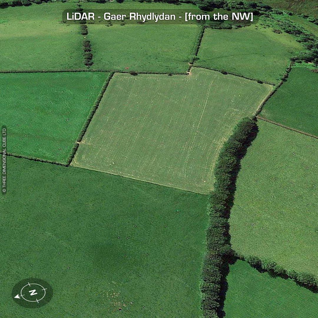
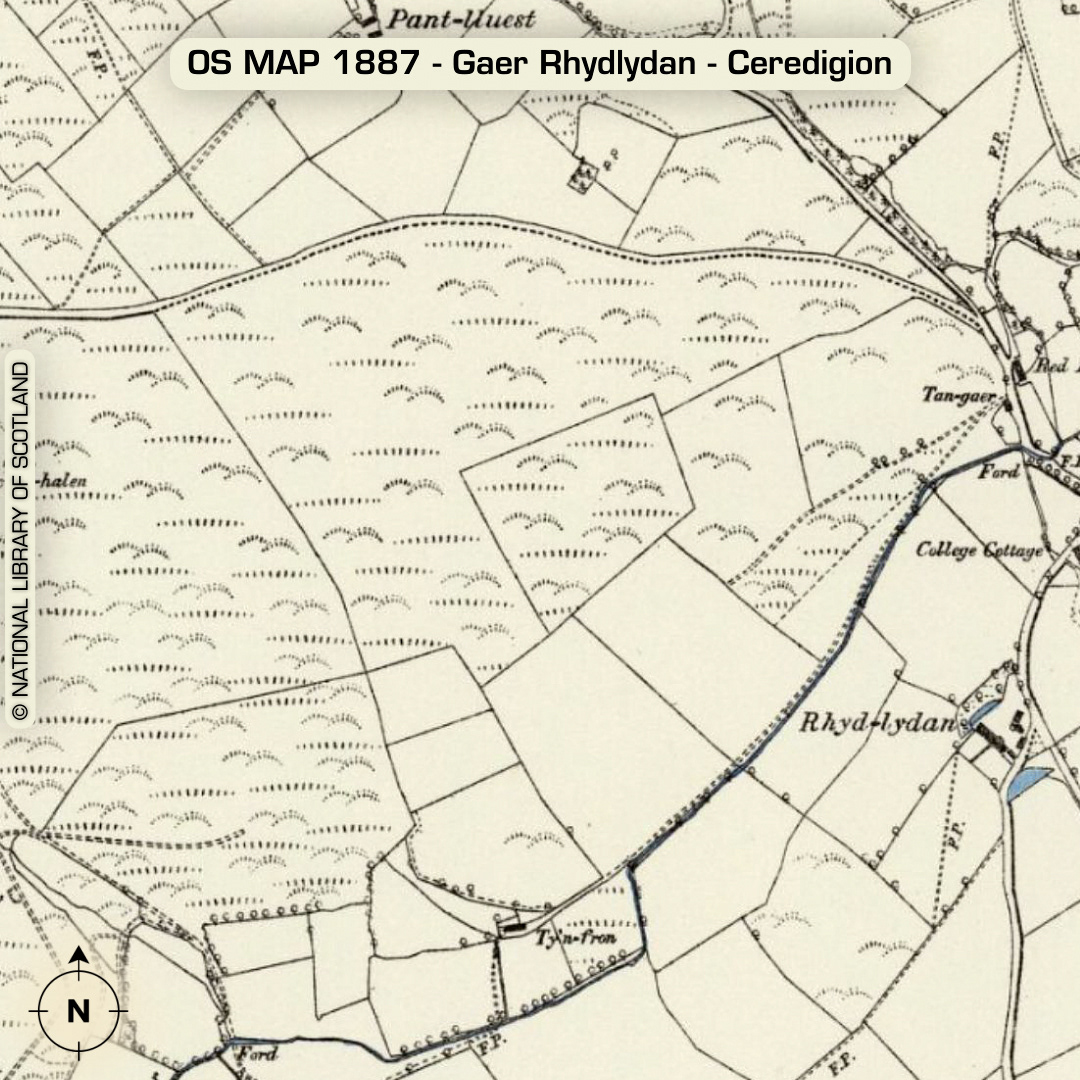
DTM- (Digital Terrain Model, i.e. No buildings or foliage) 1.5km north of the village of Tagarreg lies the almost ploughed-out contour hillfort, Gaer Rhydlydan. Not on 1st Ed OS Map (as you can see) but was mentioned by Meyrick in 1810. Turned-in entrance on SE side. Dyfed HER: ‘A few years ago the site owner (Rhydlydan Farm) reported that when ploughed the soil within north part of the enclosure was a different colour from that outside and within the rest of the enclosure.’ Hogg suggested in 1962 that this sites location was ‘unlikely for a fort’. First properly recorded in its true extent by LiDAR in 2019 (Missed it. Bah!) No recorded finds or excavations, hence undated*. (Scheduled monument) Iron Age tribal association (conjecture based on location): Demetae *Possible age range 2000-2700BP (Before present) Descriptions from hillforts.arch.ox.ac.uk & Dyfed Archaeological Trust HER. 1st ED OS Mapping via National Library of Scotland. Contains public sector information licensed under the Open Government Licence v3.0.