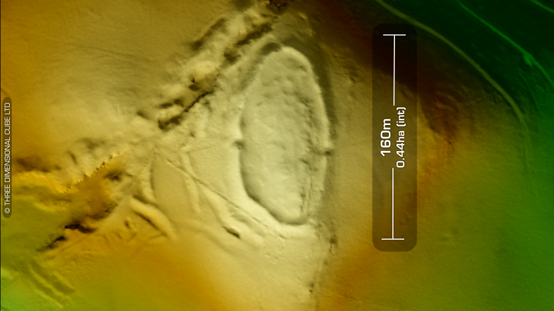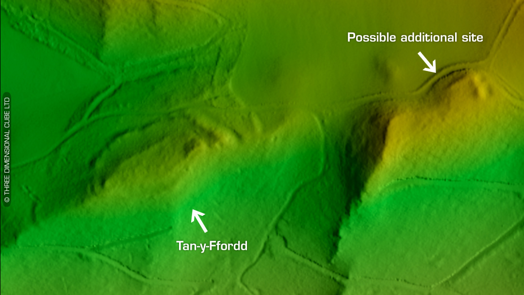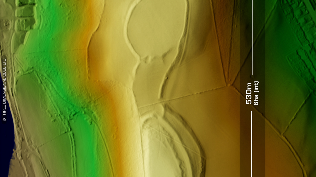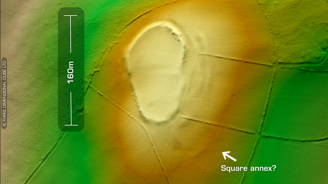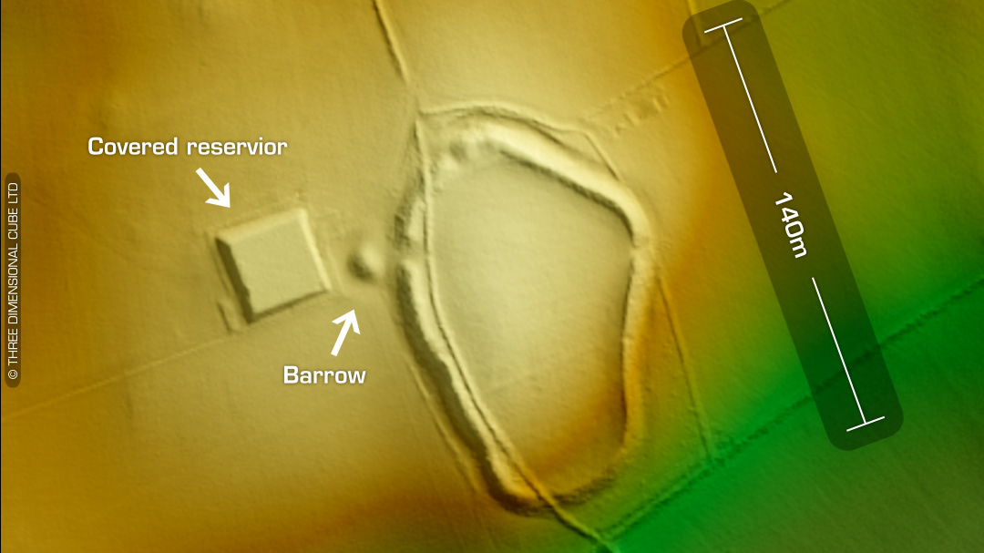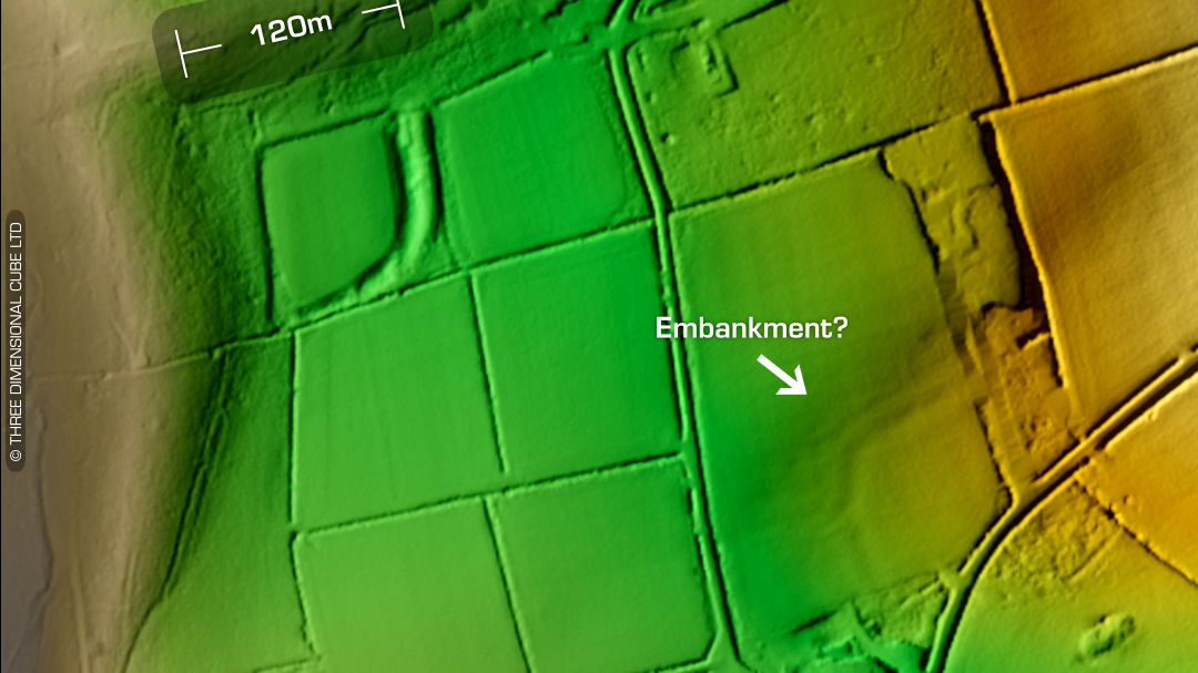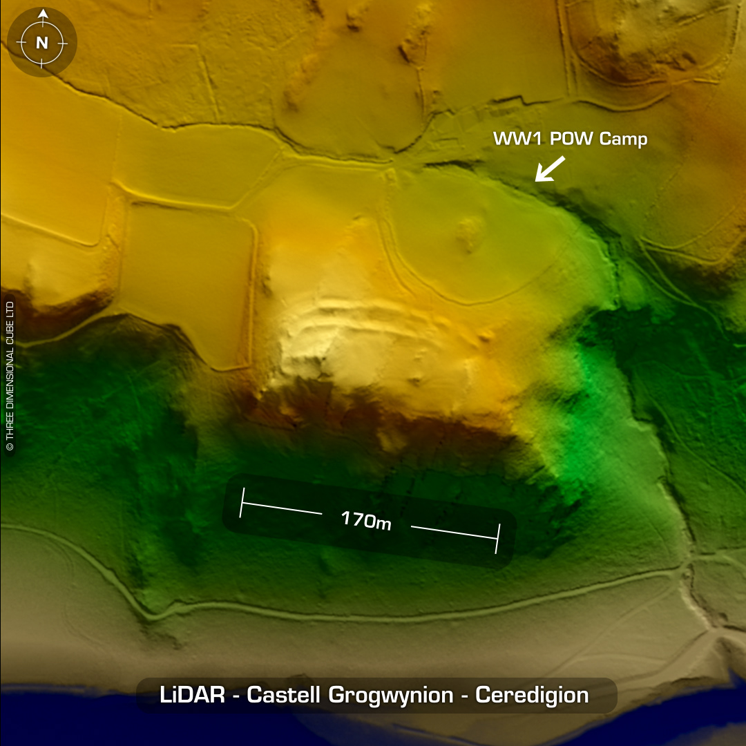
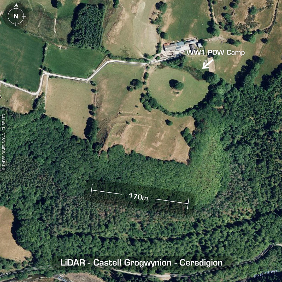
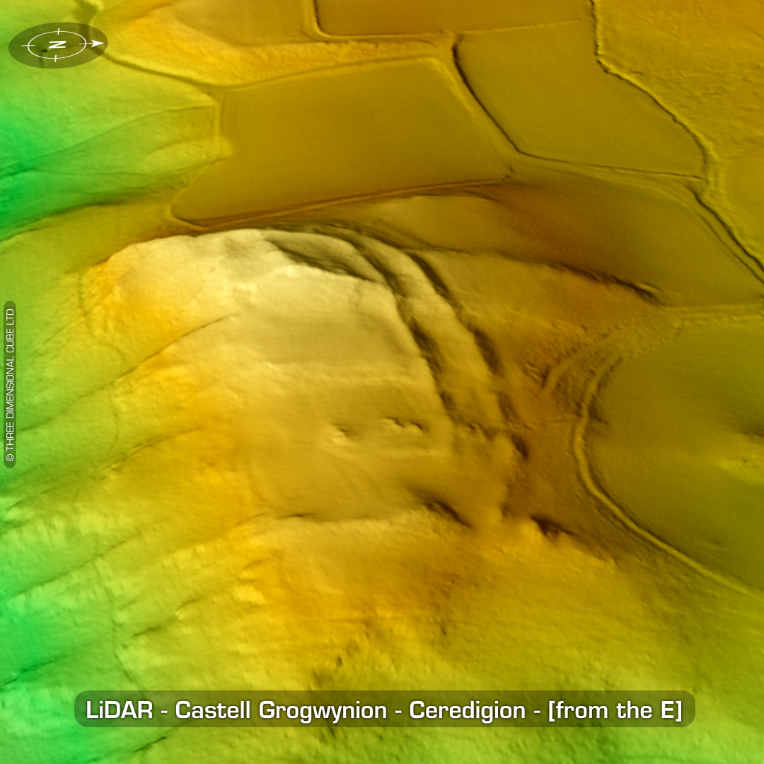

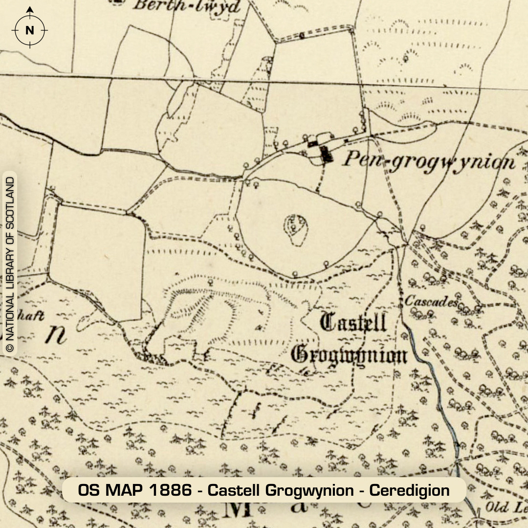
DTM- (Digital Terrain Model, i.e. No buildings or foliage) Overlooking the river Afon Ystwyth, just to the northwest of the village of Ysbyty Ystwyth sits the bivallate rectangular hillfort, Castell Grogwynion. Interior degraded by ploughing. Hogg made the site’s first full description in 1994. Large gateway & bastion. Possible slingstone recovered from a field walk outside the site. A WW1 POW camp was situated within the circular feature to the sites northeast. No recorded finds or excavations, hence undated*. (Scheduled monument) Iron Age tribal association (conjecture based on location): Demetae *Possible age range 2000-2700BP (Before present) Descriptions from hillforts.arch.ox.ac.uk & Dyfed Archaeological Trust HER. 1st ED OS Mapping via National Library of Scotland. Contains public sector information licensed under the Open Government Licence v3.0.