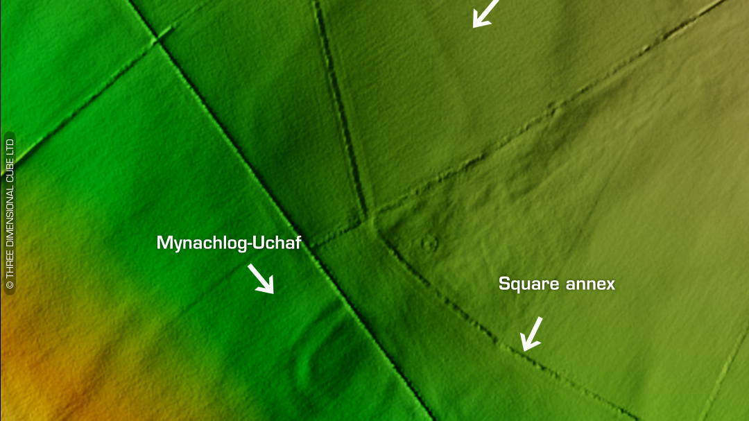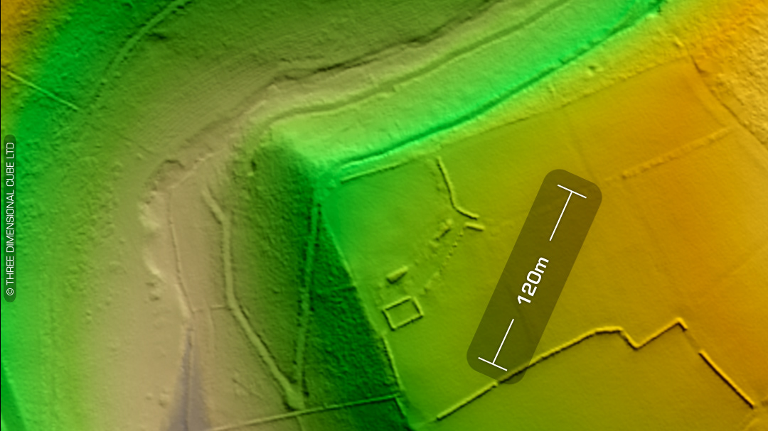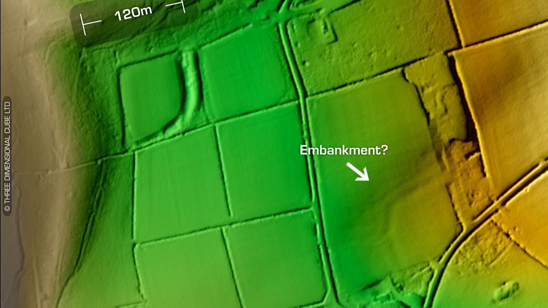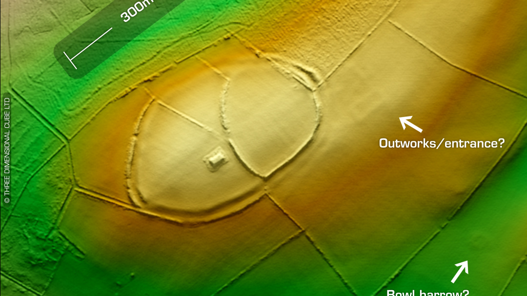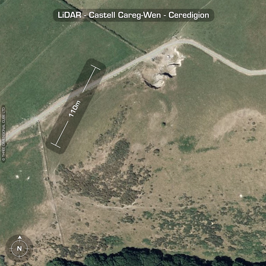
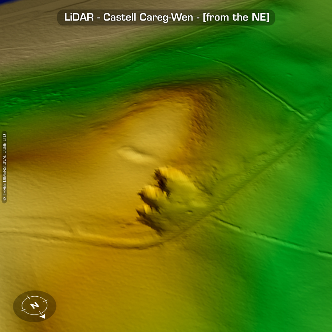
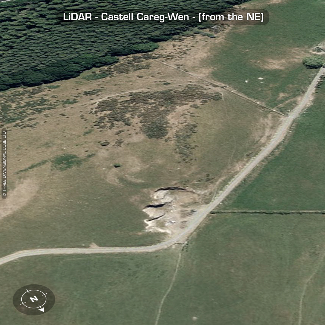
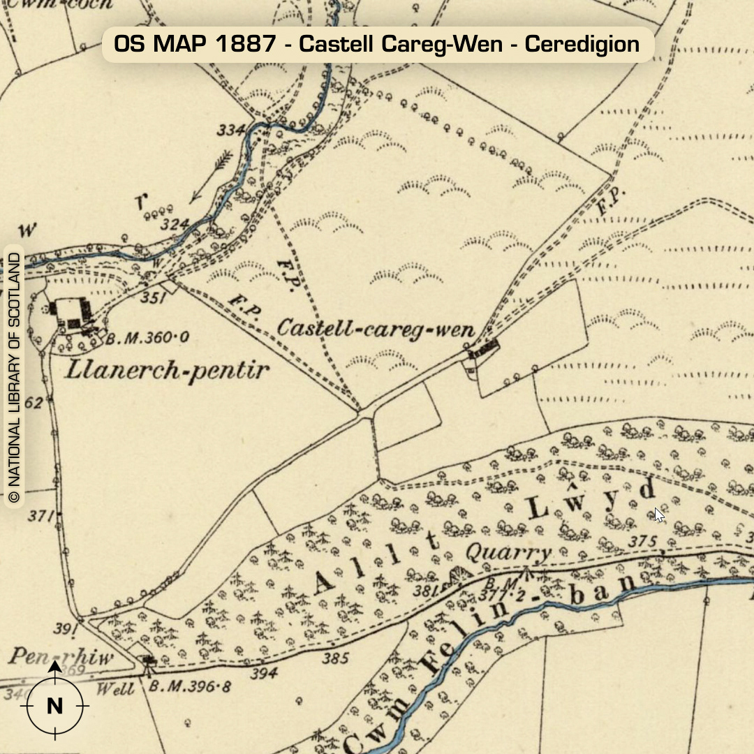
DTM- (Digital Terrain Model, i.e. No buildings or foliage) Overlooking the small village of Cnwch Coch from the east sits a heavily degraded, with its primary defence almost destroyed by quarrying hillfort, Castell-Careg-Wen. Listed on the 1835 OS map but only notated on the 1887 OS map. Quarrying in 20th century. I almost didn’t list this but as the rampart is still extant it made sense to. No recorded finds or excavations, hence undated*. (Scheduled monument) Iron Age tribal association (conjecture based on location): Demetae *Possible age range 2000-2700BP (Before present) Descriptions from hillforts.arch.ox.ac.uk & Dyfed Archaeological Trust HER. 1st ED OS Mapping via National Library of Scotland. Contains public sector information licensed under the Open Government Licence v3.0.