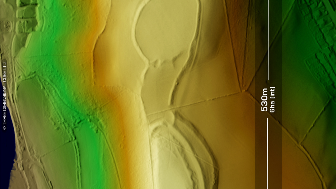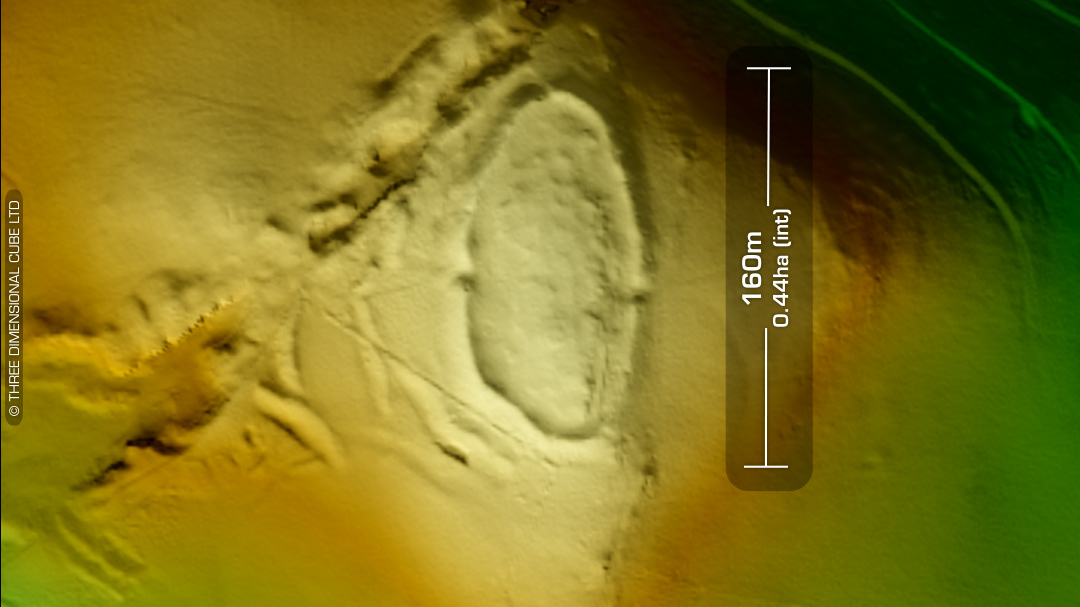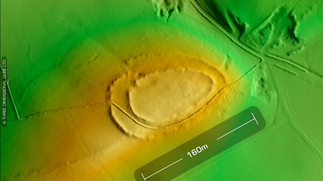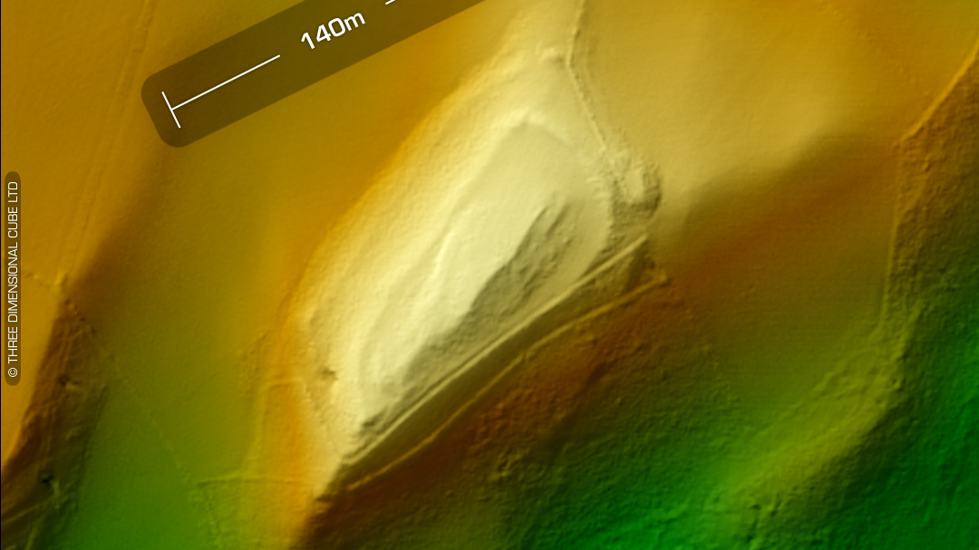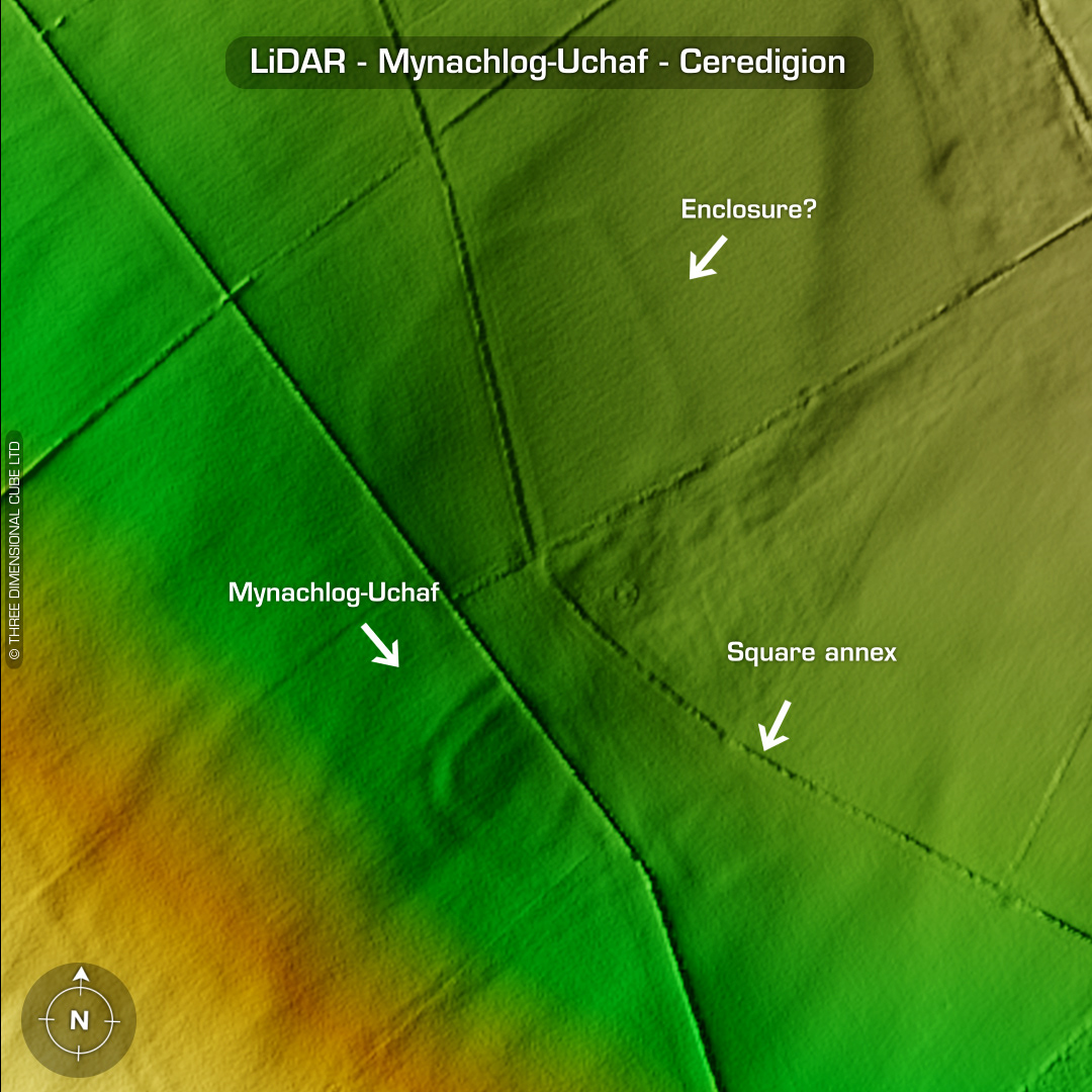


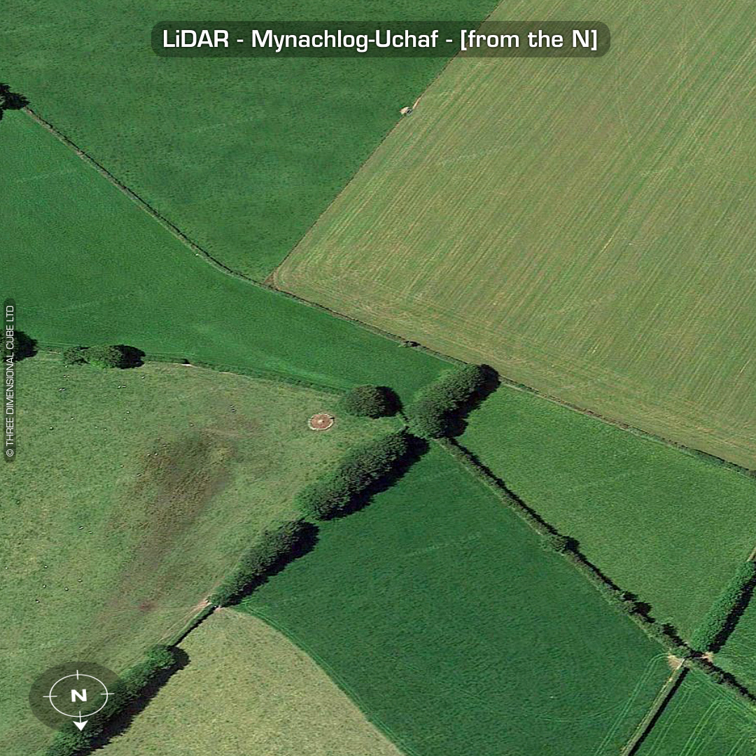

DTM- (Digital Terrain Model, i.e. No buildings or foliage) On a north facing slope to the south of the village of Synod Inn lies the almost ploughed-out settlement of Mynachlog-Uchaf. Earthworks much more prominent in the 1960s. The main defended enclosure is still quite visible on LiDAR but the square annex and enclosure to the NE have almost been destroyed. Not on 1st ed OS Map, as you can see. No recorded finds or excavations, hence undated*. (Scheduled monument) Iron Age tribal association (conjecture based on location): Demetae *Possible age range 2000-2700BP (Before present) Descriptions from hillforts.arch.ox.ac.uk & Dyfed Archaeological Trust HER. 1st ED OS Mapping via National Library of Scotland. Contains public sector information licensed under the Open Government Licence v3.0.