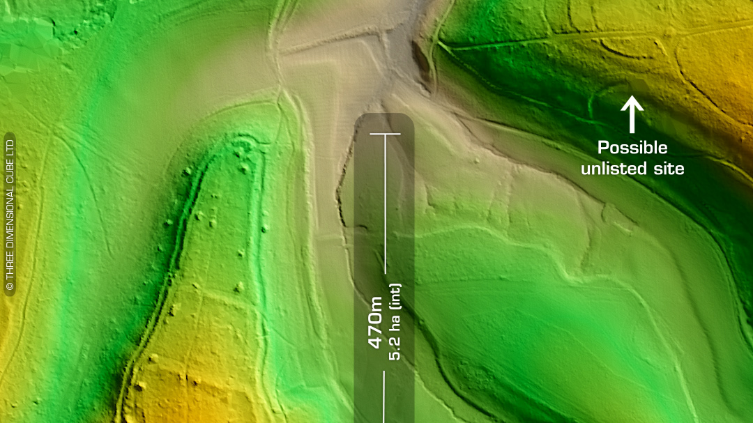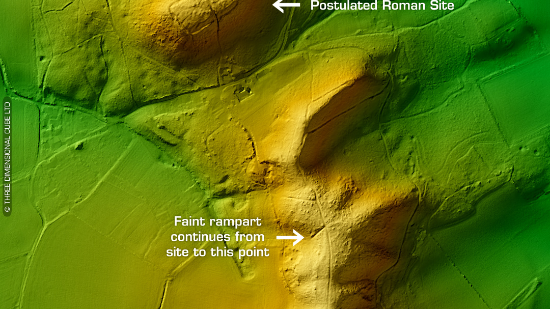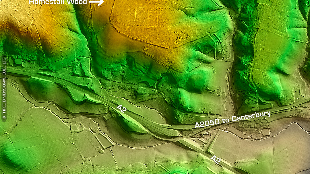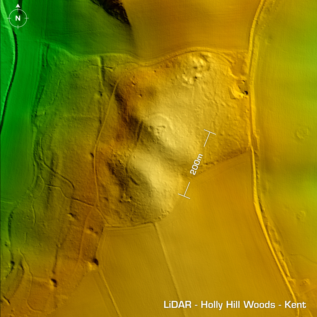
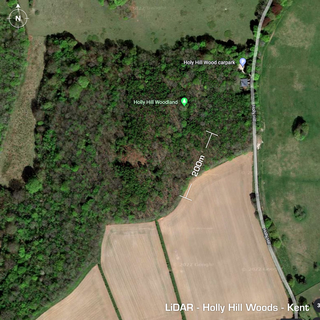
LiDAR – Holly Hill Wood – Kent DTM- (Digital Terrain Model, i.e. No buildings or foliage) My first discovery!!! To the west of Snodland, Gravesend and hidden within Holly Hill Wood lies a previously undiscovered possible temporary camp or fort. I found this site while looking for features around the area of Coldrum Long Barrow, which lies to the southwest of Holly Hill Wood. I sent my findings off to Kent HER, who asked one of their team to assess the site. Due to the site visit the site was found to be viable and will now be listed on Kent’s Historic Environment Record. I am so chuffed! Thank you, Dr Rose Broadley (of Kent HER). HER Number: TQ 66 SE 183 Iron Age tribal association (conjecture based on location): Cantiaci