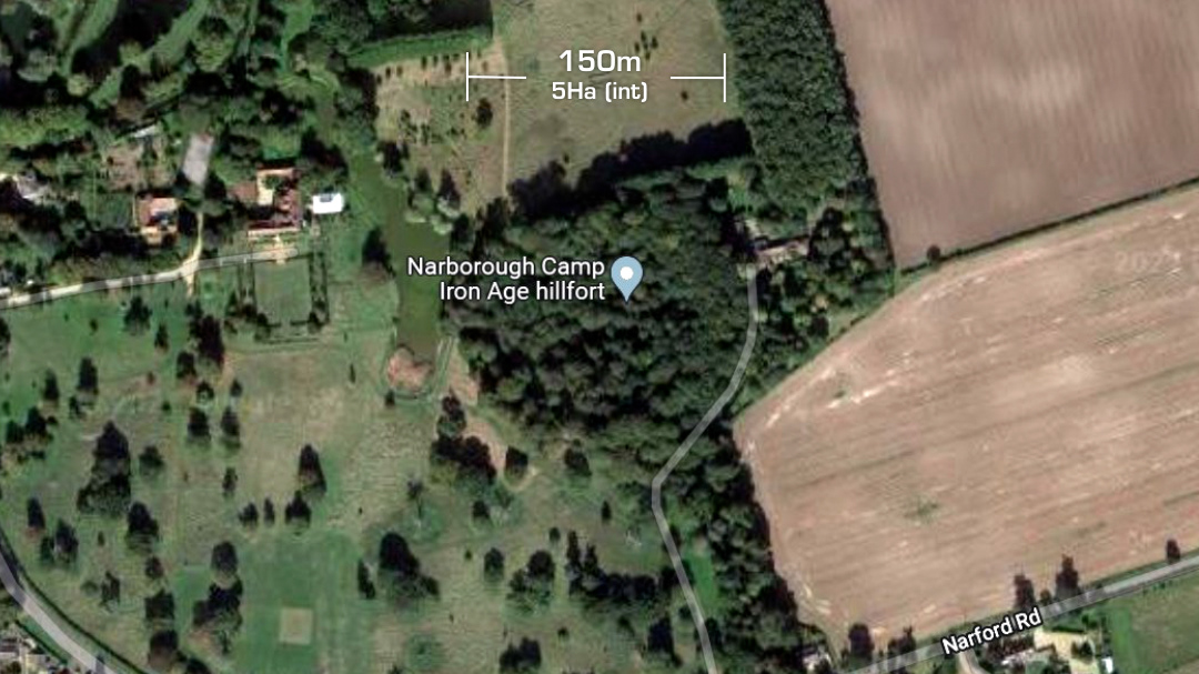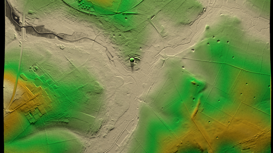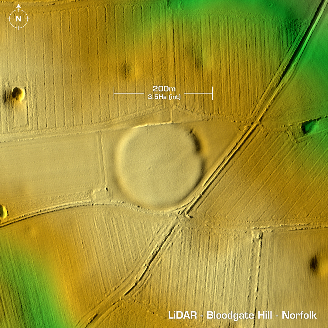
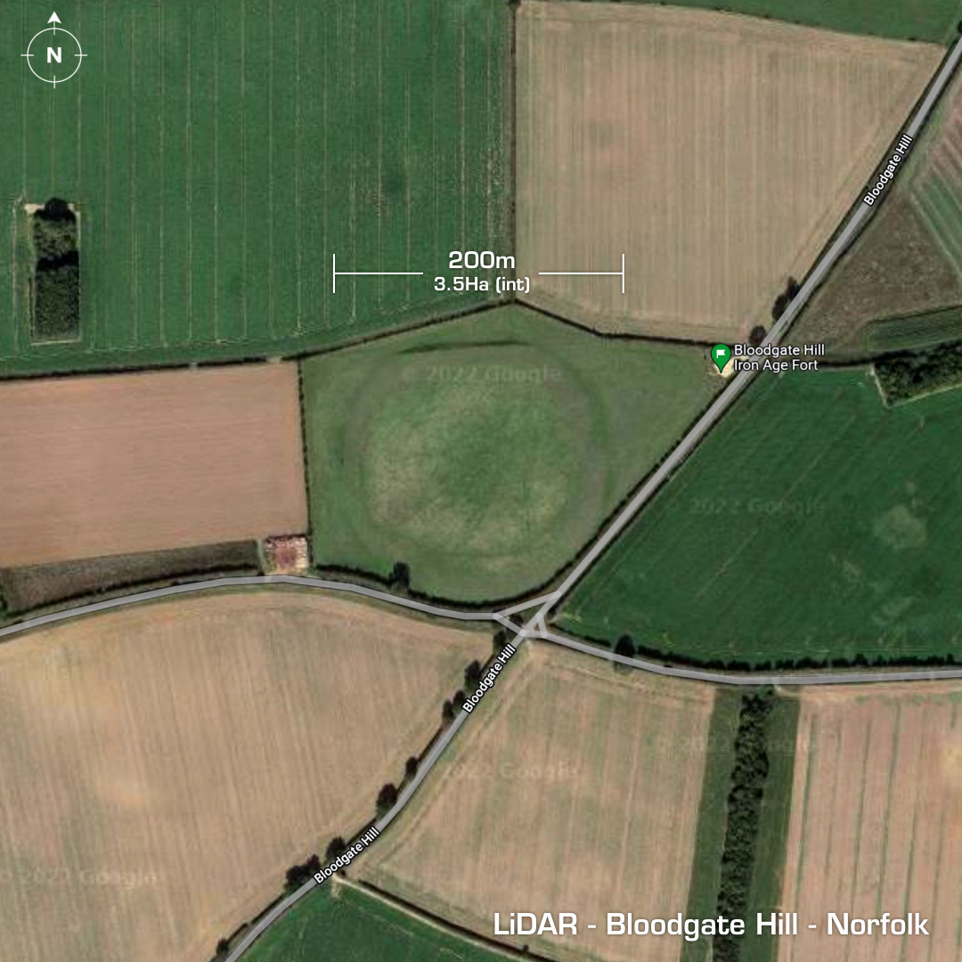
DTM- (Digital Terrain Model, i.e. No buildings or foliage) Just to the west of South Creake and alongside Bloodgate Hill Road lies the heavily degraded univallate hillfort, Bloodgate Hill. The ramparts were levelled in the 19th century. First recorded in 1797. Dated between 400 to 170 BC. Interior pit finds include Iron Age pottery & daub. Geophys of interior shows a distinct roundhouse circle. (2004) Surface finds of Iron Age pottery, flints a fragment of human skull and Roman coins. Iron Age tribal association (conjecture based on location): Iceni (Scheduled Monument) [Any descriptive text is attributed to the Atlas of Hillforts & Wikipedia websites and any associated archaeological descriptions online which will be credited accordingly.]