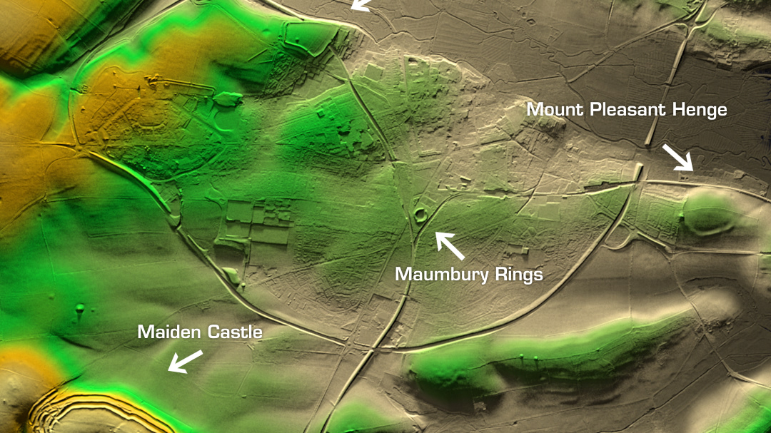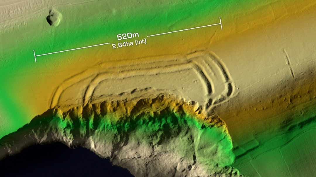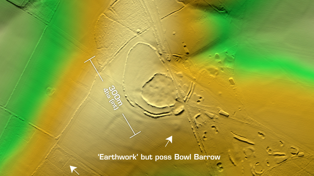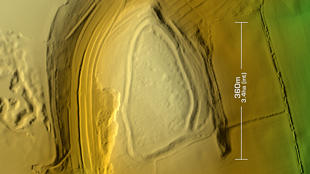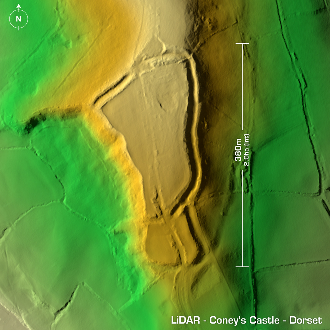
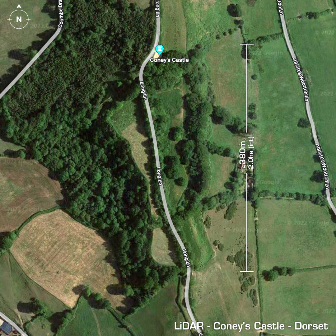
DTM- (Digital Terrain Model, i.e. No buildings or foliage) Just over 5km north of Charmouth and bisected by Long Lane lies the multivallate contour hillfort, Coney’s Castle. Degraded by road across site as well as quarrying. First illustrated on maps in 1888. Now on Heritage at Risk Register. No excavations so the site remains undated. (Scheduled Monument) Iron Age tribal association (conjecture based on location): Durotriges [Any descriptive text is attributed to the Atlas of Hillforts & Wikipedia websites and any associated archaeological descriptions online which will be credited accordingly.]