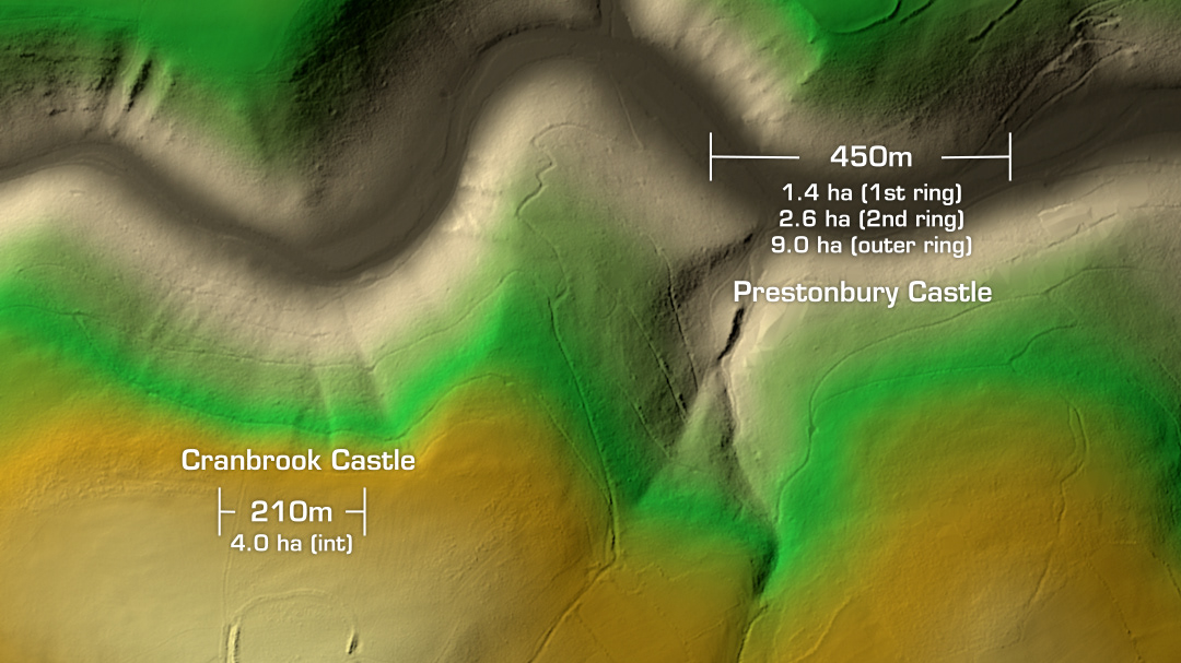
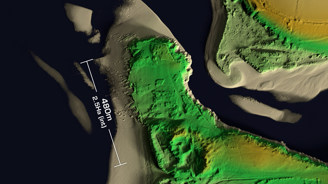
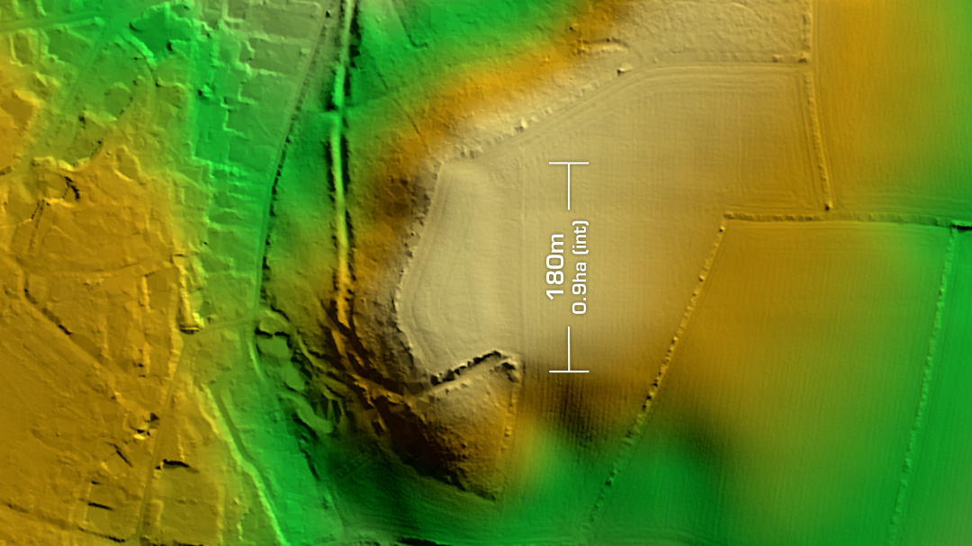
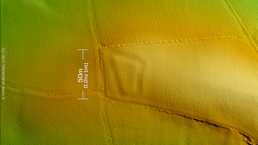
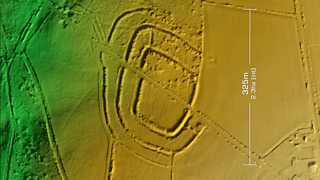
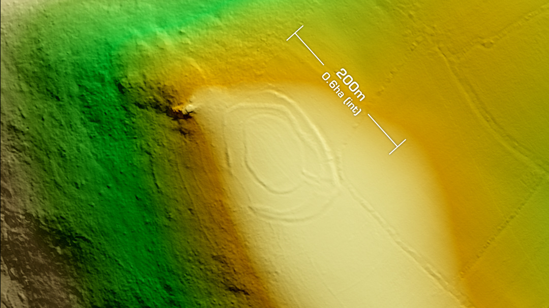
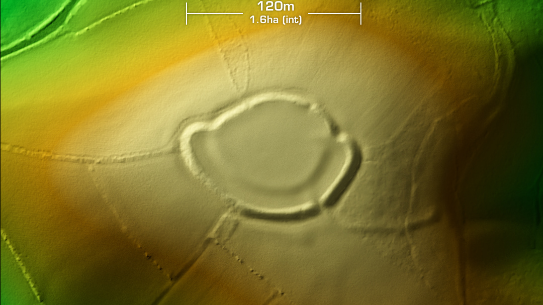
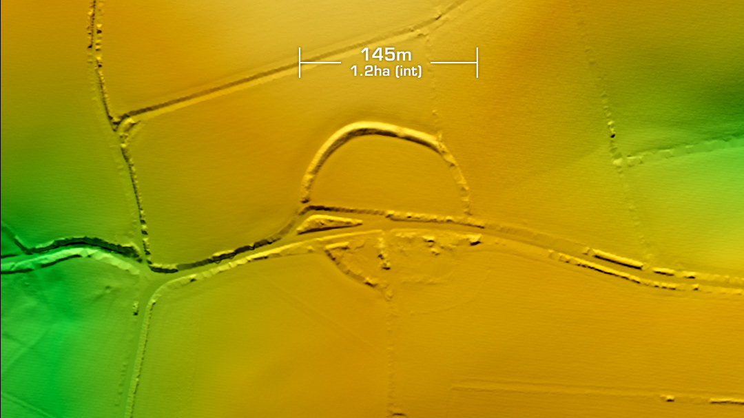
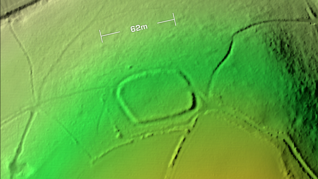
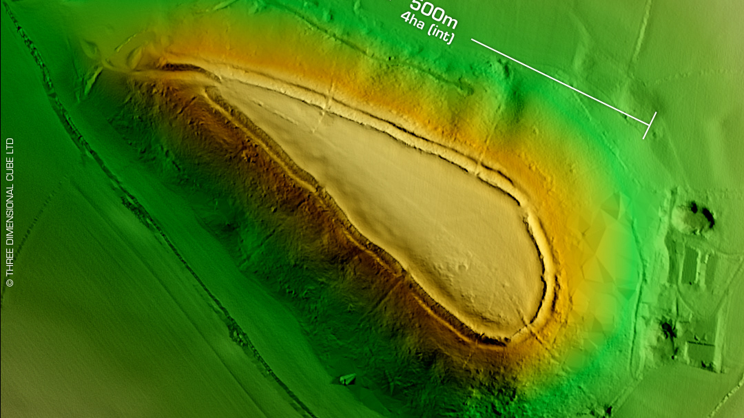
DTM- (Digital Terrain Model, i.e. No buildings or foliage) To the north of Plymouth & completely hidden within trees & ploughed fields lies the hillslope fort, Maristow Camp. Heavily degraded and hosting a 19th century carriage drive across its embankment. No recorded finds and undated. Iron Age tribal association (conjecture based on location): Dumnonii (Scheduled Monument) [Any descriptive text is attributed to the Atlas of Hillforts & Historic England websites]