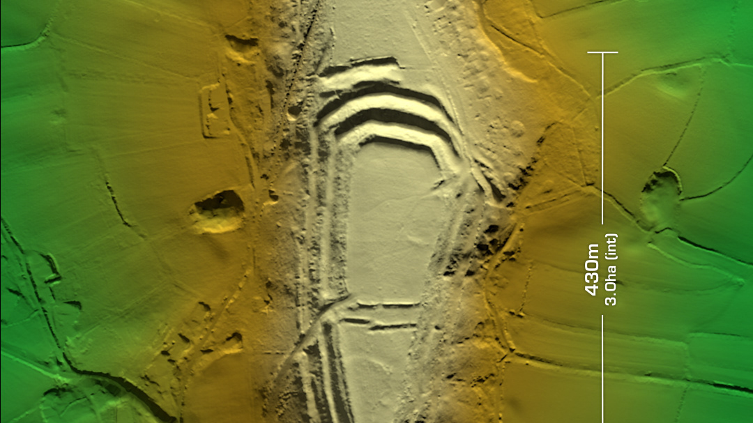
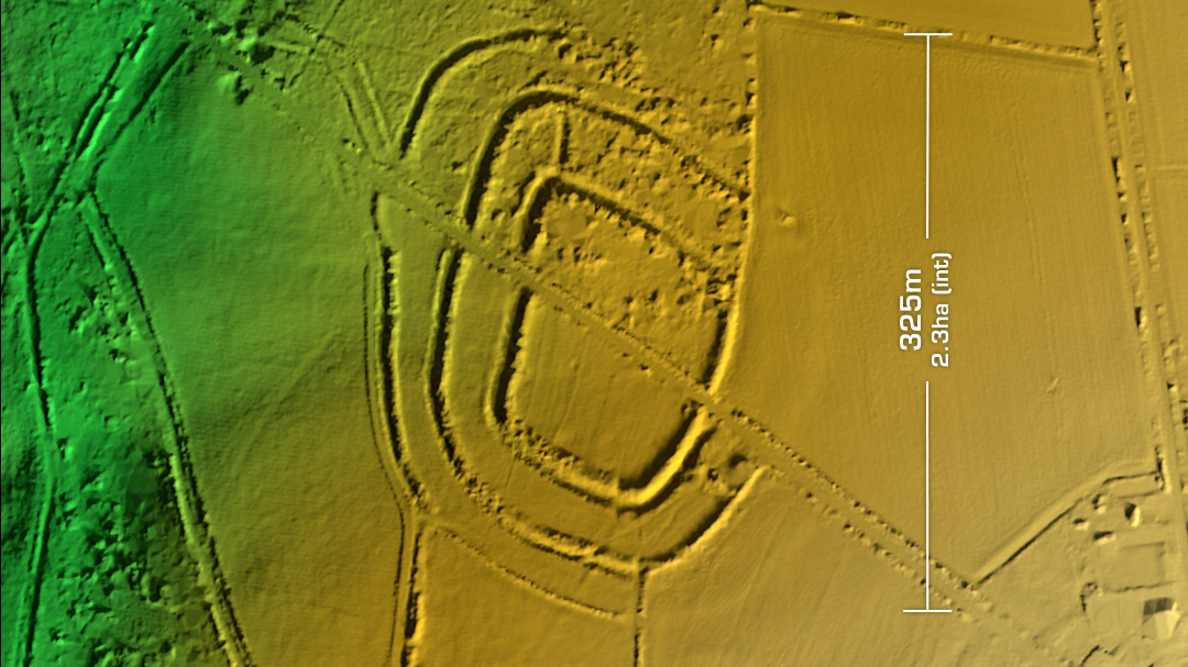
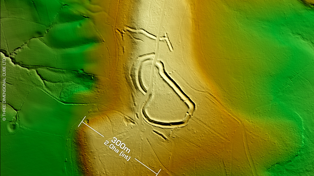
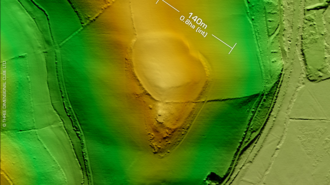
DTM- (Digital Terrain Model, i.e. No buildings or foliage) Just to the north of Seaton above the A3052 and surrounded by Holyford Woods lies the inland promontory fort, Seaton Down. Two banks bisect the spur to the SSW. Both banks built with flint nodules in mix. On 1st Ed OS Map in 1889. No recorded excavations or finds, hence undated. Just to the southeast below the A3052 and Manor Farm lies the Roman and possible earlier Iron Age settlement/farmstead, Honeyditches which has been excavated & dated. Iron Age tribal association (conjecture based on location): Dumnonii (Scheduled Monument) [Any descriptive text is attributed to the Atlas of Hillforts & Historic England websites]