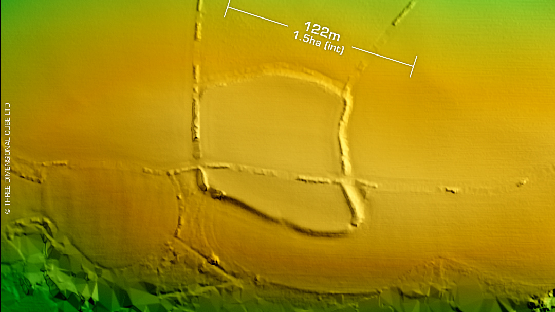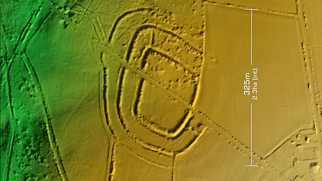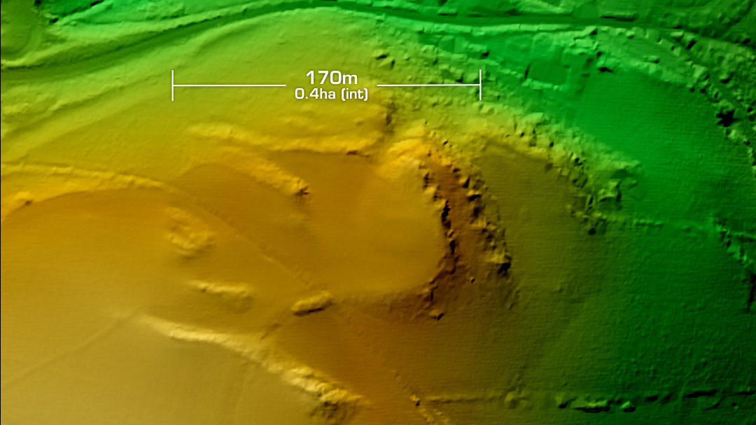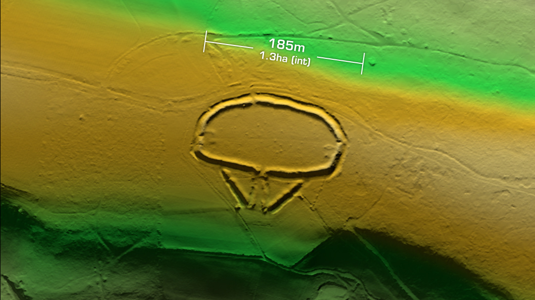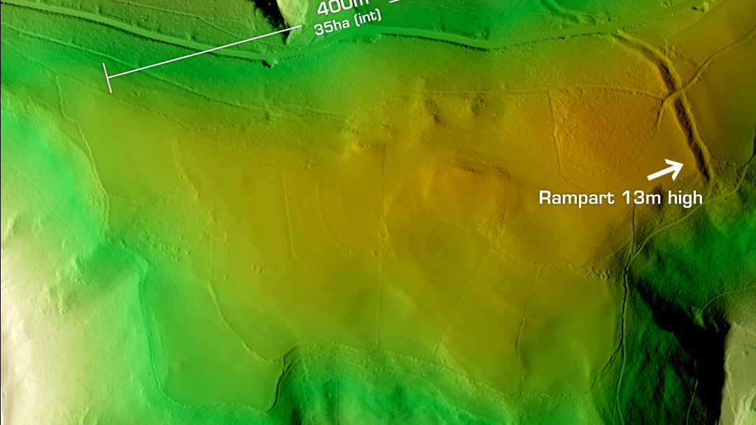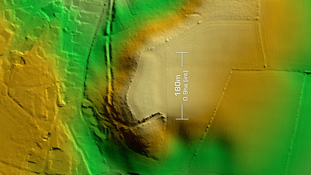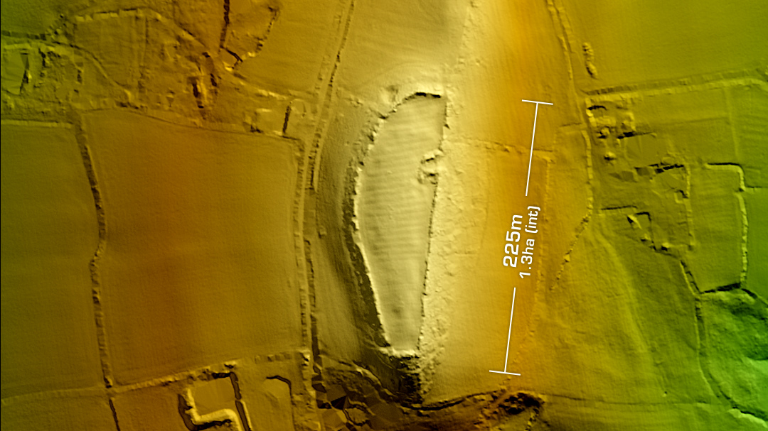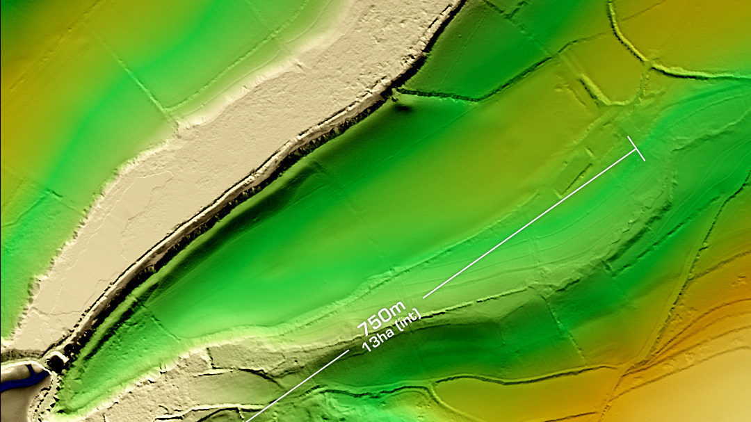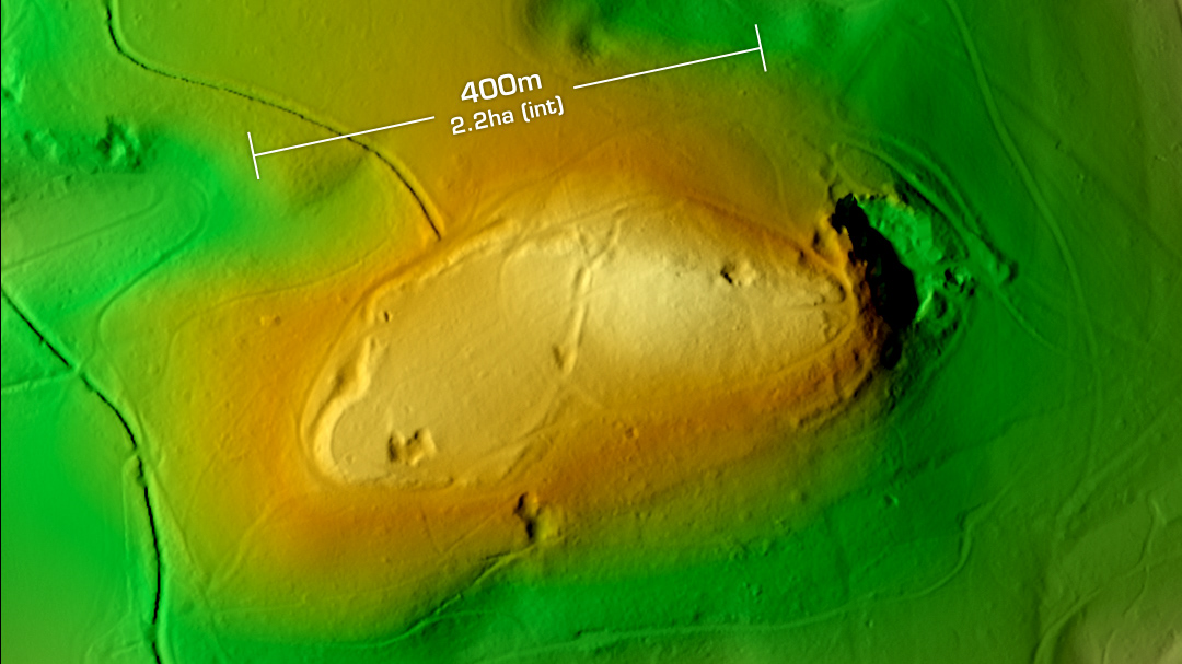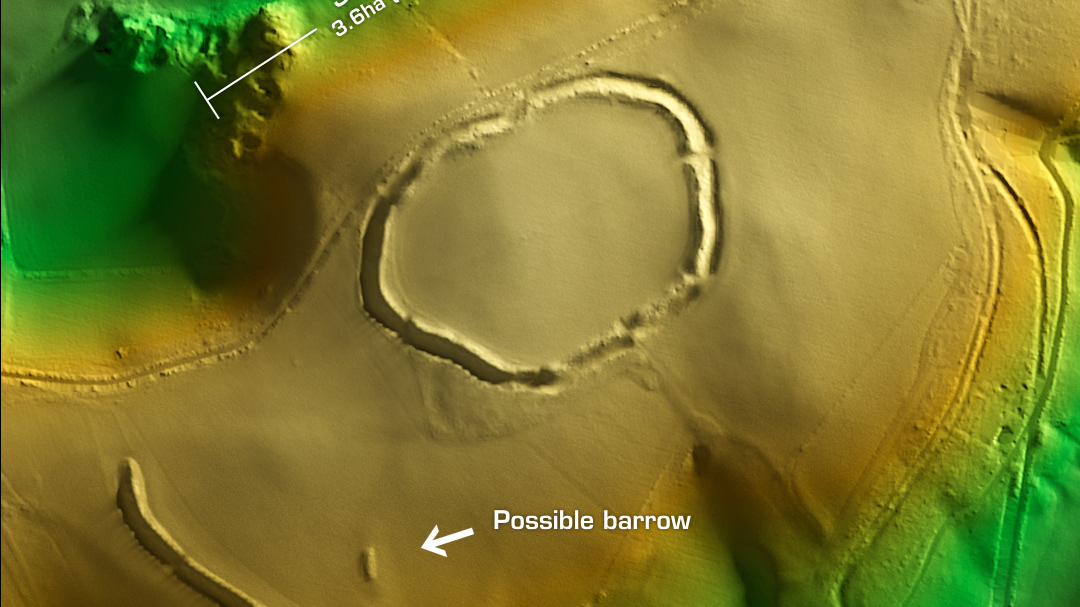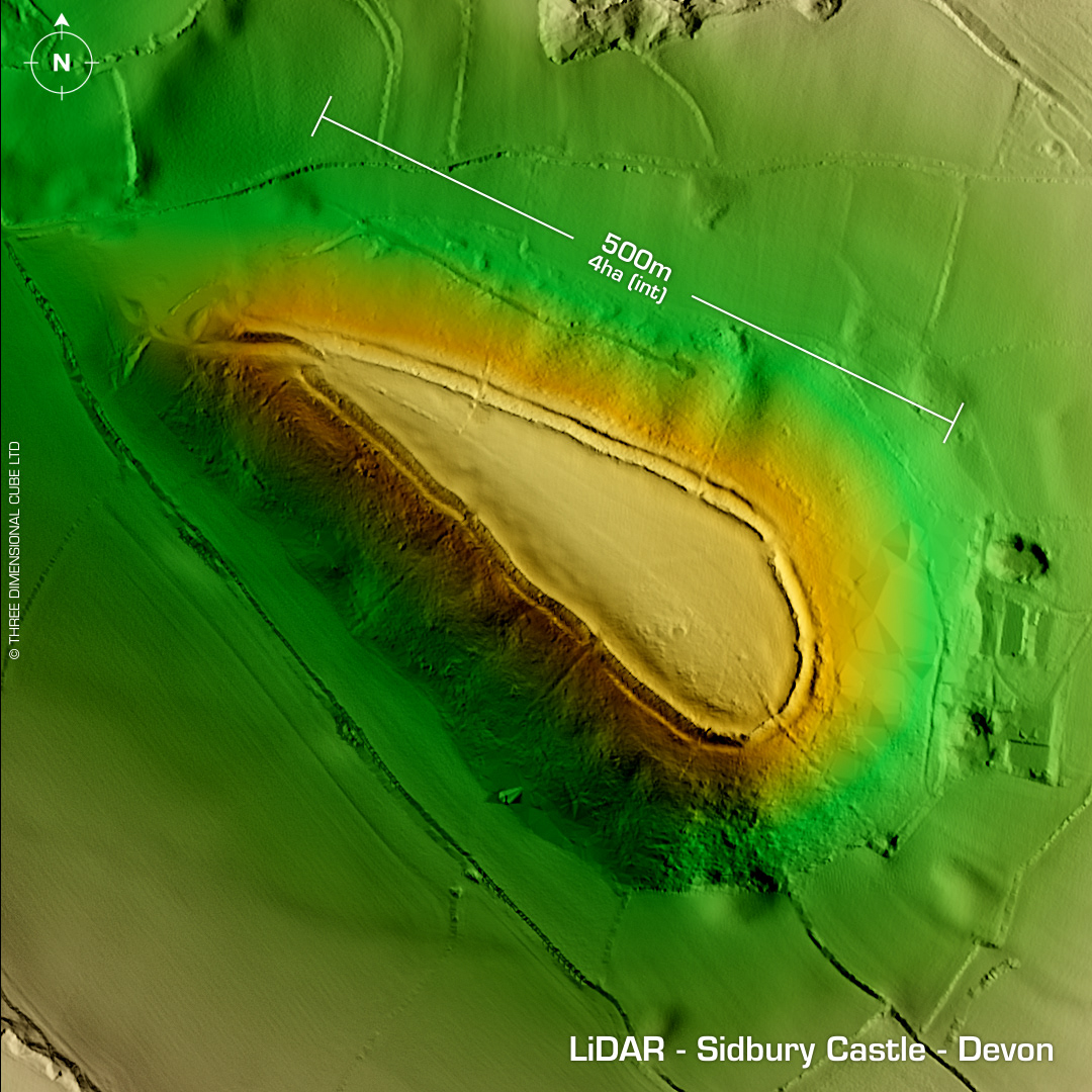
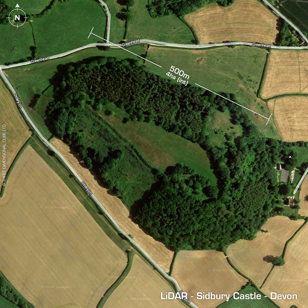
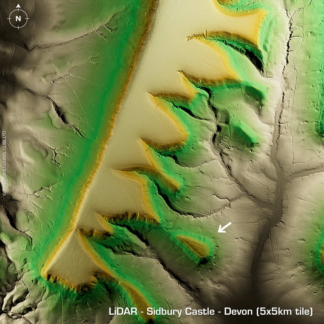
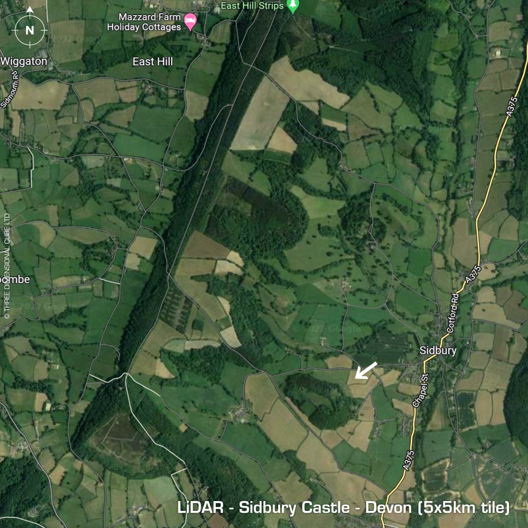
DTM- (Digital Terrain Model, i.e. No buildings or foliage) Overlooking Sidbury to the east lies the large univallate contour hillfort, Sidbury Castle. Single entrance the NW producing a bottleneck passageway 100m long. A hoard of sling stones discovered in the 19th century. Considering how impressive and well defended this site is it hasn’t been properly excavated so it remains undated. I’ve included a wide context map as I loved the overview of the area on LiDAR. Iron Age tribal association (conjecture based on location): Dumnonii (Scheduled Monument) [Any descriptive text is attributed to the Atlas of Hillforts & Historic England websites]