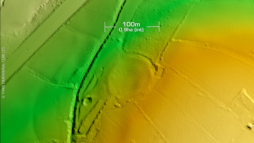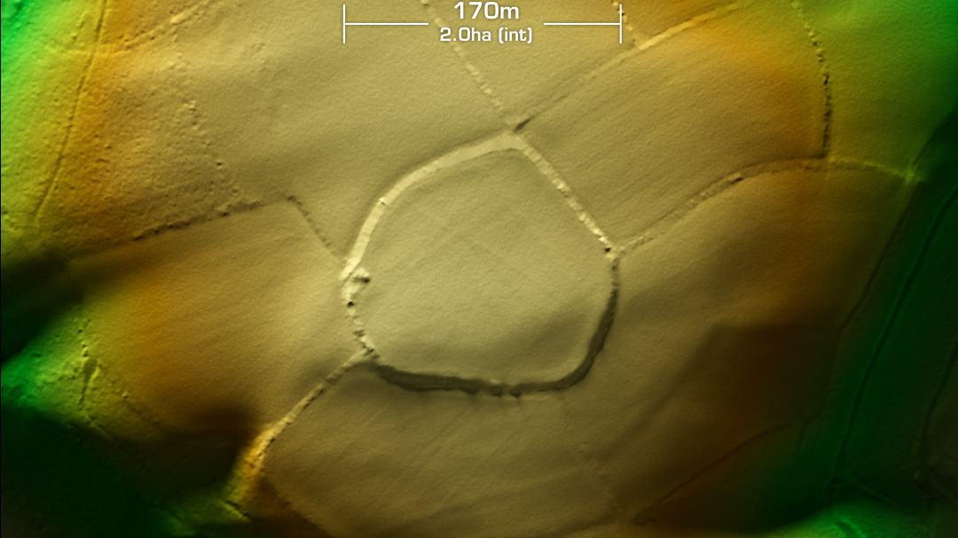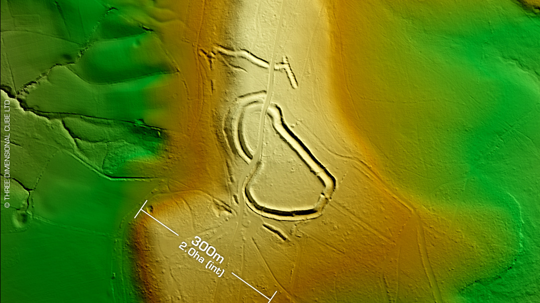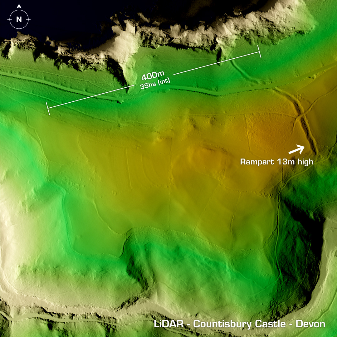
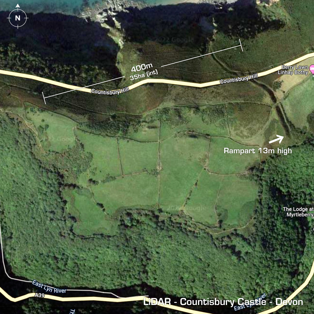
DTM- (Digital Terrain Model, i.e. No buildings or foliage) Overlooking Lynmouth Bay and protected by a huge rampart to the east lies the coastal promontory fort, Countisbury Castle. Overlooks the Myrtleberry North Camp hillfort to the southeast. Possible post Roman medieval use due to discovery of a substantial dry-stone wall. Rampart bisected by the A39 coastal road. Interior ploughed-out over the years. First recorded in 1086 in the Doomsday Book as ‘Contesberie’. Suggested as the site of ‘Arx Cynuit’, (fortified hill) where the Viking Ubba, the brother of Ivan the Boneless was defeated by the Anglo-Saxons in 878AD according to the chronicler Asser. Last survey in 1996. No recorded finds or excavations, hence undated. Iron Age tribal association (conjecture based on location): Dumnonii (Scheduled Monument) [Any descriptive text is attributed to the Atlas of Hillforts & Historic England websites and any associated archaeological descriptions online which will be credited accordingly.]