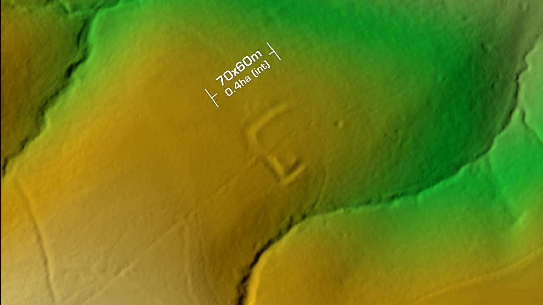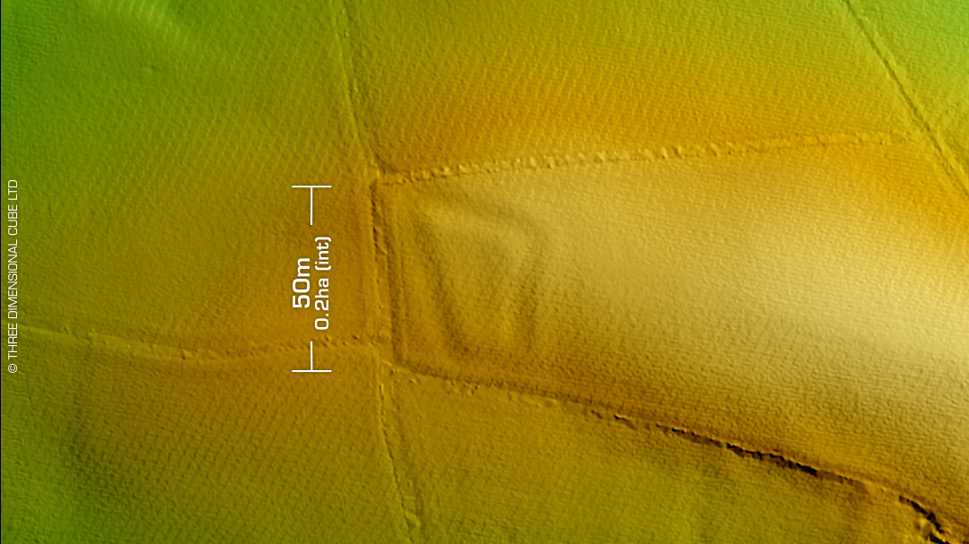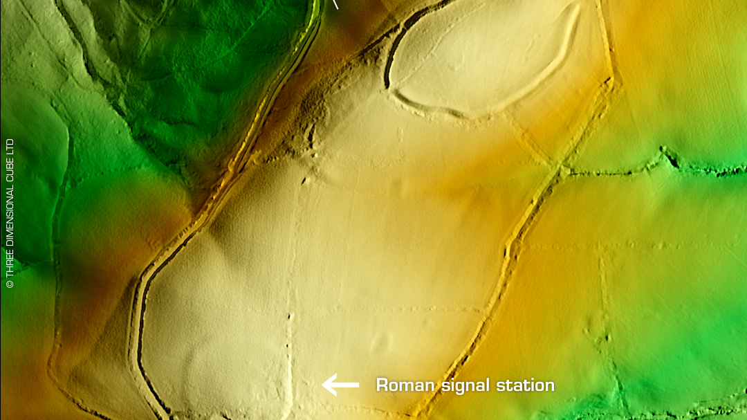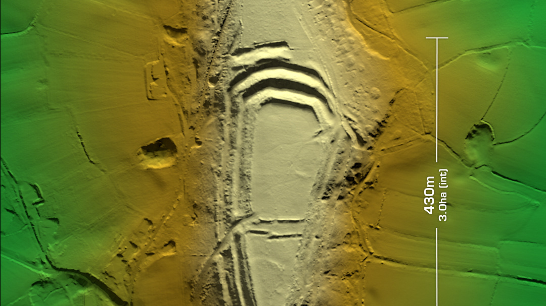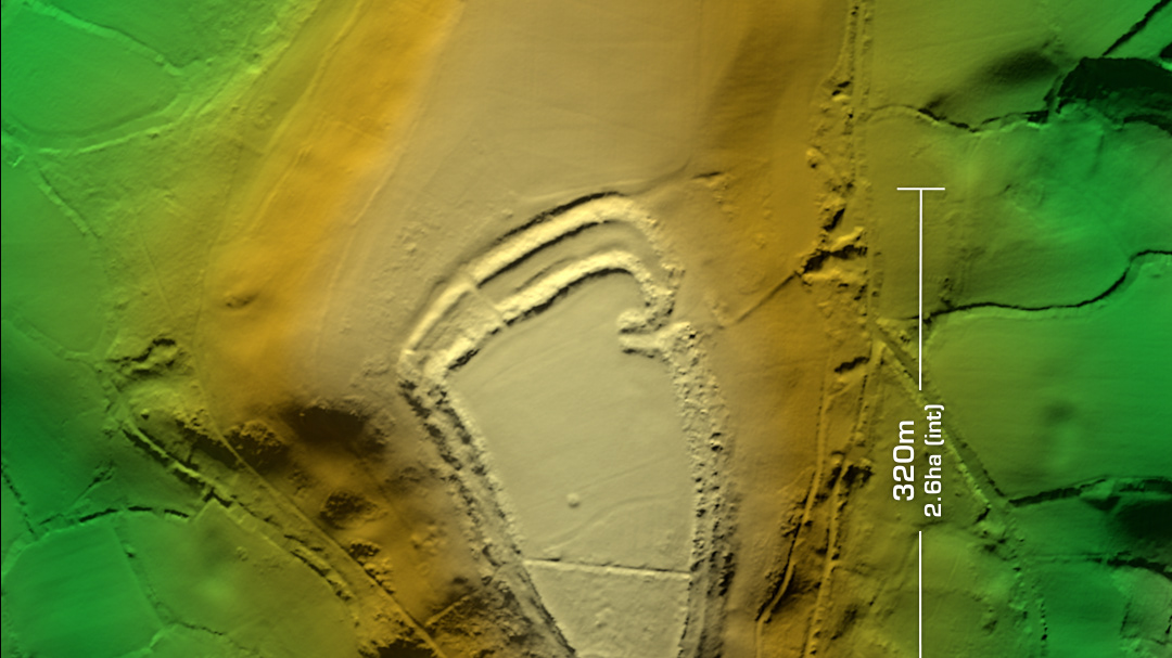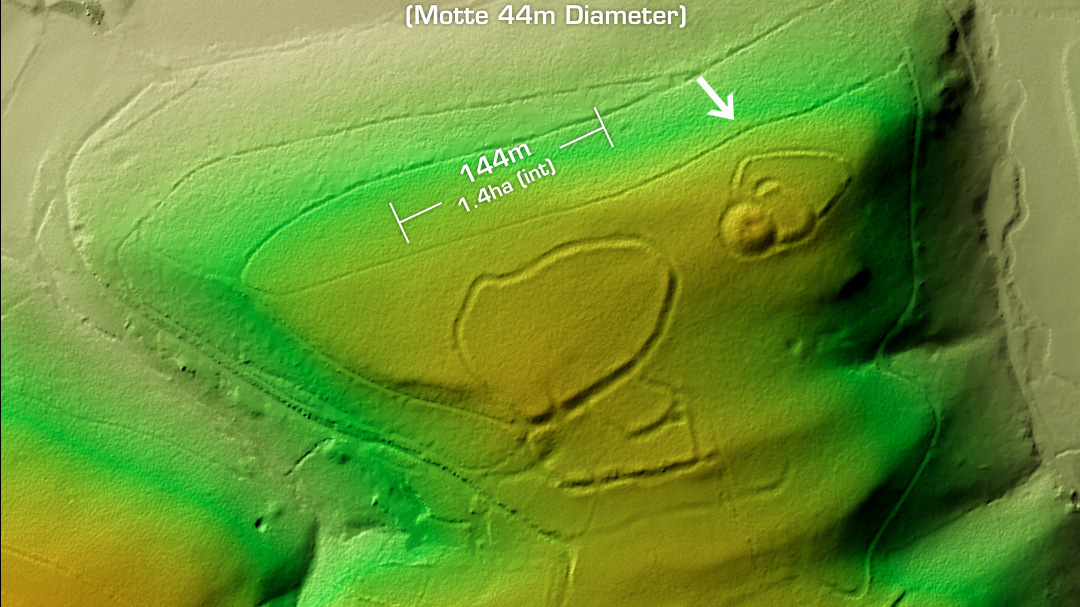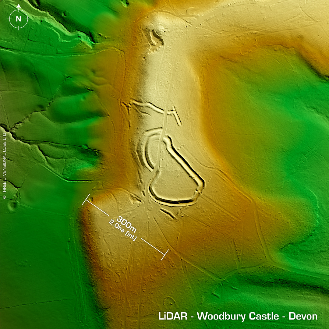

DTM- (Digital Terrain Model, i.e. No buildings or foliage) Hidden in woodland on Woodbury Common & overlooking Woodbury from the east and bisected north-south by the B3180 lies the complex contour hillfort, Woodbury Castle. Said, B-Road was constructed between 1968 & 1971 with zero fucks given. Excavations did take place while the builders cut through the embankments where evidence of postholes found beneath the rampart indicated an earlier palisade enclosure. Charcoal from oven found beneath rampart yields a C14 date circa 10AD. +/- 200. Early Iron Age pottery also found. Possible timber structure incorporated into rampart. The site has its own spring known as 'Soldiers Well'. Originally a private site with cottage & garden within ramparts. WWII bunker dug into rampart. Iron Age tribal association (conjecture based on location): Dumnonii (Scheduled Monument) [Any descriptive text is attributed to the Atlas of Hillforts & Historic England websites]