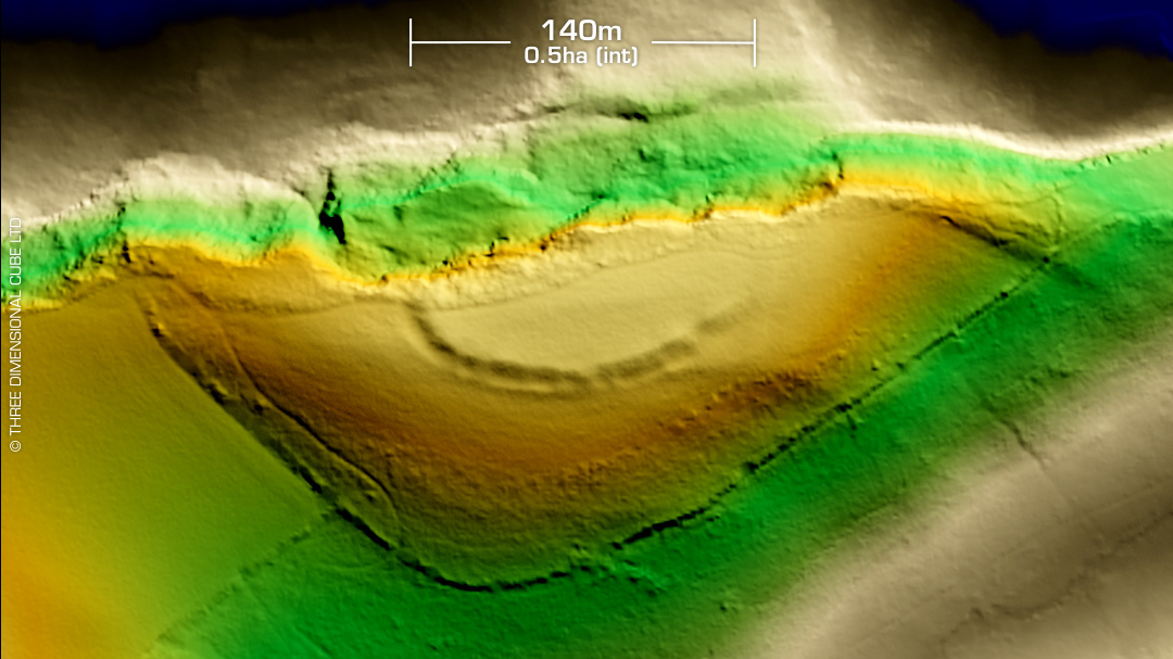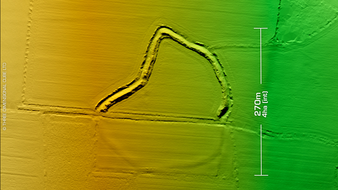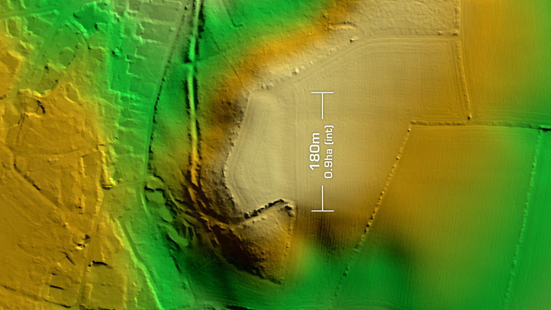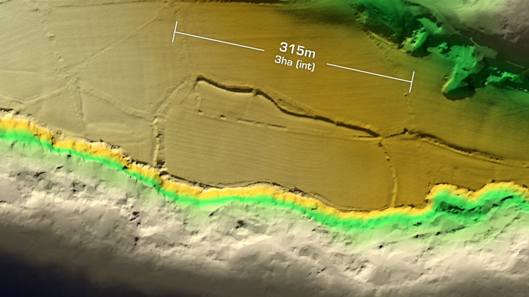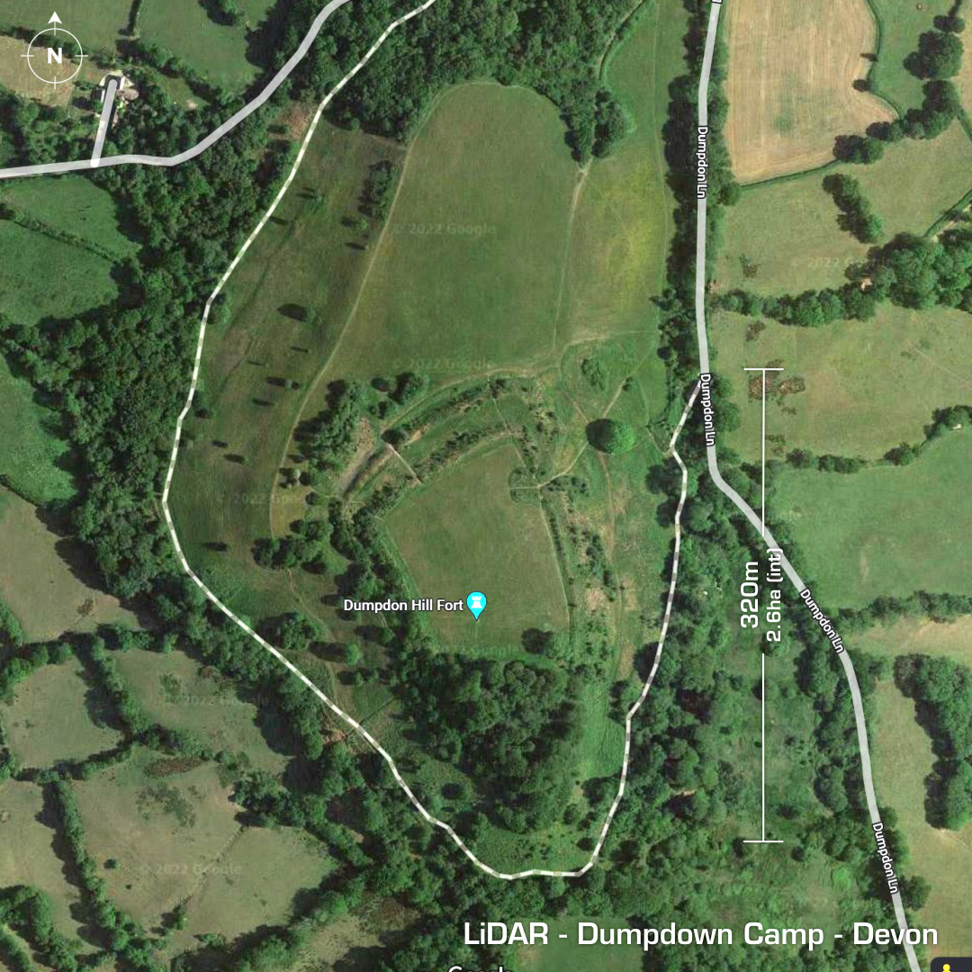
DTM- (Digital Terrain Model, i.e. No buildings or foliage) 5km to the northwest of Honiton & west of the A30 lies the impressive bivallate contour hillfort, Dumpdon Camp. Minor excavation in 1990. No recorded finds. No evidence of occupation. Possible barrow (circular feature). Rampart constructed with 2.1m x 0.4m chert blocks. Inturned entrance on the NE side. NW cut through rampart is modern. Possibly an unfinished site. Iron Age tribal association (conjecture based on location): Dumnonii (Scheduled Monument) [Any descriptive text is attributed to the Atlas of Hillforts & Wikipedia websites and any associated archaeological descriptions online which will be credited accordingly.]