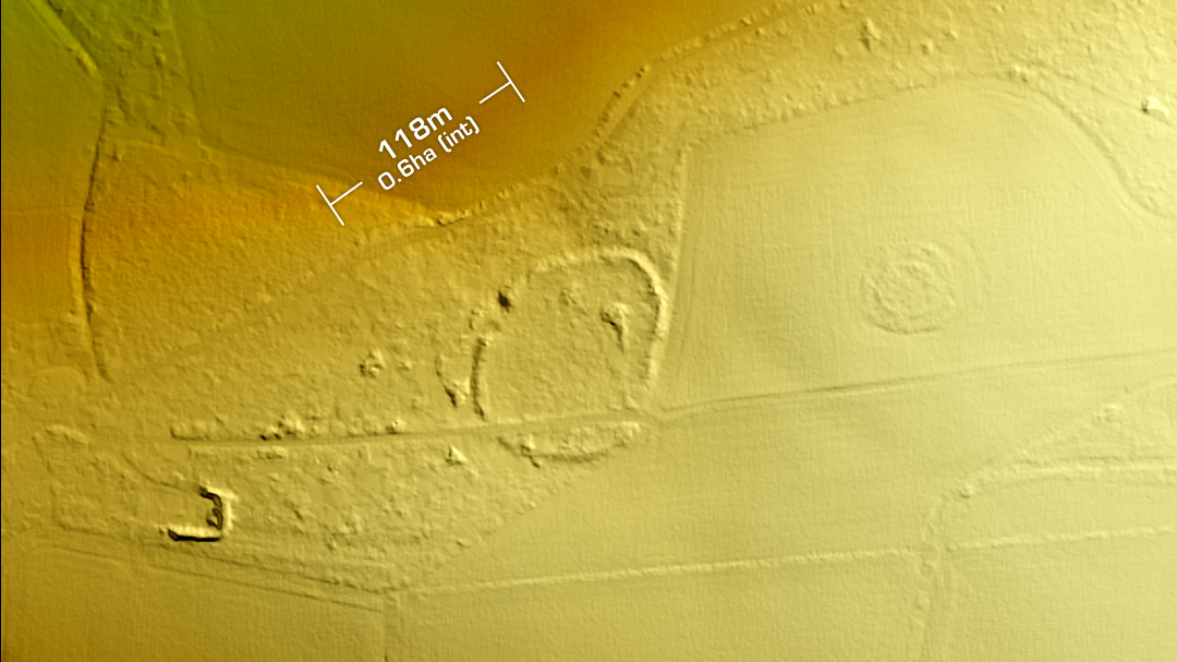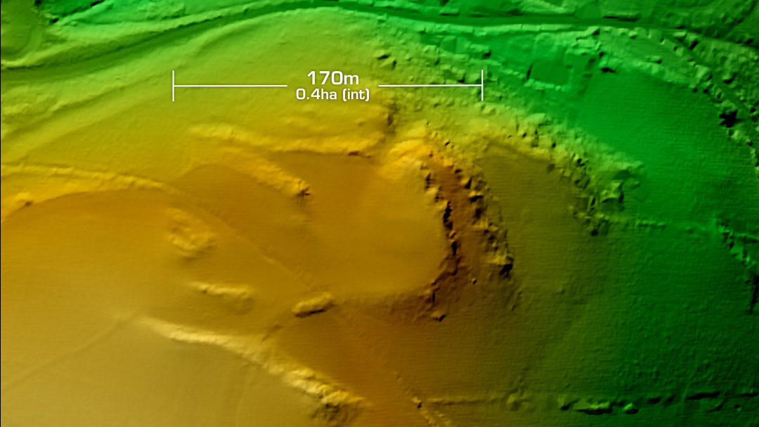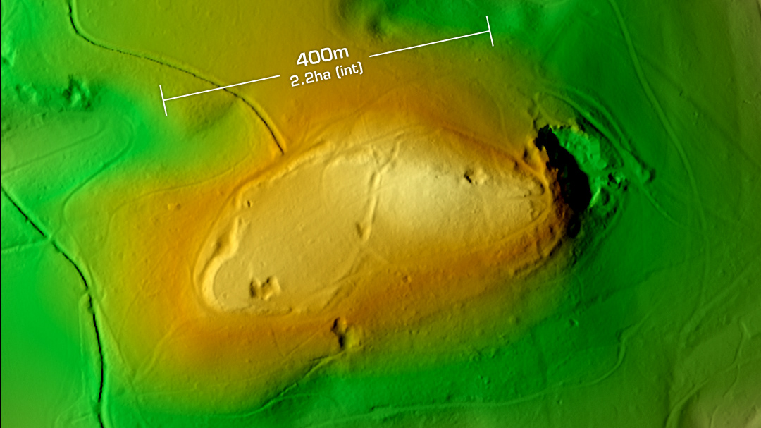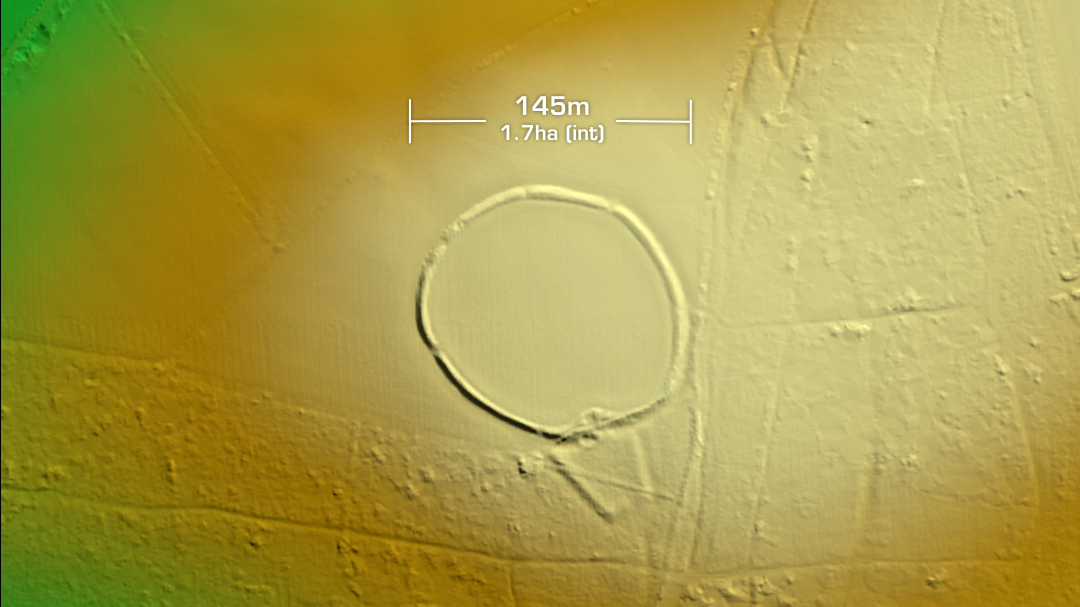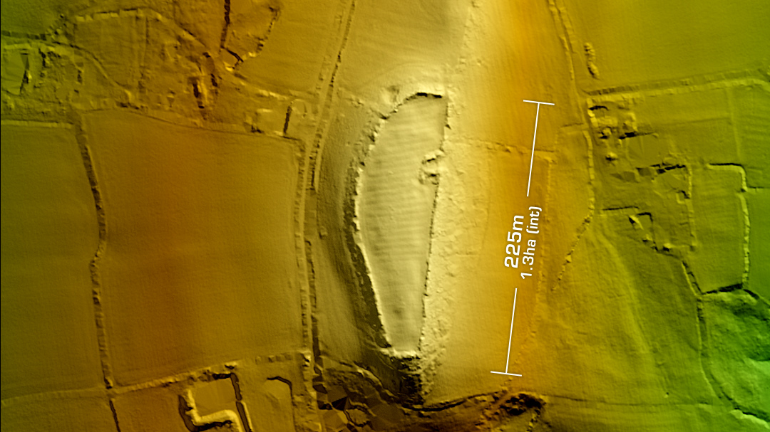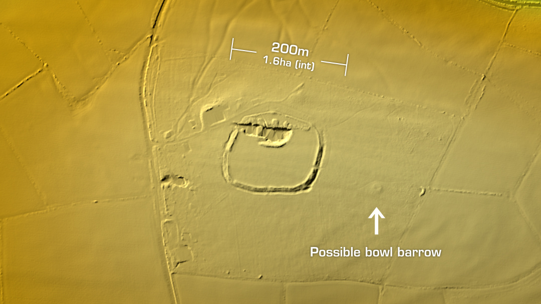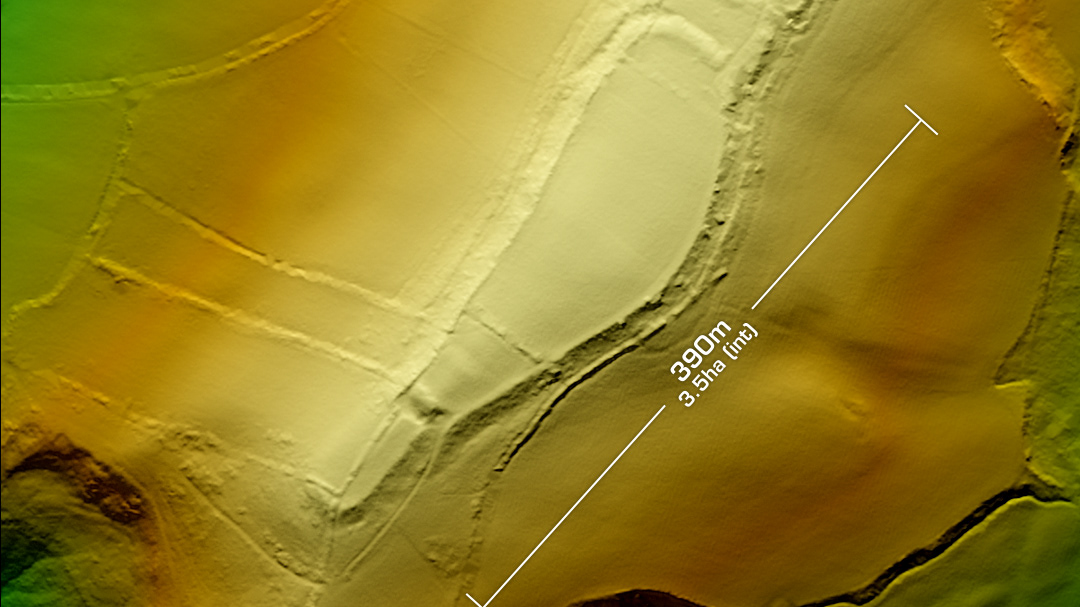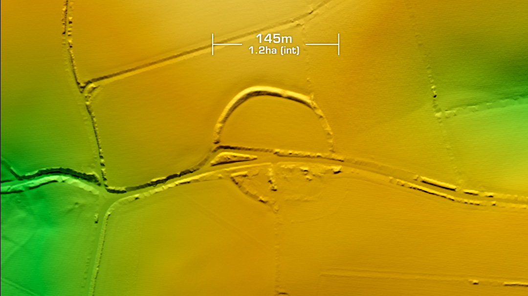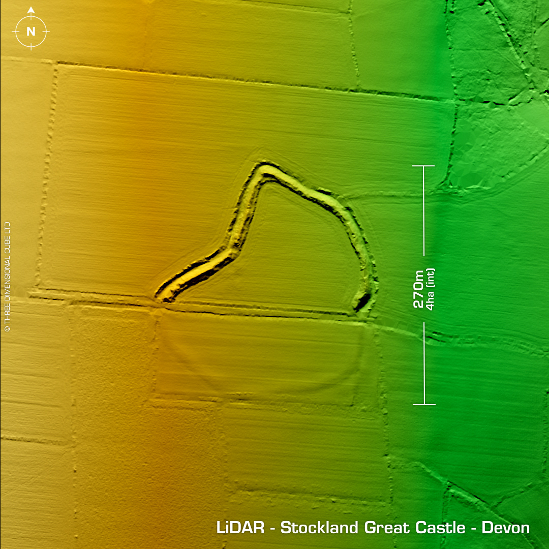
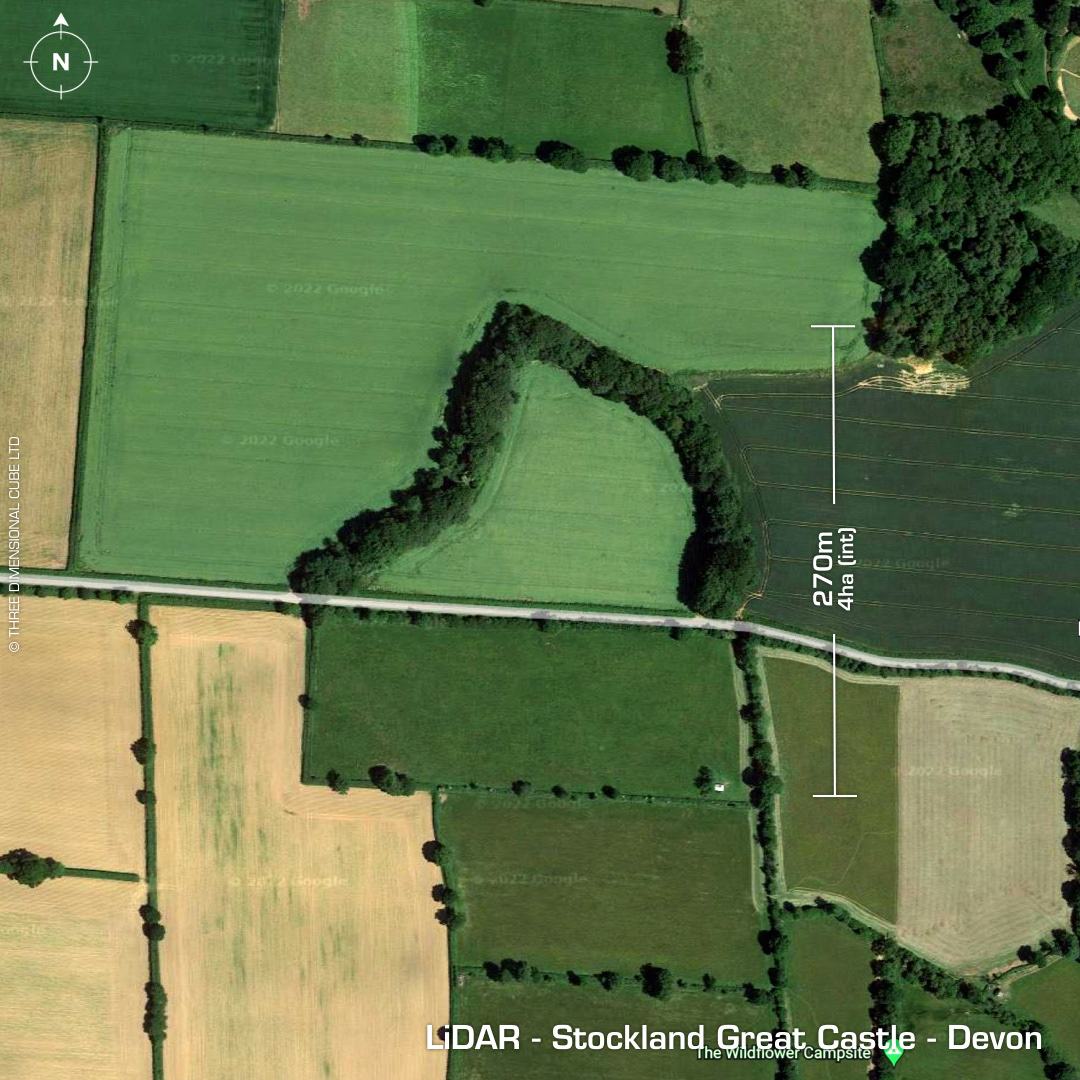
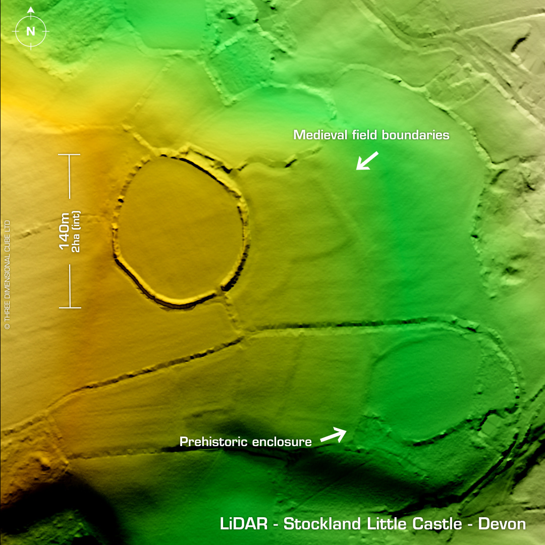
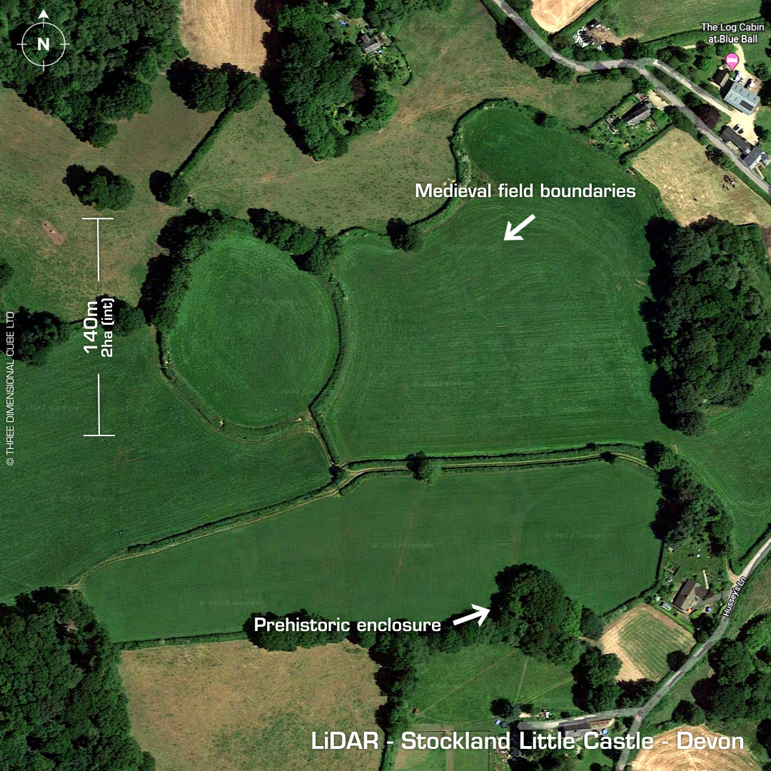
DTM- (Digital Terrain Model, i.e. No buildings or foliage) To the east of Stockland Hill road, (which is so straight it looks Roman but it’s not listed as such) and south west of Millhayes lies the irregular univallate contour hillfort, Stockland Great Castle. An old road bisects the site. South side heavily degraded by ploughing and only just visible. Chance finds of sling stones but no recorded excavations. Northeast of this site lies the Stockland Little Castle, known as a ‘round’. Possible prehistoric to Roman. Alongside this site lies stepped Medieval field boundaries and a possible much earlier enclosure. Iron Age tribal association (conjecture based on location): Dumnonii (Scheduled Monument) [Any descriptive text is attributed to the Atlas of Hillforts & Historic England websites]