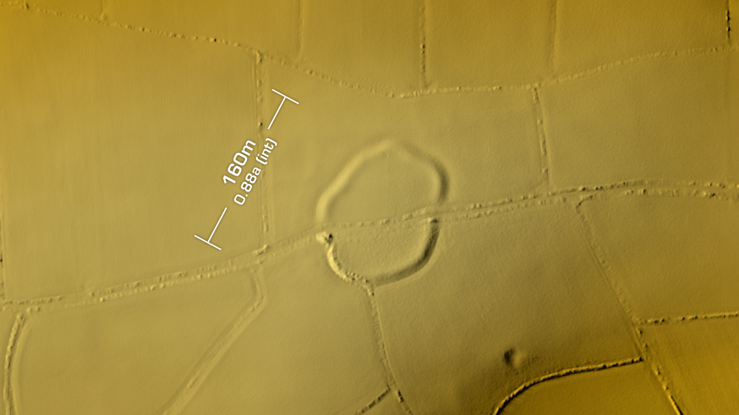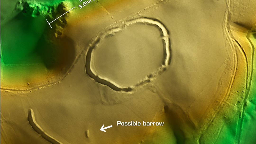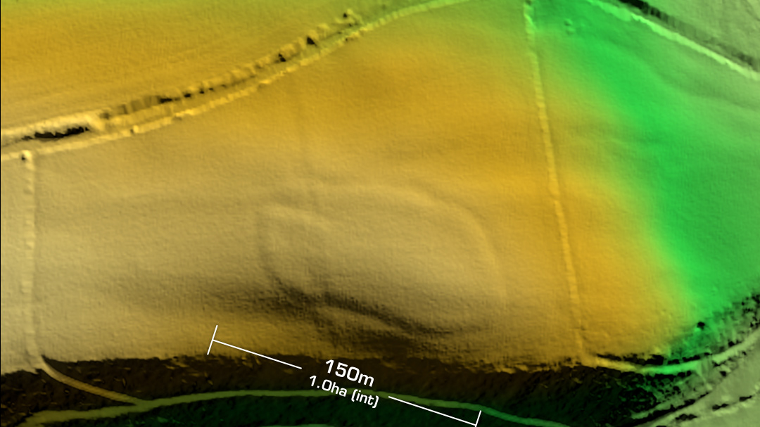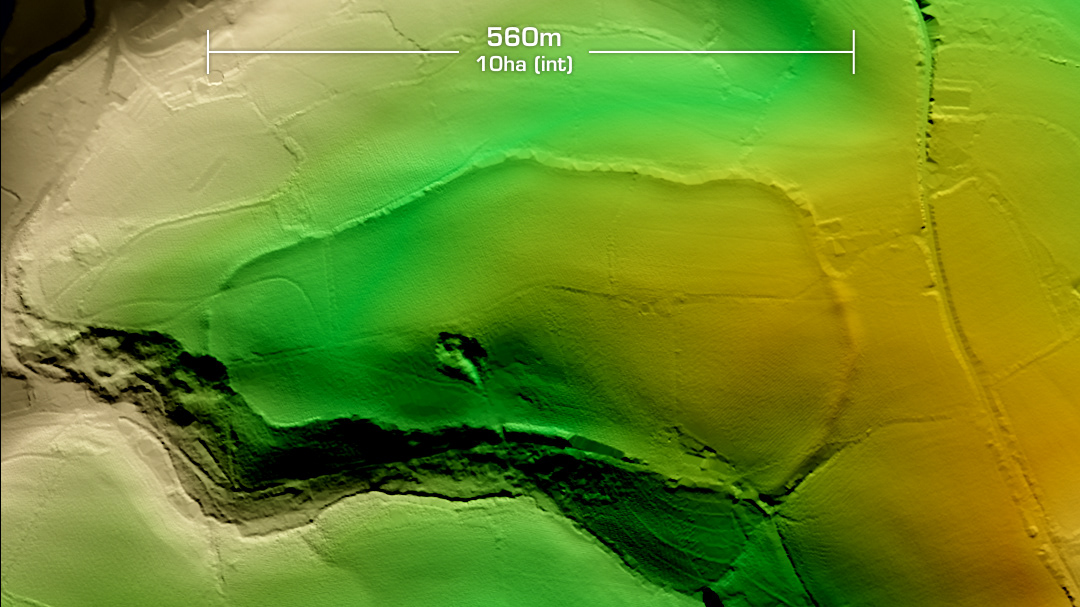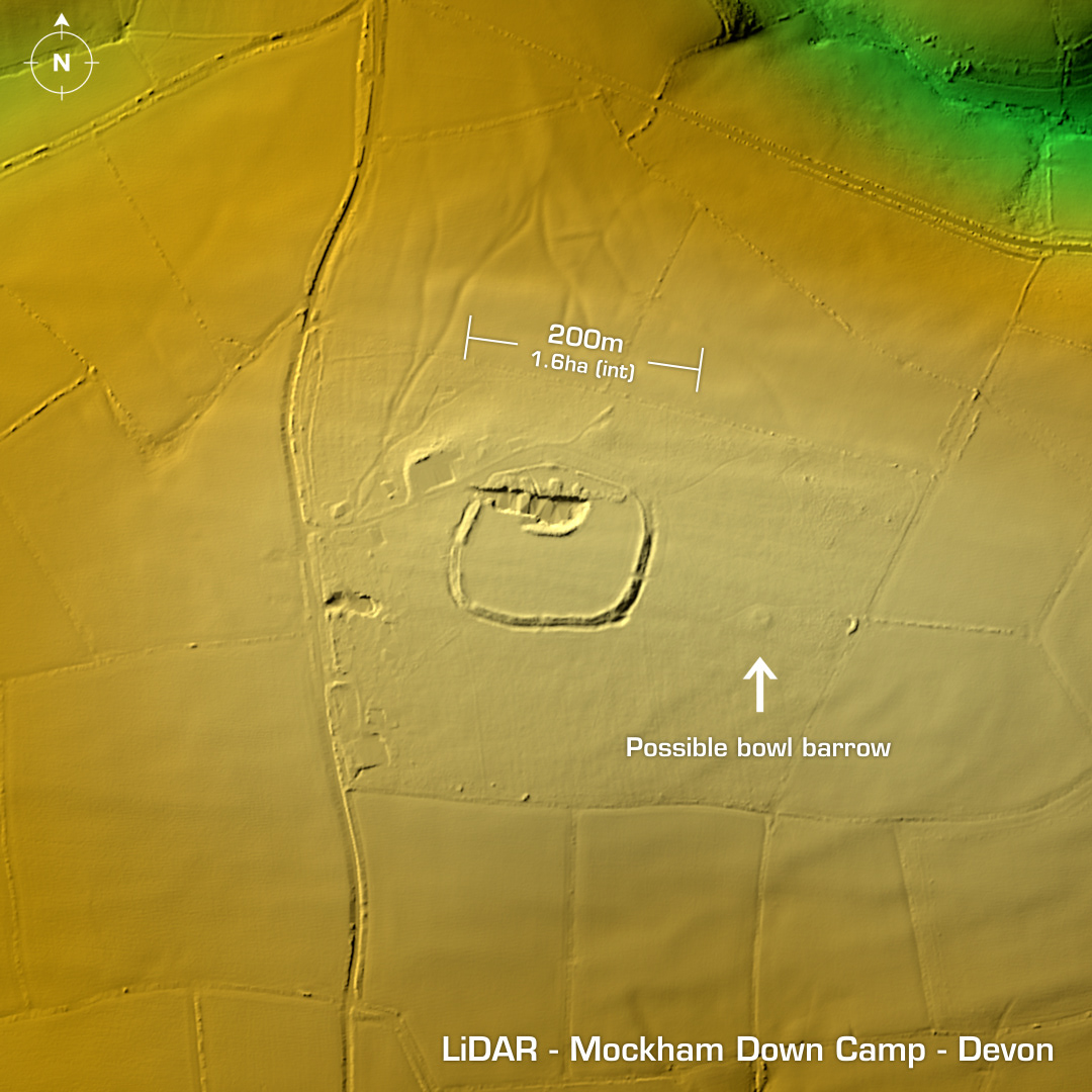
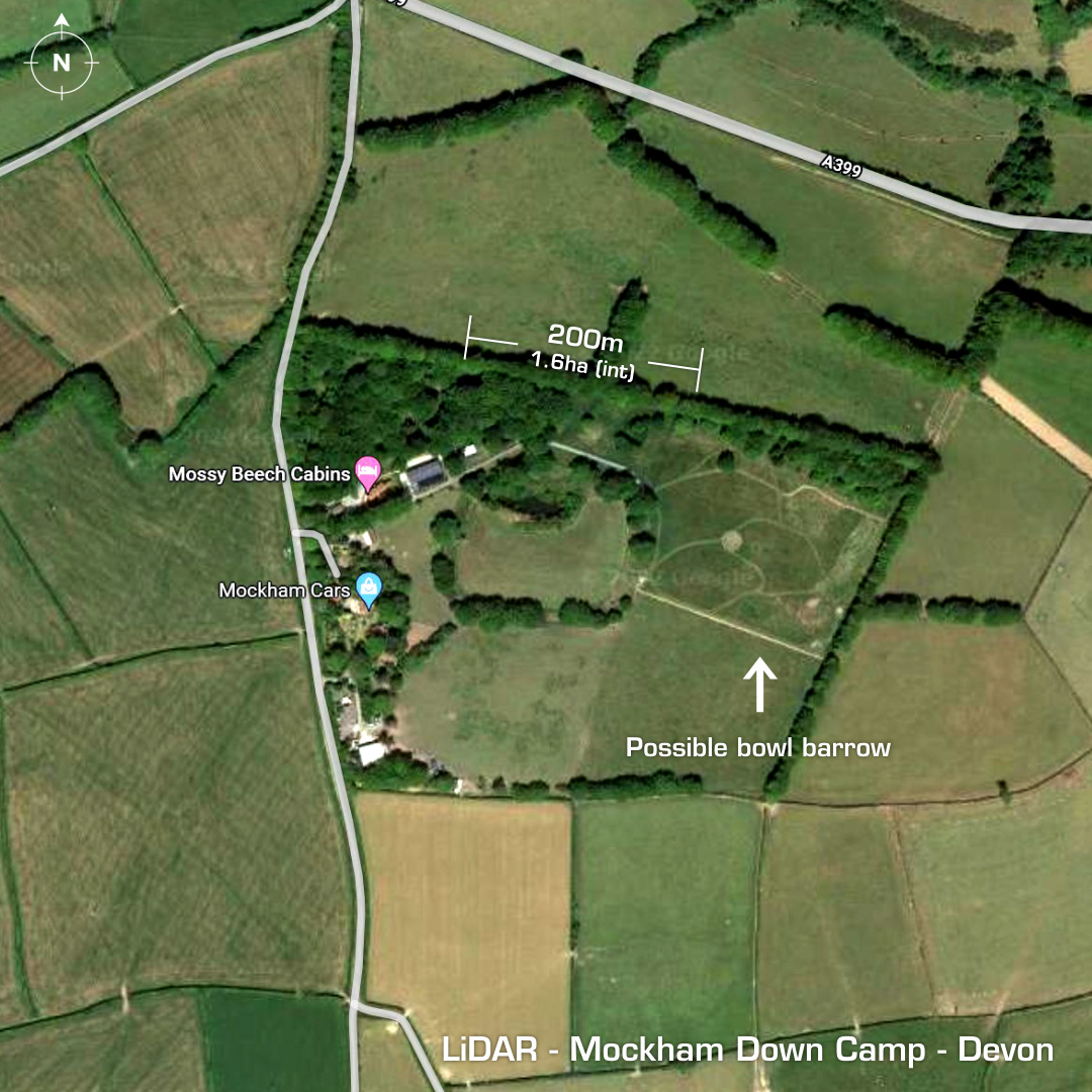
DTM- (Digital Terrain Model, i.e. No buildings or foliage) A kilometre to the east of Benton and just below the A399 on the site of ‘Mossy Beach Cabins’ lies the univallate partial contour hillfort, Mockham Down Camp. This site lies just over a kilometre from the Beara Castle hillfort to the west. A large gravel pit, now full of water lies within the NW entrance. Degraded by ploughing. First documented on 1889 OS Map. Possible Bowl Barrow to the east. No excavations hence undated. Iron Age tribal association (conjecture based on location): Dumnonii (Scheduled Monument) [Any descriptive text is attributed to the Atlas of Hillforts & Wikipedia websites and any associated archaeological descriptions online which will be credited accordingly.]