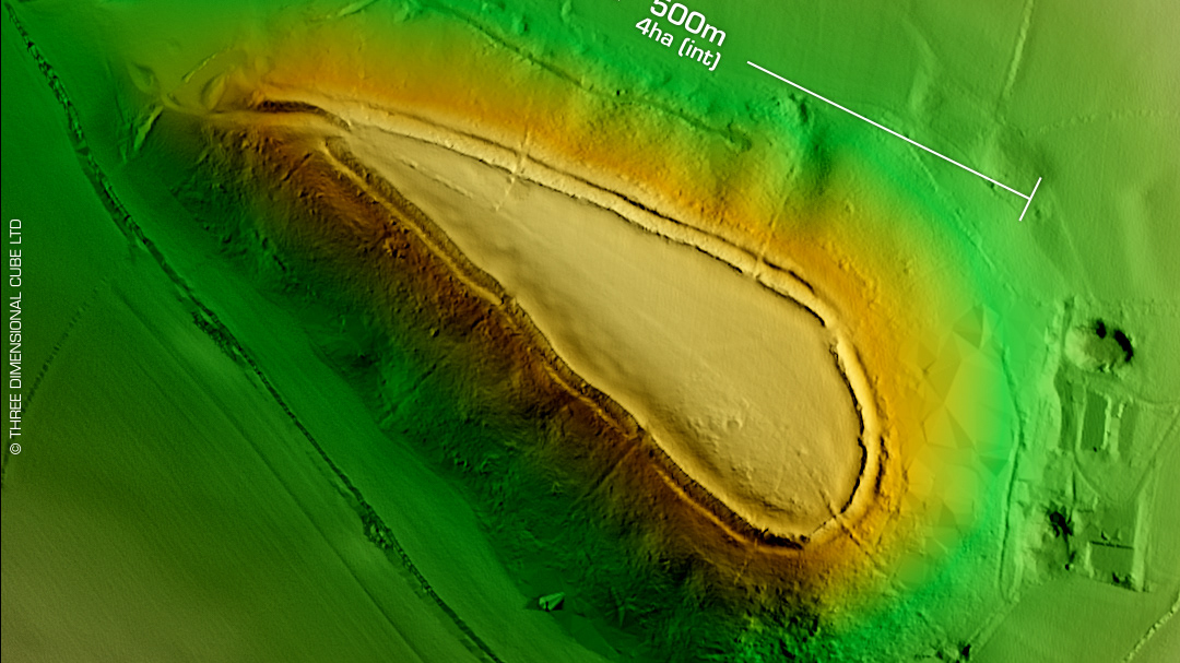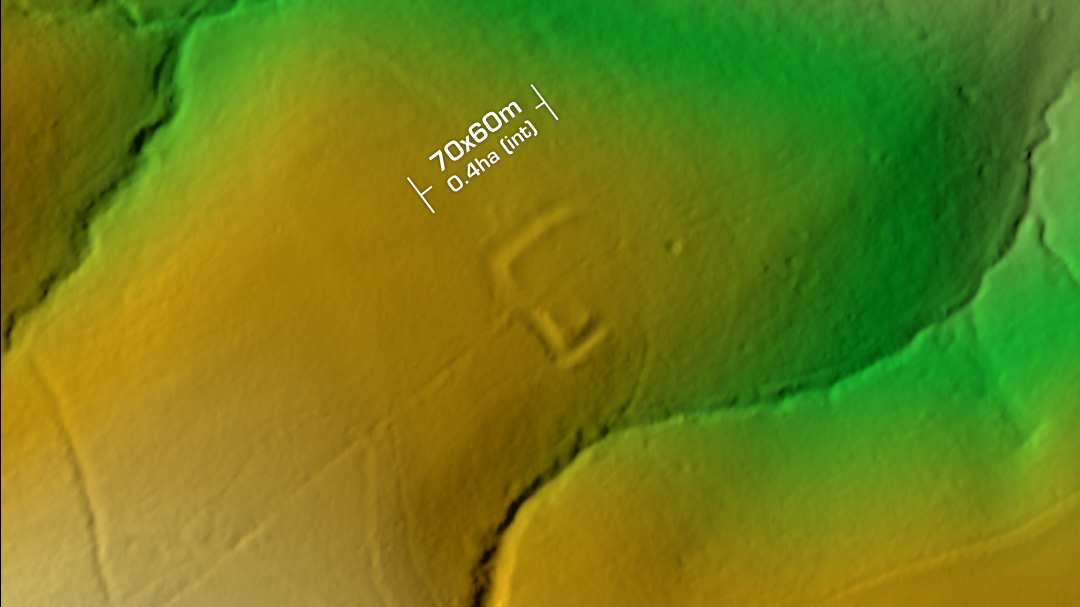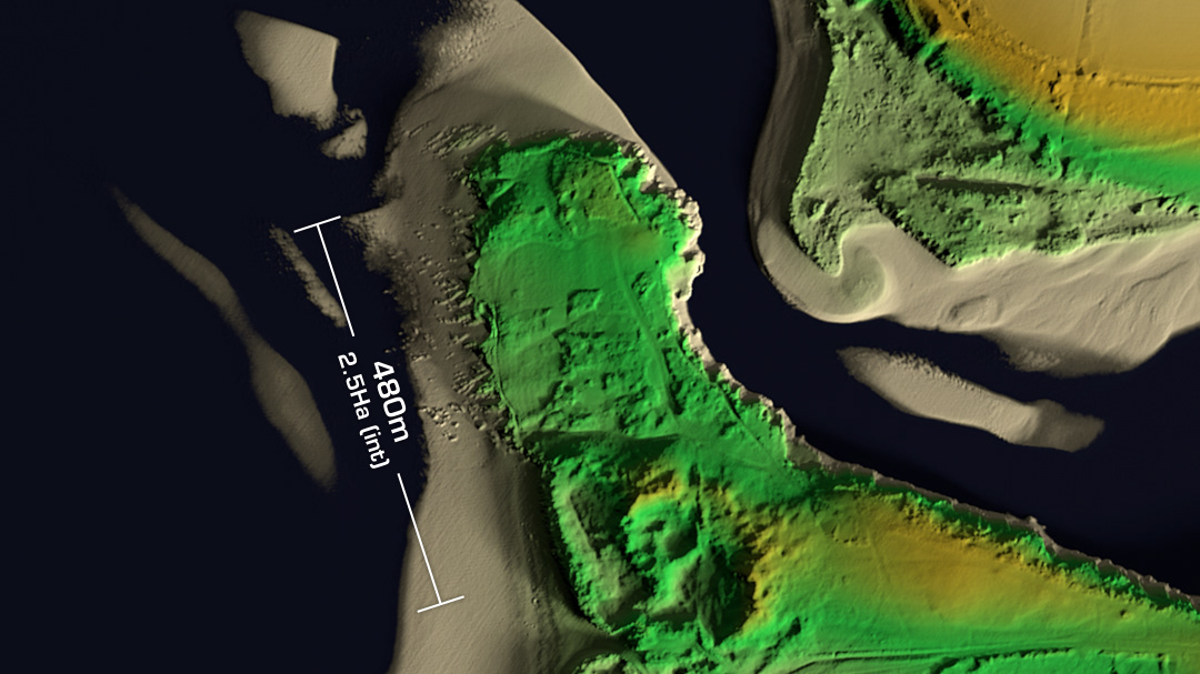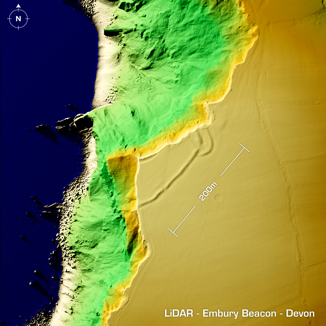
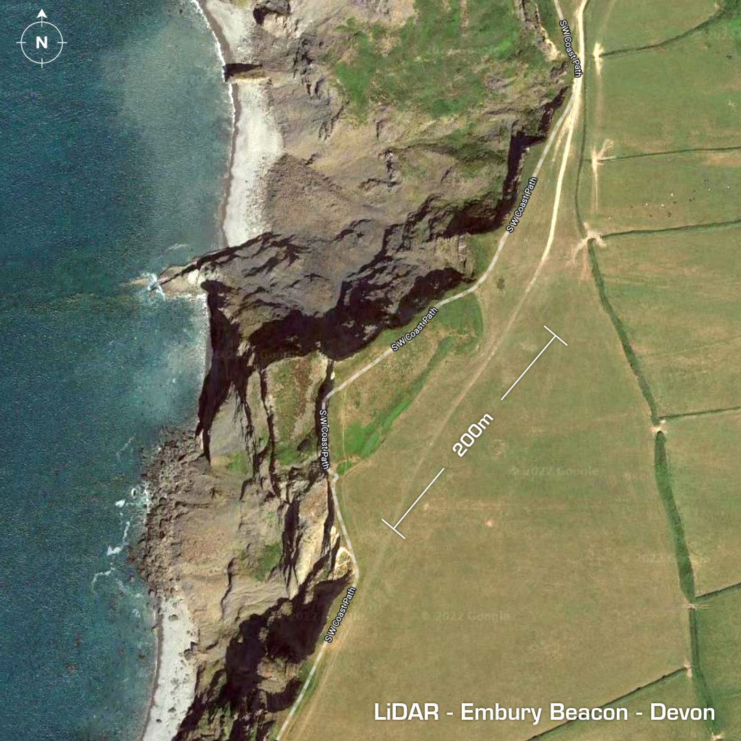
DTM- (Digital Terrain Model, i.e. No buildings or foliage) Bisected by the cliff edge between South Hole & Welcombe lies the coastal promontory fort, Embury Beacon. Coastal erosion in the last couple of thousand years has destroyed over half of the site so we shall never know its true shape or size. First excavation in 1972. Finds include post holes and possible barbican on NE corner, Iron Age Glastonbury Ware, hearths, a spindlewhorl and sling stones. Iron Age tribal association (conjecture based on location): Dumnonii (Scheduled Monument) [Any descriptive text is attributed to the Atlas of Hillforts & Historic England websites and any associated archaeological descriptions online which will be credited accordingly.]