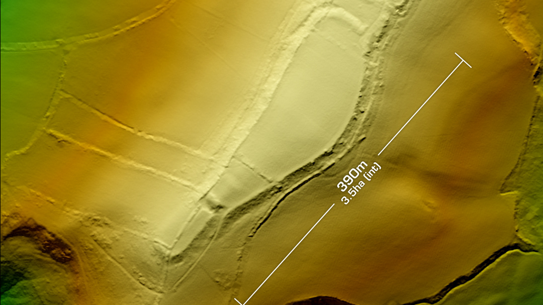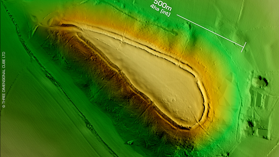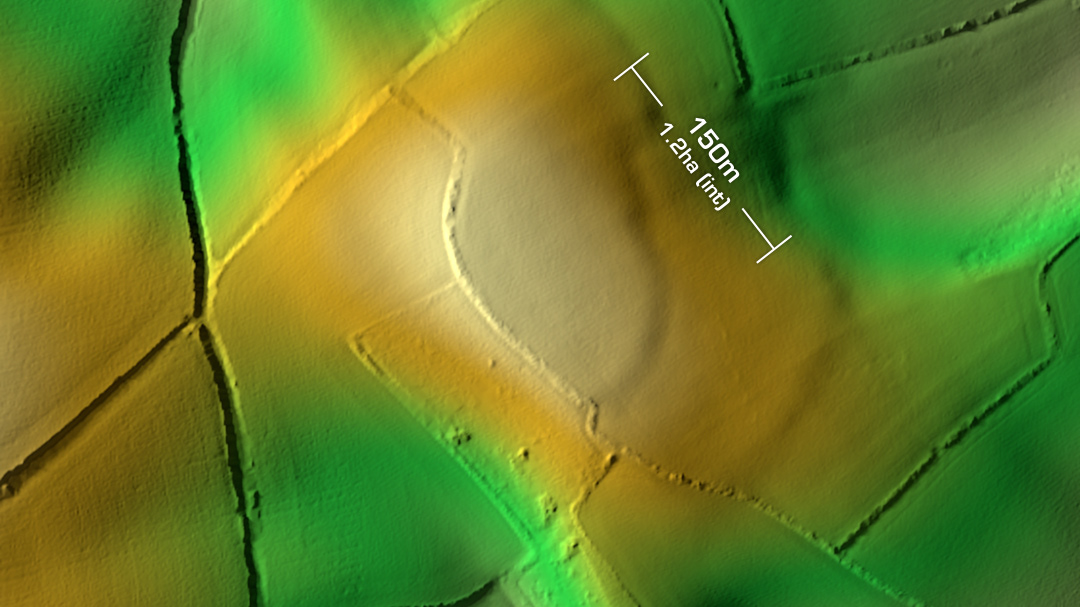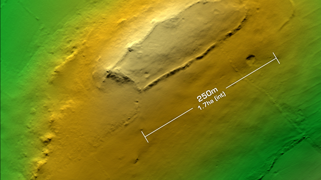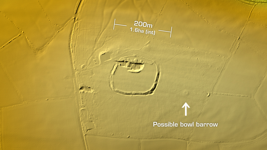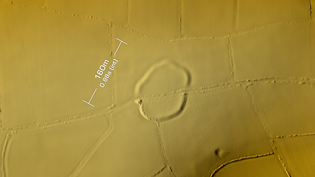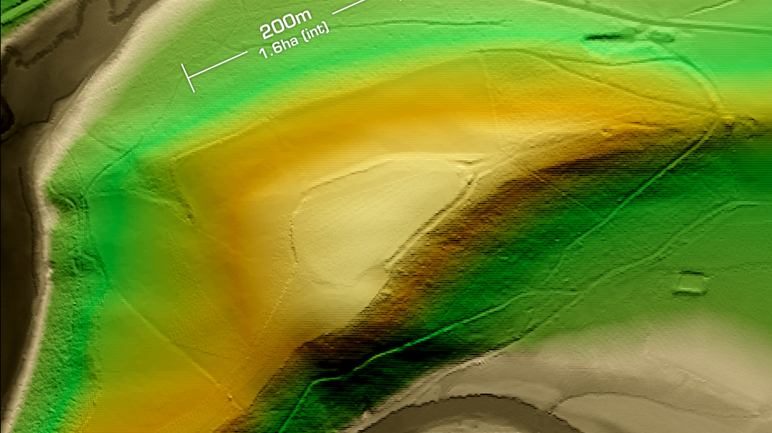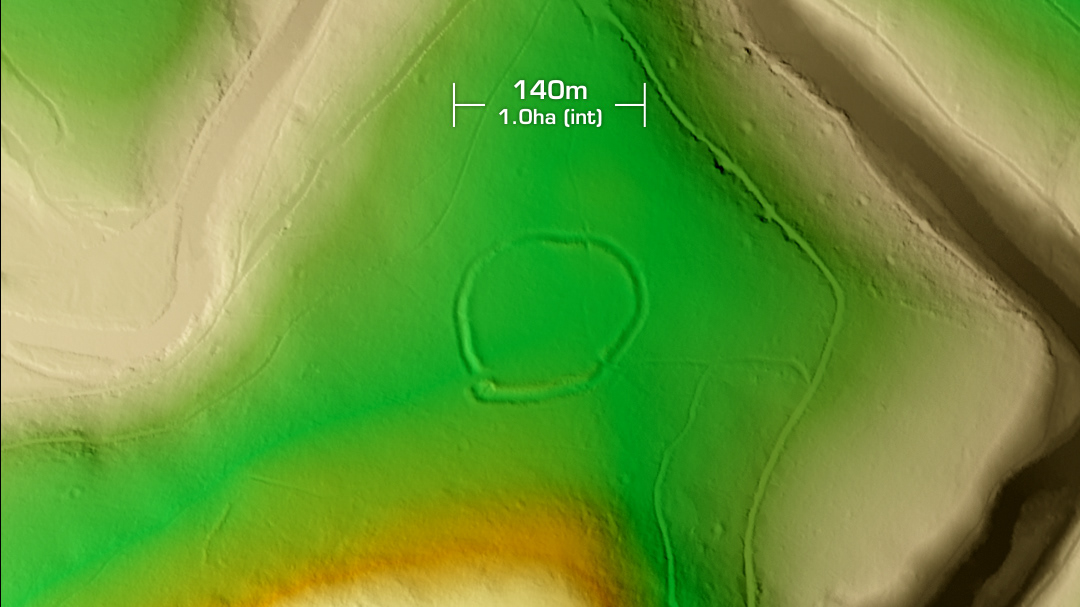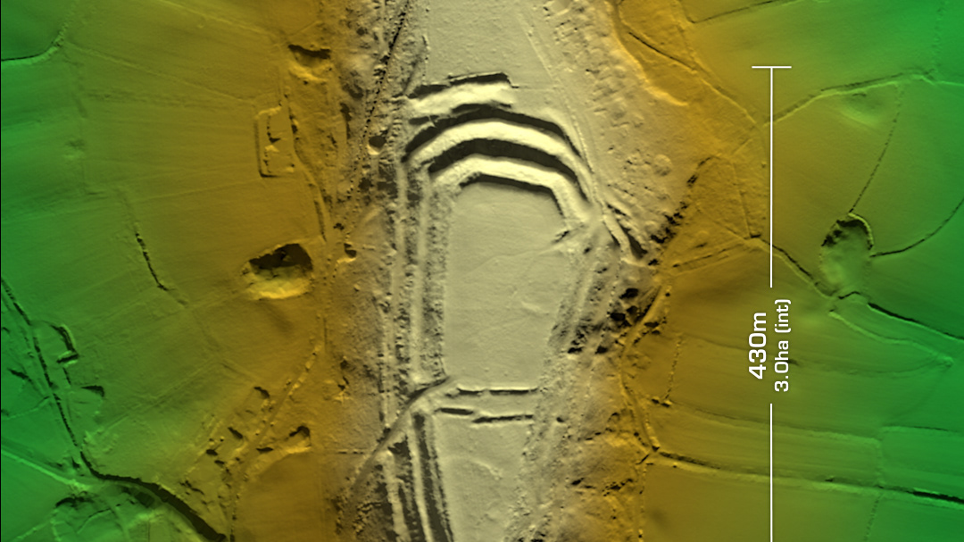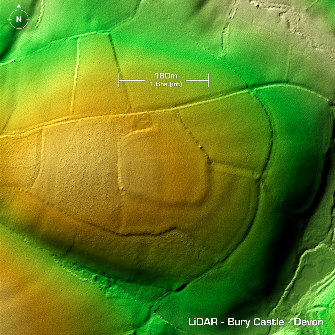
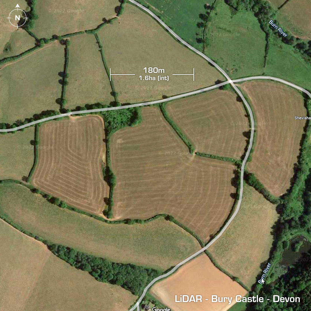
DTM- (Digital Terrain Model, i.e. No buildings or foliage) Just over a km southeast of Butterleigh on land belonging to Shevishaies Farm lies the ‘recently’ discovered (1960) contour hillfort, Bury Castle. Entrance to the north with causeway across ditch. Heavily degraded by ploughing over the centuries. No recorded finds or investigations, hence undated. Deffo worth a field walk if you can get permission… Iron Age tribal association (conjecture based on location): Dumnonii (Non-Scheduled Monument) [Any descriptive text is attributed to the Atlas of Hillforts & Wikipedia websites and any associated archaeological descriptions online which will be credited accordingly.]