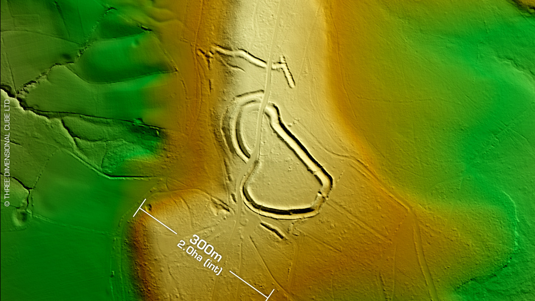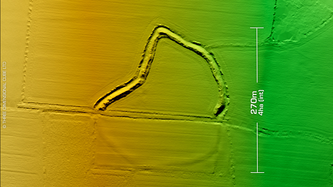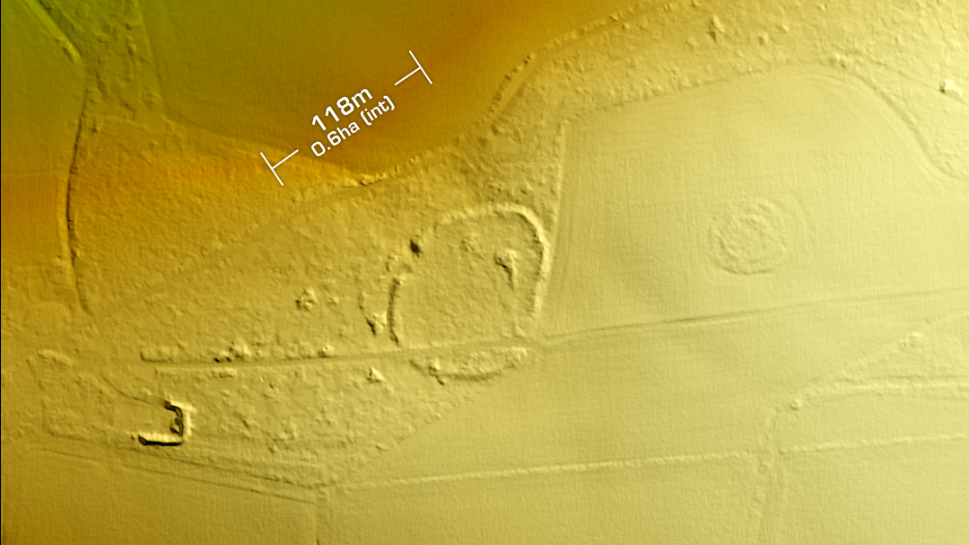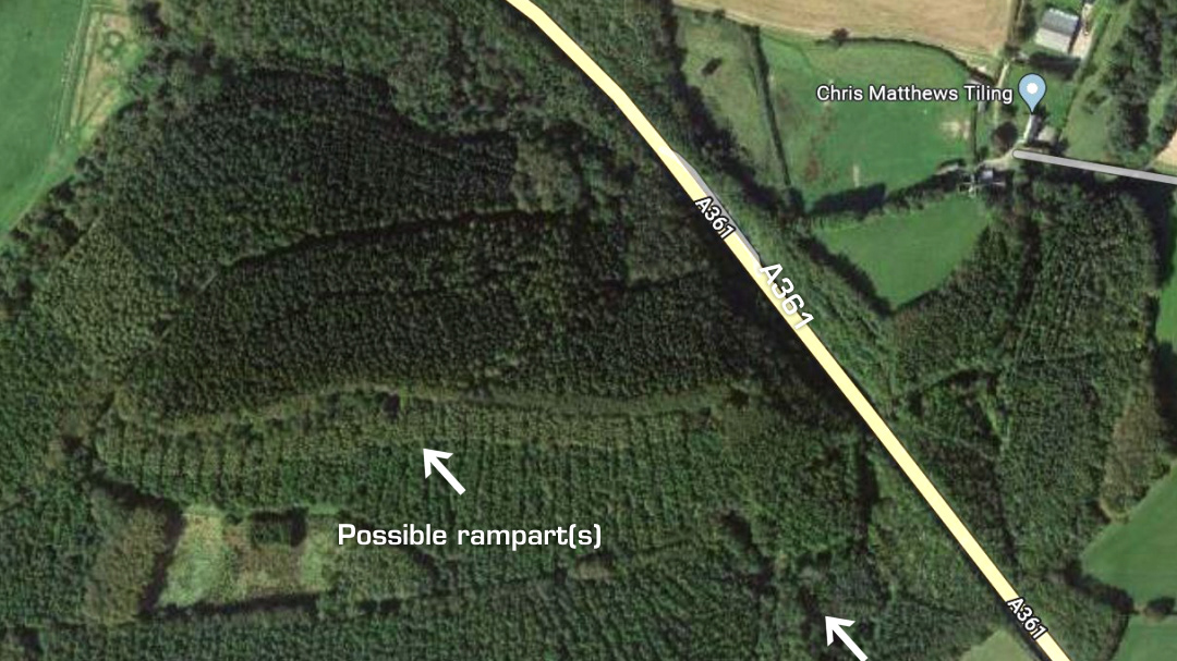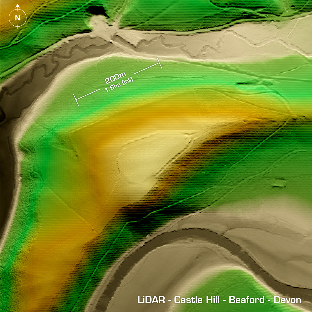

DTM- (Digital Terrain Model, i.e. No buildings or foliage) To the southeast of Great Torrington and overlooking the River Torridge by the A3124 lies the contour hillfort, Castle Hill. Protected by various ramparts and embankments (you can make out on the LiDAR) this fort has been degraded by ploughing over the centuries. Recent research speculates that this is one of two possible sites of early Medieval battle of Cynuit in 878AD between the Vikings, led by Ubhe Ragnarsson and the Anglo Saxons, led by Ealdorman Odda. When Odda won the battle, this prevented the Vikings from gaining complete control of England. First recorded in 1887. Field investigation by OS in 1973. Iron Age tribal association (conjecture based on location): Dumnonii (Scheduled Monument) [Any descriptive text is attributed to the Atlas of Hillforts & Historic England websites and any associated archaeological descriptions online which will be credited accordingly.]