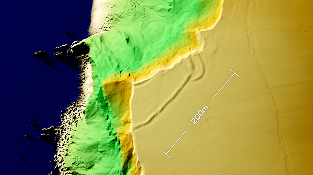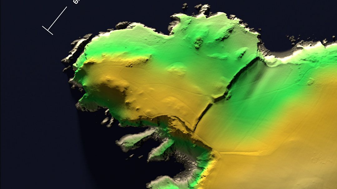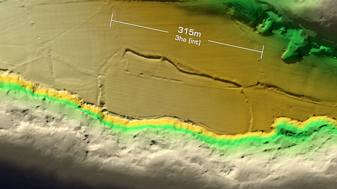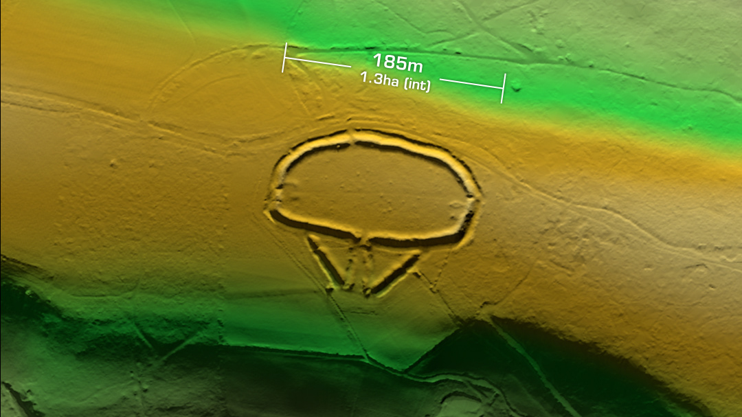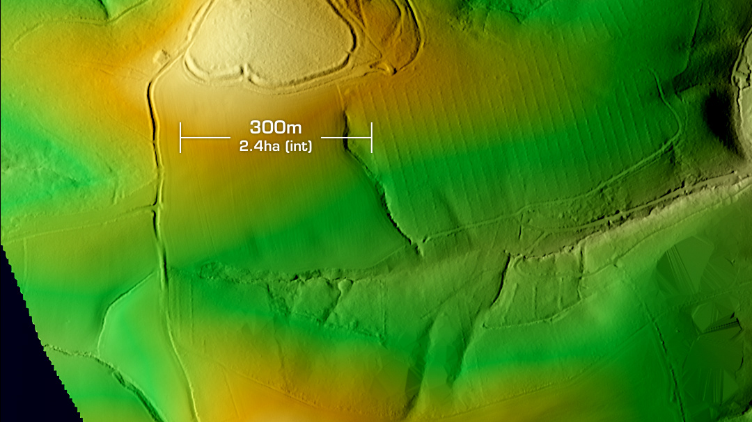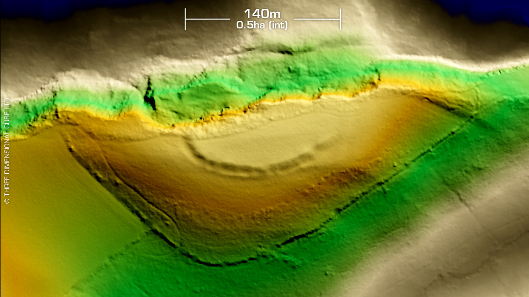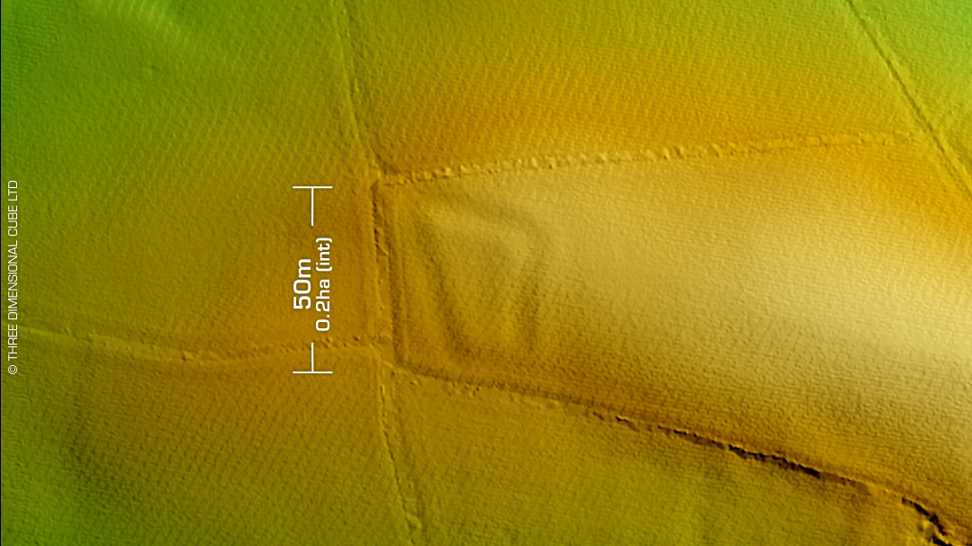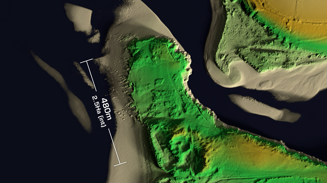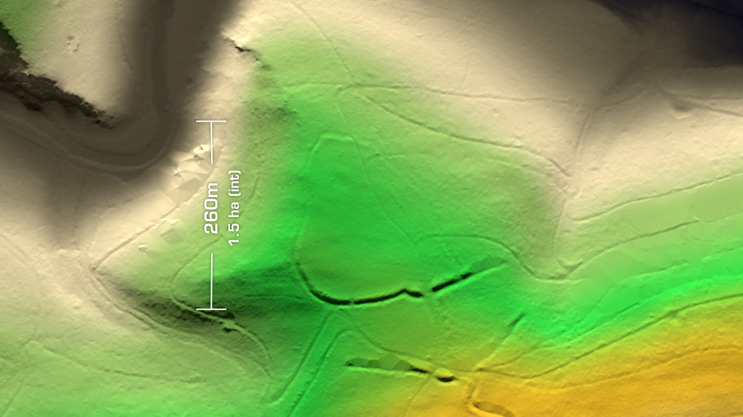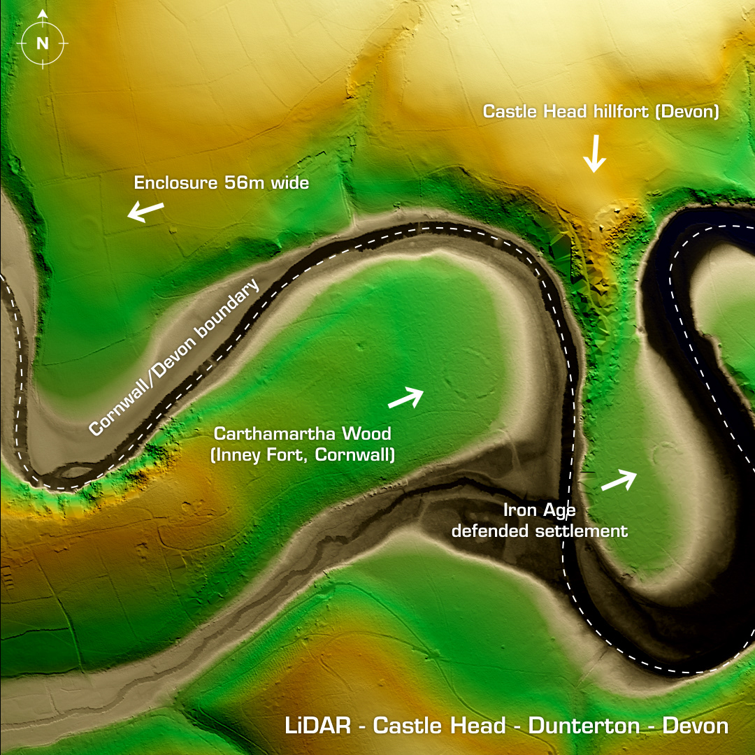
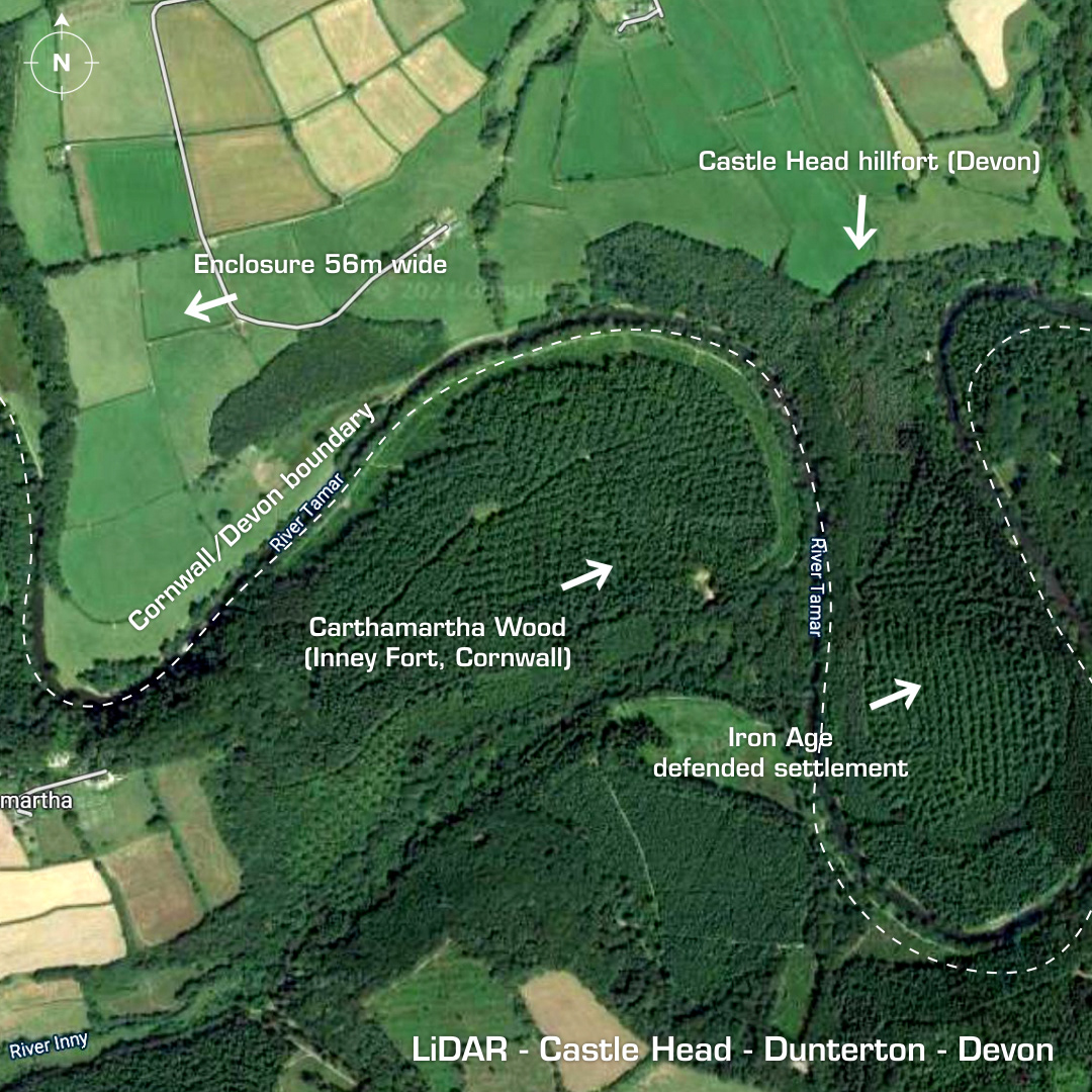
DTM- (Digital Terrain Model, i.e. No buildings or foliage) The River Tamar cuts between these four sites just to the east of Rezare in Cornwall and below Dunterton on Devon. At Castle Head are the remains of a promontory fort indicated on the LiDAR. The polygons are artefacts of the foliage removal algorithm. The embankment is the semi-circular shape, but the site has been heavily degraded by erosion & possible quarrying. Remains of a summer house on west side. Below this is an Iron Age ‘defended settlement’/enclosure. To the west is another enclosure and finally below is the round multivallate contour Cornwall hillfort, Inney Fort. First excavated in 1937 which found possible hut platforms. None of these sites have been properly excavated so they are technically undated. Iron Age tribal association (conjecture based on location): Dumnonii (Scheduled Monument) [Any descriptive text is attributed to the Atlas of Hillforts & Historic England websites and any associated archaeological descriptions online which will be credited accordingly.]