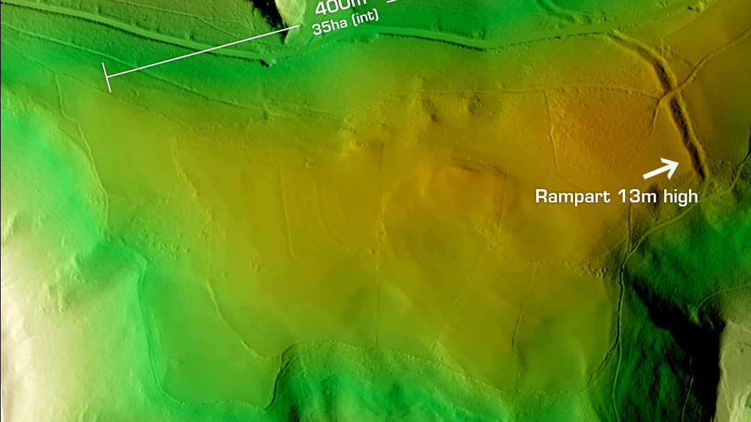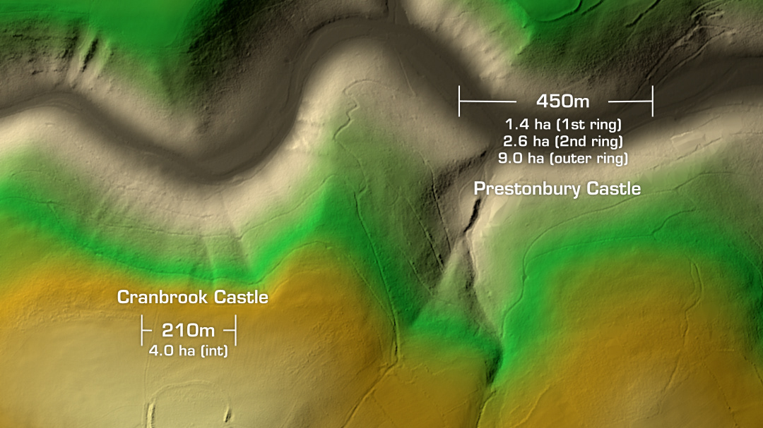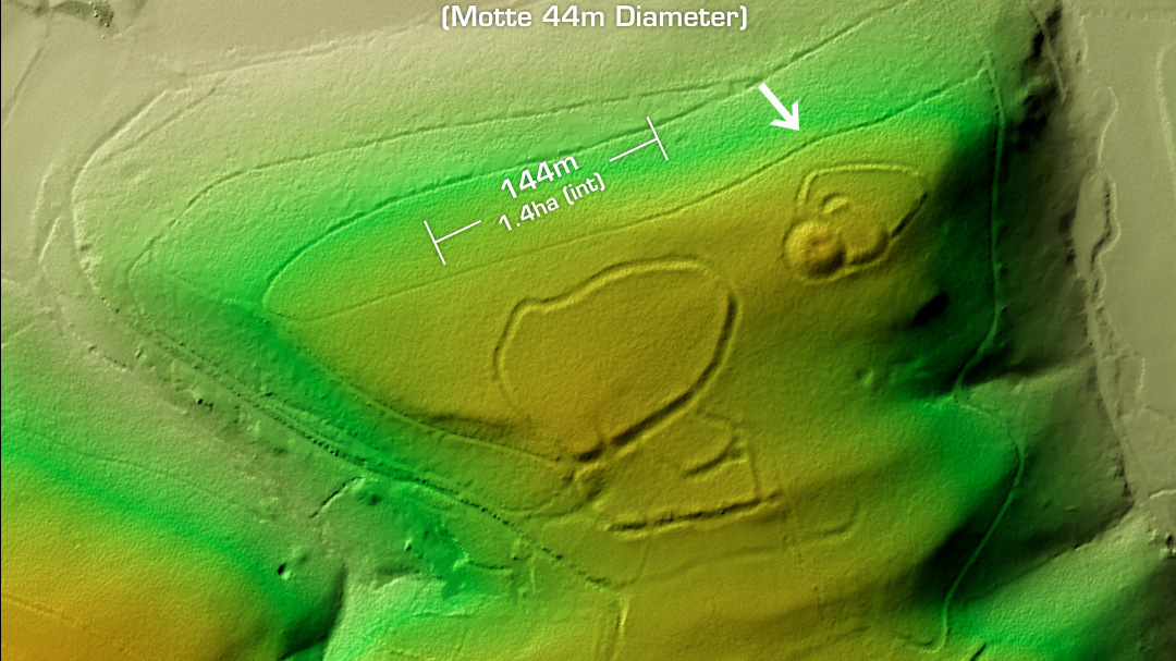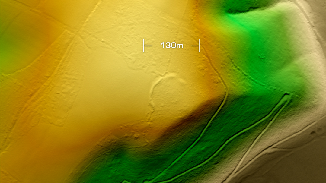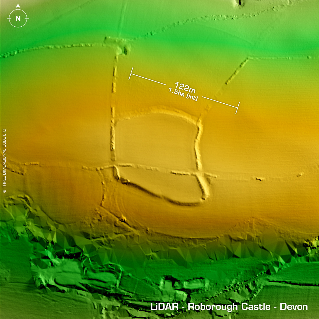
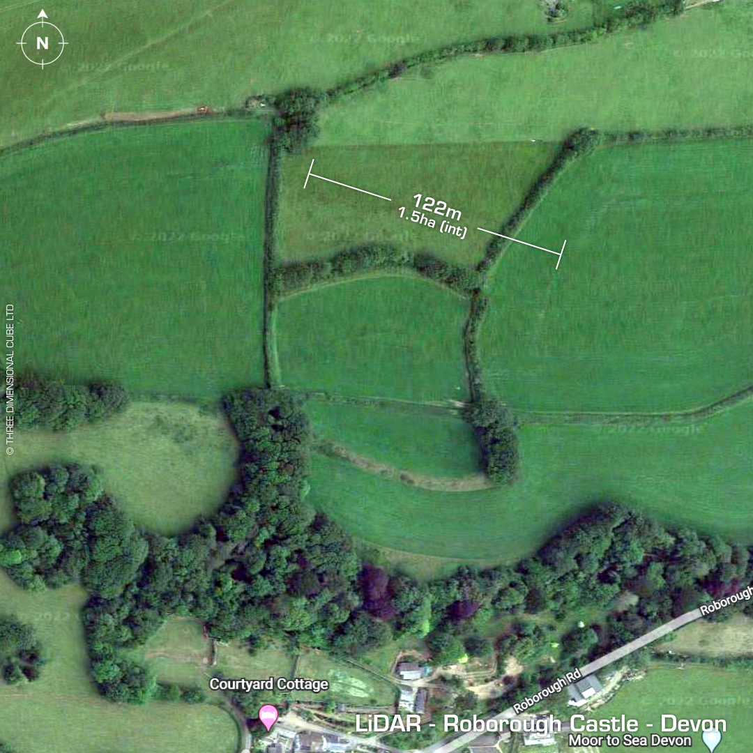
DTM- (Digital Terrain Model, i.e. No buildings or foliage) On the northern outskirts of Barnstable as the A39 curves round to the east, just below it bordered by trees & hedges lies the multivallate contour hillfort, Roborough Castle. Heavily degraded by ploughing. Possible re-use in the 10th century as a fortified site or ‘burh’. It may be one of the sites listed in the 10th century Burgal Hidage, which is an Anglo Saxon document describing over thirty fortified sites. Documented on the 1st Edition OS Map in 1889. No recorded finds or excavations, hence undated. Now on the Heritage at risk Register. Iron Age tribal association (conjecture based on location): Dumnonii (Scheduled Monument) [Any descriptive text is attributed to the Atlas of Hillforts & Historic England websites]