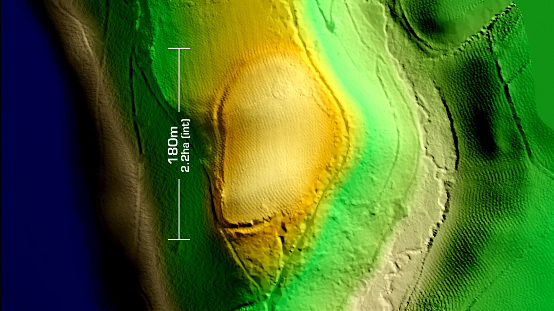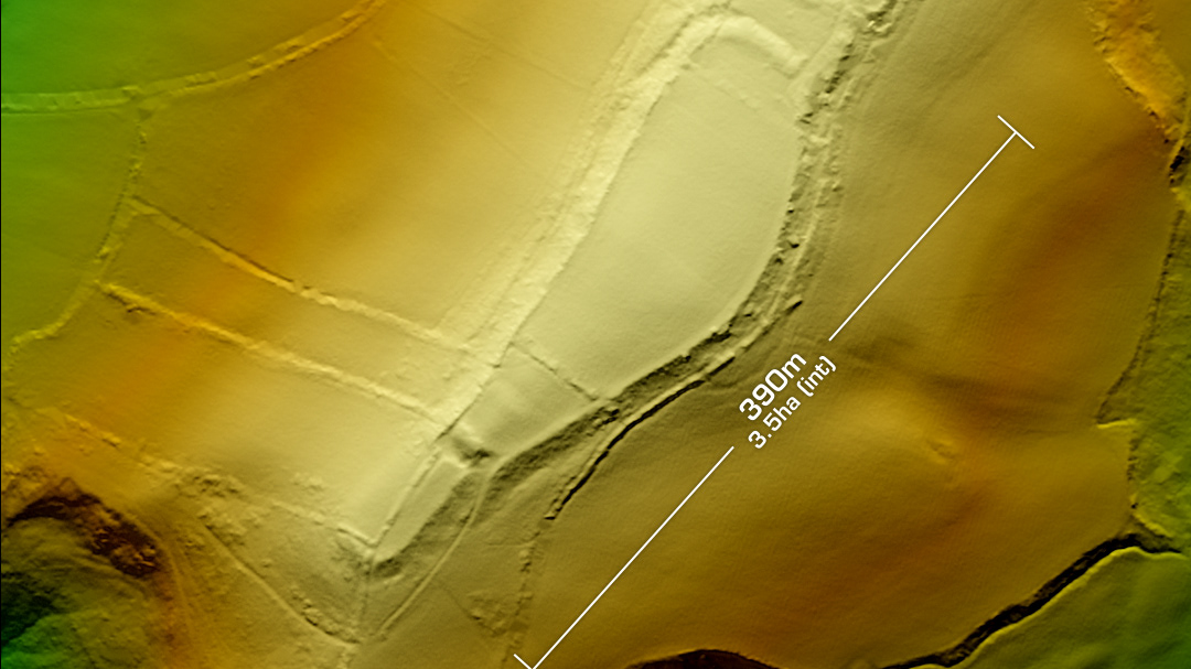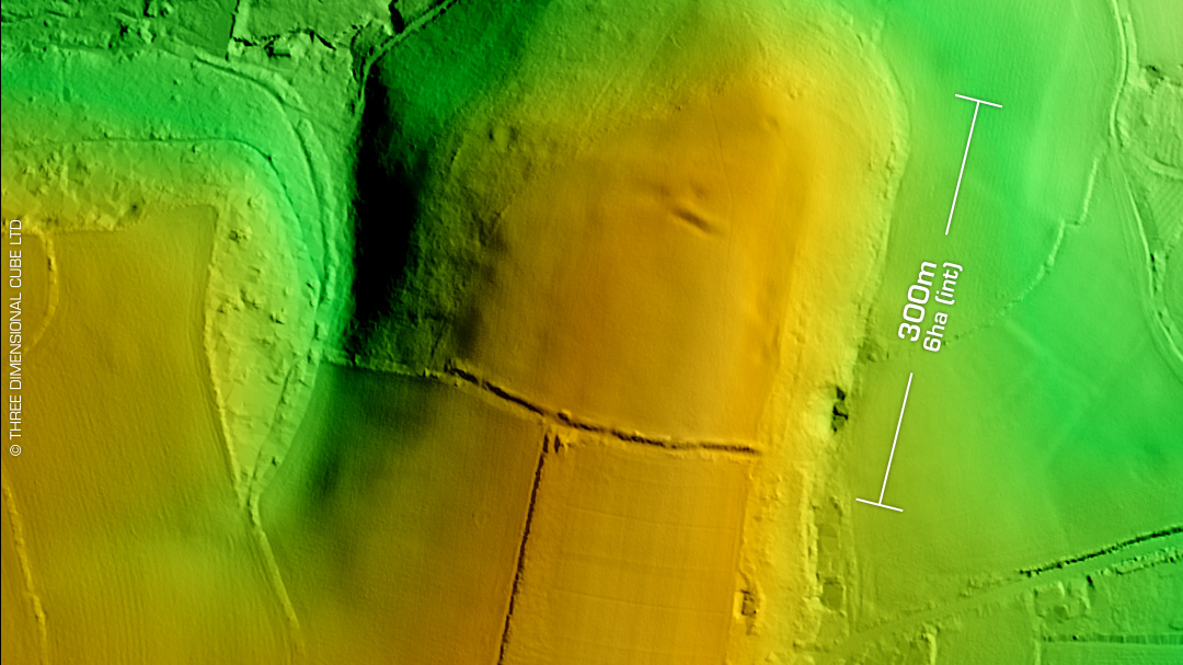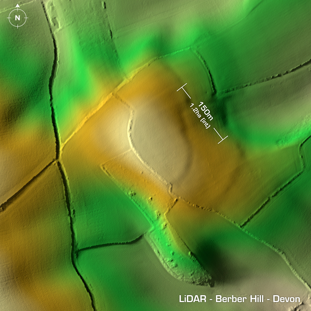
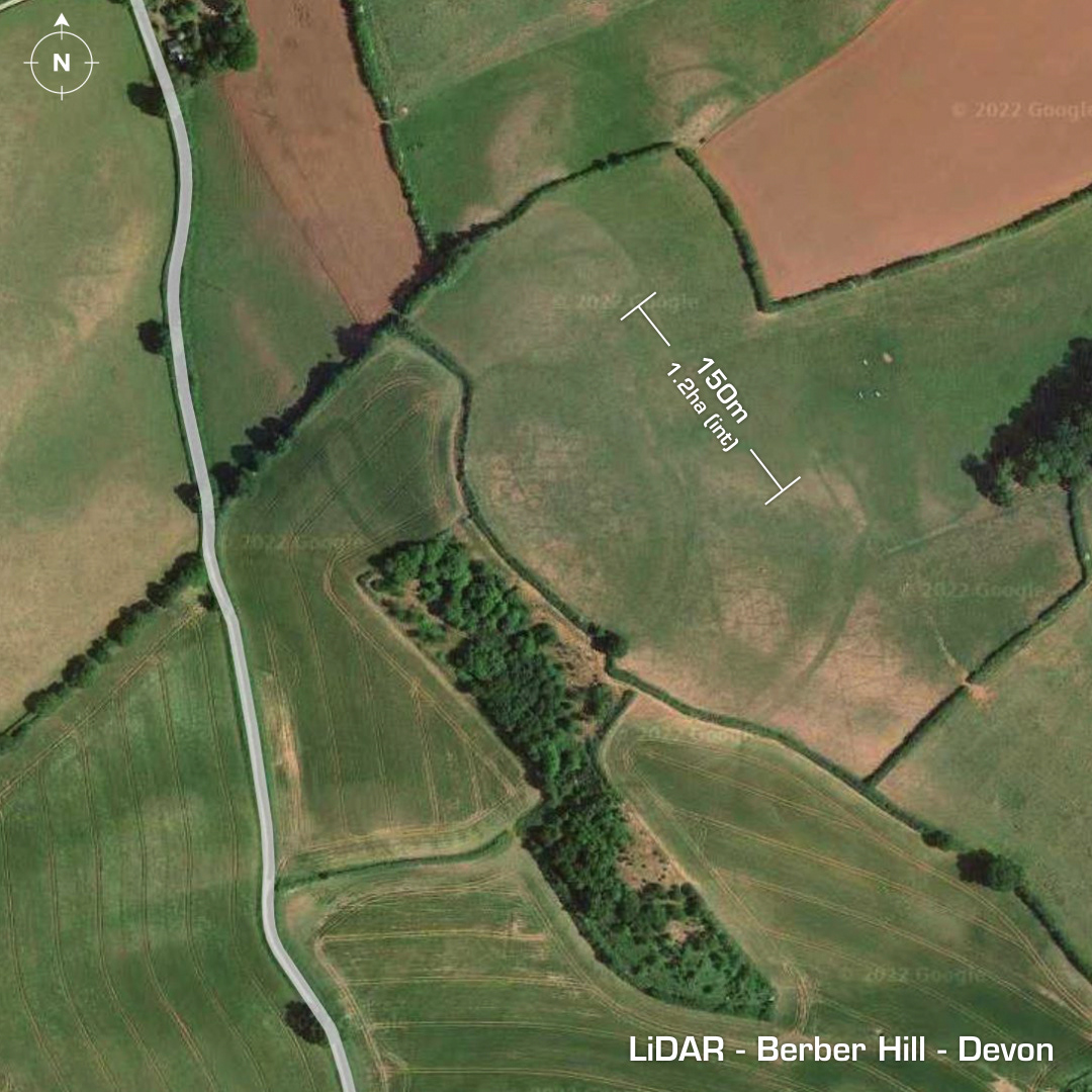
DTM- (Digital Terrain Model, i.e. No buildings or foliage) To the south of Kenn and in between Bickham House to the west and Cole Park to the east lies the contour hillfort, Berber Hill. Originally discovered via an ariel cropmark in 1984. Heavily degraded by ploughing. There could be a trace of an embankment on the southeast approach, but it could just be the geology. Mind you, it does show up on the Google Maps as a crop mark so it’s a possibility! No site investigations, hence undated. Iron Age tribal association (conjecture based on location): Dumnonii (Un-Scheduled Monument) [Any descriptive text is attributed to the Atlas of Hillforts & Wikipedia websites and any associated archaeological descriptions online which will be credited accordingly.]