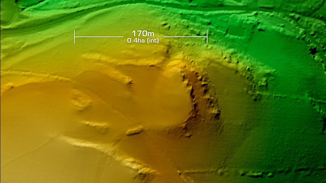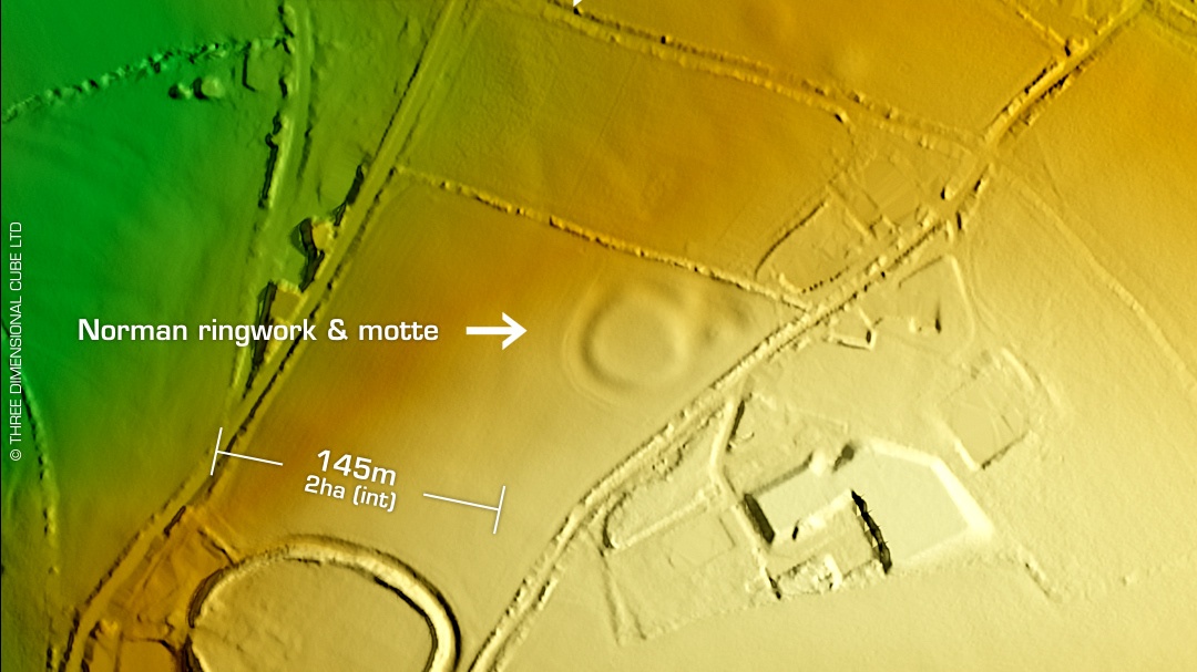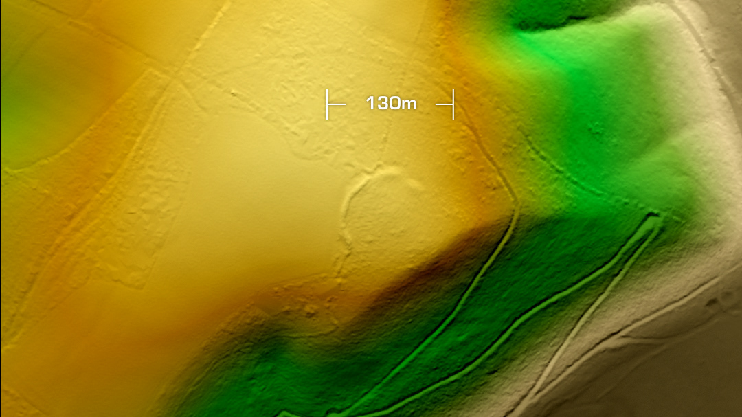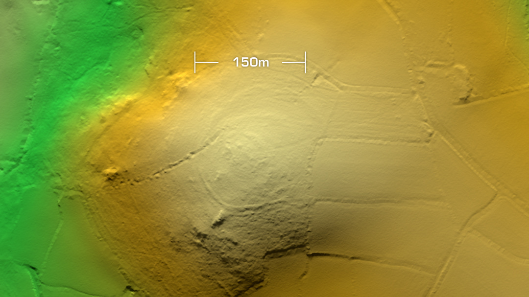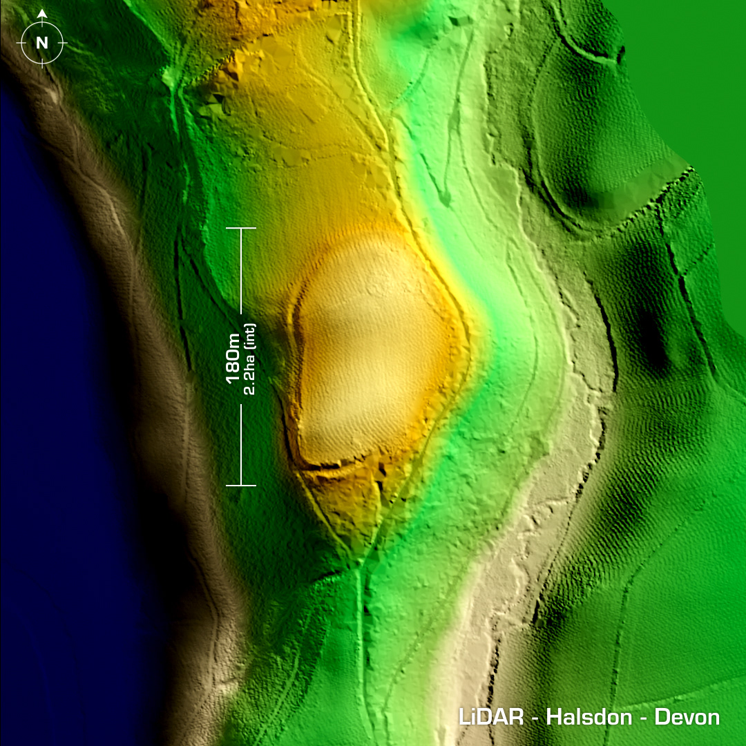
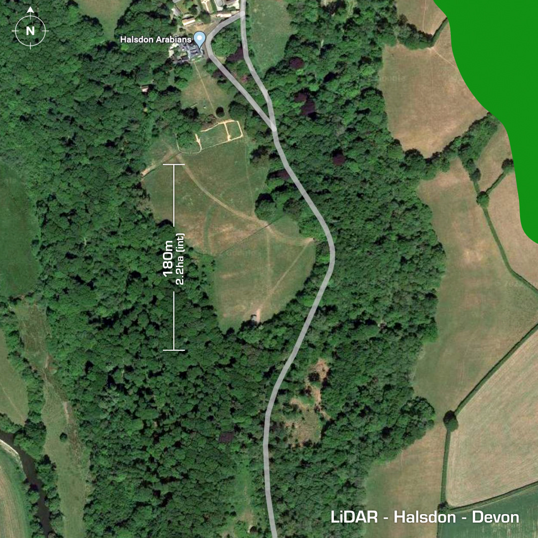
DTM- (Digital Terrain Model, i.e. No buildings or foliage) West of Dolton & hidden in woodland (owned by the Devon Trust at Halsdon House) overlooking the River Torridge lies the contour hillfort, Halsdon. A 19th century ornamental parkland now covers over half the site which was then subsequently ploughed-out in WW2. No investigations, hence undated and surprisingly not on the English Heritage register. Iron Age tribal association (conjecture based on location): Dumnonii (Un-Scheduled Monument) [Any descriptive text is attributed to the Atlas of Hillforts & Historic England websites and any associated archaeological descriptions online which will be credited accordingly.]