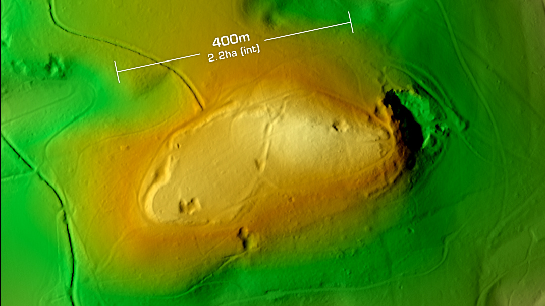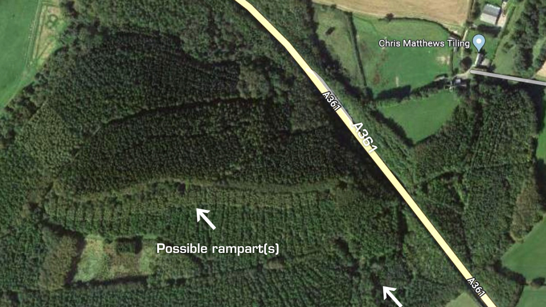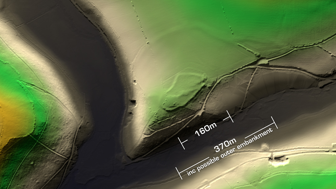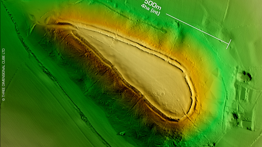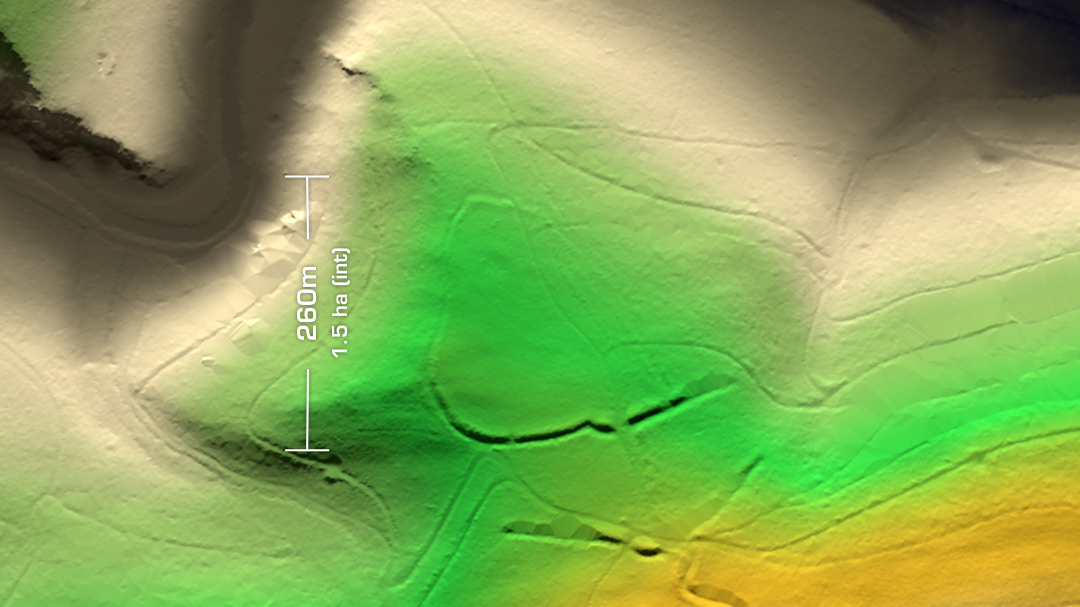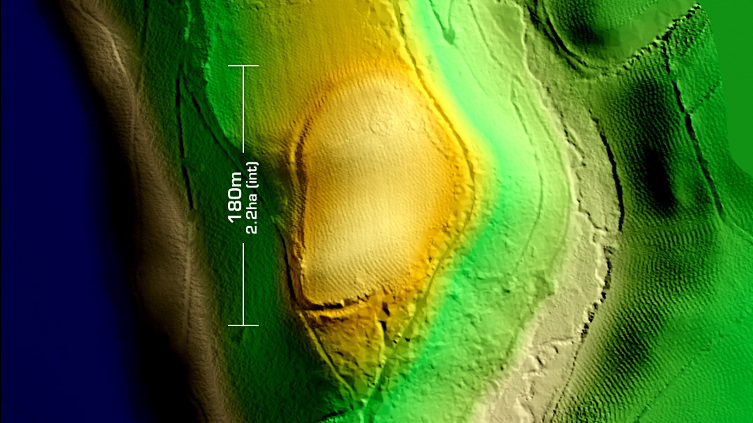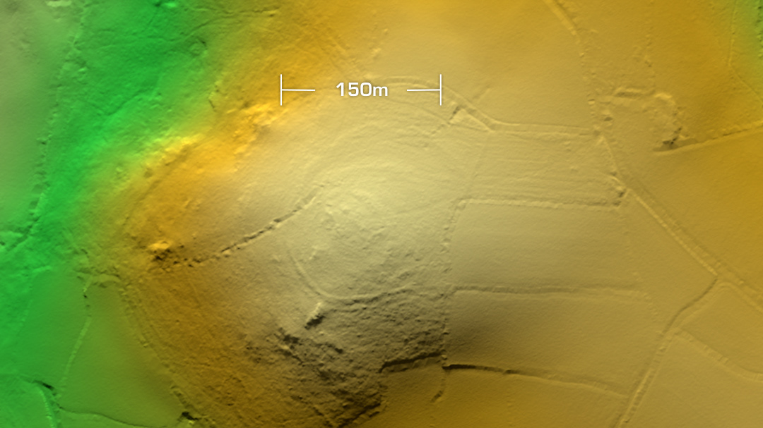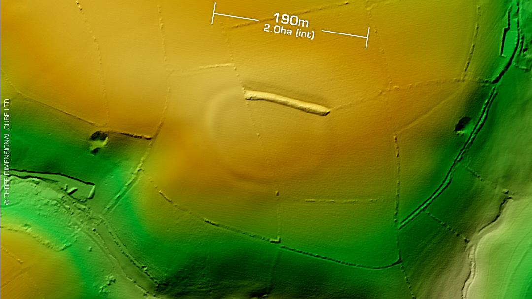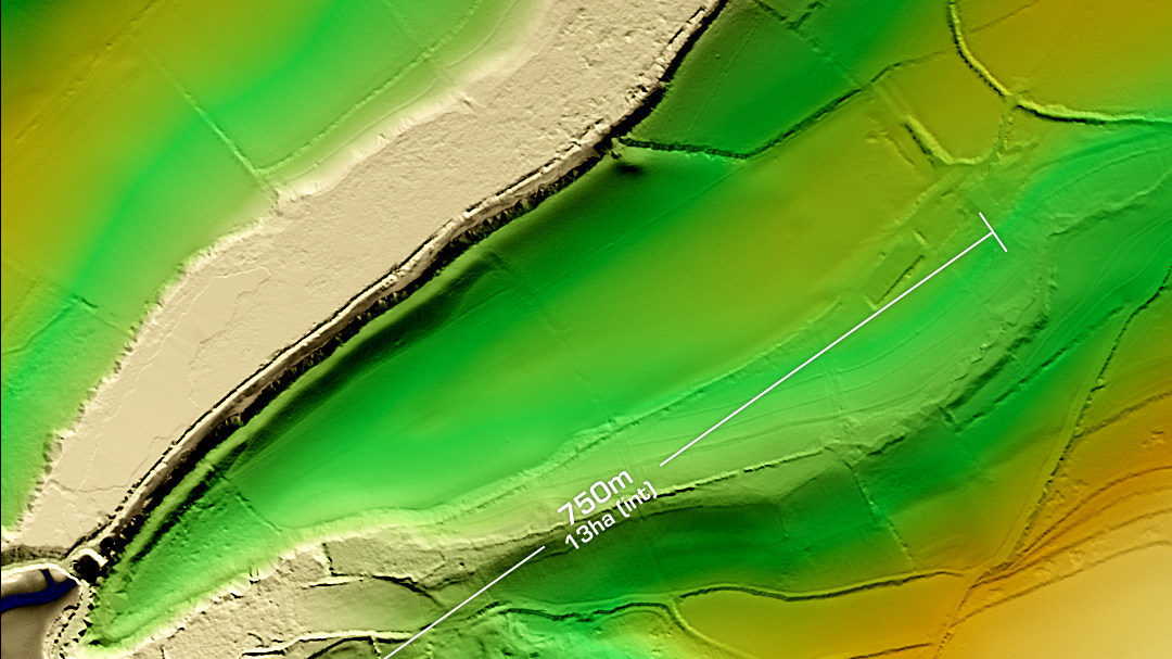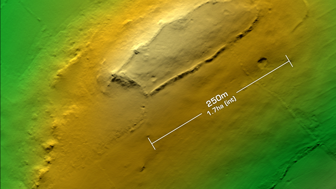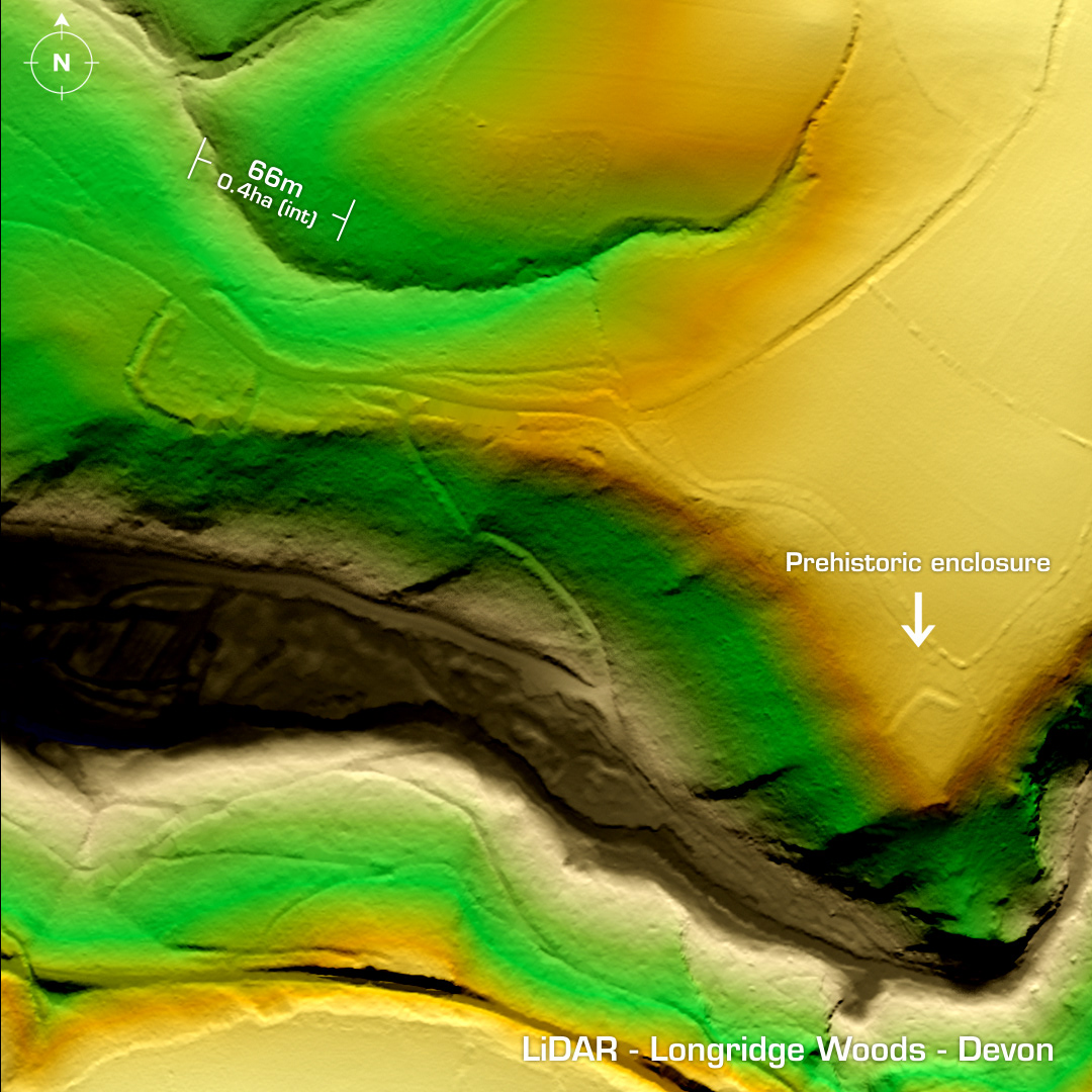
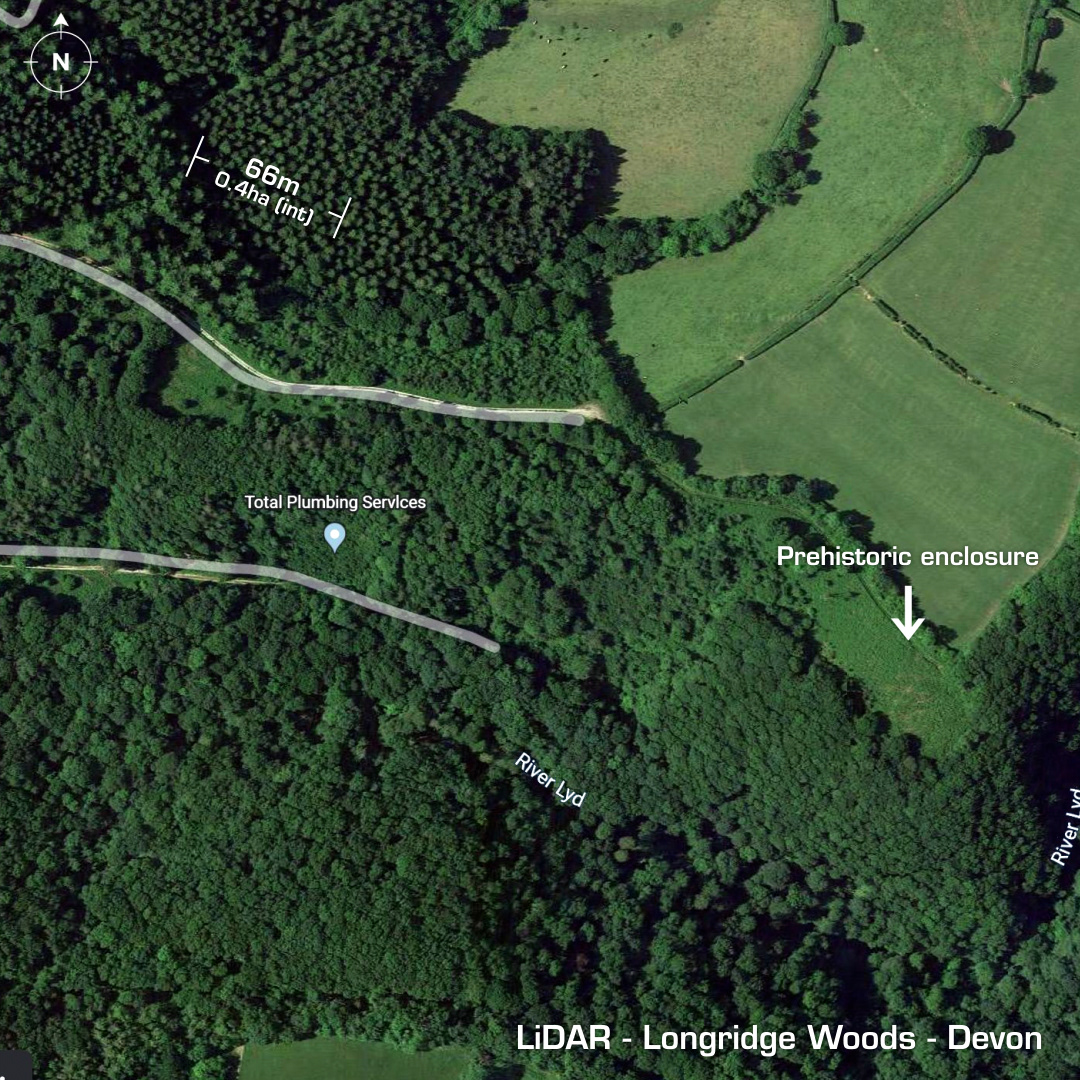
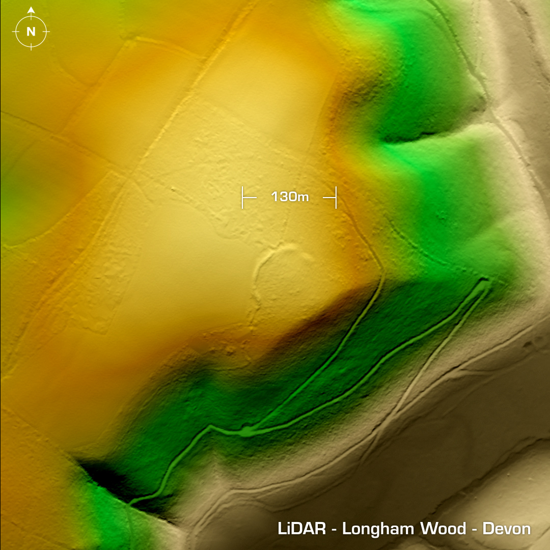
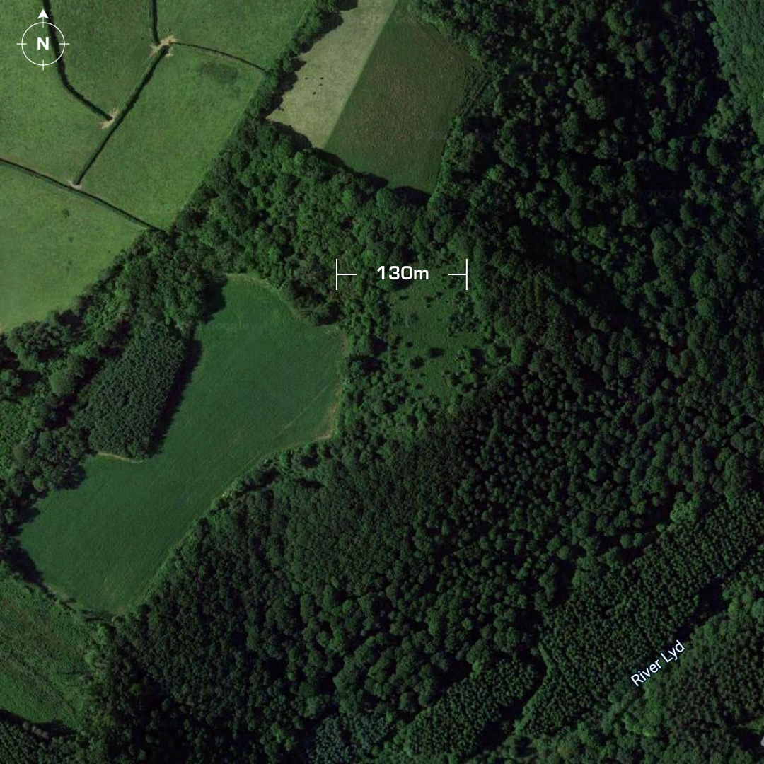
DTM- (Digital Terrain Model, i.e. No buildings or foliage) Hidden within woodland to the southwest of Lydford lie three sites; Longridge Wood (fort), a prehistoric enclosure (indicated) and a separate site to the west of Longridge wood: Longham Wood. Longridge Wood is a univallate hillslope fort. Investigations found evidence of a 30m long medieval longhouse in its interior alongside additional outlines of a two-celled building and a square structure. No full investigation, hence undated. The prehistoric enclosure is listed on HER but there have been no further investigations. Regarding Longham Wood, I sent off some visuals to Devon HER, but Marrina Neophytou came back to me to say the site was already recorded as it had been picked-up as a cropmark by the Royal Air Force in 1949 then subsequently interpreted via LiDAR. No recorded site investigation but the interpretation was Late neolithic to Iron Age. Iron Age tribal association (conjecture based on location): Dumnonii (Scheduled Monument) [Any descriptive text is attributed to the Atlas of Hillforts & Historic England websites]