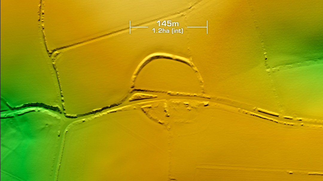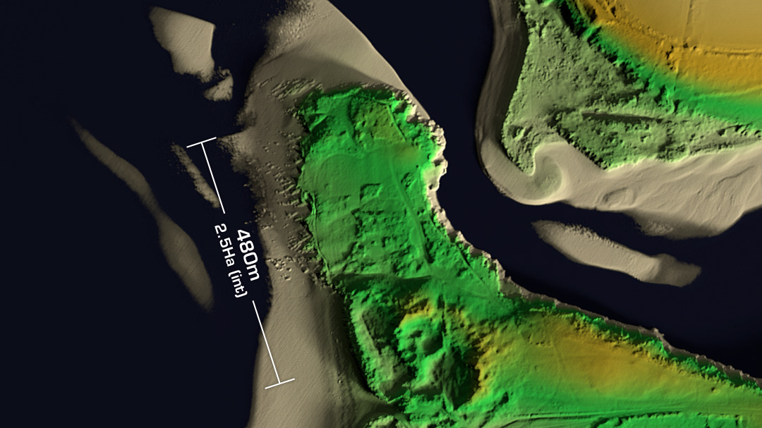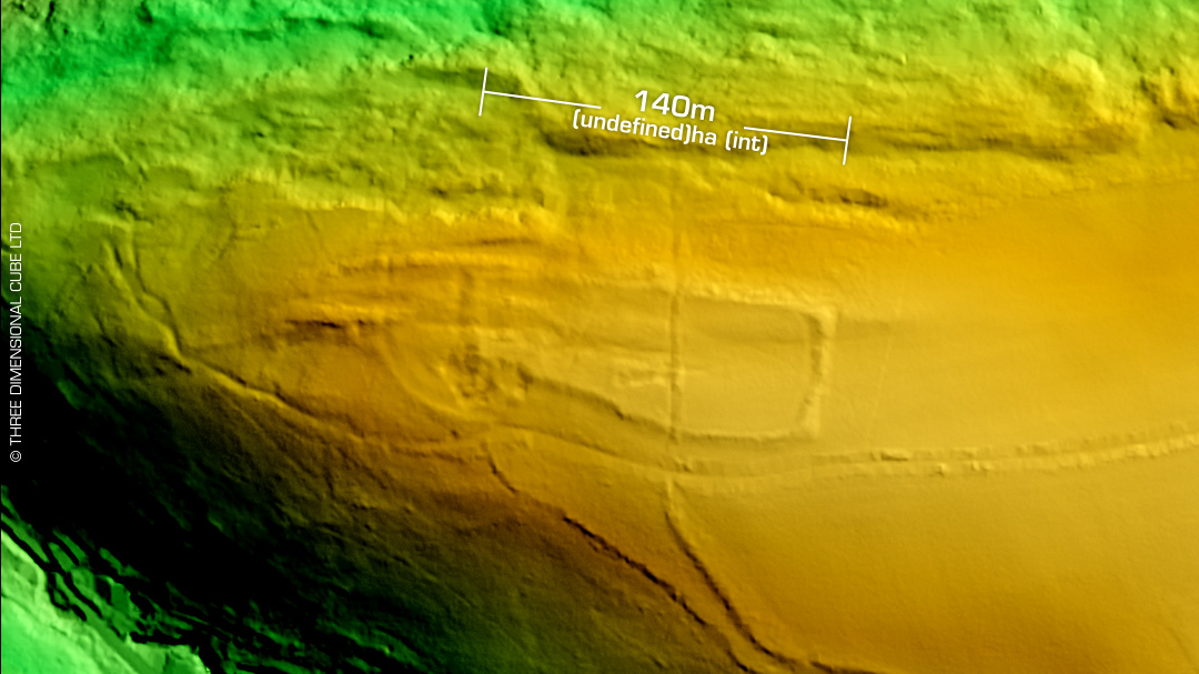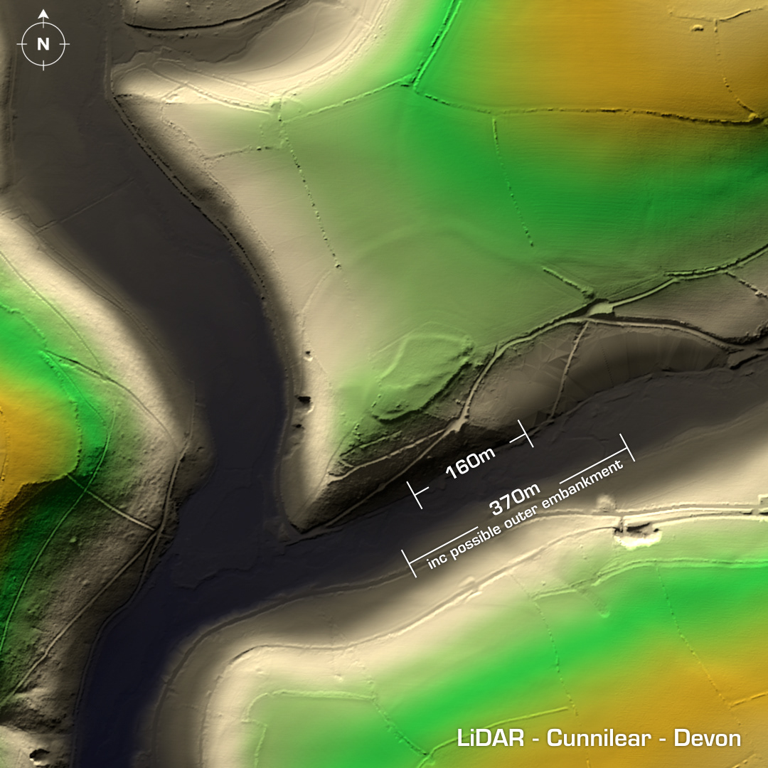
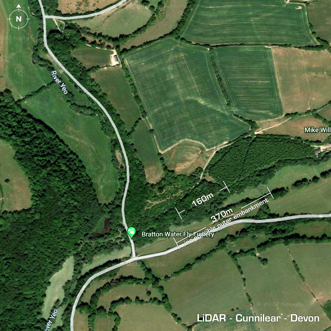
DTM- (Digital Terrain Model, i.e. No buildings or foliage) Just south of Lower Loxhore at the promontory of the south facing hill lies the univallate and (possible) partial contour hillfort, Cunnilear. Heavily degraded by ploughing & quarrying this site probably also includes the outer embankment you can see on the LiDAR & cropmark on Google Maps but as it has had minimal investigations (1953 & ’73-details lost) it remains undefined & undated. Iron Age tribal association (conjecture based on location): Dumnonii (Scheduled Monument) [Any descriptive text is attributed to the Atlas of Hillforts & Wikipedia websites and any associated archaeological descriptions online which will be credited accordingly.]