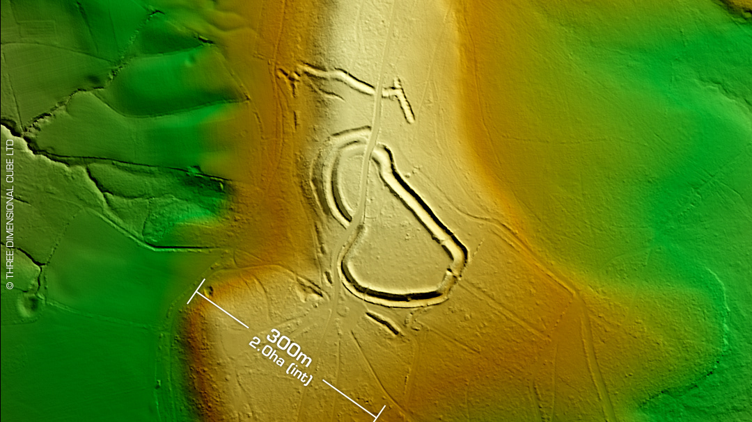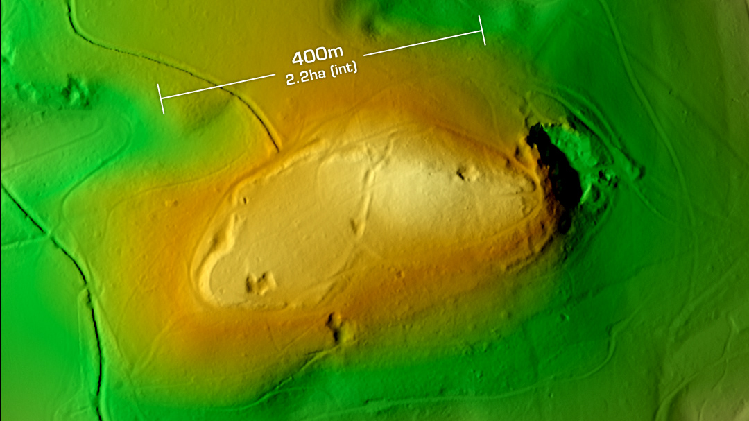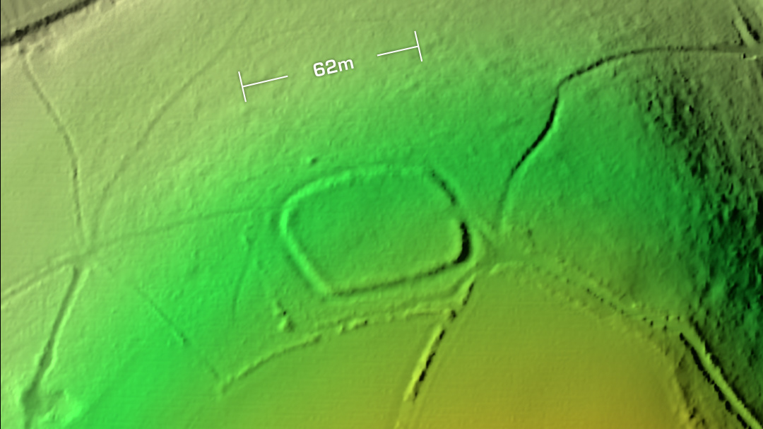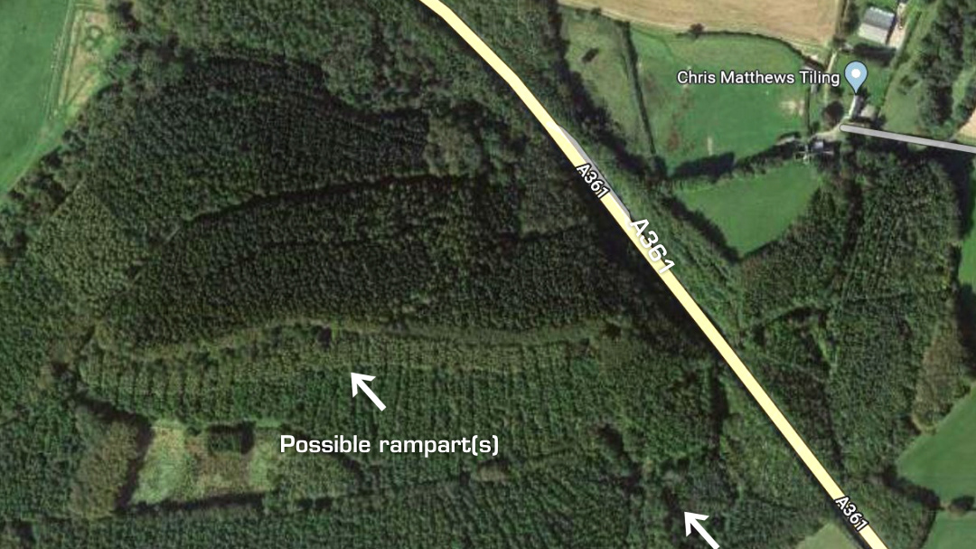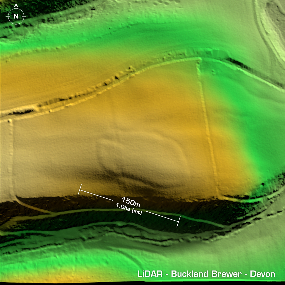
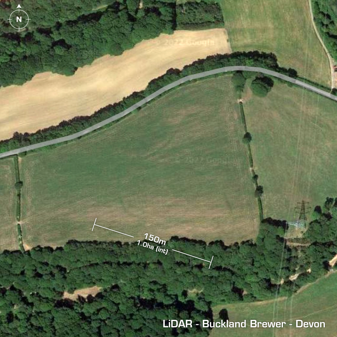
DTM- (Digital Terrain Model, i.e. No buildings or foliage) Just to the east of the village of Buckland Brewer lies the possible partial contour hillfort of the same name. Heavily degraded by ploughing over the centuries. In 1867 J.A. Parry suggested the site had double ramparts, but on LiDAR the site only appears to have a single one. A bisecting trench excavation would sort that out as well as securing its provenance, which is still contested but the chances of that are slim. List site visit in 2007. Undated. Iron Age tribal association (conjecture based on location): Dumnonii (Un-scheduled Monument) [Any descriptive text is attributed to the Atlas of Hillforts & Wikipedia websites and any associated archaeological descriptions online which will be credited accordingly.]