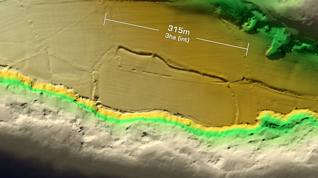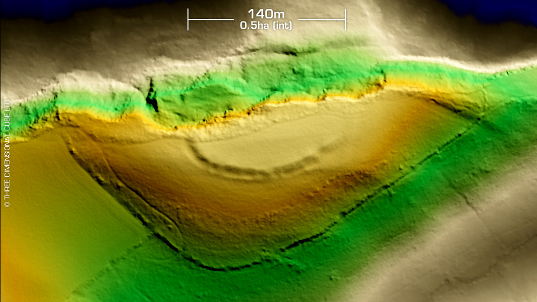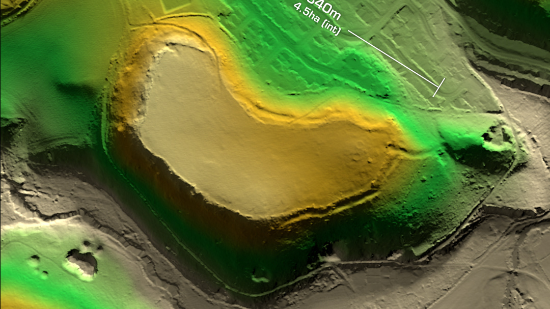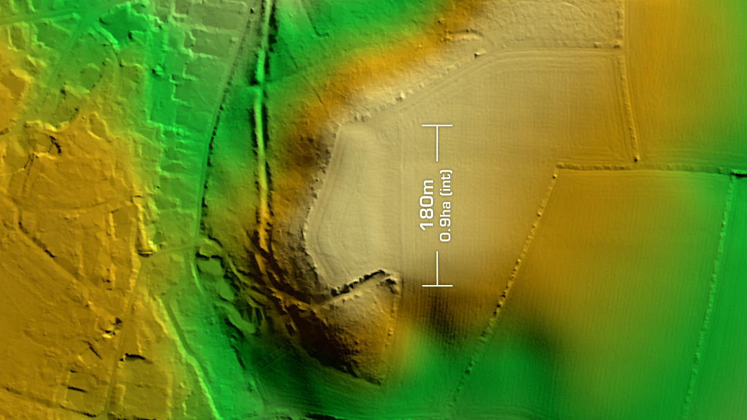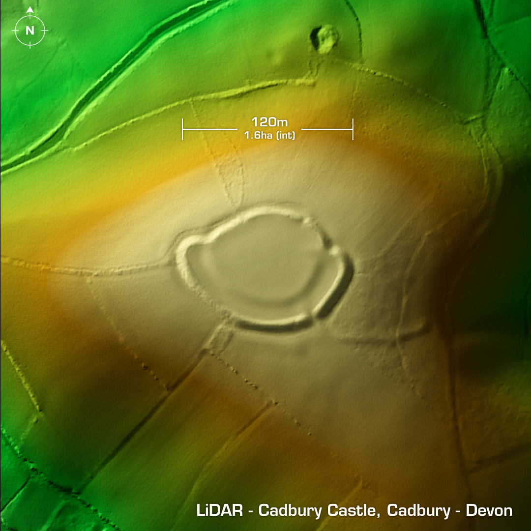
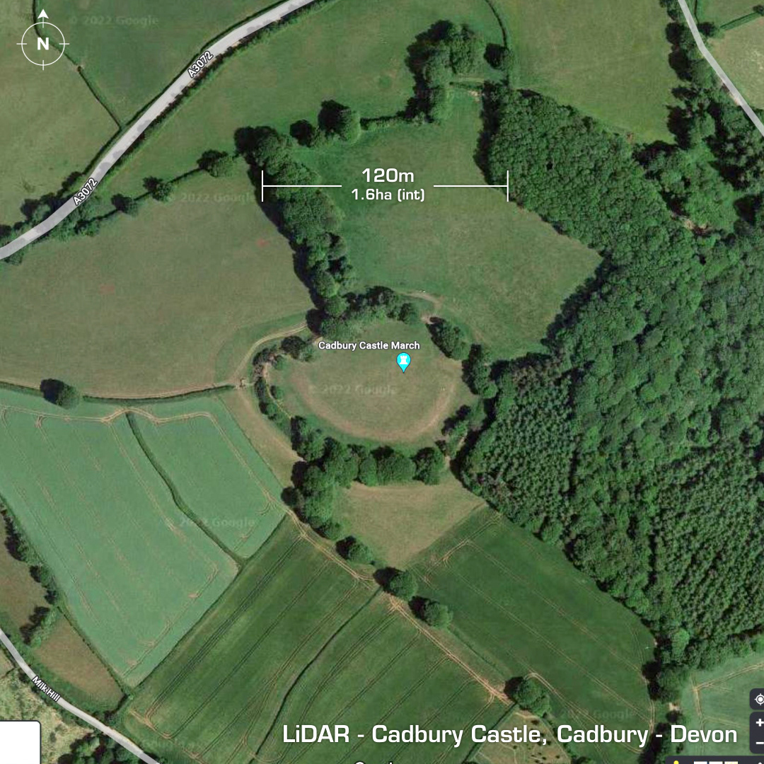
DTM- (Digital Terrain Model, i.e. No buildings or foliage) Commanding the hilltop at Cadbury, Devon & just south of the A3072 lies the contour hillfort, Cadbury Castle. (Not related to ‘Cadbury Castle hillfort’ in Yeovil, Somerset) Outer ramparts over 3m high. Two phase construction determined by Lady Fox in 1996. No excavations but when the landowner emptied a shaft/well in the interior down to circa 17m in 1848 he discovered twenty-four copper bracelets, shale bracelet fragments, beads, finger rings, 4th century AD pottery, and a 3rd century AD coin hoard. Geophys in 2010 found possible hut platforms as well as a new ditch on the south side, which you can just make out on the LiDAR. This is possibly an embellishment from when the site was occupied in the 1645 English Civil War by Fairfax’s troops. A 17th century sword was recovered here. Interior heavily degraded by ploughing. Iron Age tribal association (conjecture based on location): Dumnonii (Non-Scheduled Monument) [Any descriptive text is attributed to the Atlas of Hillforts & Wikipedia websites and any associated archaeological descriptions online which will be credited accordingly.]