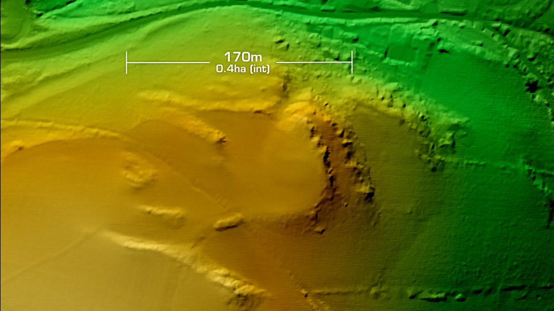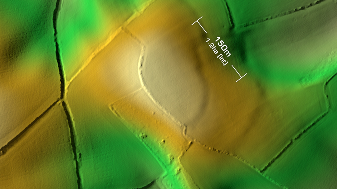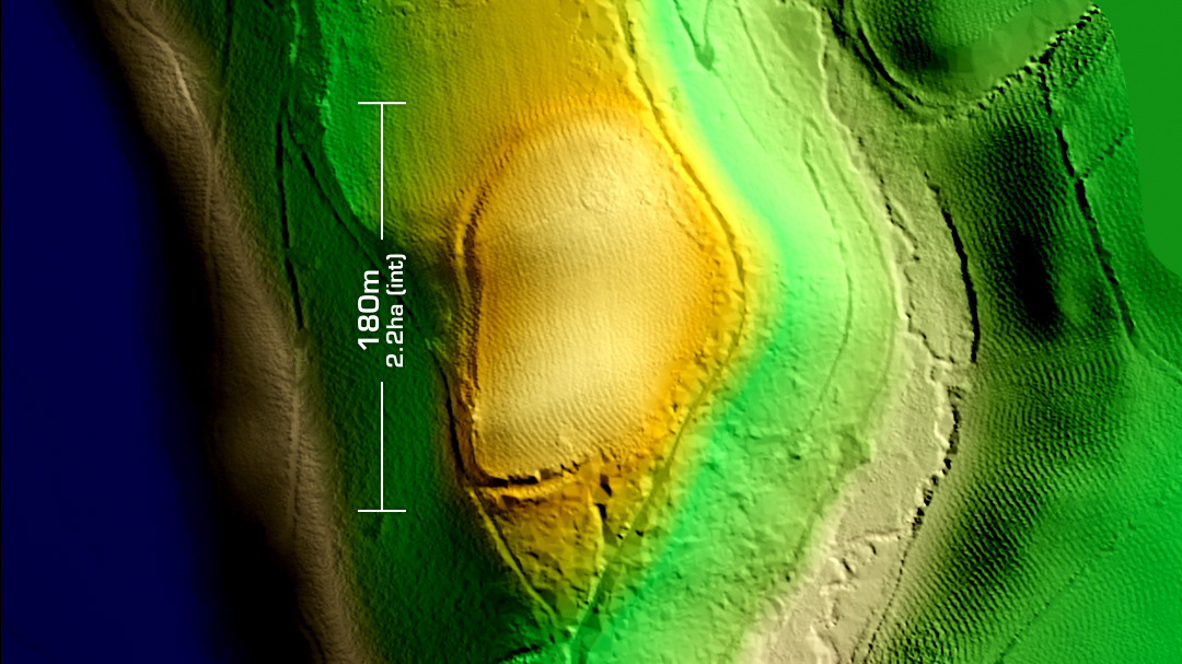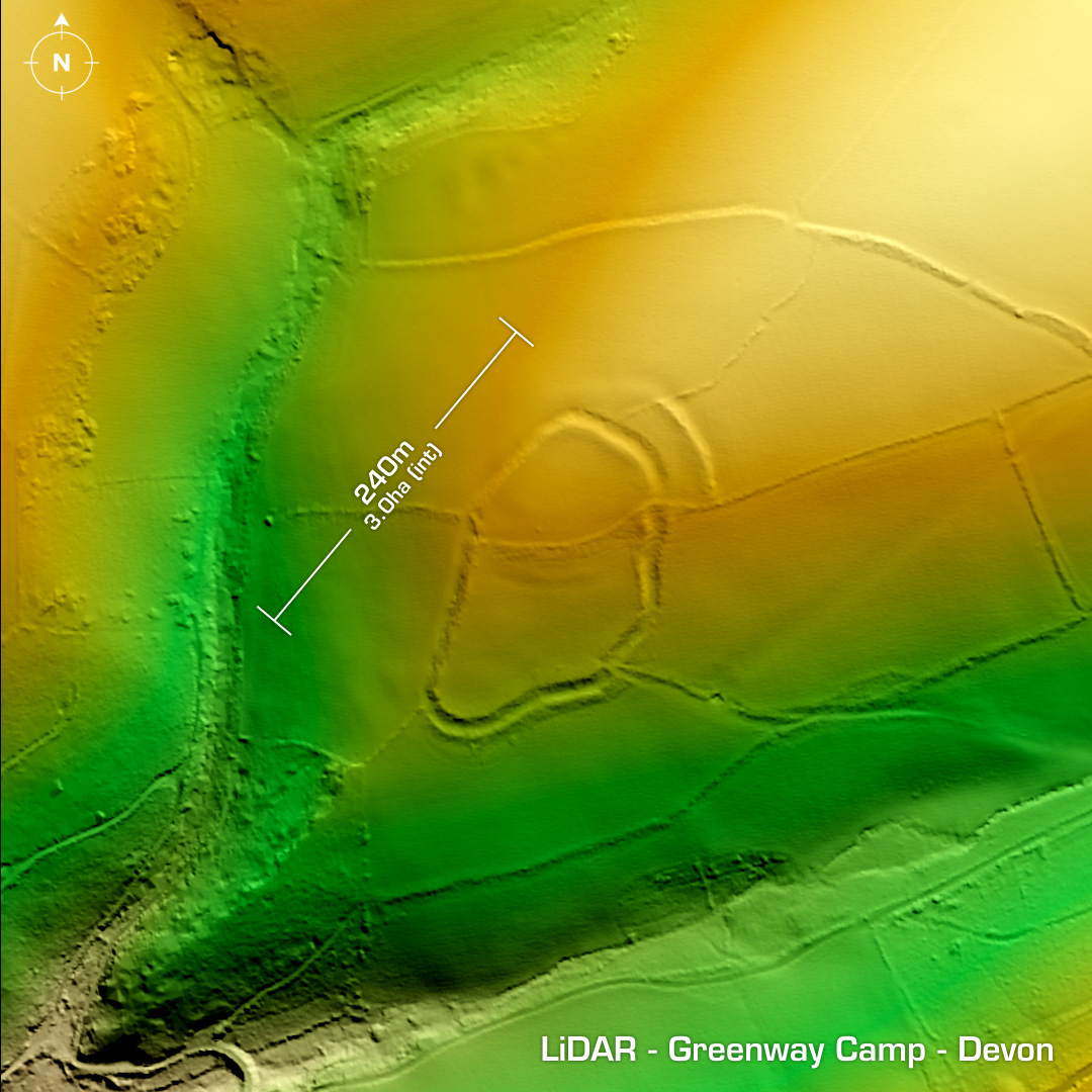
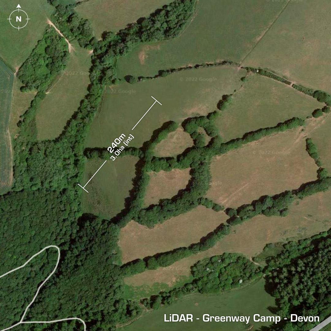
DTM- (Digital Terrain Model, i.e. No buildings or foliage) Outlined by trees west of Hillhead and overlooking the River Dart lies the hillslope fort, Greenway Camp. Degraded by ploughing but there is evidence of an earlier neolithic enclosure, which can just be made out on the LiDAR as a circular ring bisecting the site to the north. No recorded excavations but surface finds include late medieval objects in 1949 which now reside in Torquay’s Museum. Field investigations in 1991 & 2000. First written reference in the Woolcombe Manuscript of 1839. Iron Age tribal association (conjecture based on location): Dumnonii (Scheduled Monument) [Any descriptive text is attributed to the Atlas of Hillforts & Historic England websites and any associated archaeological descriptions online which will be credited accordingly.]