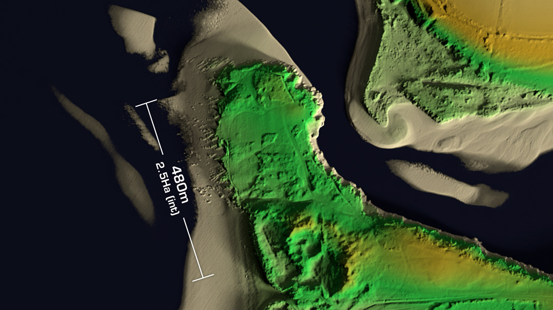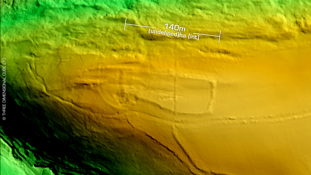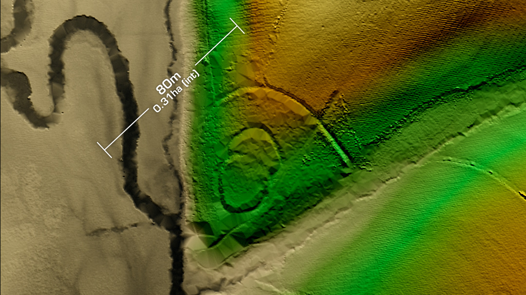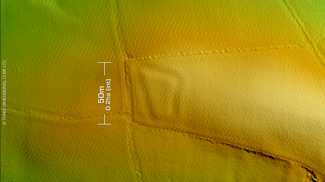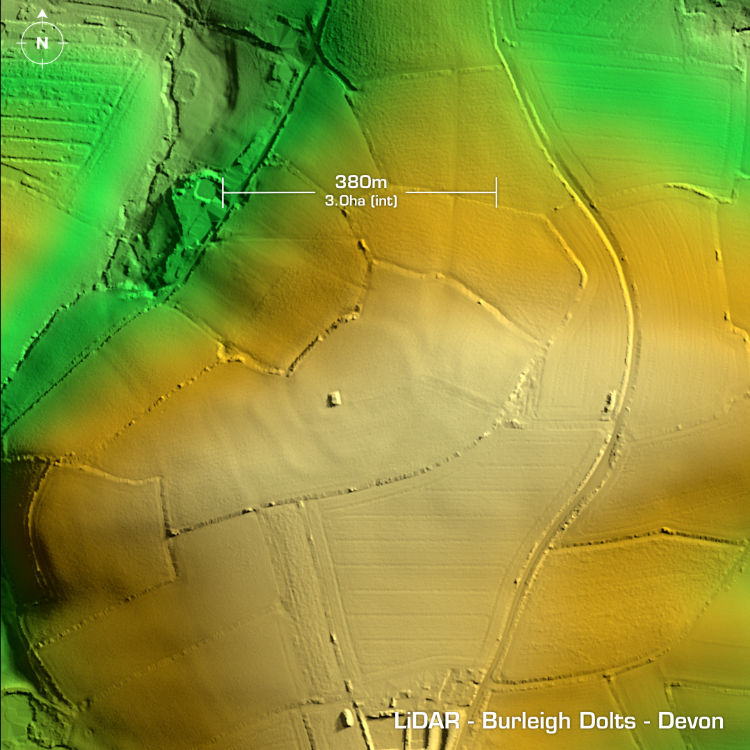
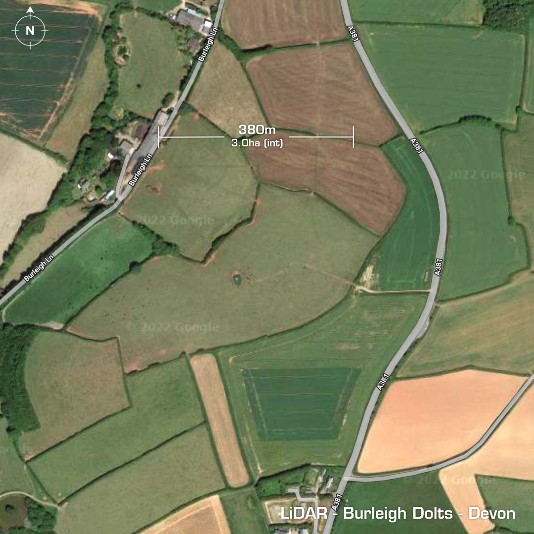
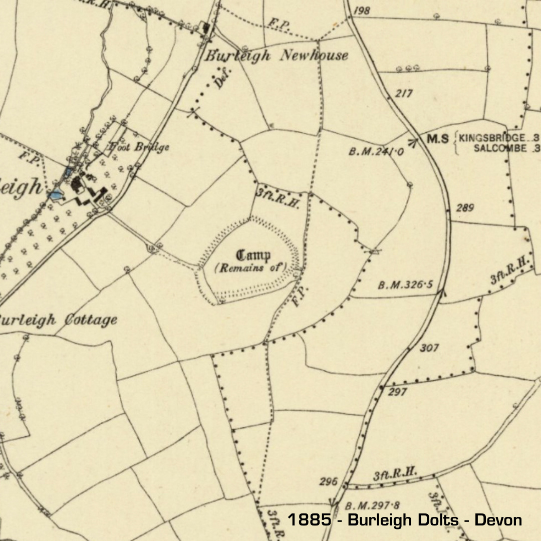
DTM- (Digital Terrain Model, i.e. No buildings or foliage) Just to the north of Malborough between Burleigh Lane and the A381 lies the mostly destroyed bivallate hillfort, Burleigh Dolts. Formerly three semi-concentric enclosures, now mostly ploughed out. Inner defences deliberately destroyed in 1950, even though it has been a scheduled site since 1922… The included 1885 map shows the inner defences. The rectangular structure is a brick WW2 radar station bunker, which is now a reservoir. No excavations, hence undated. Iron Age tribal association (conjecture based on location): Dumnonii (Scheduled Monument) [Any descriptive text is attributed to the Atlas of Hillforts & Wikipedia websites and any associated archaeological descriptions online which will be credited accordingly.]