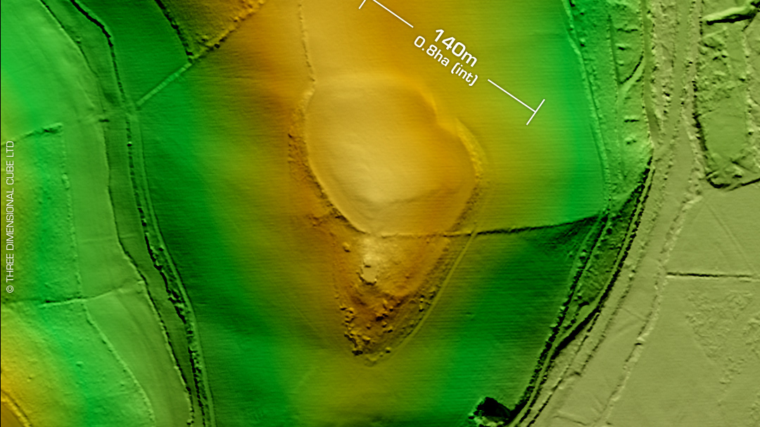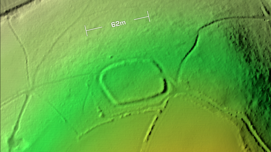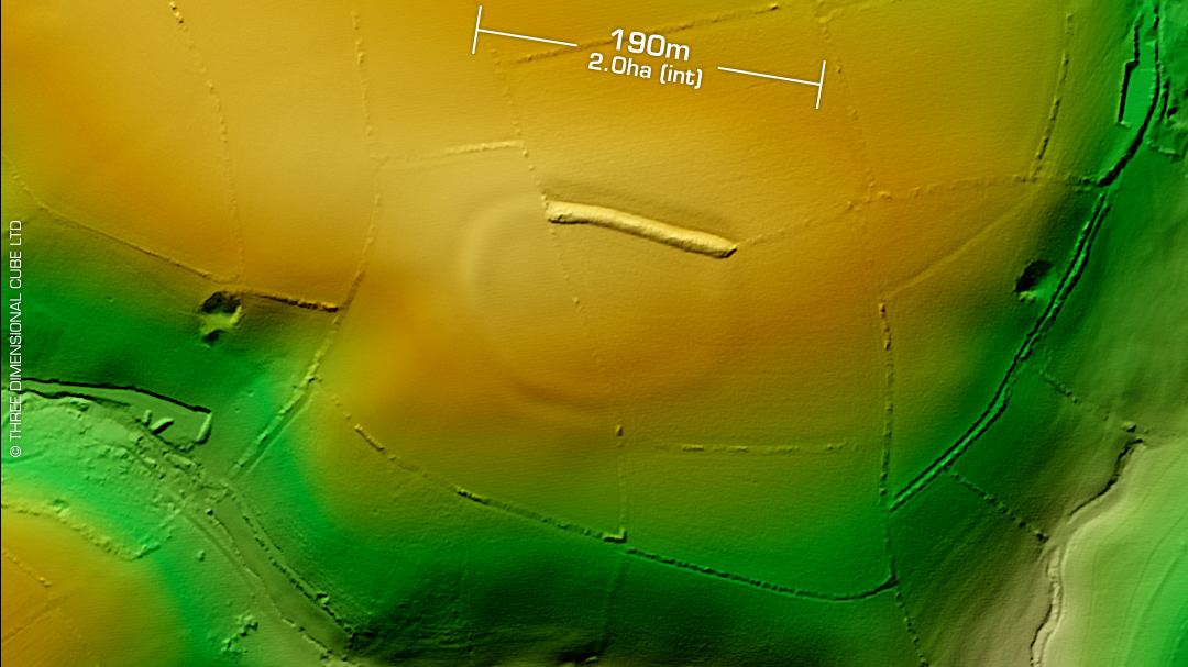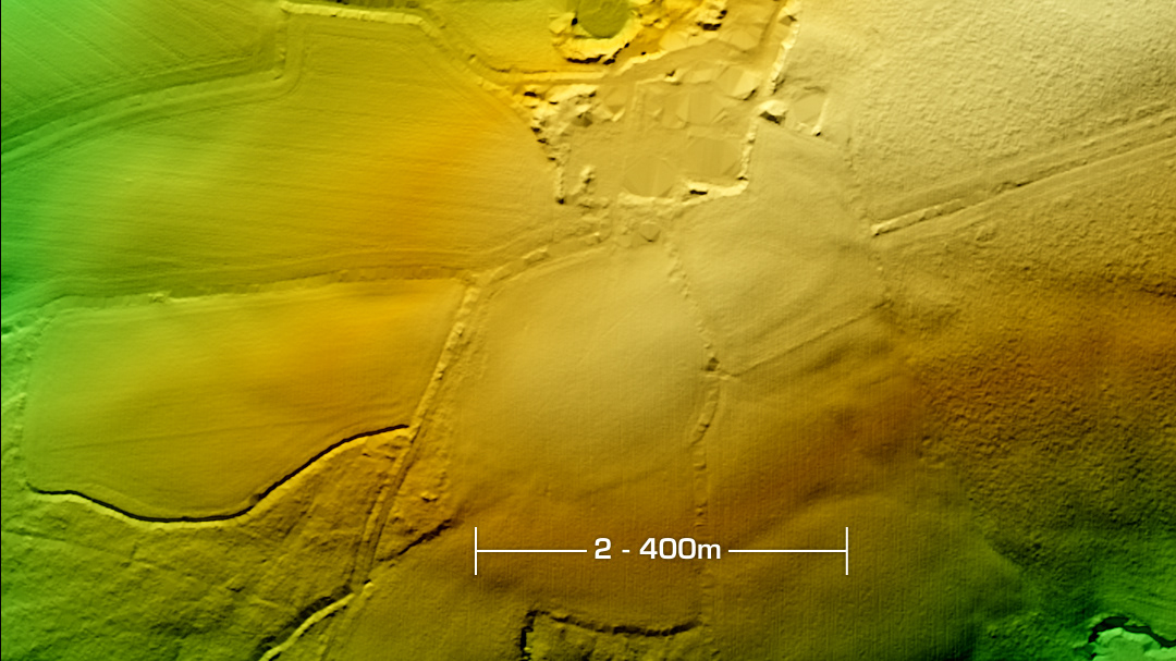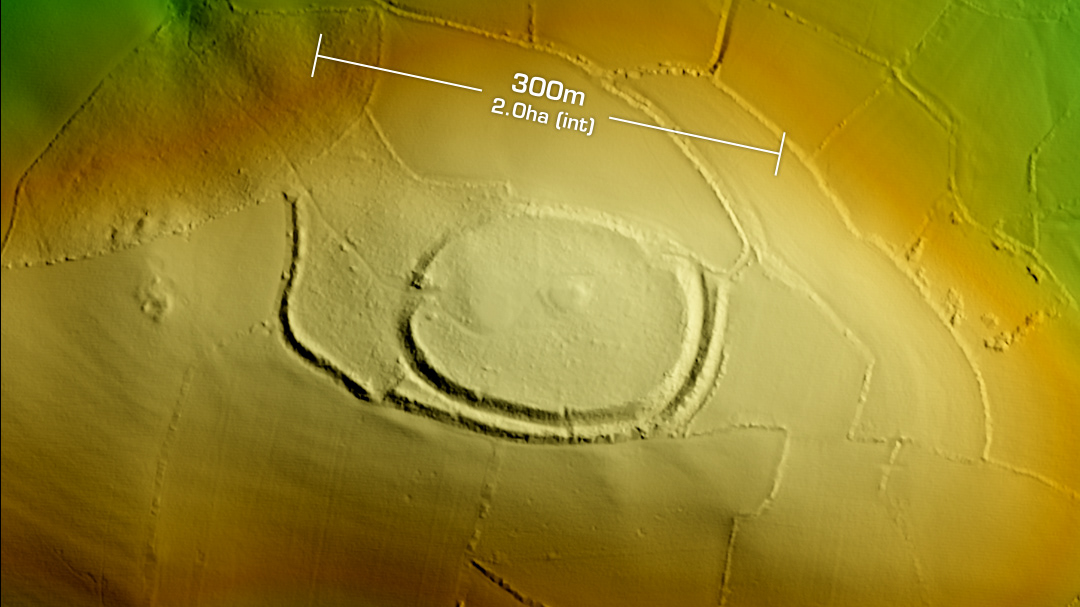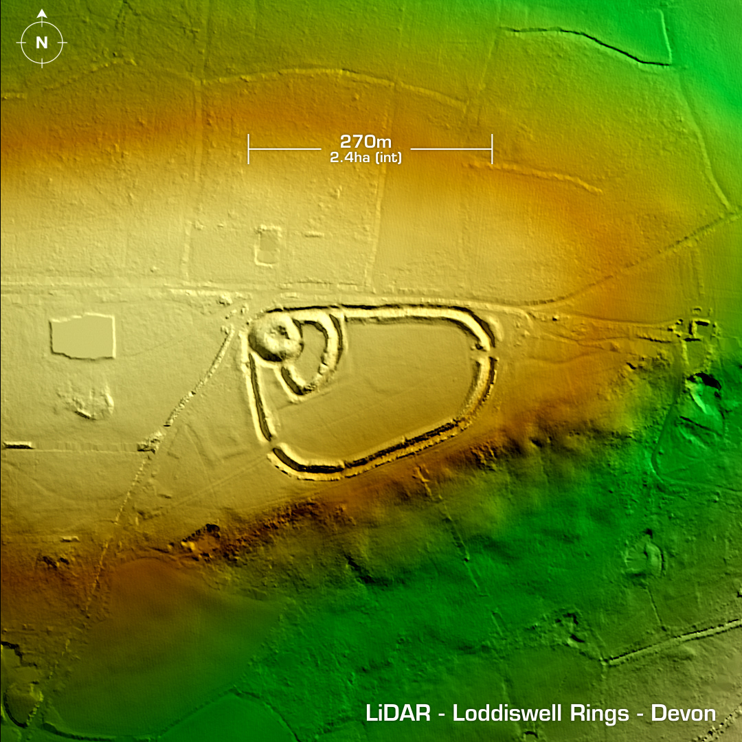
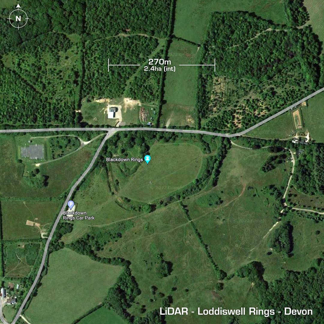
DTM- (Digital Terrain Model, i.e. No buildings or foliage) To the north of Loddiswell (on Google Maps listed as Blackdown Rings) is the partial contour hillfort, Loddiswell Rings. Subsequently re-used to enclose a medieval motte and bailey at the NW corner. This in turn sited a ‘Pole Beacon’ in 1752. First map reference in 1886. First survey in 1990. No further investigations, hence undated. Iron Age tribal association (conjecture based on location): Dumnonii (Scheduled Monument) [Any descriptive text is attributed to the Atlas of Hillforts & Historic England websites]